
Yesterday was our first day in quite awhile that featured dry conditions across the state. Today, a disturbance will be bringing another round of rain showers for our western counties. Looking at the satellite this morning, you can see the clouds on the increase as a result of the rain approaching from the west:

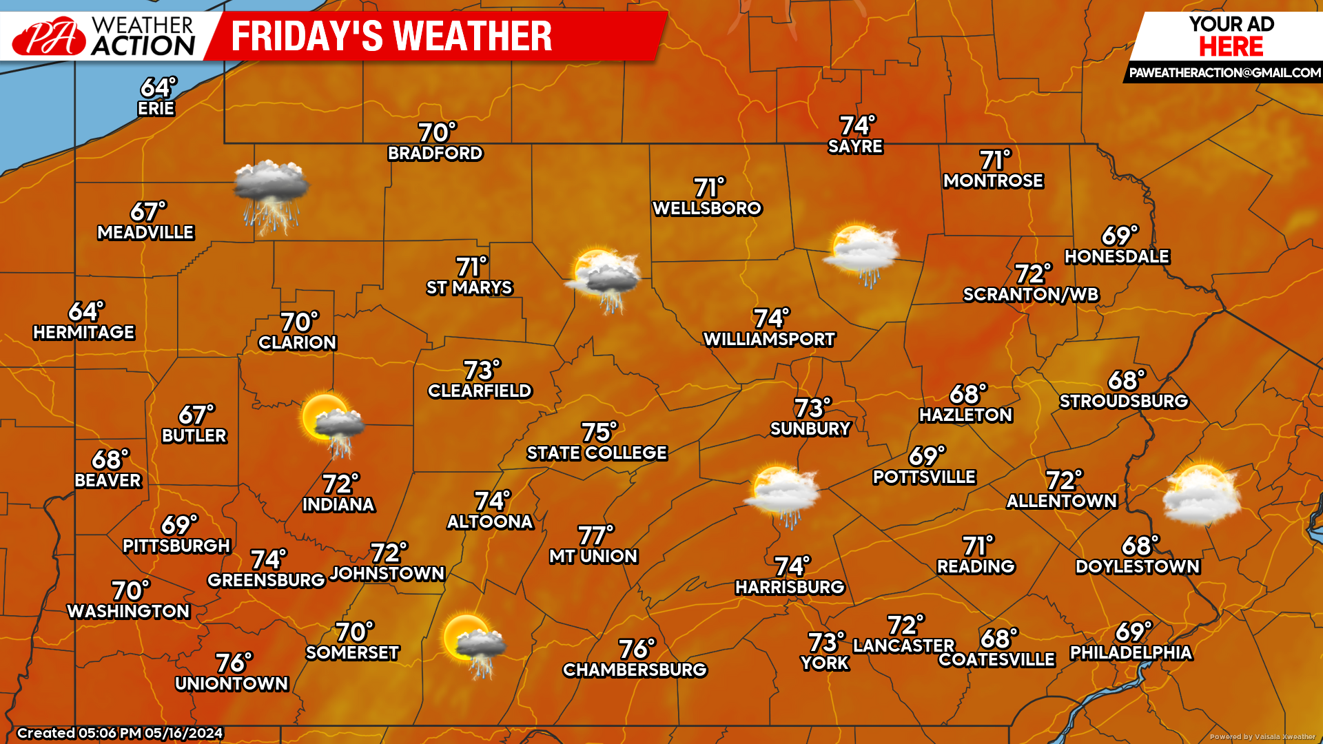
TODAY’S WEATHER FORECAST: 5/10
Overall, a dry morning is expected state-wide. Increased rain showers are expected this afternoon in the western half of the state. Fortunately for eastern areas, these showers are expected to dwindle as they progress eastward, leaving these areas only dealing with clouds in the afternoon.
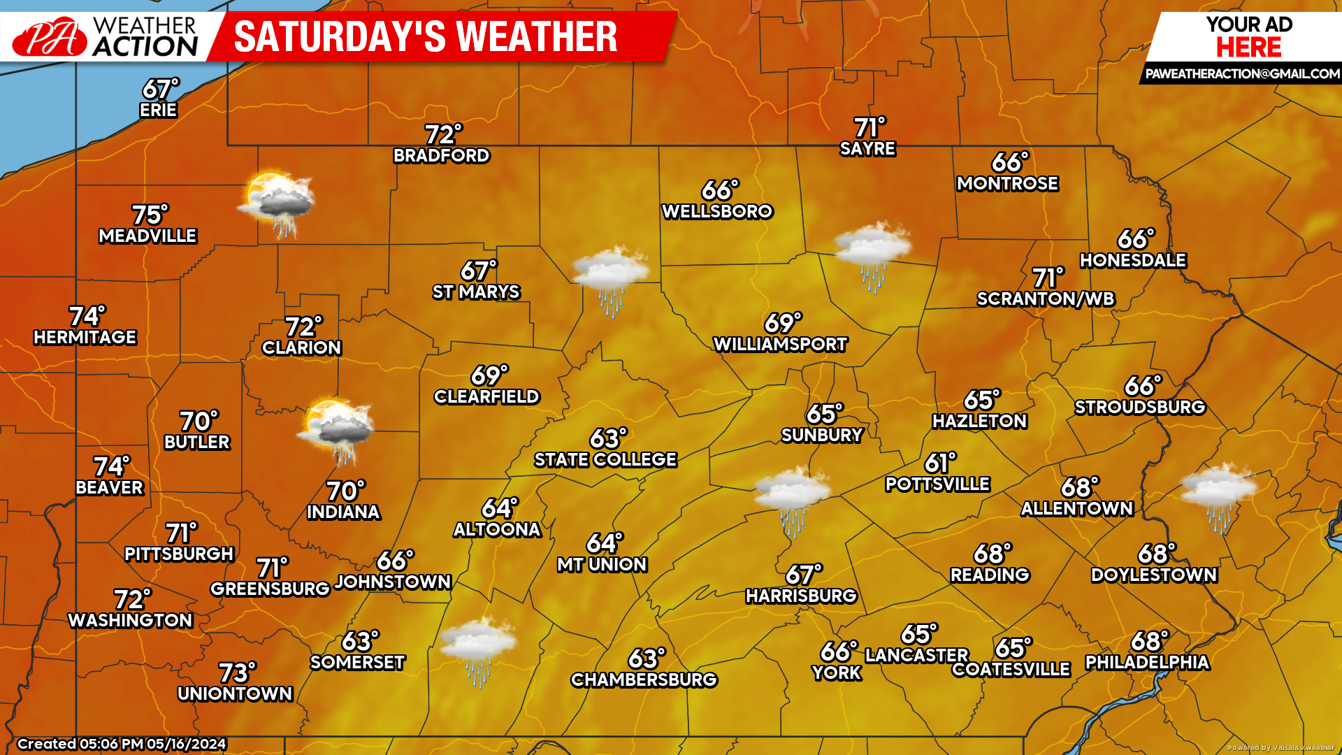
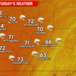
SATURDAY’S WEATHER FORECAST: 3/10
Like clock-work, it is the weekend and sure enough more rain is expected across the state. The only good news is, the models have backed off on rain totals, nevertheless, Saturday will feature showers and dreary across the state.
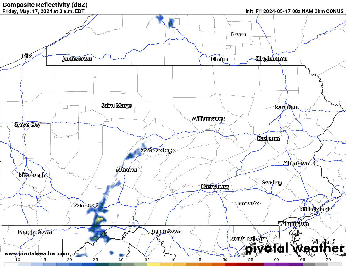
HI-RES NAM FUTURE RADAR THROUGH SATURDAY:
The Hi-Res NAM future radar will show the expected showers today lose steam as they head east. Saturday looks to be rainier than today, especially for the eastern two thirds of the state. The disturbance will begin to pull away Saturday evening, leaving Sunday mostly dry!
RAINFALL TOTALS THROUGH SATURDAY NIGHT: 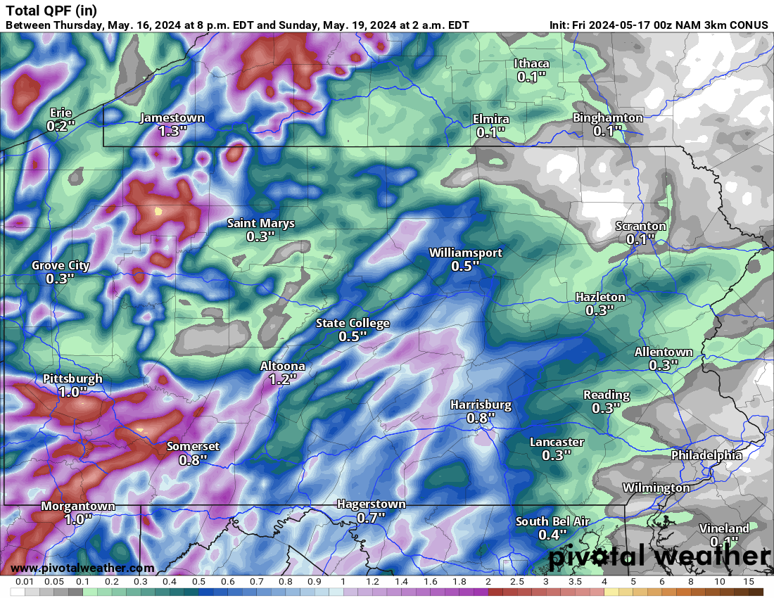
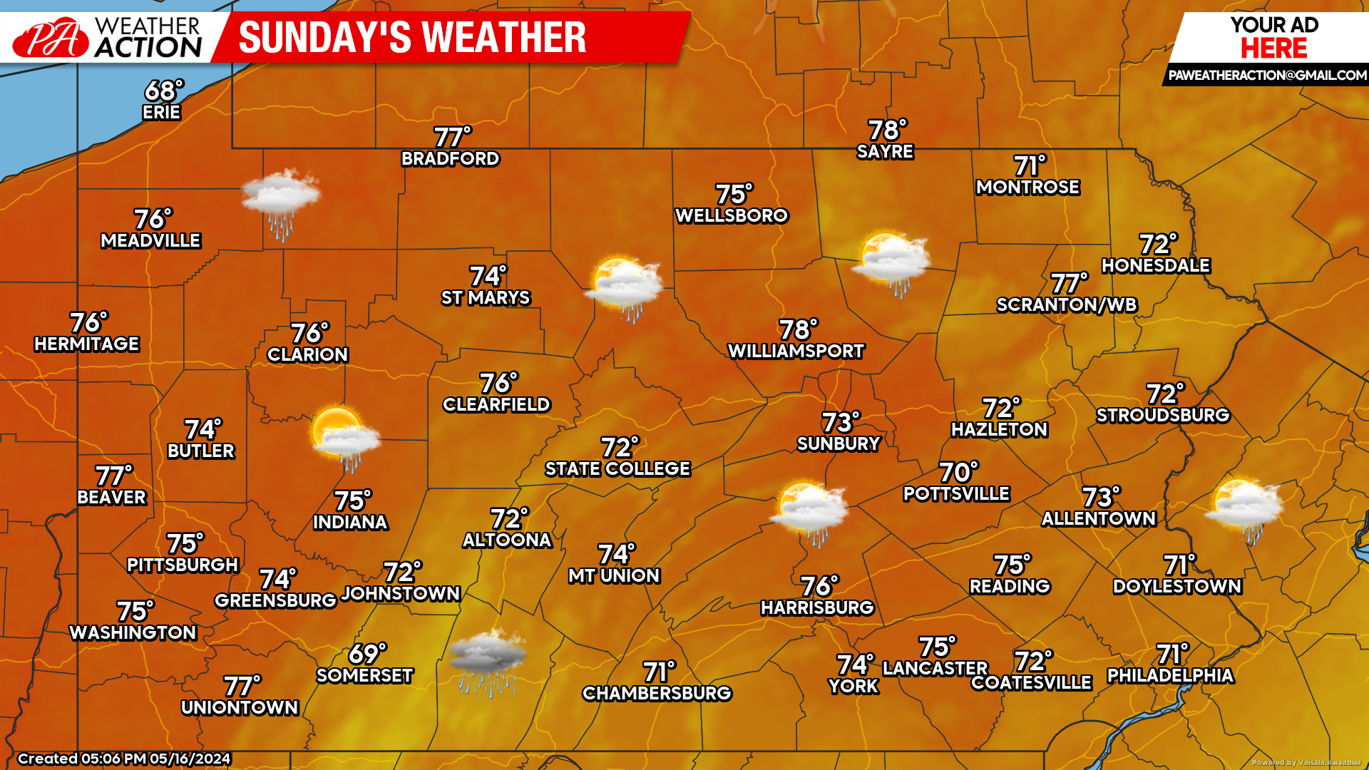
SUNDAY’S WEATHER FORECAST: 8/10
Sunday will be the day for any outdoor activities. Thanks to the low pressure system departing the area Saturday night, a mix of clouds and sunshine is in store for Sunday. Still a chance of an isolated shower passing shower.
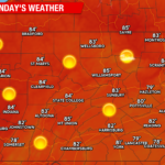
A GLIMPSE INTO NEXT WEEK:
Looking into the early parts of next week, it appears we will start off with dry conditions before another chance for rain by mid-week. Have a great weekend!
You must be logged in to post a comment.