
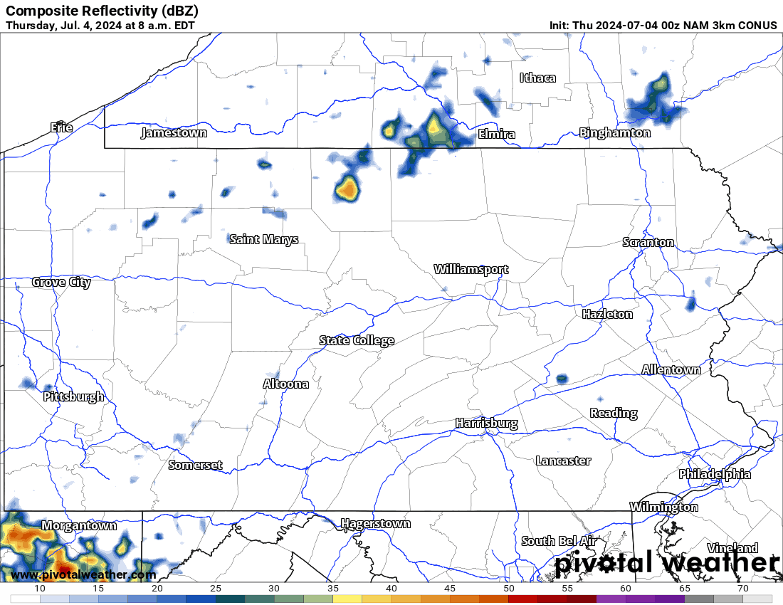
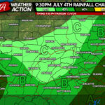
Happy Fourth of July! As mentioned in our previous forecasts, there is the chance for showers and storms today that could impact Fourth of July celebrations this evening. Below is a look at the current radar this morning:
Fourth of July Forecast: 8/10
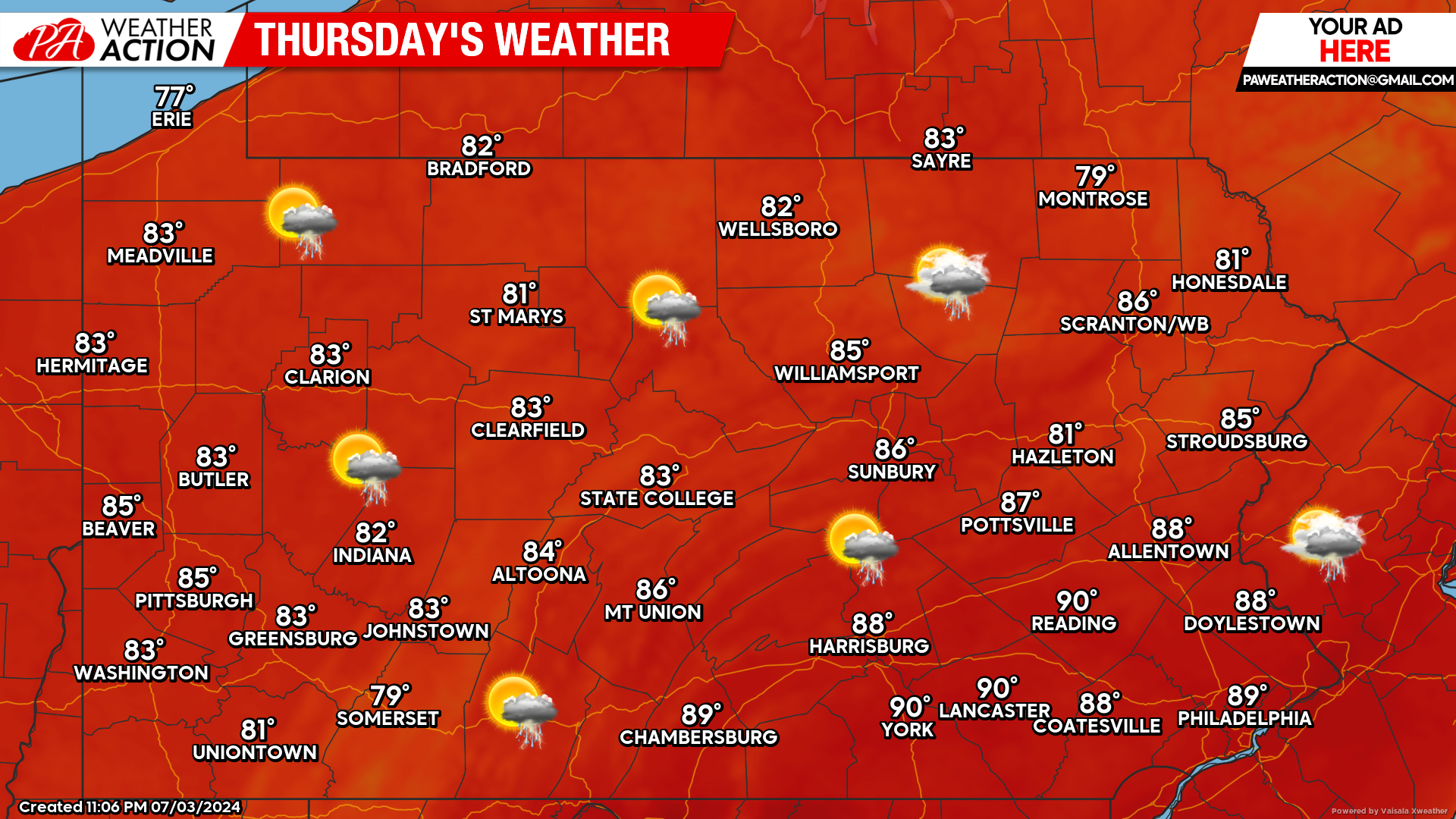
Today poses the threat for showers and thunderstorms across the state. The good news is, this is not an all day rain event. These showers and storms will be on and off. The bad news is, Fourth of July celebrations could be impacted this evening, all depending on the timing of the storms.
Hi-Res NAM Future Radar Valid Through Early Saturday AM:
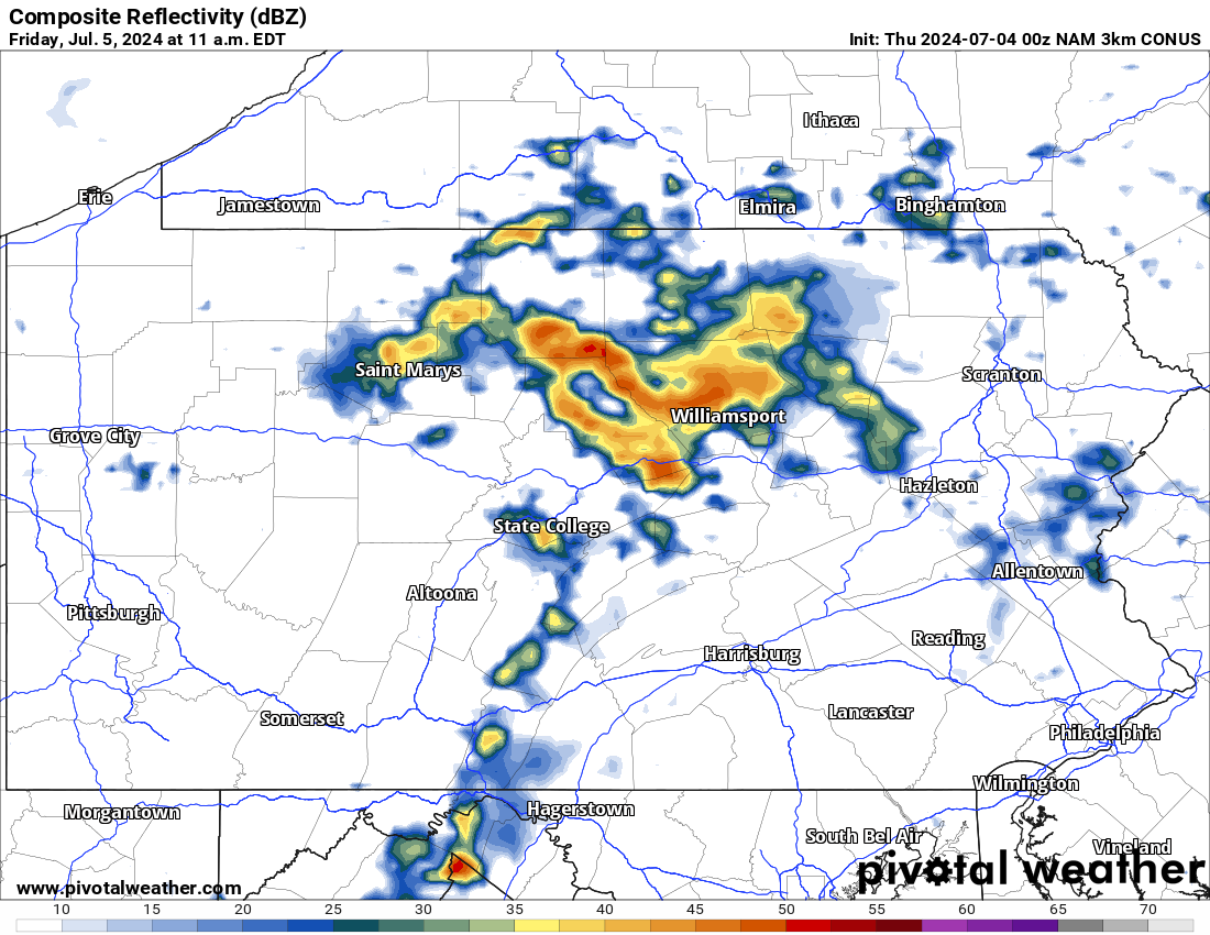
Taking a look at the Hi-Res NAM future radar below, this particular model likes to keeps today storm threat rather limited, instead shows widespread showers. Severe thunderstorms are possible on Friday. For time reference, view the top left of the graphic below:
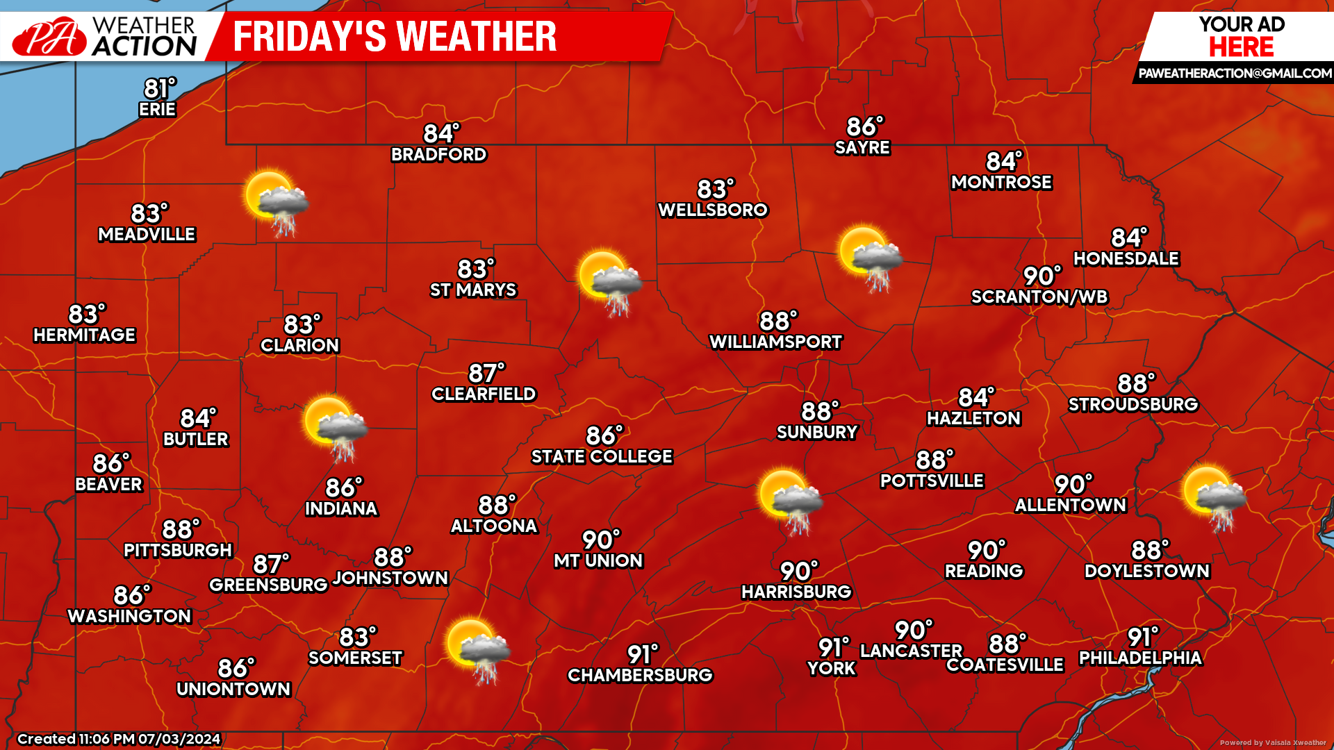
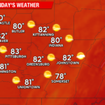
Friday’s Weather Forecast: 7/10
Friday’s forecast features a better chance for severe weather across the state. These thunderstorms will have the potential to produce damaging winds and hail. High temperatures will approach 90 degrees in many areas.
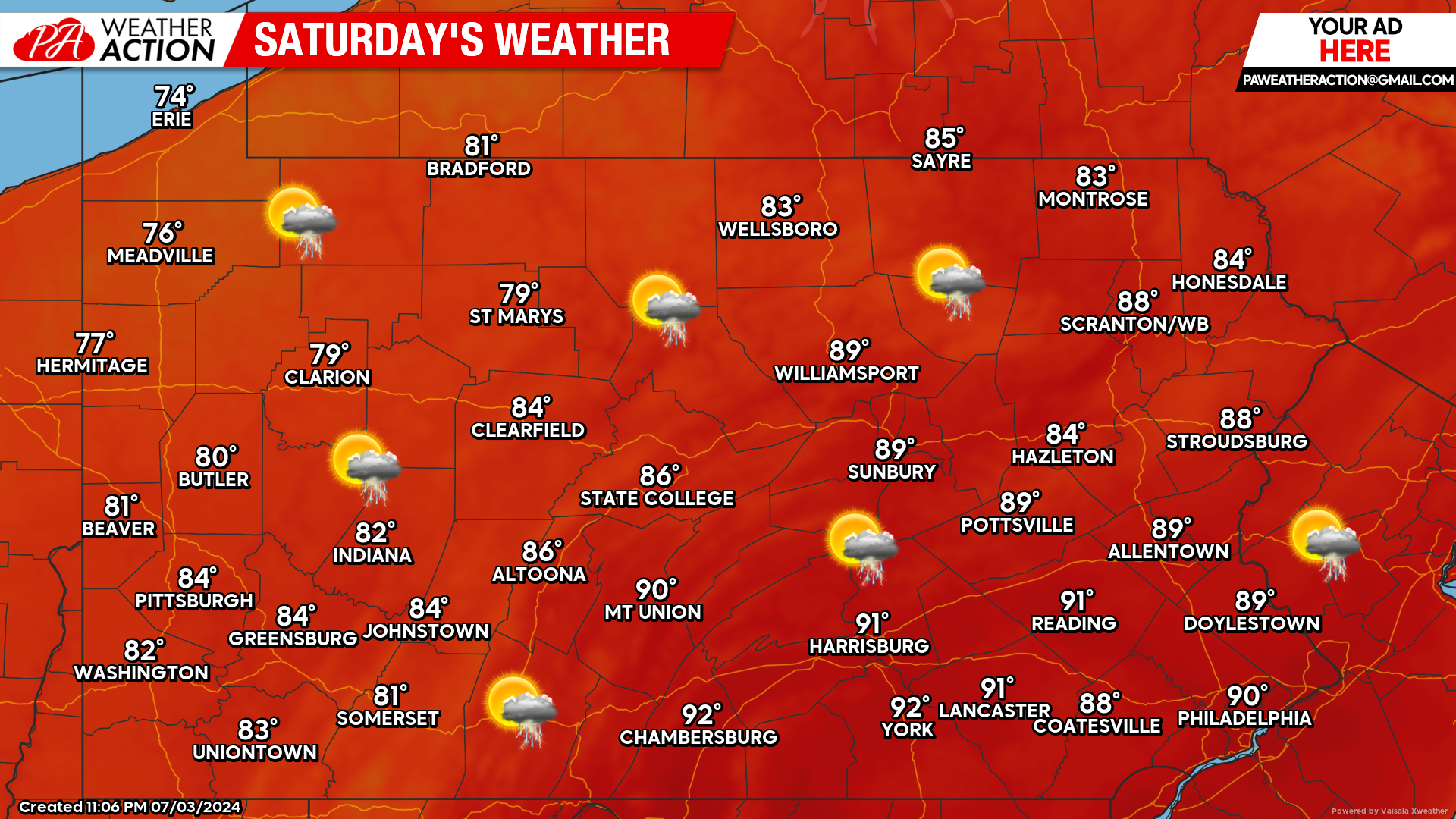
Saturday’s Weather Forecast: 8/10
Saturday features more chances for thunderstorms. However, not as widespread as Friday. Temperatures will range anywhere from the 70s across the northwestern counties to the lower 90s across the southern and eastern counties.
You must be logged in to post a comment.