
Today’s system that will be bringing rainfall to everyone across the state will also be responsible for the lake effect snowfall tonight through Wednesday. Once the storm system transfers to the coast late this evening, winds will change from the south, to the northwest for areas across Western Pennsylvania. This will allow for temperatures to drop and will also allow the rain to change to snow. Below is a look at 7:00 PM this evening: 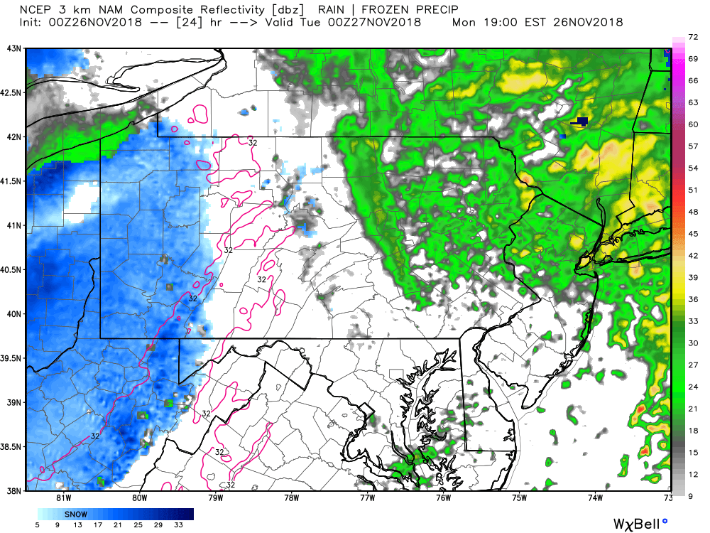
The bulk of the lake effect snowfall will be focused over prime lake effect snow areas across Northwest Pennsylvania. As we take the future radar out to 1:00 AM Tuesday morning, the snow will continue to fall over these areas: 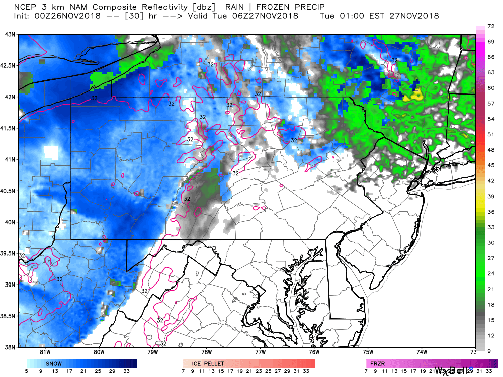
Because the snowfall is falling overnight, whatever snow does fall will accumulate on all surfaces. So even areas such as Pittsburgh and surround suburbs who will not receive all that much snow could still be dealing with a slick Tuesday morning commute to work or school. There will likely be a lull period Tuesday afternoon with the exception being far Northwest and North-Central Pennsylvania. However, the snow is expected to pick back up late Tuesday Evening and into Wednesday. Below is a look at 7:00 PM Tuesday Evening: 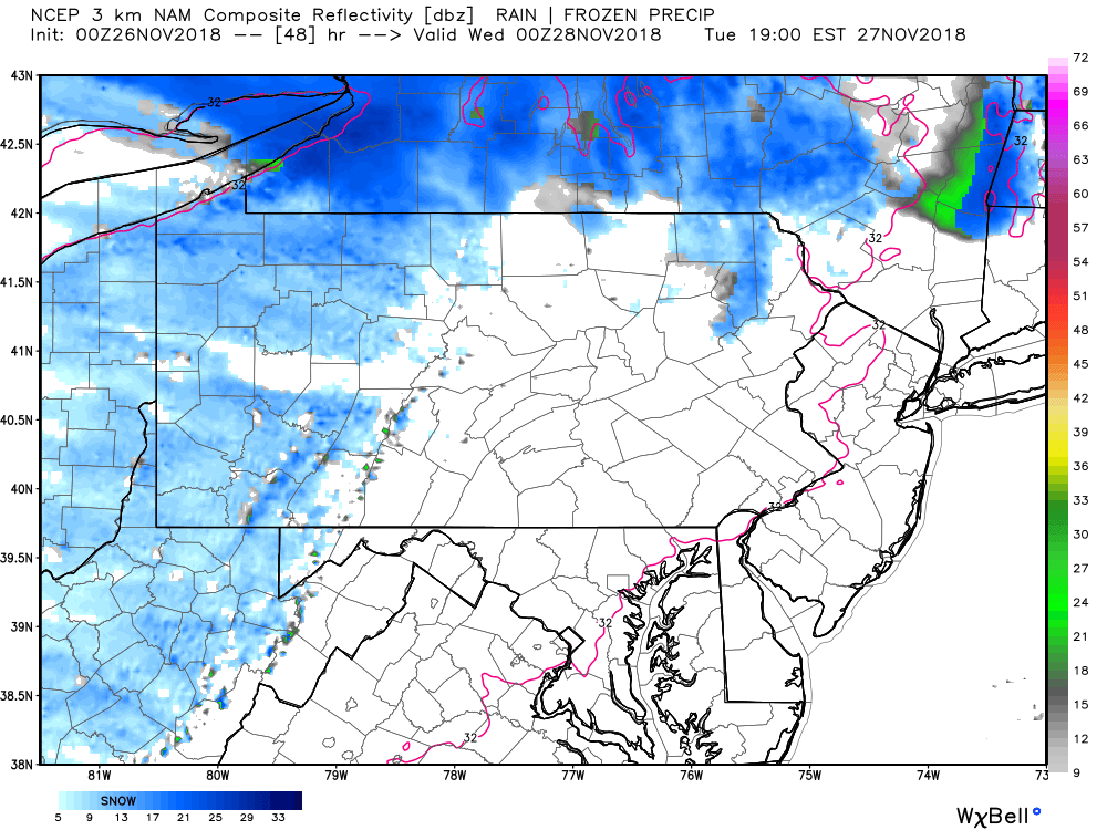
It is expected those heavier snow bands that are shown in Upstate New York during that time frame, will drift back south as favorable Lake Effect snowfall conditions really setup late Tuesday Night into Wednesday. Below is a look at 7:00 AM Wednesday: 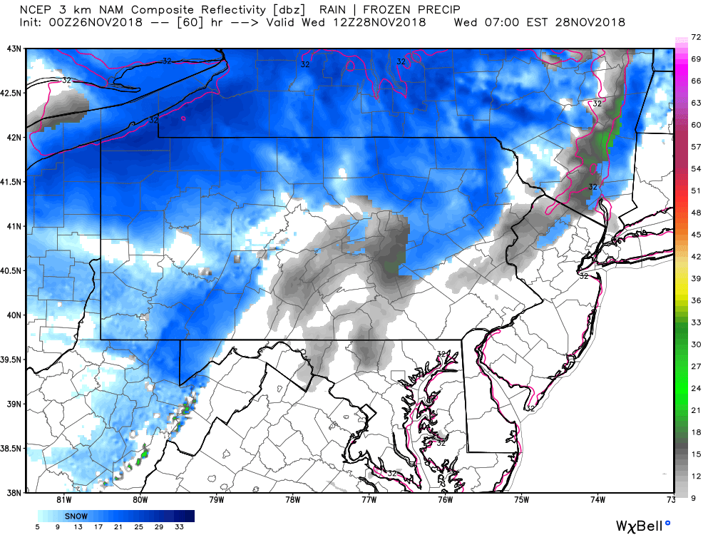
We do expect more snowfall to accumulate Tuesday night into Wednesday Morning than tonight into Tuesday morning. The snowfall will not completely taper off for Northwest and Northern Pennsylvania until late Wednesday night and maybe even as late as Thursday morning.
SNOWFALL EXPECTED THROUGH WEDNESDAY: 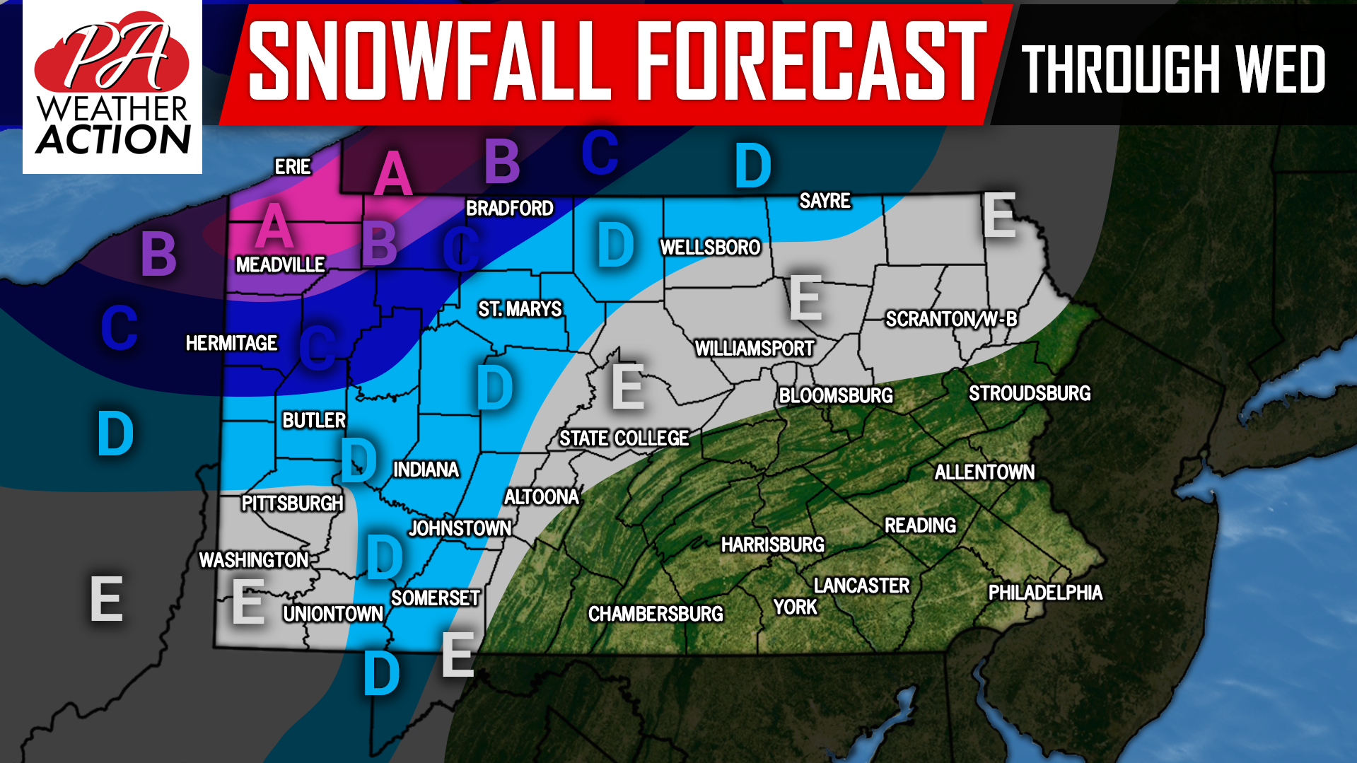
Area A: These locations are under the prime spot for lake effect snowfall through Wednesday. Expect heavy snow, with whiteout conditions at times. 10 to 14 inches of snow is expected, with isolated locations receiving as much as 18 inches of snow. Travel will not be recommended.
Area B: Moderate to heavy snowfall can be expected on and off tonight through Wednesday. Whiteout conditions at times is possible. 6 to 10 inches of snowfall is expected, with isolated locations receiving higher amounts. Travel is not recommended.
Area C: Moderate, to at times heavy snowfall can be expected on and off tonight through Wednesday. Snow bands will not be quite as strong and not as consistent in this area so expect 3 to 6 inches of snowfall. Travel will be hazardous.
Area D: On and off light to moderate snowfall can be expected tonight through Wednesday. 1 to 3 inches of snowfall can be expected.
Area E: On and off light snow can be expected tonight through Wednesday. Accumulations will remain under one inch.
Follow our Facebook page for the latest information, click here: Pennsylvania Weather Action’s Facebook Page
Be sure to download our free app to keep you ahead of the lake effect snow and much more, click here: Pennsylvania Weather Action’s App
Stay bundled up this Winter with Pennsylvania Weather Action gear, click here to view our store: Pennsylvania Weather Action’s Store
Share the snowy news with your family and friends using our icon below!
You must be logged in to post a comment.