
We’ve already had the wettest meteorological summer ever recorded here in PA, and more heavy rain is on the way. The remnants of Tropical Storm Gordon will move into the area this weekend, producing several inches of rainfall across areas of the state. Light to moderate rain will be widespread around the region Saturday, with heavier rainfall making its way into the state by early Sunday morning. By Sunday afternoon, heavy rain will overspread the entire state. This is when the flash flood threat will begin to materialize.
First of all, turn around when approaching flooded roadways. Roads near streams and creeks are most likely to flood first. If you can’t see the road under the water, don’t risk it. You don’t know if parts of the road/bridge are gone. Here is an example from Lebanon County from last Friday:
The target for heaviest rainfall will be in Western PA this time around, where amounts up to a half foot are expected. Here is a Flash Flood Risk map from the NWS:
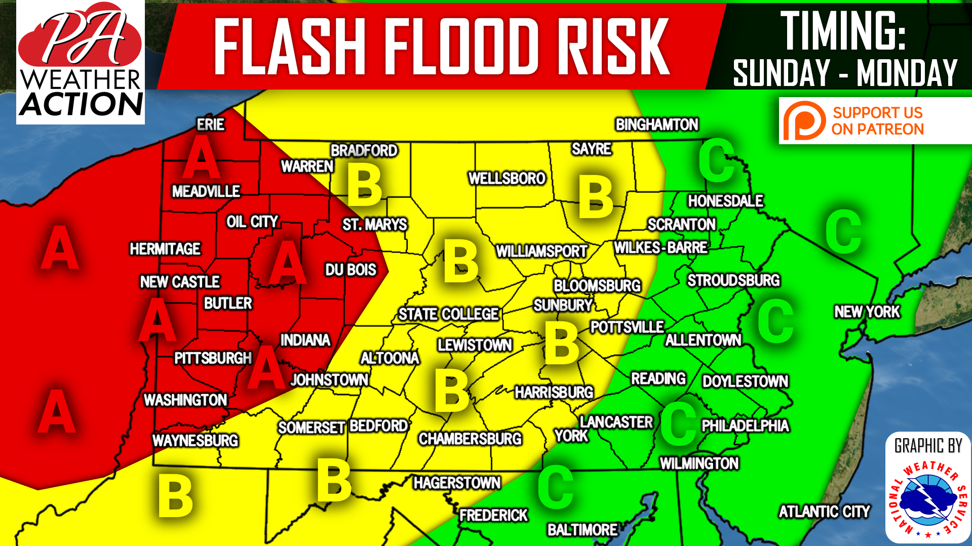
Area A: Flash flooding is likely on streams and in urban areas with poor drainage. Scattered road closures are expected. Even if a road isn’t closed yet, but flooding exists, that doesn’t mean it’s safe to cross.
Area B: Flash flooding is possible on streams and in urban areas with poor drainage. Scattered road closures are expected. Once again, even if a road isn’t closed yet, but flooding exists, that doesn’t mean it’s safe to cross.
Area C: Scattered flash flooding is possible on streams and in urban areas with poor drainage. Scattered road closures are expected.
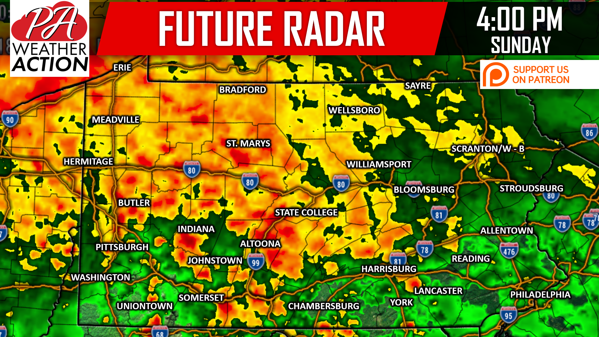
Here is the Hi-Res NAM model for 4:00 PM Sunday:
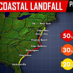
Showers and thunderstorms will continue into Monday, extending the flash flood risk. Rain will finally come to an end Tuesday, but by then we may be tracking something much bigger. If Florence moves our way, we could be looking at major flooding. Click this link for Our Article on Florence & Potential Major East Coast Impacts
RAINFALL FORECAST MAP
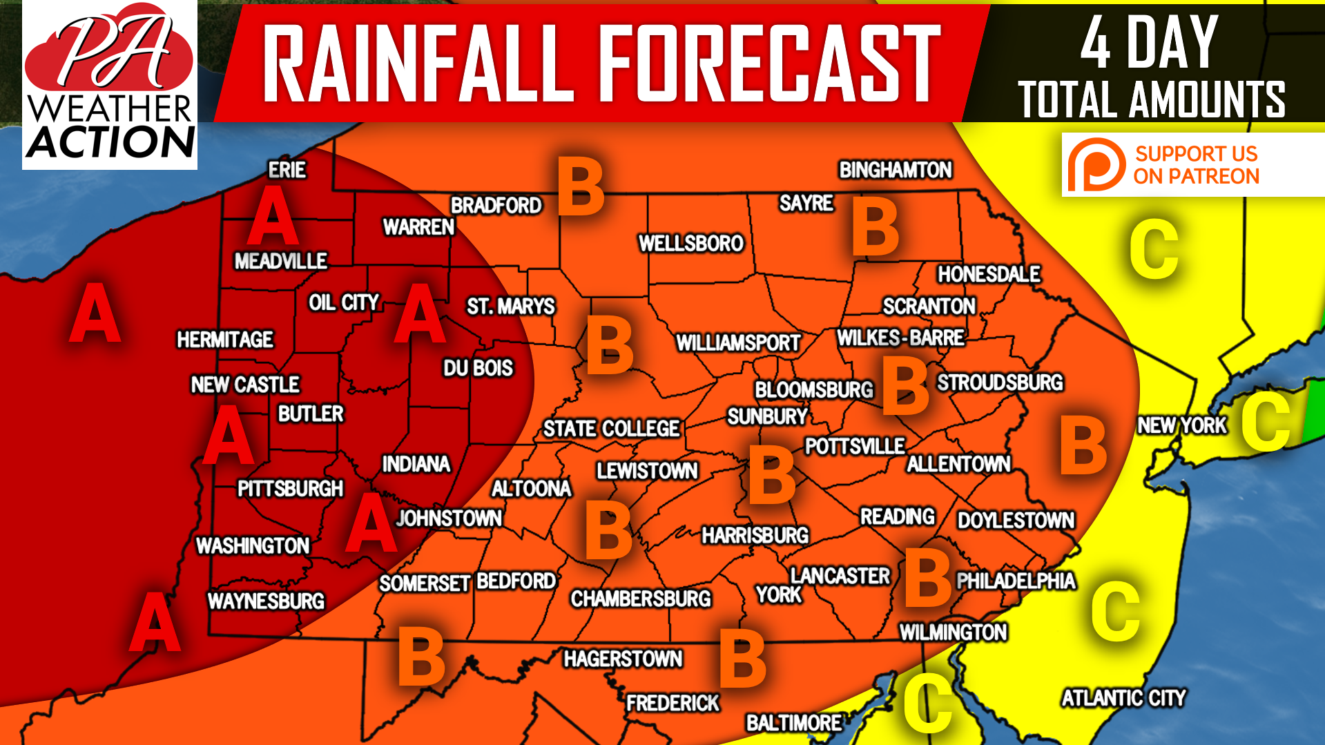
Area A: Rainfall amounts of 4-6″ are likely. AVOID FLOODED ROADWAYS, trying to save 10 minutes of your time is not worth the possible consequences.
Area B: Rainfall amounts of 2-4″ are anticipated. Flooding near streams and creeks is possible. Use alternative routes if roadway is flooded.
Area C: Rainfall amounts of 1-2″ are expected.
Download our free app for NWS alert notifications, radar, latest forecasts, and a dedicated section to track Florence >>> Download Our App Here!
If you appreciate our efforts and would like to make a small donation along with some extra perks, click here>>>Support PA Weather Action on Patreon!
Share this important update with your family and friends using the button below, stay safe!
You must be logged in to post a comment.