
A brief wintry mix took many by surprise on Sunday and even prompted some school delays Monday morning. That was just a taste of what’s to come in the next week, as two significant winter storms will bring the threat of ice. Road salt will be going for a premium this week, because shovels and plows won’t do the job too well!
The first of two winter storms, and the one this article will be focused on, is late Wednesday through midday Thursday. Some short range models are projecting a thin band of moderate snow from the north Pittsburgh suburbs all the way to the Lower Susquehanna Valley Wednesday afternoon, so we will be watching that. The main event starts shortly after.
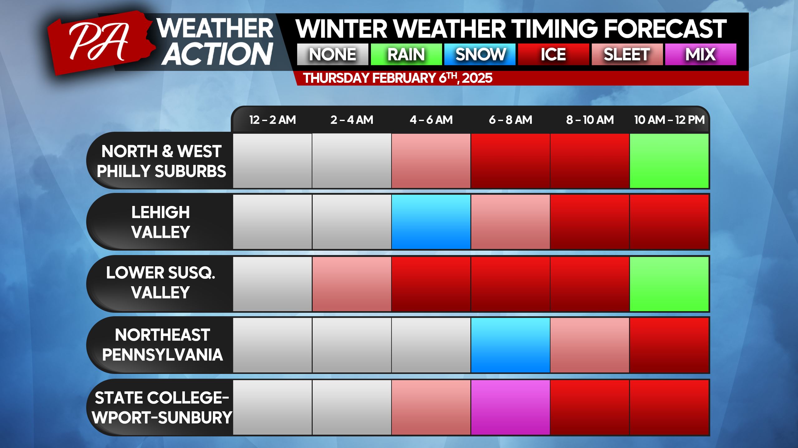
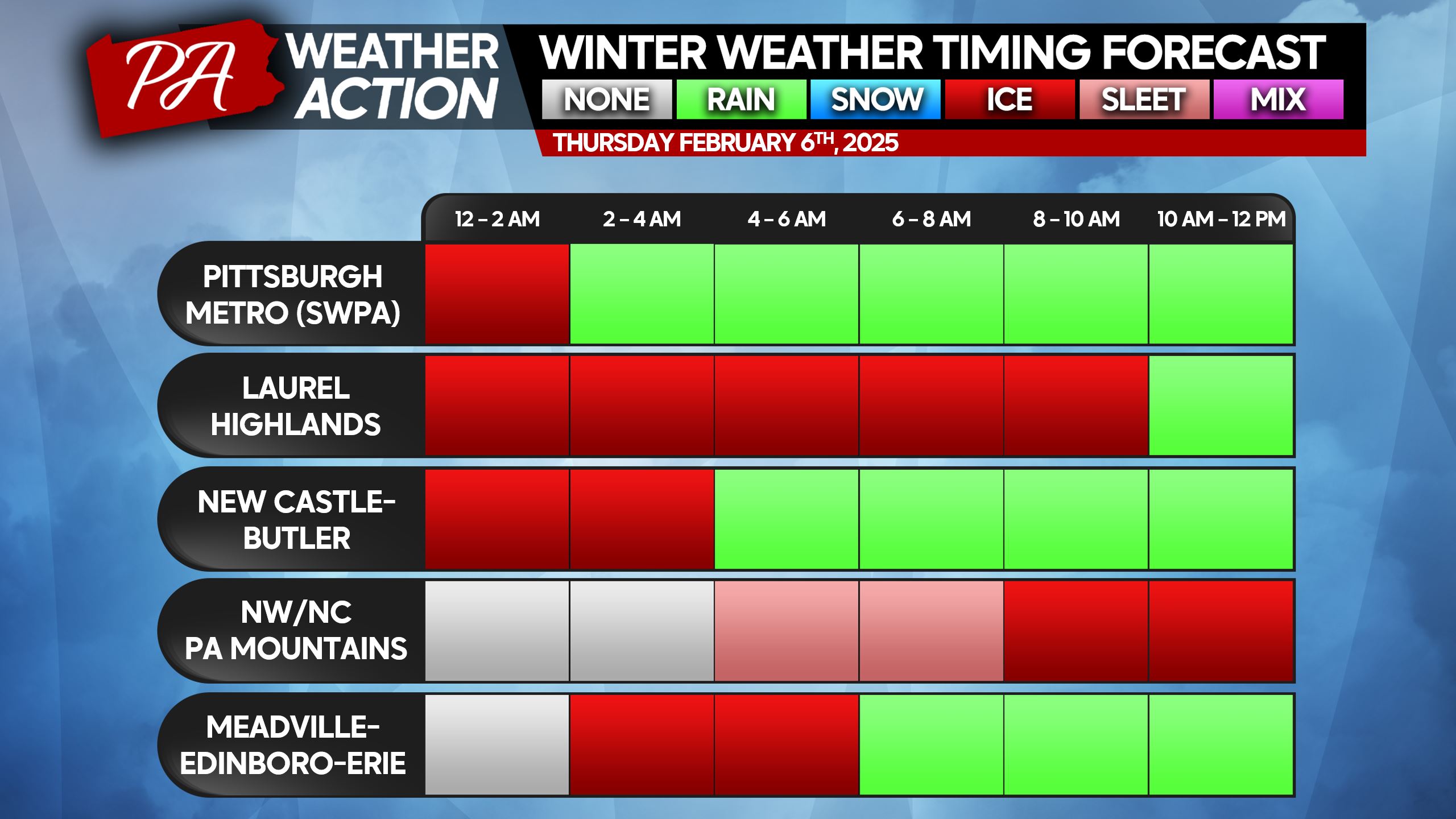
This will be a cold air damming situation, with a high pressure to our northeast keeping the cold air in place in the Appalachians. As a result, worst impacts will be closest to the spine of the mountains. Many of us will start with sleet, before going over to freezing rain and then ending as plain rain.
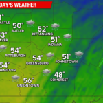
Your weather app may be telling you Thursday will have a high in the 40s or 50s, but that is only probable in Southwest PA. Nearly every cold air damming event, we see temperatures stay below what models think. With that said, temperatures in the mid to upper 30s Thursday afternoon should thaw out the ice.
WINTER STORM TIMING CHARTS
Timing for this event will be localized, and dependent on temperatures in the upper levels and here at the surface. Things like topography and microclimates will play a higher role than usual. These timing charts factor those things in. If you don’t see your town, please find the nearest city/area.
THURSDAY SNOW & SLEET FORECAST
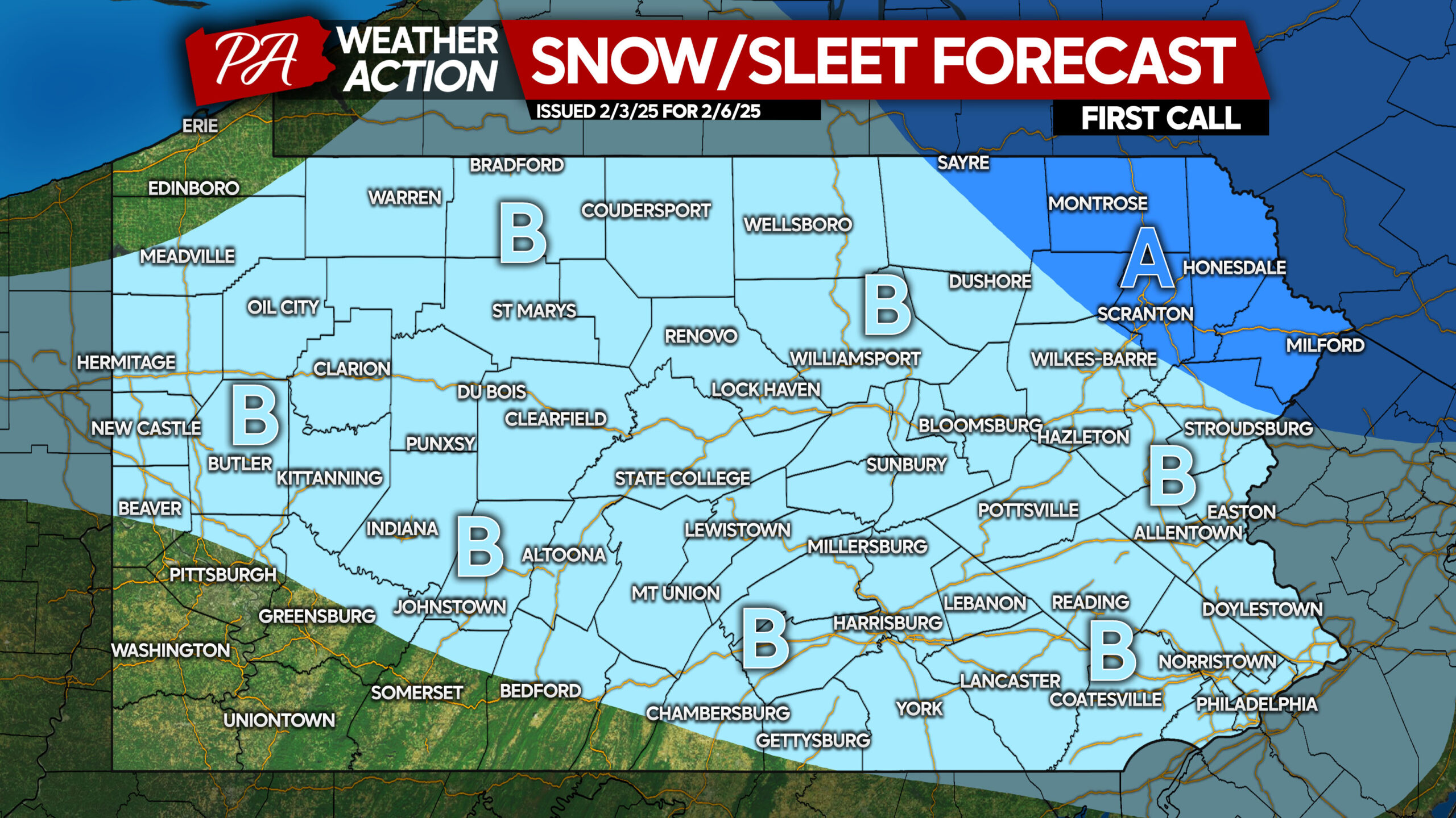
As this is our first call, it doesn’t factor in the potential thin band of snow in the areas we mentioned Wednesday afternoon. That will be a localized feature that will be in Tuesday’s forecast due to current uncertainty.
Area A: Snow and sleet accumulation of 1 – 3″.
Area B: Snow and sleet accumulation of less than 1″. This will mostly be sleet, which are ice pellets that are heavy to shovel.
FIRST CALL ICE FORECAST FOR THURSDAY
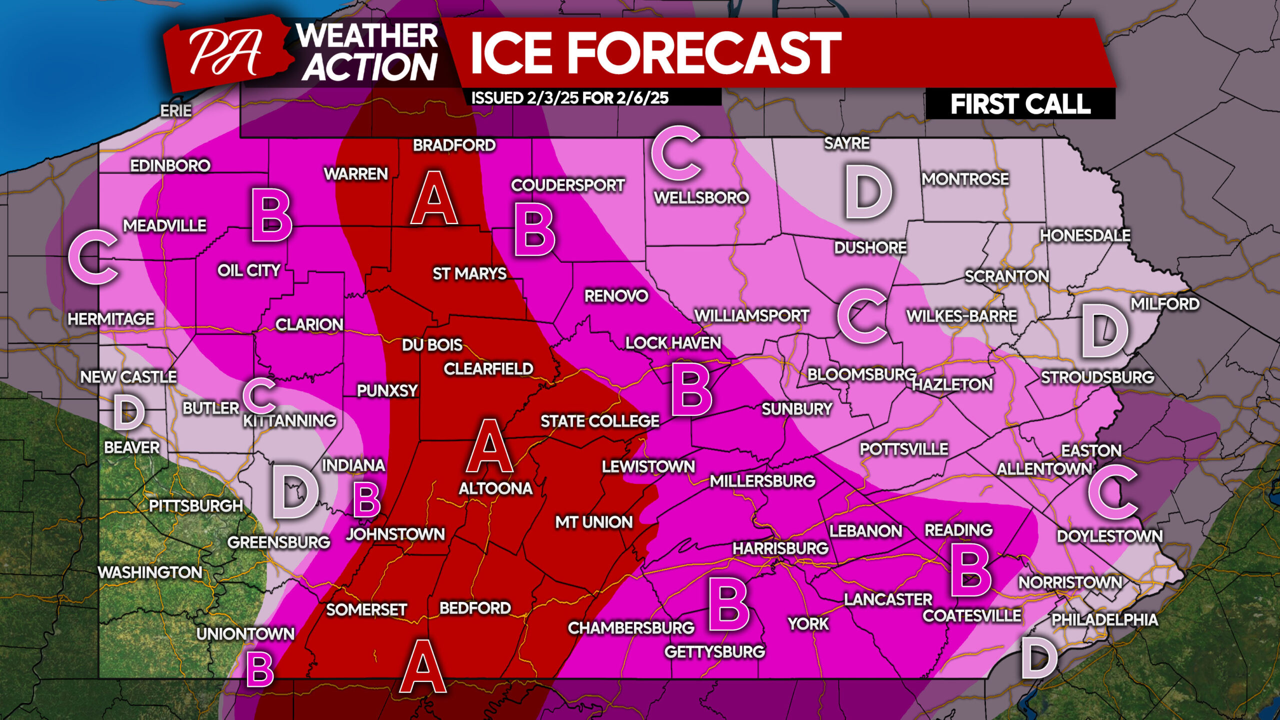
Note that all surfaces will be slippery, not just roads. Even walking will be hazardous with a glaze of ice.
Area A: Significant ice accumulation expected, with ice accumulation between a quarter and a third of an inch (1/4 – 1/3″). Roads will be extremely slippery regardless of vehicle/tires. School closings expected Thursday, with business closings likely the first half of the day.
Area B: Moderate to significant ice accumulation anticipated, with ice accumulation of a tenth to a quarter of an inch (1/10 – 1/4″). Roads will be very slippery, likely leading to school closings Thursday and delayed business openings.
Area C: Light to moderate ice accumulation expected, with ice accumulation between a twentieth and a tenth of an inch (1/20 – 1/10″). While that may not sound like much, it is in terms of ice. Roads will be slippery, likely causing delays and/or closings for schools and businesses.
Area D: Light ice accumulation anticipated, with ice accumulation of a hundredth to a twentieth of an inch (1/100 – 1/20″). This is still enough to make surfaces slippery, especially in Eastern PA where temperatures will warm slower than near Pittsburgh.
Don’t forget to share this forecast with friends and family! We want to prevent falls and accidents as much as possible.
You must be logged in to post a comment.