
Chances for snow showers will continue throughout the week as lake effect snow showers are forecasted to impact the region. Cold temperatures and windy conditions will have some areas experiencing negative wind chill values.
Tuesday
Mostly cloudy with chances for snow showers, cold temperatures and gusty winds. Highs will range in the 20s, with lows in the upper to mid-teens. Winds will be out of the west-northwest at 8 to 18 mph, higher elevations could see higher wind speeds, wind gusts approaching 30 mph are possible bringing negative wind chill values in some areas.

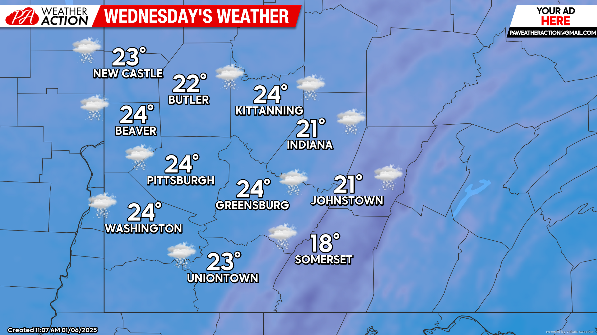
Wednesday
Mostly cloudy with a chance of snow showers in the afternoon hours. Highs will be in the low 20s to mid-teens, lows will be in the near single digits. Winds will be out of the west at 8 to 15 mph, wind gusts approaching 30 mph are possible, negative wind chill values are possible.
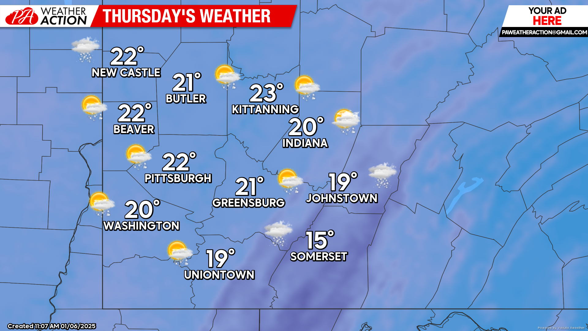
Thursday
Partly sunny with a slight chance for snow showers. Highs will be in the low 20s to mid-teens, lows will be in the single digits. Winds will be out of the northwest at 7 to 10 mph, with gusts approaching 25 mph, wind chill values below -10 are possible in some areas.
Snow chances continue into the weekend. Be sure to follow PA Weather Action for more forecasts and details regarding snowfall accumulations statewide.

You must be logged in to post a comment.