
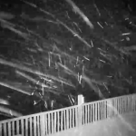
Yesterday’s nor’easter packed quite the punch for the area. Some areas experienced flooding rain, while others experienced power outages due to strong winds and lightning. On top of the strong winds and rain, elevated locations across the Laurel Highlands experienced their first accumulating snowfall of the season!
With the nor’easter passing by to our north, it left today chilly and blustery for most of us with breezes blowing in from the northwest. Tomorrow temperatures are not expected to rebound as temperatures will range from the upper 30s to lower 50s across the state.
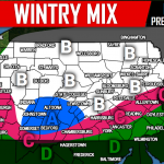
Wednesday will be even colder than tomorrow with temperatures stuck in the 30s and 40s state-wide for high temperatures, check out the projected high temperatures for Wednesday below: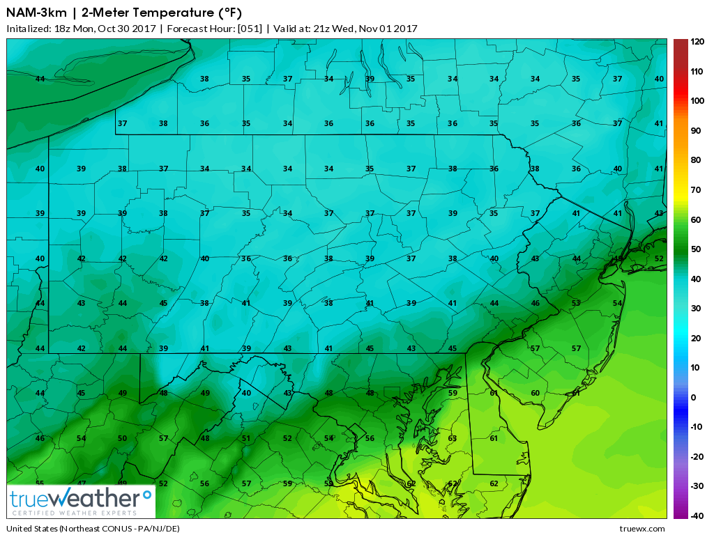
Combining with the cold temperatures, an area of low pressure will deliver light precipitation to the state on Wednesday. It is possible areas across the Laurel Highlands and areas north of interstate 80 will see snow flying in the air. The rest of us will see a cold light rain.
Below is a look at the latest NAM and GFS models indicating this well:
NAM: 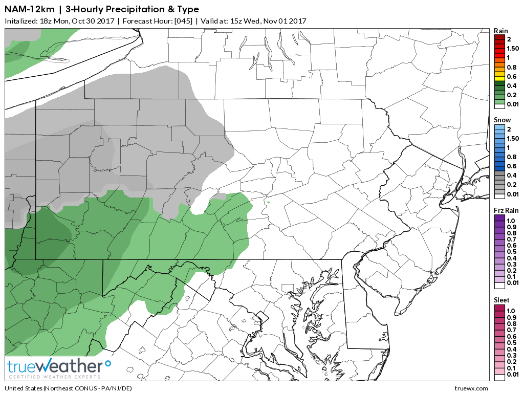
GFS: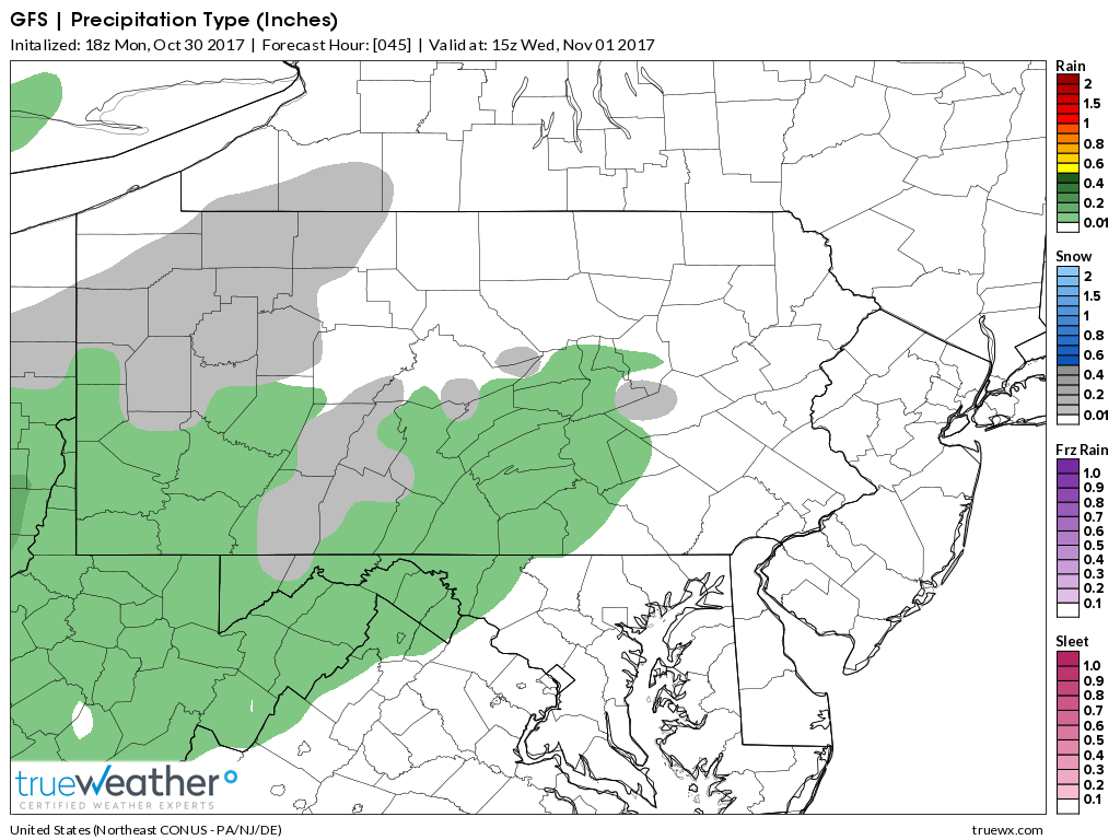
We are not anticipating much in the way of accumulation for areas that do receive the snow showers. Slushy coating at best on grassy surfaces. But for some, it will be the first snowfall of the season.
Thursday temperatures will begin to rebound into the 50s and by Friday temperatures will be back into the 50s and 60s for most.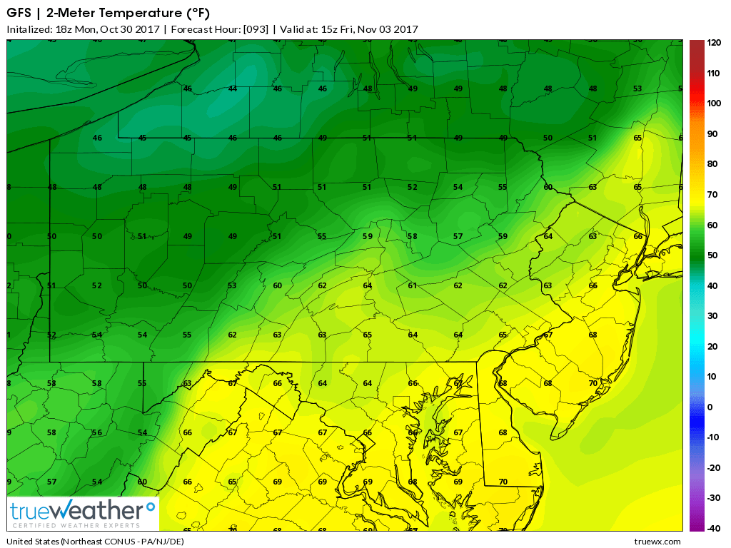
Be sure to have our Facebook liked for the latest information regarding our weather and more, click here>>>Pennsylvania Weather Action’s Facebook Page
Share the news of the potential snow showers Wednesday and the upcoming warm up with your family and friends using our icon below!
You must be logged in to post a comment.