

After damaging storms made their way through Northeast PA Friday evening, more storms pose a threat Saturday and Sunday. Firework shows will be heavily dependent on luck of the draw and it will be crucial to monitor radar and warnings. These days will not be washouts, but be prepared to move or cover outdoor items.
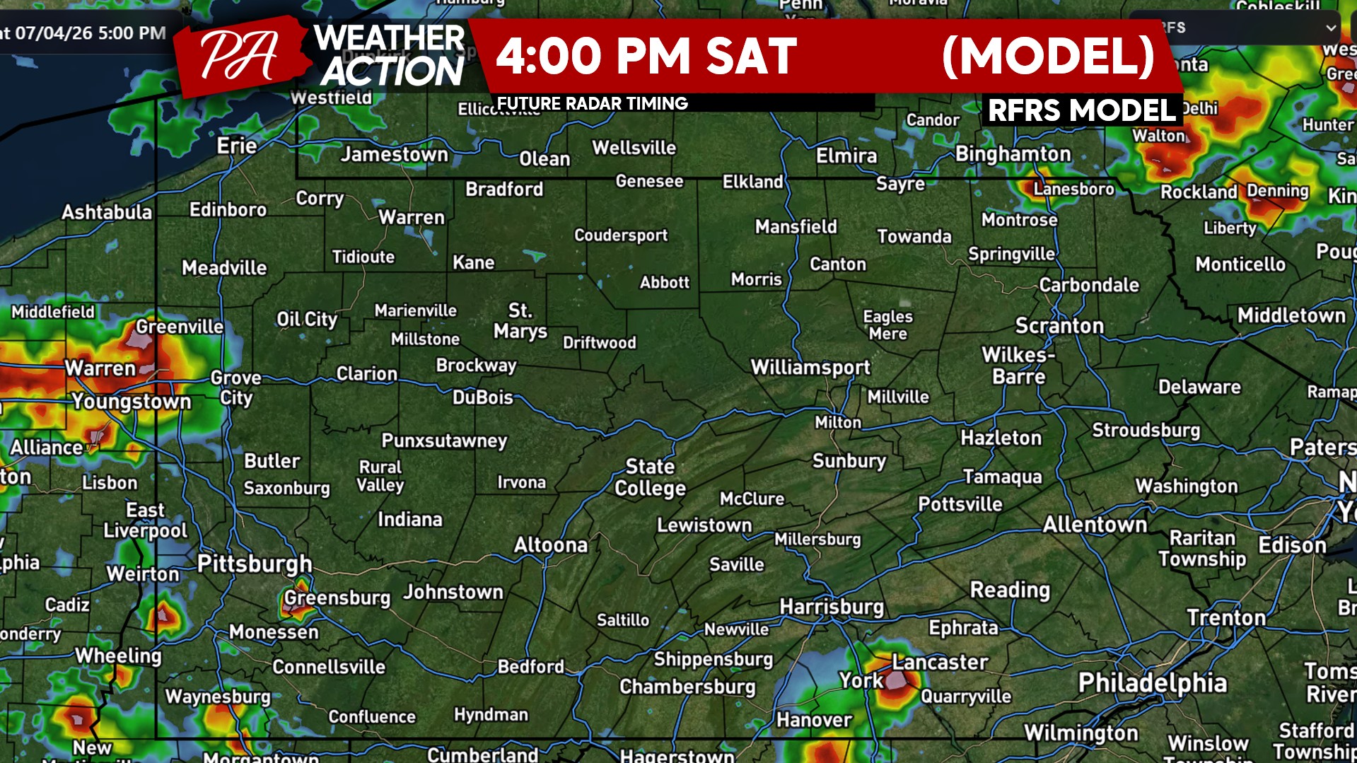
SATURDAY THUNDERSTORM TIMING
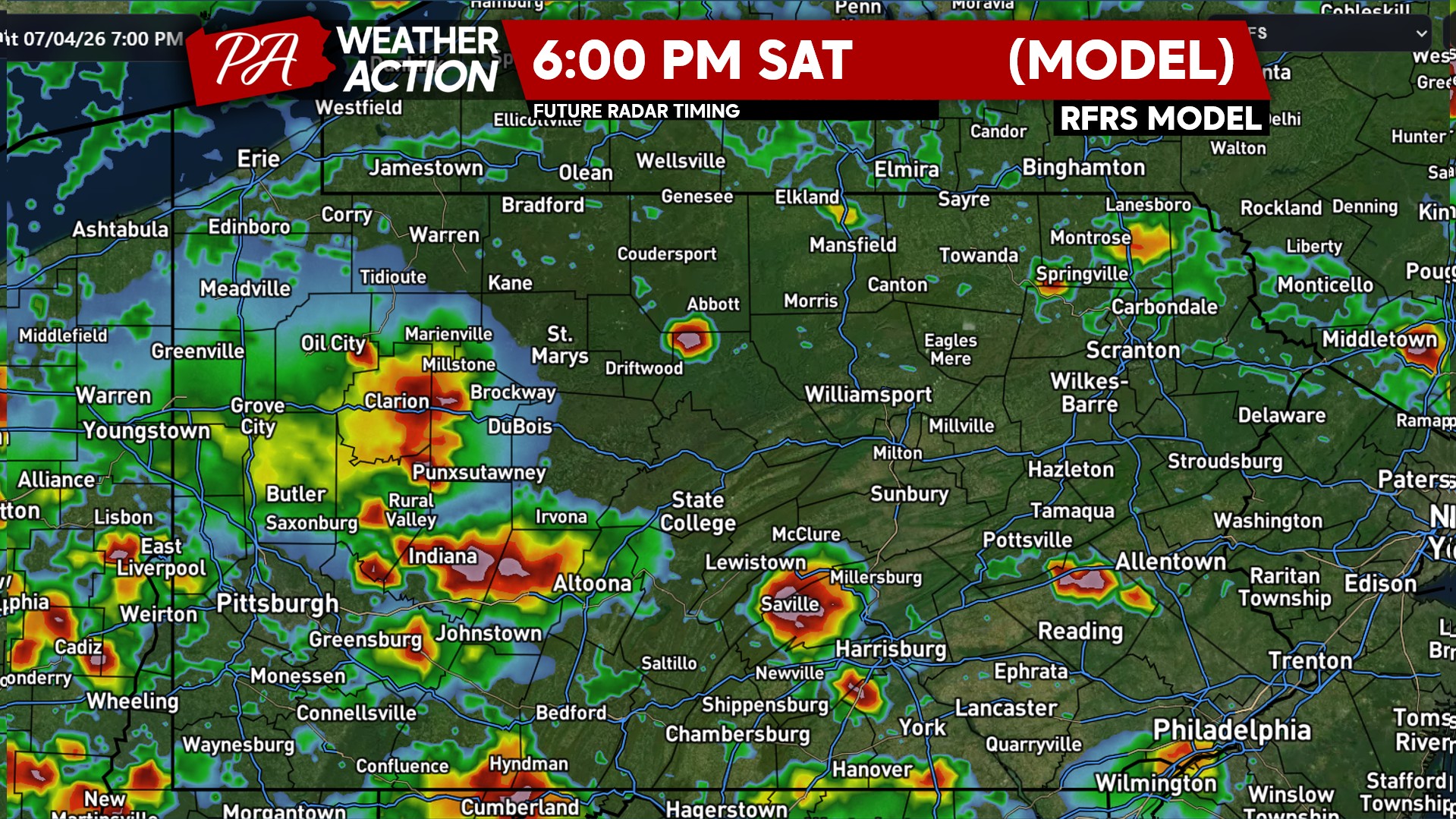
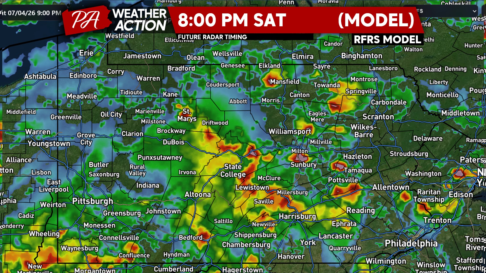
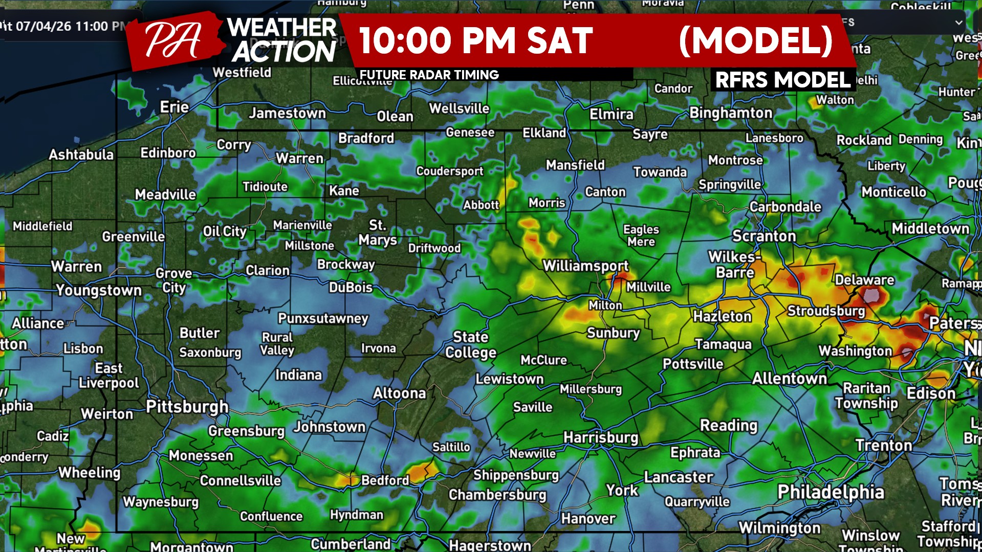
Storms will begin to fire up late Saturday afternoon. As usual, models are in significant disagreement over how widespread coverage will be. Some models have very isolated activity, others are scattered to widespread. Thunderstorm coverage will increase around dinnertime and sustain into the evening before weakening just prior to midnight.
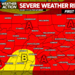
SATURDAY 7/4 SEVERE THUNDERSTORM THREAT FORECAST
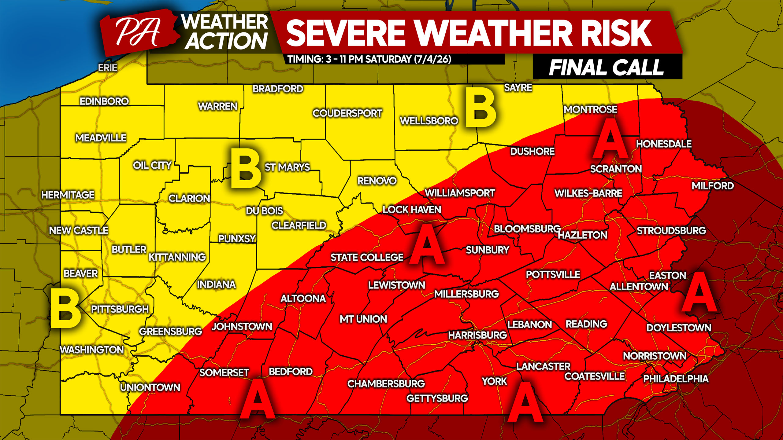
Area A: Scattered strong to severe thunderstorms are likely in the late afternoon through the evening. These storms will be luck of the draw, meaning some areas will be hit while others missed. Keep a very close eye on radar and NWS warnings! The main threat is damaging winds of 50-80 MPH.
Area B: Isolated strong to severe thunderstorms are likely in the late afternoon through the evening. These storms will be luck of the draw, meaning some areas will be hit while others missed. Keep a very close eye on radar and NWS warnings! The main threat is damaging winds of 50-70 MPH.
SUNDAY THUNDERSTORM TIMING
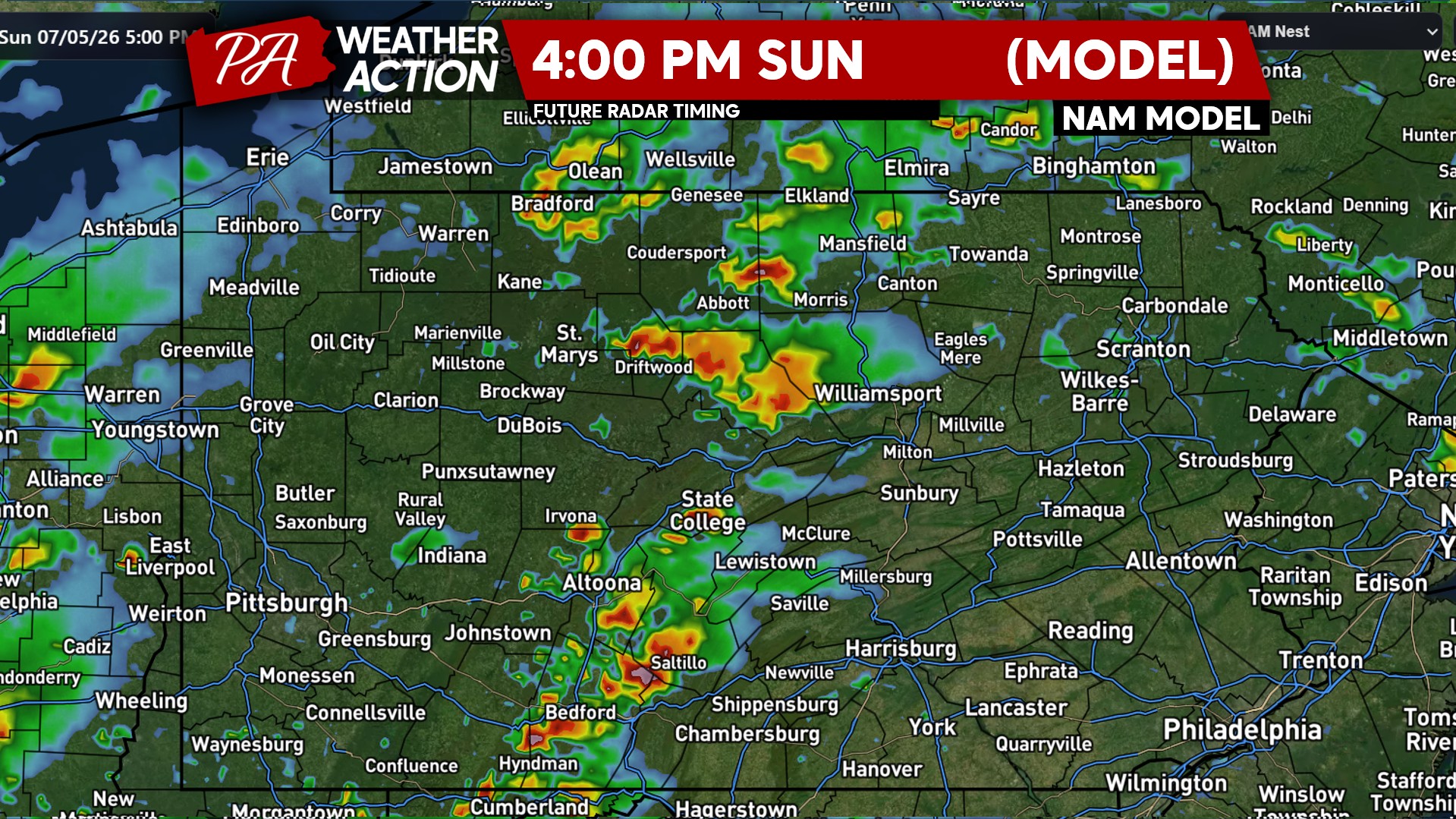
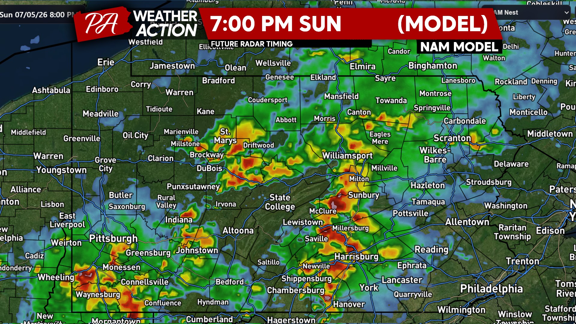
Thunderstorm coverage looks to be most widespread on Sunday. Isolated flash flood will even begin to be a concern as slow-moving storms may train over the same areas. Damaging winds will continue to be the main concern. Thunderstorms will be possible from around 2 PM Sunday through very early Monday morning. Below is a look at future radar from the Hi-Res NAM.
SUNDAY 7/5 SEVERE THUNDERSTORM THREAT FORECAST

Area A: Widespread strong storms with isolated severe thunderstorms likely mid-Sunday afternoon through the evening. The main threat is damaging winds of 50-70 MPH.
Area B: Isolated to scattered strong to severe thunderstorms mid-Sunday afternoon through the evening. The main threat is damaging winds of 50-60 MPH.
Firework shows postponed on Saturday evening will not have any better luck on Sunday! Monitor radar and alerts, along with minutely forecasts! You can get that all in our free app here!
Don’t forget to share this forecast with friends and family with outdoor plans!
You must be logged in to post a comment.