
It’s been so long since the last snowstorm we almost forget it’s still winter! With 7:15 PM sunsets and temperatures well into the 60s this coming week, you’d never think lake effect snow squalls and winter storm warnings are also in the mix.
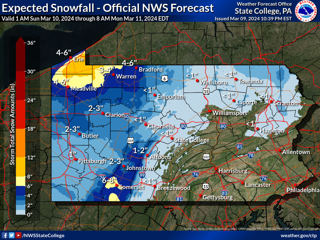
Snowfall accumulations of 6 – 10″ are expected across Erie, Crawford, and Warren County, with 3 – 6″ expected in the Laurel Highlands. Even in Southwest PA around Pittsburgh, 1 – 2″ of snow are likely.
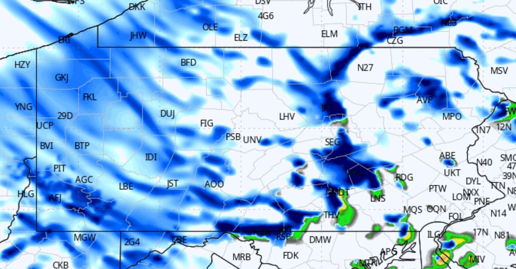
Below is HRRR Model Future Radar for Sunday’s snow squalls. Rain may mix in east of the mountains.
The graphic below indicates no snow accumulation east of the mountains in Central PA and the Lehigh Valley, but a quick coating to a half-inch is certainly possible where heavier, longer-duration squalls (30-60 minutes) move through.
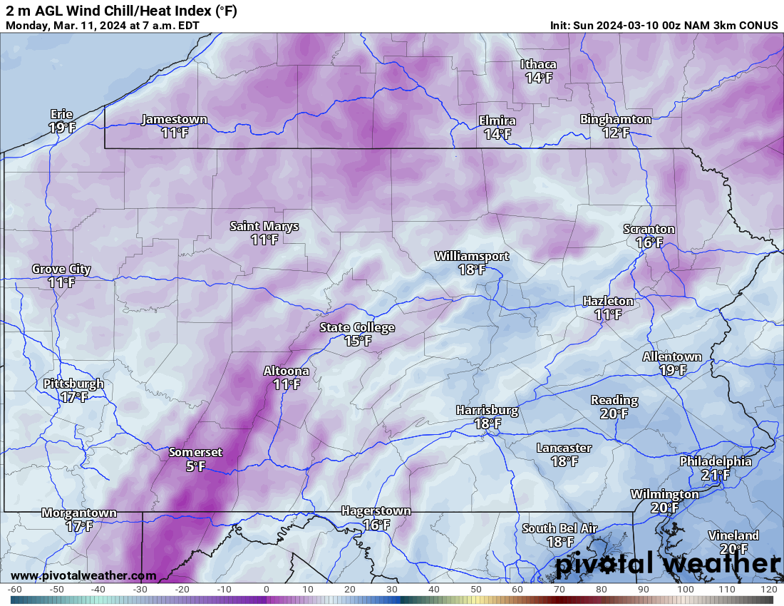
Wind gusts of 35 – 55 MPH are expected Sunday and Monday, causing ice cold wind chills Monday morning in the single digits and teens for most of us as shown below.
Gradually reduce speed in snow squalls as visibility reduces and roads become slick, which will mainly be in Western PA. Regardless of where you are, judge the conditions are respond accordingly!
Just give it a couple days and we will be enjoying the weather much more (that is, unless you’re crazy and prefer today’s weather).

You must be logged in to post a comment.