
After several gloomy days and a couple rounds of rainfall, the sun finally broke through this afternoon as a surface high moved into the region.
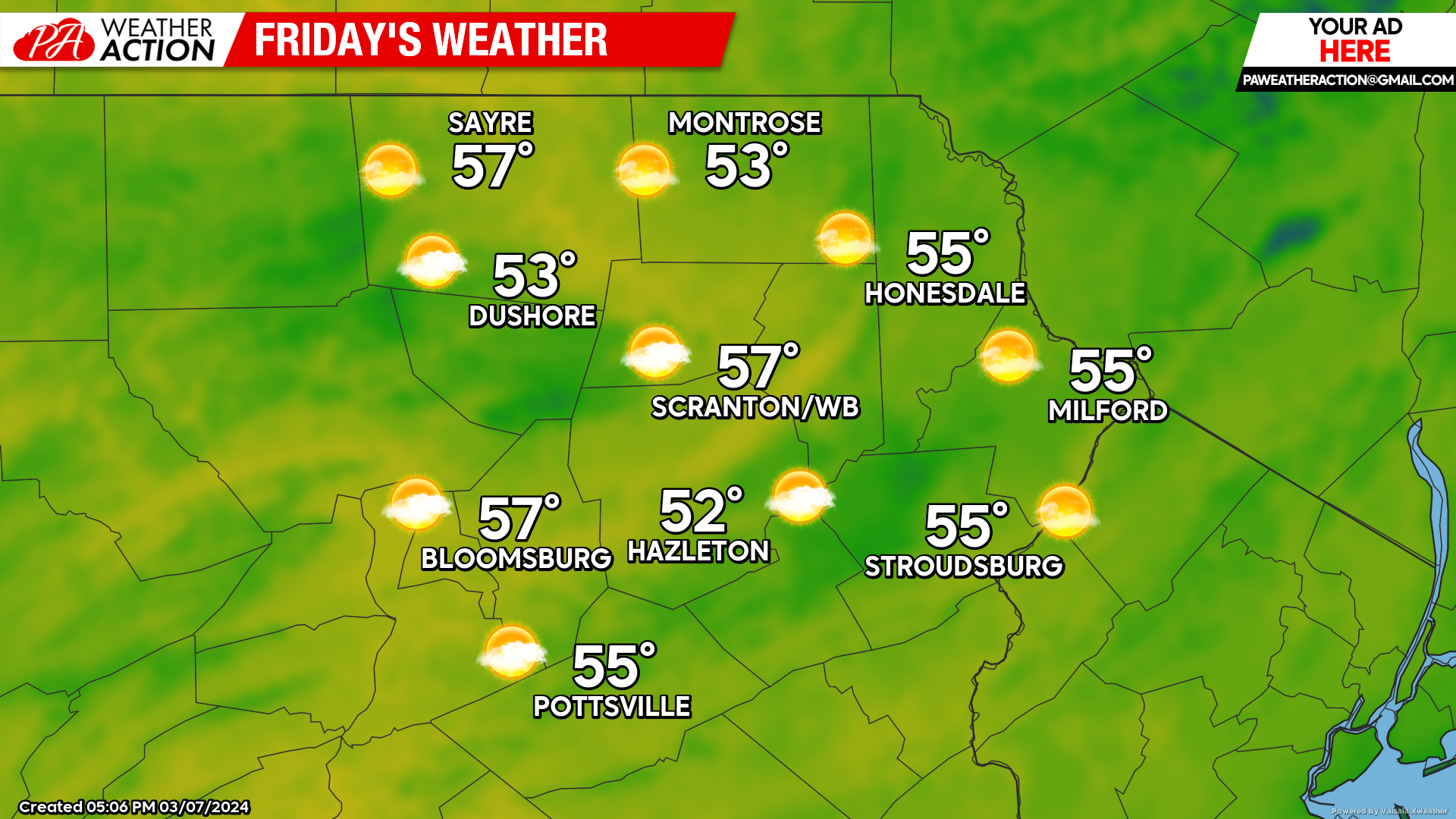
FRIDAY
That surface high will provide sunshine through much of Friday. Clouds will increase late in the day as the next system approaches from the southwest.
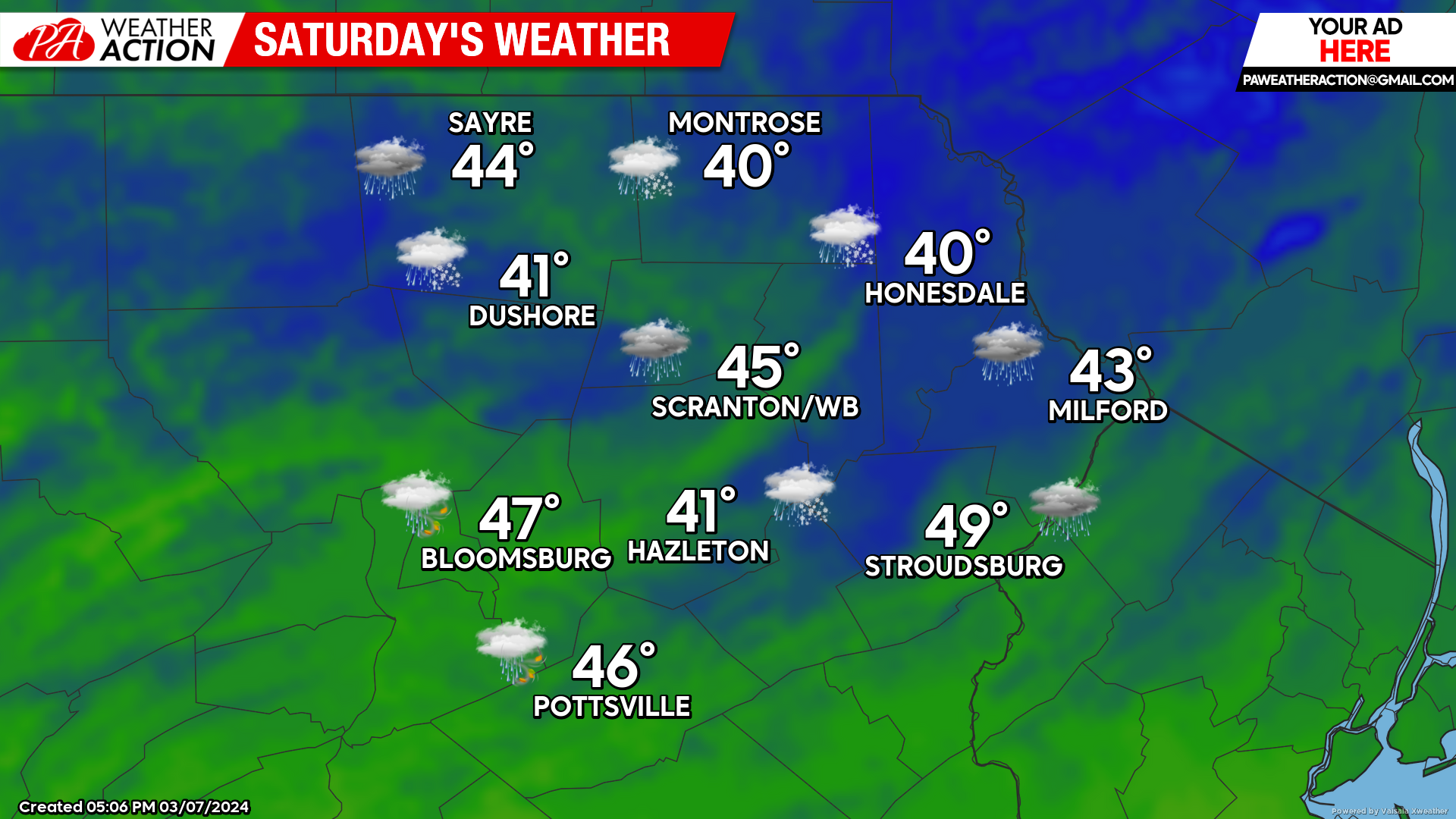
SATURDAY
That system will track through the eastern Great Lakes and northeastward along the US-Canada border / St Lawrence seaway on Saturday. Precipitation will overspread our area midday Saturday. The surface high could provide just enough cold air at the onset for some mixed precipitation along the PA-NY border, but any frozen precipitation will quickly change to rain. Rain will become increasingly heavy during the afternoon ahead of an approaching cold front that will cross our area from west to east late Saturday evening. The wind will increase as well, gusting over 30mph during the afternoon and evening, possibly 40mph in the more exposed areas of the higher elevations.
REMEMBER TO TURN CLOCKS AHEAD ONE HOUR AT 2AM SUNDAY!!!!
SUNDAY
As people recover from the lost hour of sleep, strong wind gusting 30-40 mph will usher colder air into the region along with snow showers. The strong wind will continue Sunday night into Monday.

BEYOND SUNDAY
(Mon-Fri March 11-15)
After a windy start with near-normal temperatures Monday, temperatures will climb to above-normal levels for the remainder of the week. There will be the opportunity for showers late in the week. High temperatures Monday will be in the low 40s with lows in the low-mid 20s. High temperatures later in the week will be near 50 in the higher elevations, and well into the 50s for the valleys.

You must be logged in to post a comment.