
The first snow of Fall is exciting every year for every age, there’s just something about it! Often times it arrives a little earlier in October in the form of harmless flakes that melt on contact with the ground. However, this cold front is very strong and will have harsh snow squalls coming in from Lake Erie. Temperatures will near freezing across Western & Northern PA, which may cause these squalls to produce poor travel conditions even though the ground is still warm.
TIMING
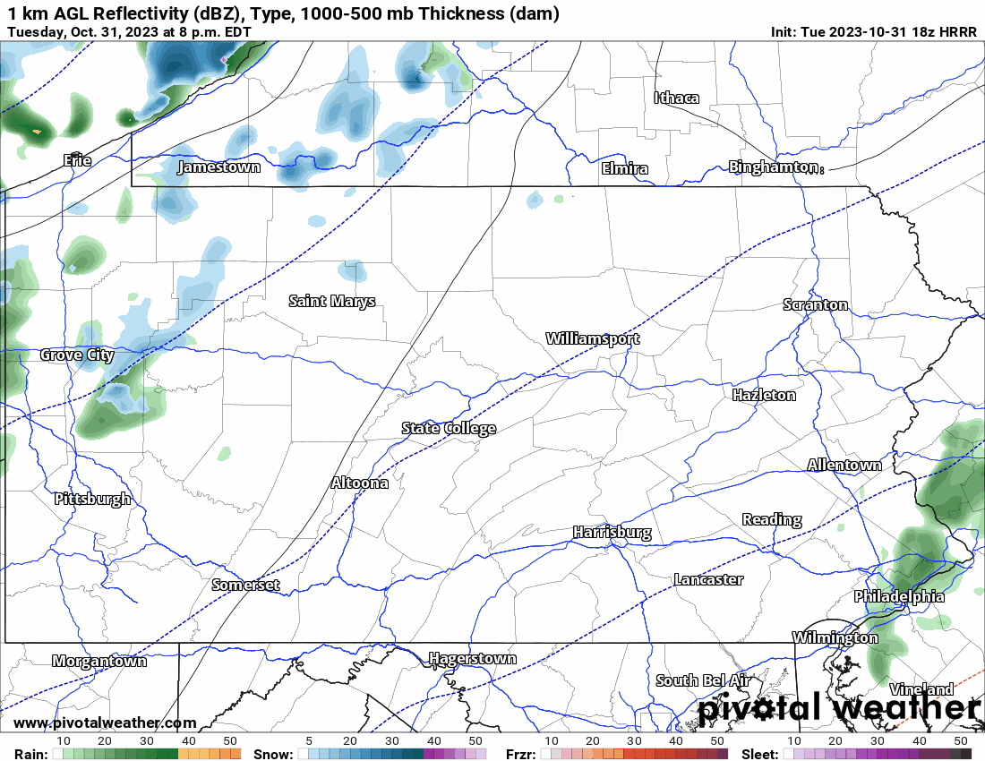
Snow squalls will arrive in Western PA after 9 PM Tuesday evening, and push east into the Alleghenies by early Wednesday morning. It’s even possible the leftovers of some of these squalls may make it over the mountains and into some of the Central PA valleys before sunrise Wednesday. Then around and after sunrise Wednesday, lake effect snow showers are expected mainly in the Northwest PA lake effect belt and western-facing slopes of the Laurel Highlands, mainly west of Somerset and Johnstown. Below is future radar from this evening’s High Resolution Rapid Refresh Model.
[quads id=2]
SNOWFALL FORECAST TUESDAY EVENING – WEDNESDAY EVENING (10/31 – 11/1/23)
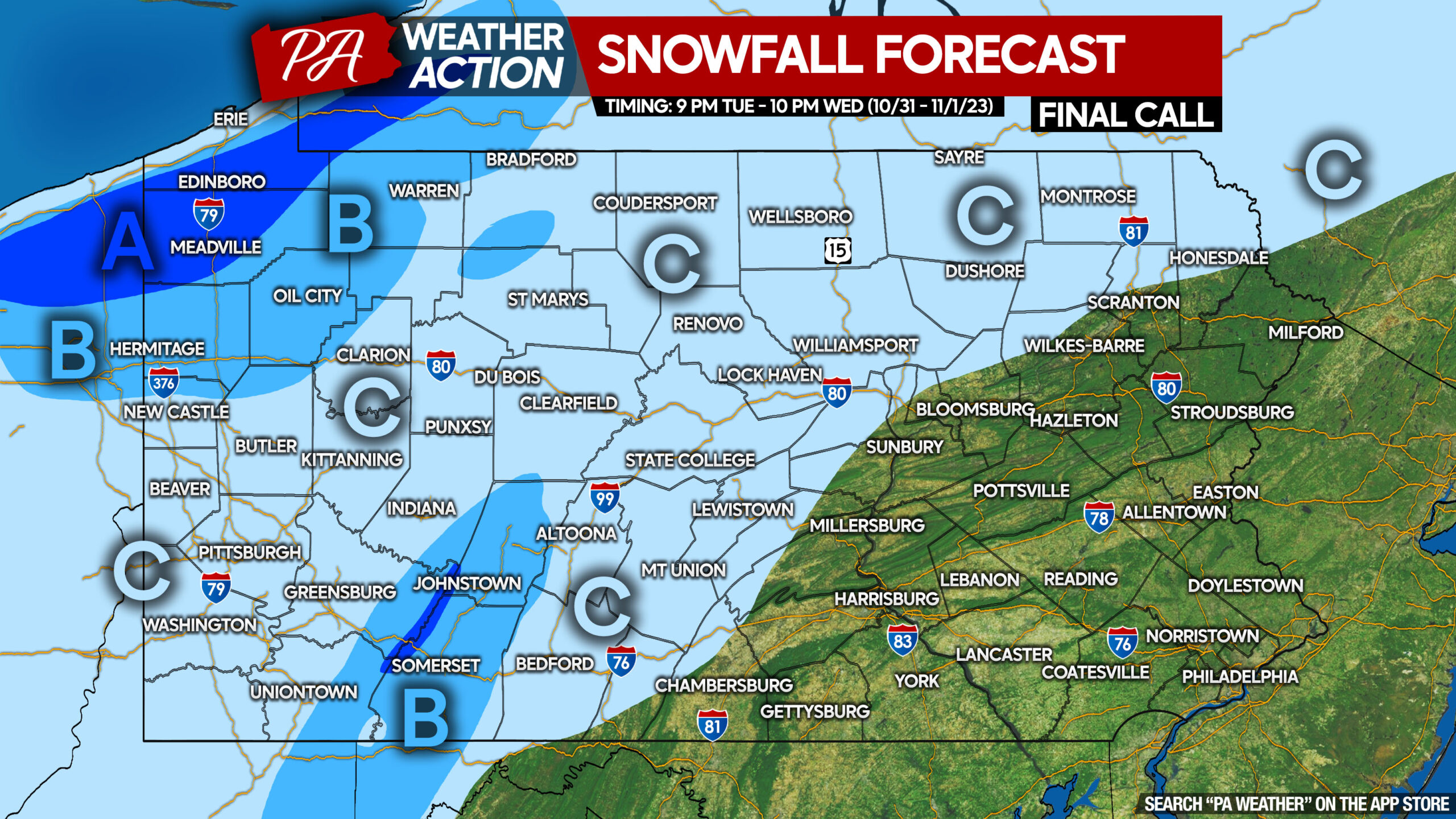
Area A: Frequent snow squalls and snow showers expected during forecast period. Snowfall accumulation of 2 – 4″ expected. Roadway impacts likely during snow squalls.
Area B: Scattered snow squalls and snow showers expected during forecast period. Snowfall accumulation of 1 – 2″ anticipated. Roadway impacts likely during snow squalls.
Area C: Scattered snow squalls in and west of the mountains, isolated mixed snow and rain showers east of the mountains (elevation-dependent). A coating of snow is possible. Roadway impacts possible in Western PA only during heavy snow squalls.
There’s nothing quite like the first snow of the year, and it can take people by surprise! Don’t forget to share this article with friends and family using the button below.

You must be logged in to post a comment.