
The cold front that squelched our late-season warmth is well south of our area. Precipitation from a surface low rippling along the front will soon exit our area, with northwest wind on the backside of the low driving temperatures into the low-mid 30s regionwide overnight.
TUESDAY
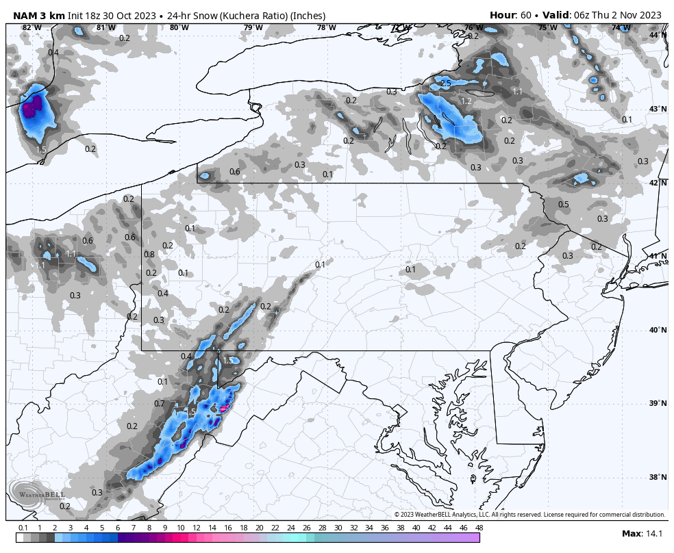
Halloween will feature partly cloudy skies and light wind. A moisture-starved disturbance dive through southern Great Lakes tomorrow and across our area Tuesday night. This will likely produce scattered light snow showers and the first flakes for many across the region Tuesday night, except for those living in the lowlands of southern Schuylkill, Carbon, and Monroe where surface temperatures will likely be too warm. These snow showers will not amount to much, with only the highest elevations having a chance at enjoying a coating. Still, the first flakes are an important moment for many, so it is worth mentioning!

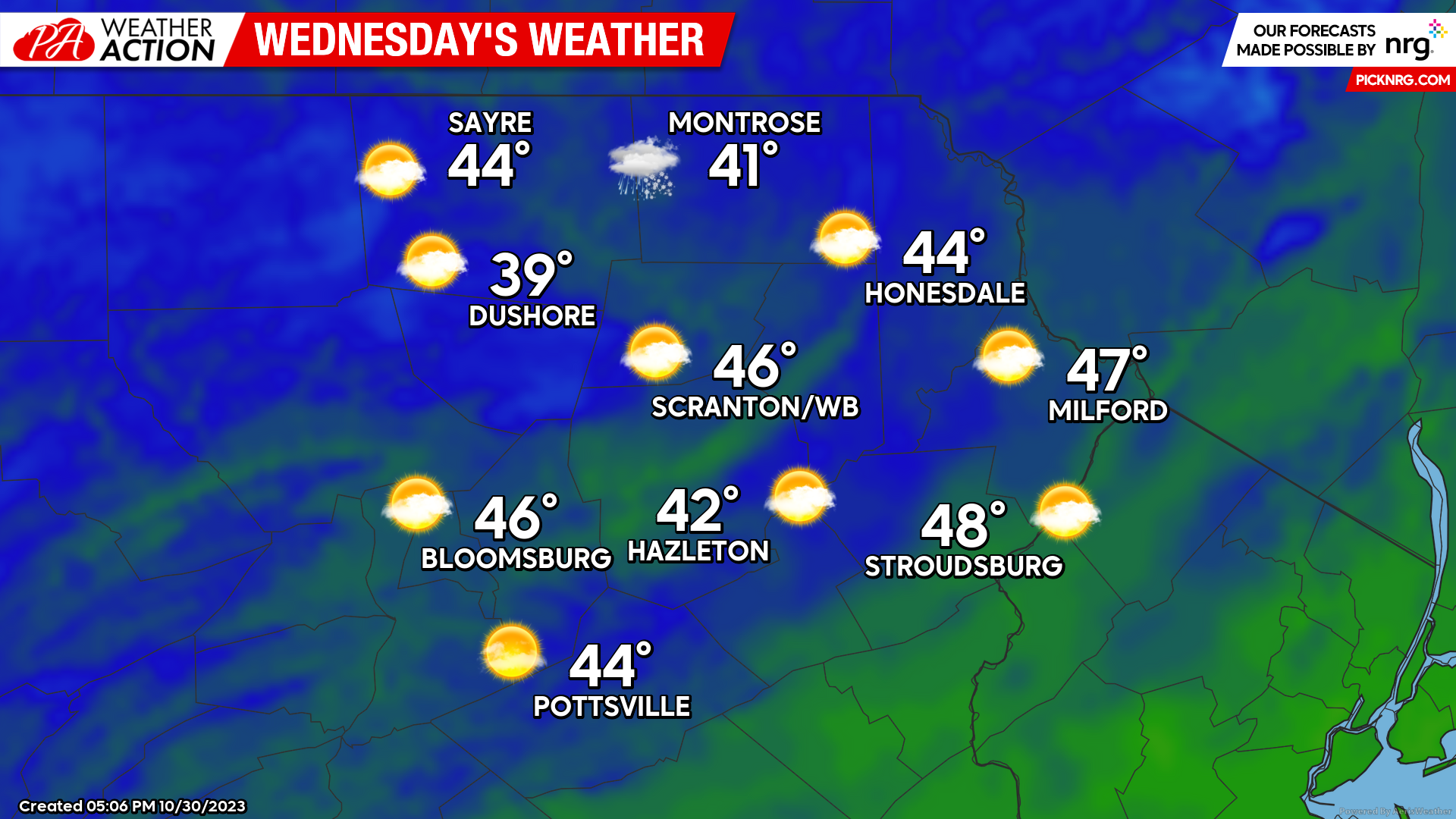
WEDNESDAY
That departing disturbance will induce gusty NW wind on Wednesday, along with scattered snow showers across the northern part of the area. It will also draw even-colder air into our area, with a widespread hard freeze and temperatures in the 20s Wednesday night into Thursday morning. Welcome to November!
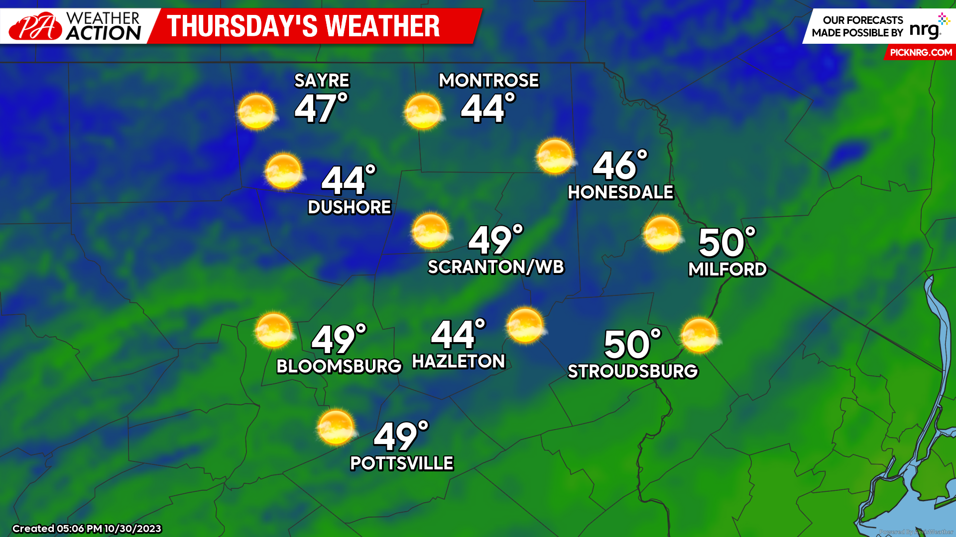
THURSDAY
Thursday will feature slightly below-normal temperatures, but with ample sunshine and light wind as a sprawling surface high will move over our region. Enjoy!
You must be logged in to post a comment.