
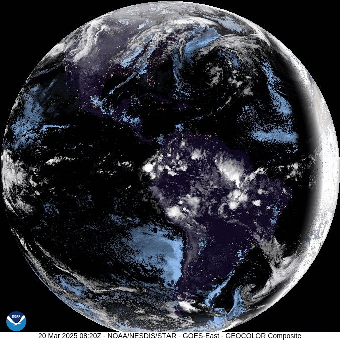
We’ve enjoyed a very mild week, with temperatures climbing above 70 F in parts of our area on Wednesday! And, as if on cue, Spring began with the Vernal Equinox which occurred at 5:01 AM Thursday morning. Every part of Earth enjoys 12 hours of daylight today! The visible satellite loop shows today’s sunrise perfectly aligned with the north-south meridians.
Breezy south wind ahead of an approaching cold front sent temperatures soaring well into the 60s this afternoon. That cold front will cross our area this evening, accompanied by a line of showers that will provide around a half inch of rain. When the front reaches the coast, a surface low will form along the front off the NJ coast this evening. That low will intensify tonight and move northeastward along the front, and will be located east of New England by Friday afternoon. Behind the front tonight, wind from the northwest will increase with gusts approaching 40 mph across the higher terrain by Friday morning. As colder air is blown into our area, there could even be some snowflakes across the higher terrain, but no accumulation is anticipated.
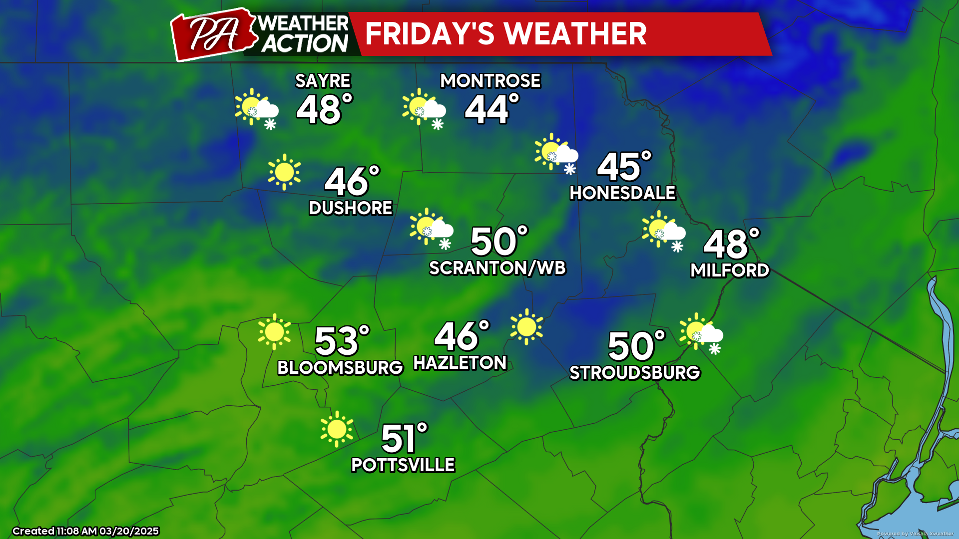
FRIDAY
Now that Spring has officially commenced, strong wind gusts exceeding 40 mph from the northwest will make for a chilly, blustery day. On a positive note, there will be ample sunshine as high pressure moves over our area. Enjoy!
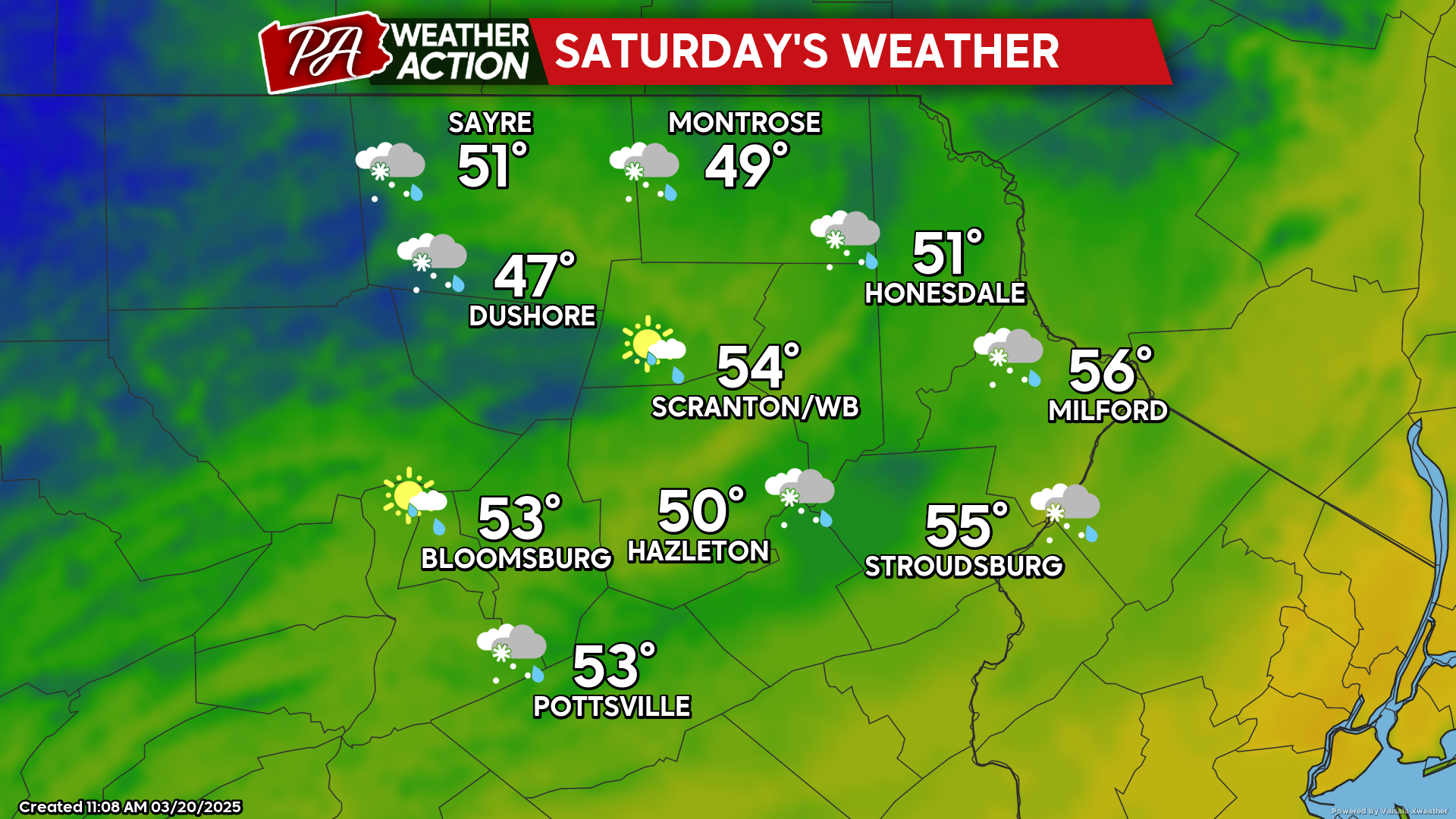
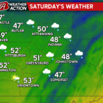
SATURDAY
Another cold front will push eastward through our area and bring additional showers and breezy conditions. Colder air will be whisked southeastward by gusty winds during the afternoon, and there could even be some snow showers in the higher terrain by evening!
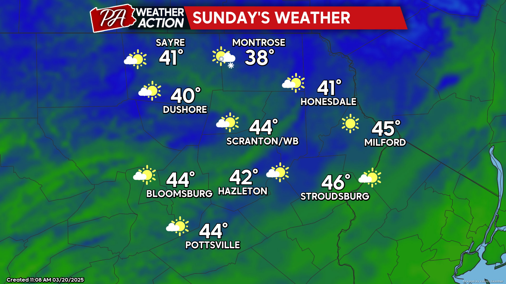
SUNDAY
High pressure will bring partly to mostly sunny skies. Temperatures will be a little colder than normal for this time of year, with widespread low-mid 40s. Some of the higher elevations might even fail to reach 40. Meanwhile, a storm system will move northward into the Great Lakes, dragging a warm front into our area, which could deliver a wintry mix Sunday night. Welcome to Spring!
You must be logged in to post a comment.