

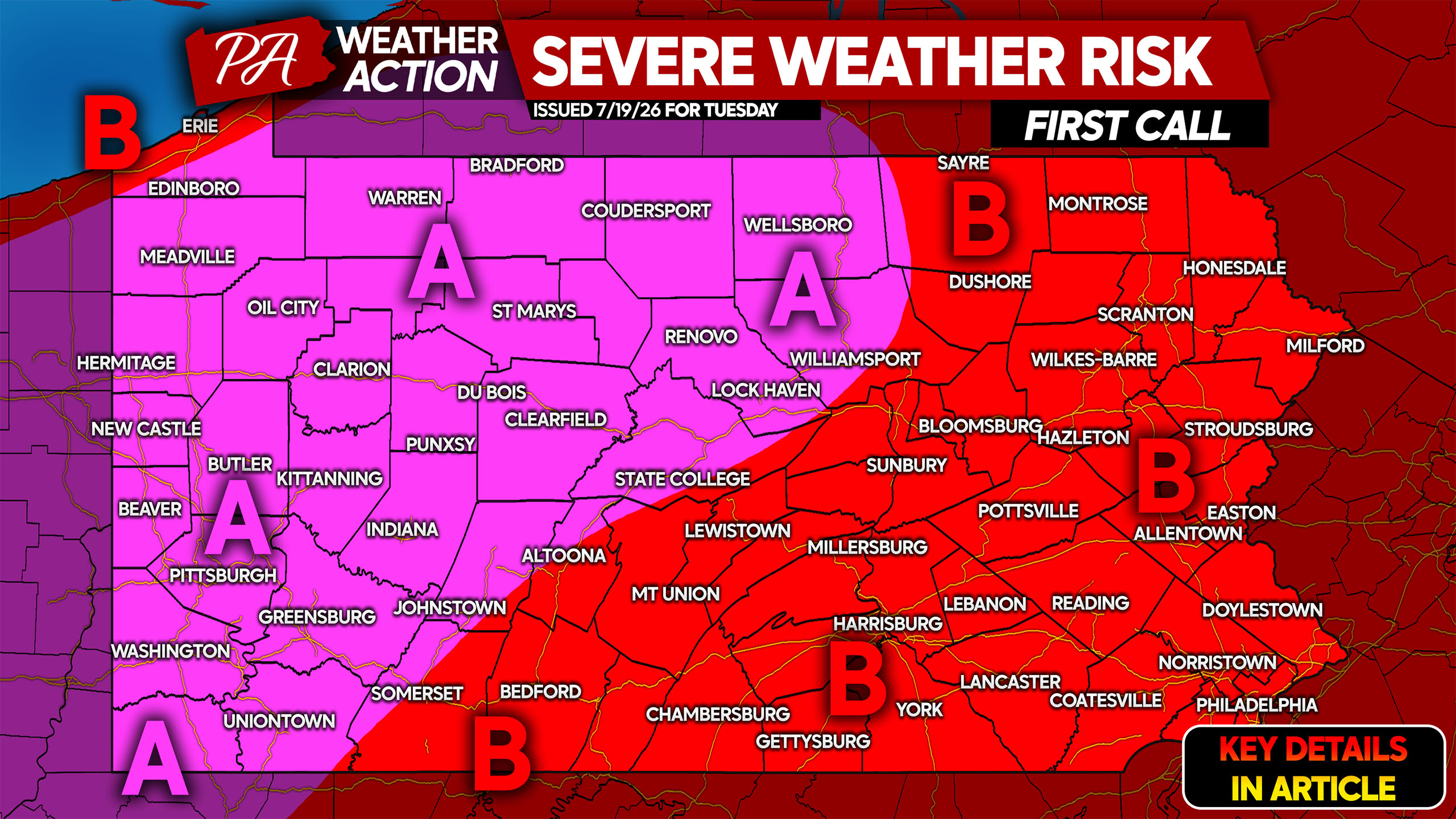
FINAL CALL POSTED, VIEW ARTICLE BELOW:
After a dramatic day of severe weather on Saturday resulted in at least two tornadoes, another equally significant day of severe storms looms on Tuesday. Damaging winds up to 90mph are once again on the table, along with an even higher tornado and hail threat.
Supercells are likely to develop Tuesday afternoon across much of the state, especially in Northern and Western PA. By early evening, those supercells are expected to spread into the eastern half of the state.
A more solid line of storms may push through from northwest to southeast at the end of the evening Tuesday.
FUTURE RADAR TIMING
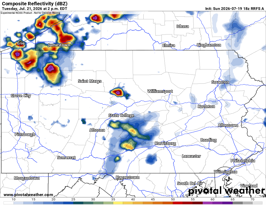
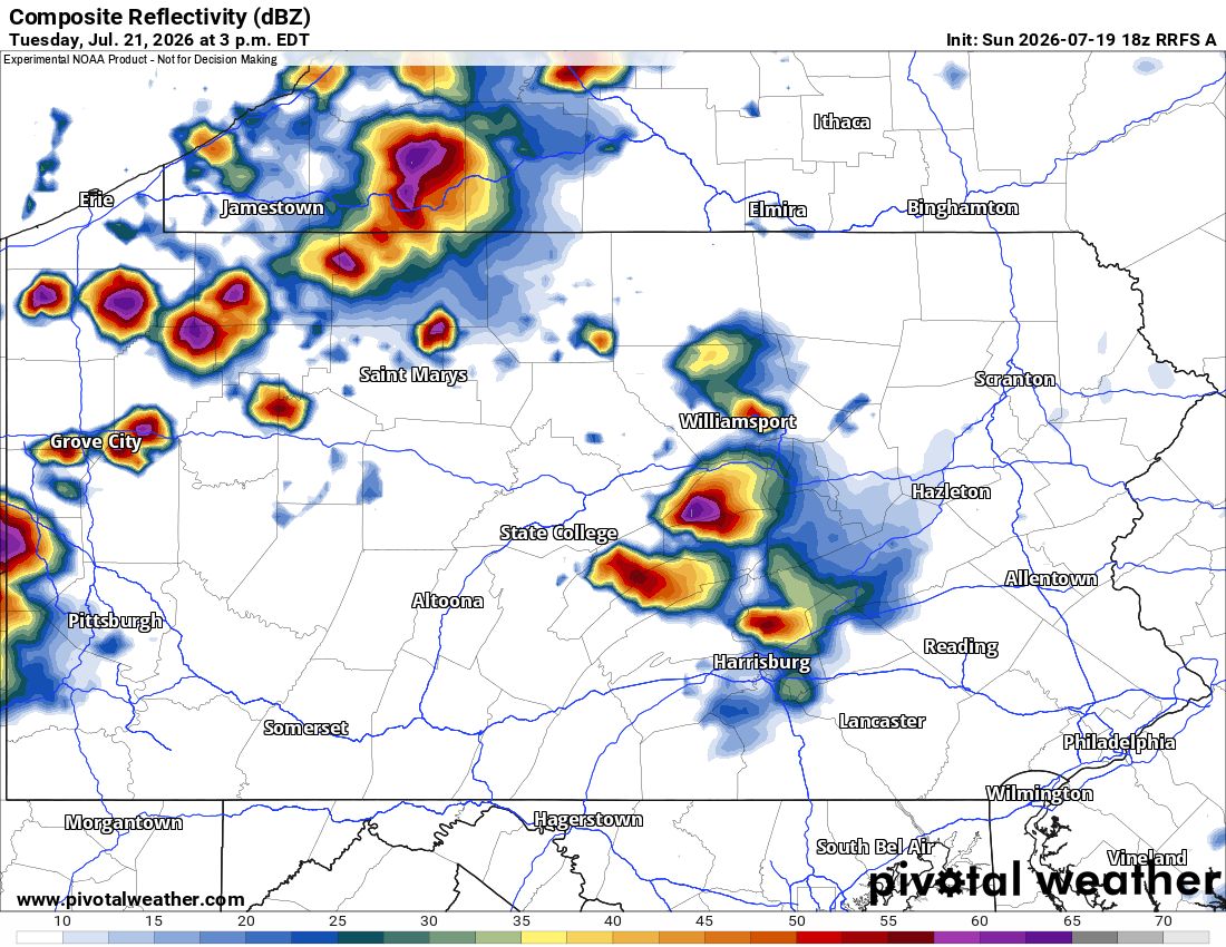
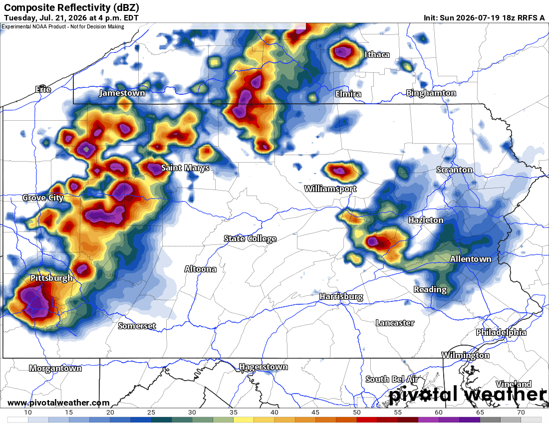
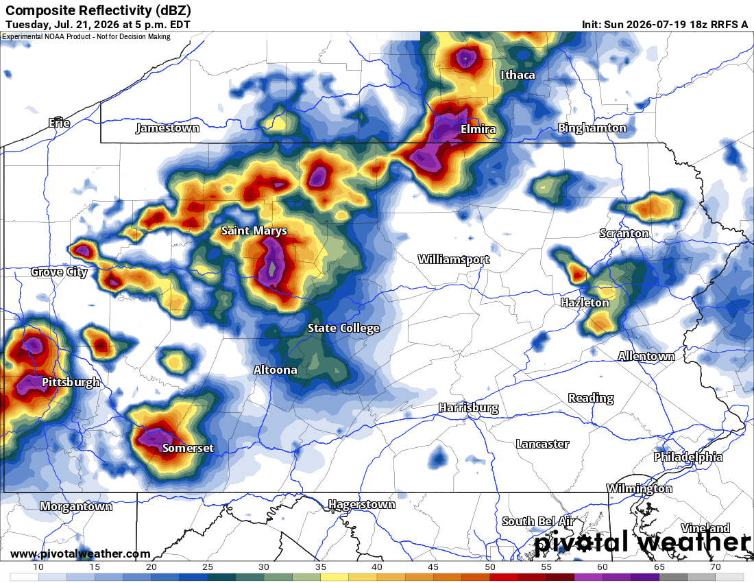
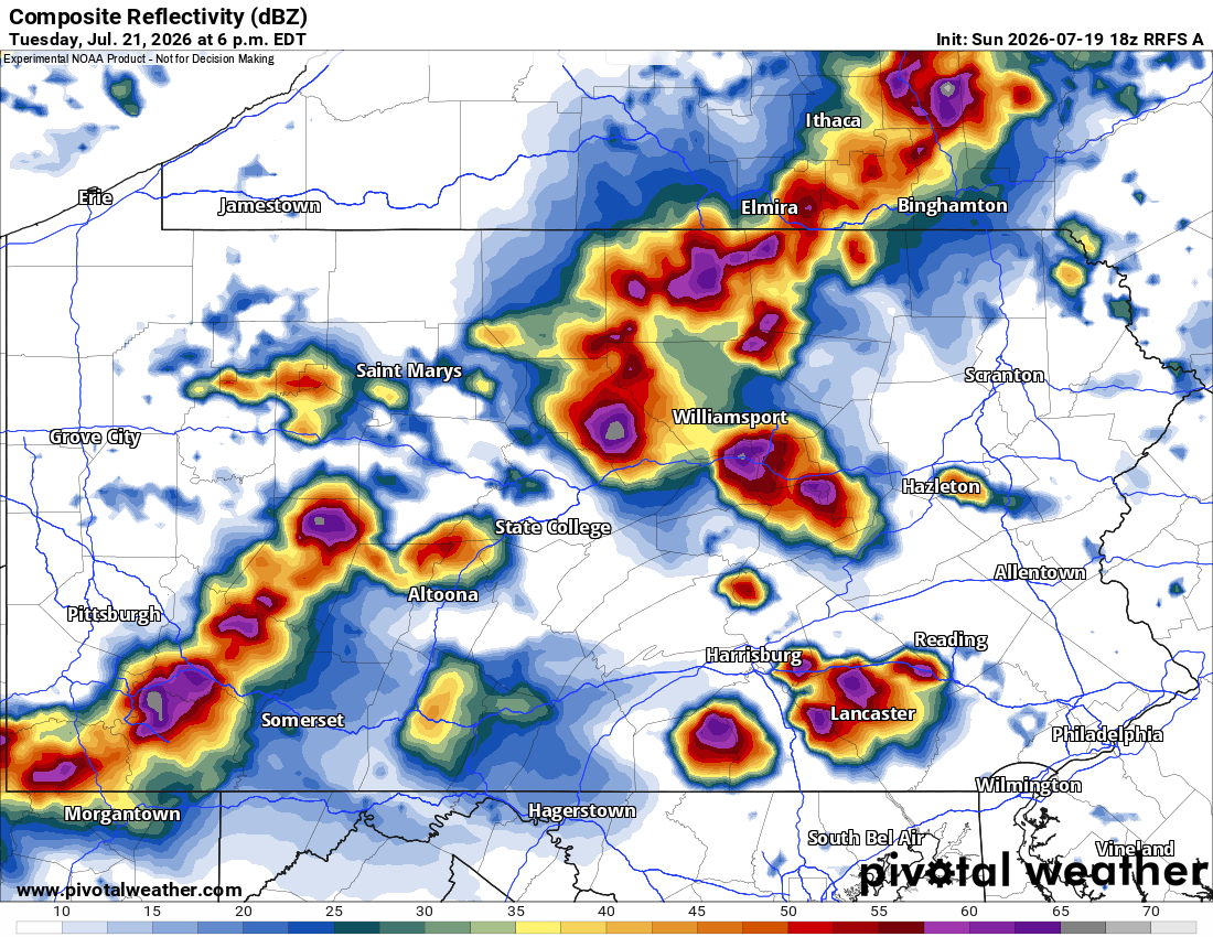
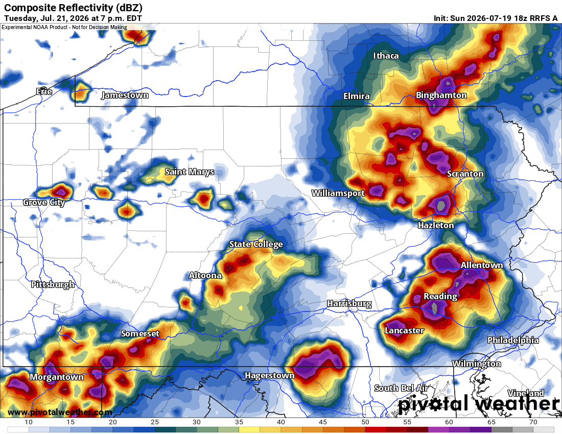
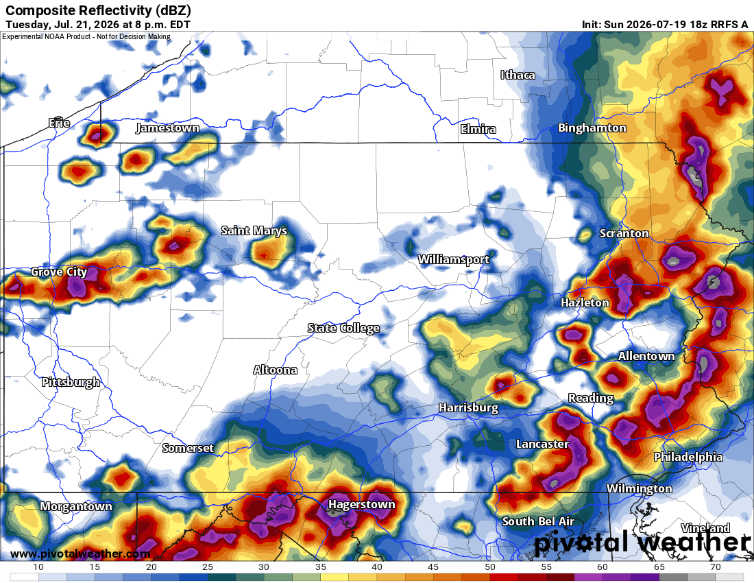
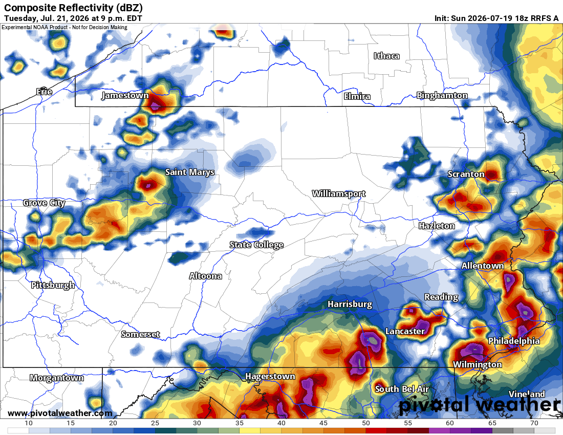
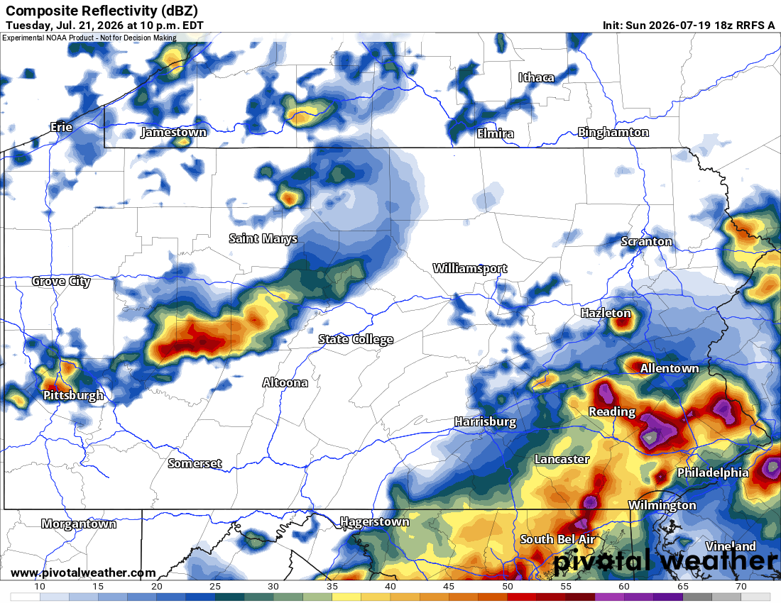
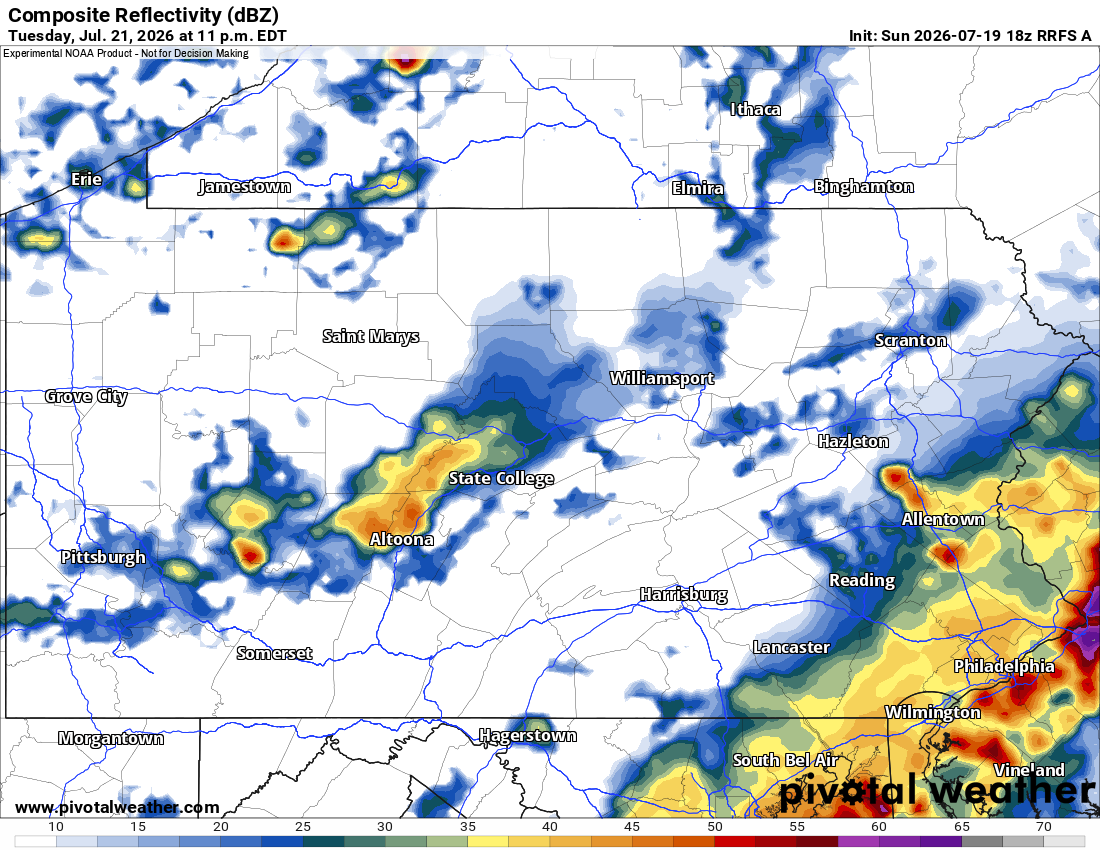
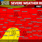
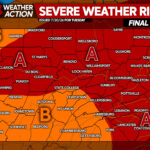
SEVERE THUNDERSTORM THREAT FORECAST FOR TUESDAY
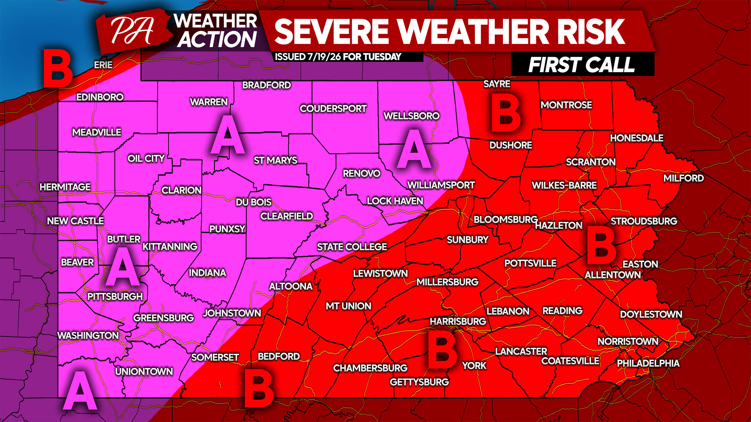
Area A: Scattered to widespread severe thunderstorms are expected Tuesday afternoon and evening. Damaging winds up to 90mph possible in the most intense supercells, along with isolated tornadoes and large hail.
Area B: Isolated to scattered severe thunderstorms are expected Tuesday afternoon and evening. Damaging winds up to 80mph are possible in the most intense supercells, along with isolated tornadoes and large hail.
Don’t forget to share this forecast with family and friends, as these storms look to be particularly impactful.

You must be logged in to post a comment.