
The second call snowfall forecast for Tuesday into Wednesday, along with details on the following storm have been posted. Please follow the linked article below.
Second Call Snowfall Forecast for Two Winter Weather Threats Midweek in Pennsylvania
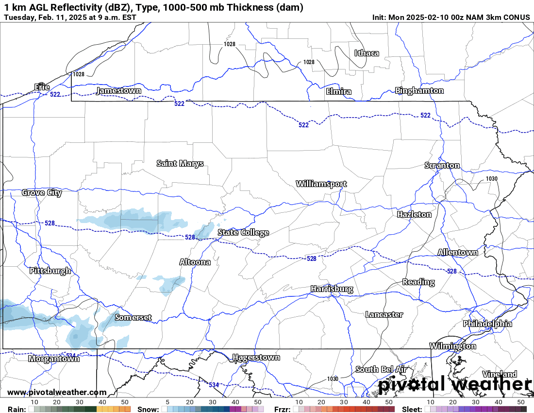
As mentioned, we are in the middle of an active weather pattern. Another winter storm will impact the area Tuesday into Wednesday, however, today will be calm. Below is a look at the currently satellite imagery:

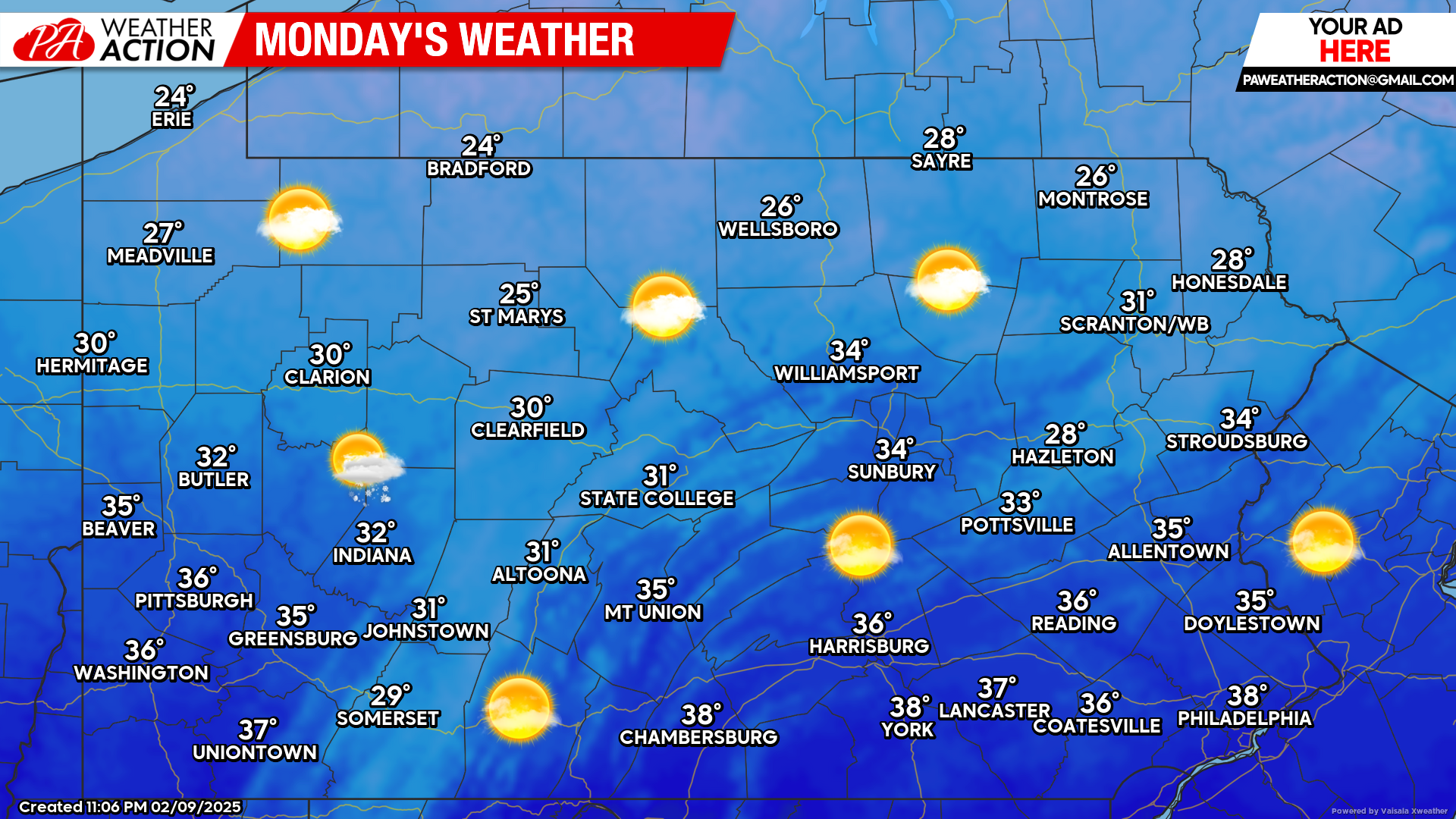
Today’s Weather Forecast: 9/10
Today will feature mostly sunny skies with temperatures in the 20s and 30s across the state.
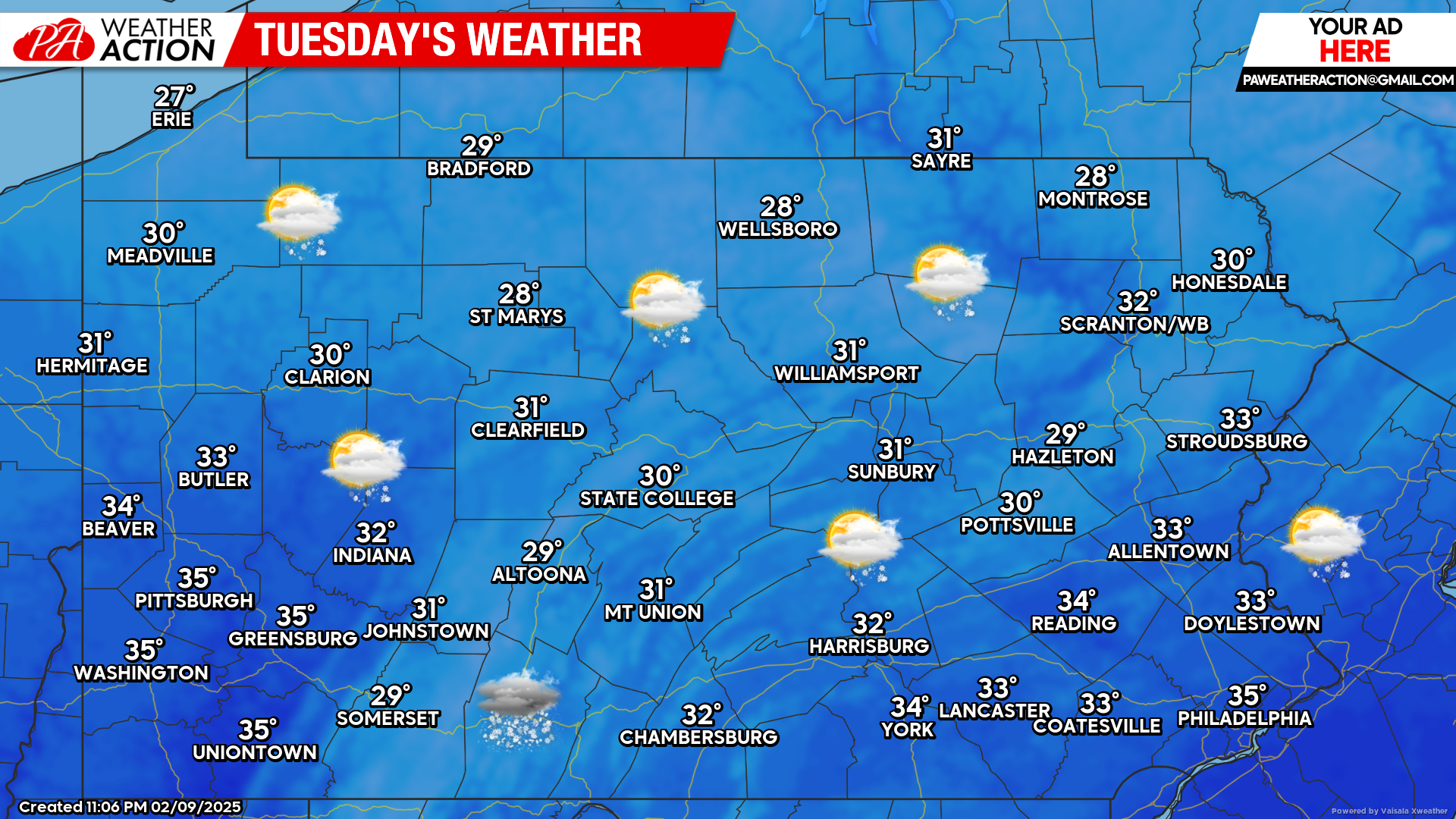
Tuesday’s Weather Forecast: 4/10
Increasing clouds in the morning will lead to steady snow by the afternoon and evening hours, mainly across southern Pennsylvania. Temperatures will generally range from the upper 20s to low 30s.
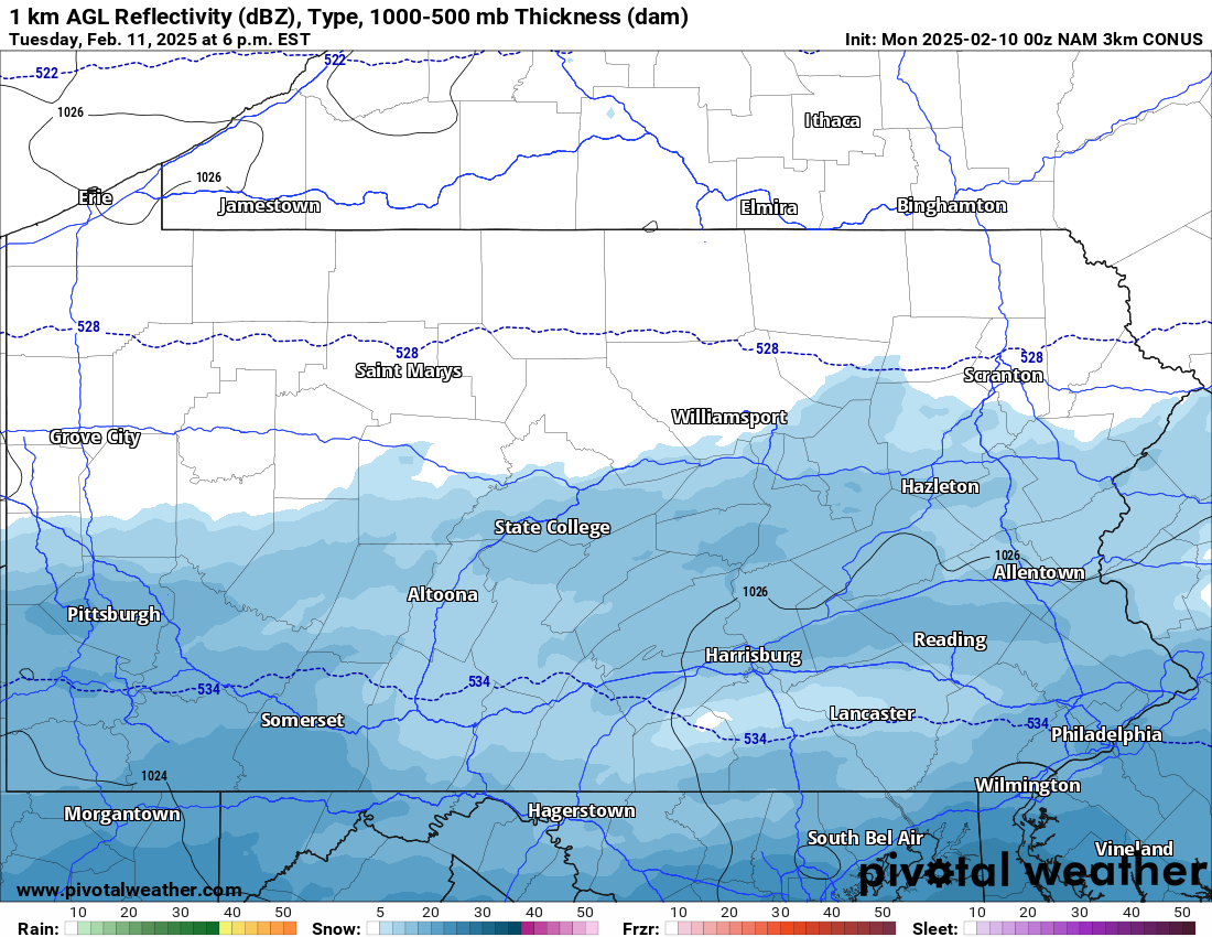
Hi-Res NAM Future Radar Valid Tuesday 9:00 AM Through 7:00 AM Wednesday:
Steady, accumulating snow will impact southern Pennsylvania, especially south of the turnpike Tuesday into Wednesday. Please plan accordingly if you have travel plans Tuesday evening through Wednesday morning. Several inches of snow is possible, with the highest amounts being along the PA/Maryland border.
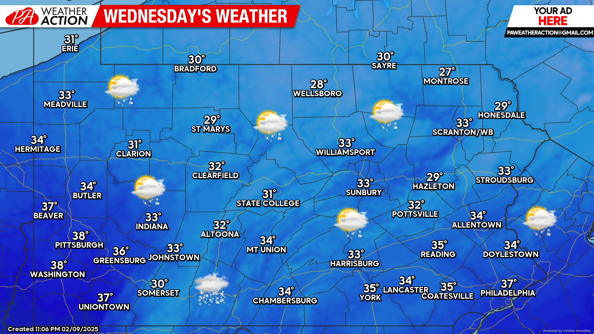
Wednesday’s Weather Forecast: 5/10
Morning snow is likely across southern Pennsylvania. By the afternoon hours, clouds will once again be on the increase ahead of our next storm system that will likely bring another wintry mix to the state Wednesday night into Thursday.
If you missed our first call snowfall total forecast for Tuesday into Wednesday, click the link below:
First Call Snowfall Forecast for Tuesday – Wednesday’s Southern Pennsylvania Snow


You must be logged in to post a comment.