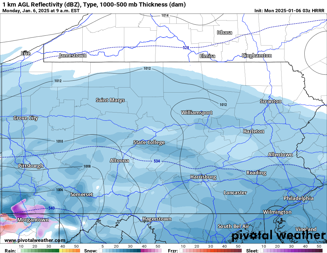
The first widespread significant snowstorm of the season for southern Pennsylvania is currently underway. Many of us are waking up to a fresh coating to several inches of snowfall! Below is a look at the latest radar:
Today’s Weather Forecast: 1/10
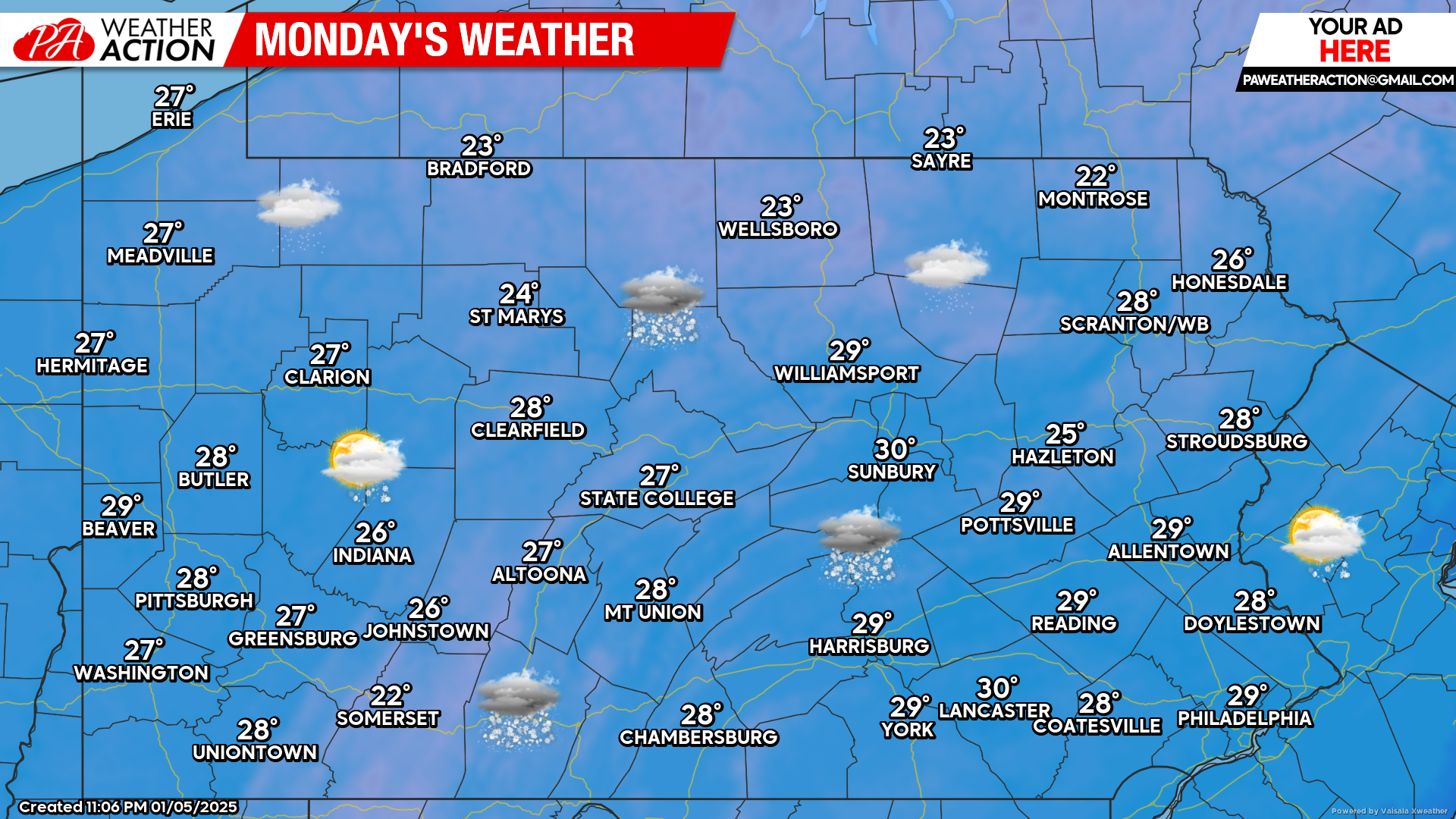
Widespread snowfall is expected today, with the heaviest snowfall closer to the Pennsylvania/Maryland border. Temperatures will not make it out of the 20s which will result in whatever snow falling, to accumulate on all surfaces.
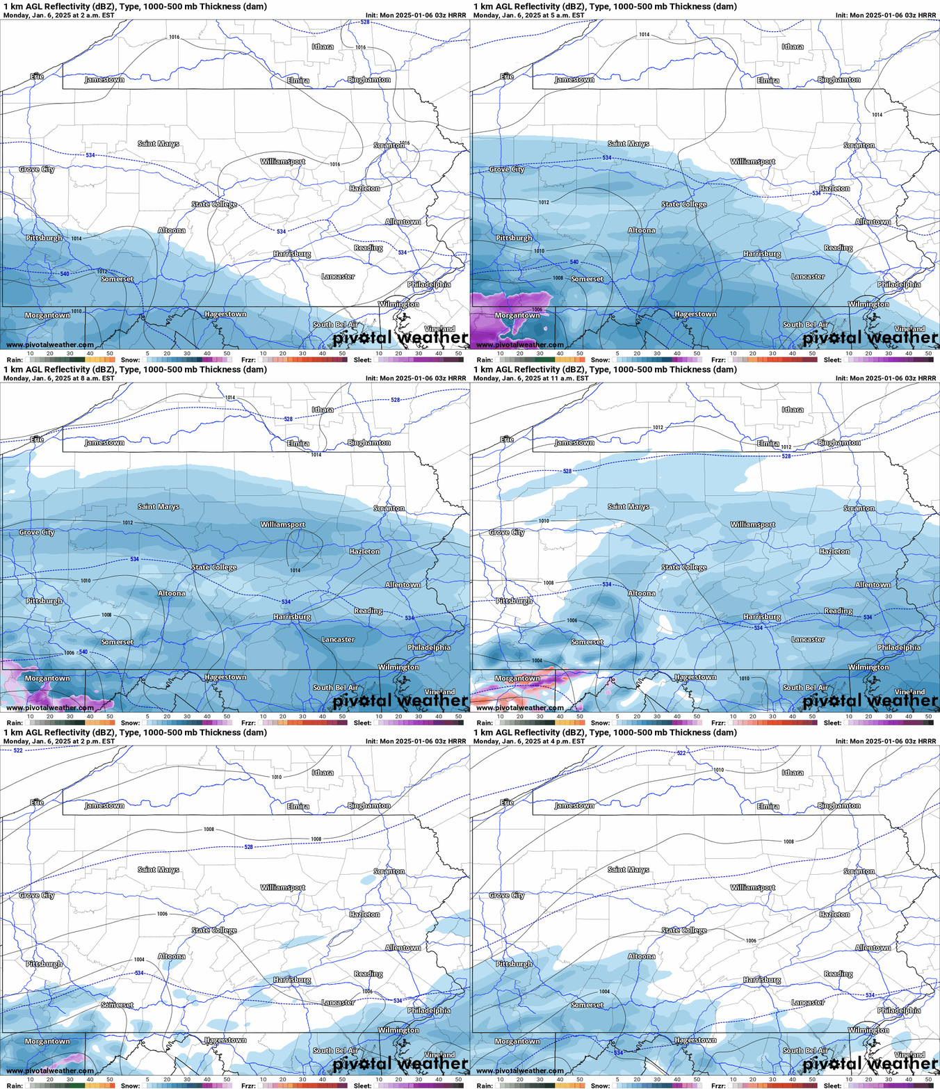
HRRR Future Radar Valid through 4:00 PM this afternoon:
Below is a look at the latest short range HRRR model future radar through 4:00 pm this afternoon. The bulk of the snow will occur during the morning hours today.
By the early afternoon, we expect the snowfall to diminish, with lingering snow showers possible through the evening hours.
Tuesday’s Weather Forecast: 7/10
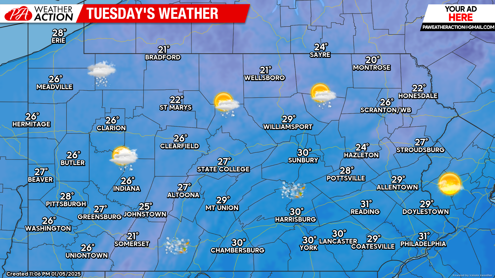
Tuesday, the snow will clear out of most of the state. However, winds will be on the increase resulting in lake effect snow showers to take place across northwest Pennsylvania.
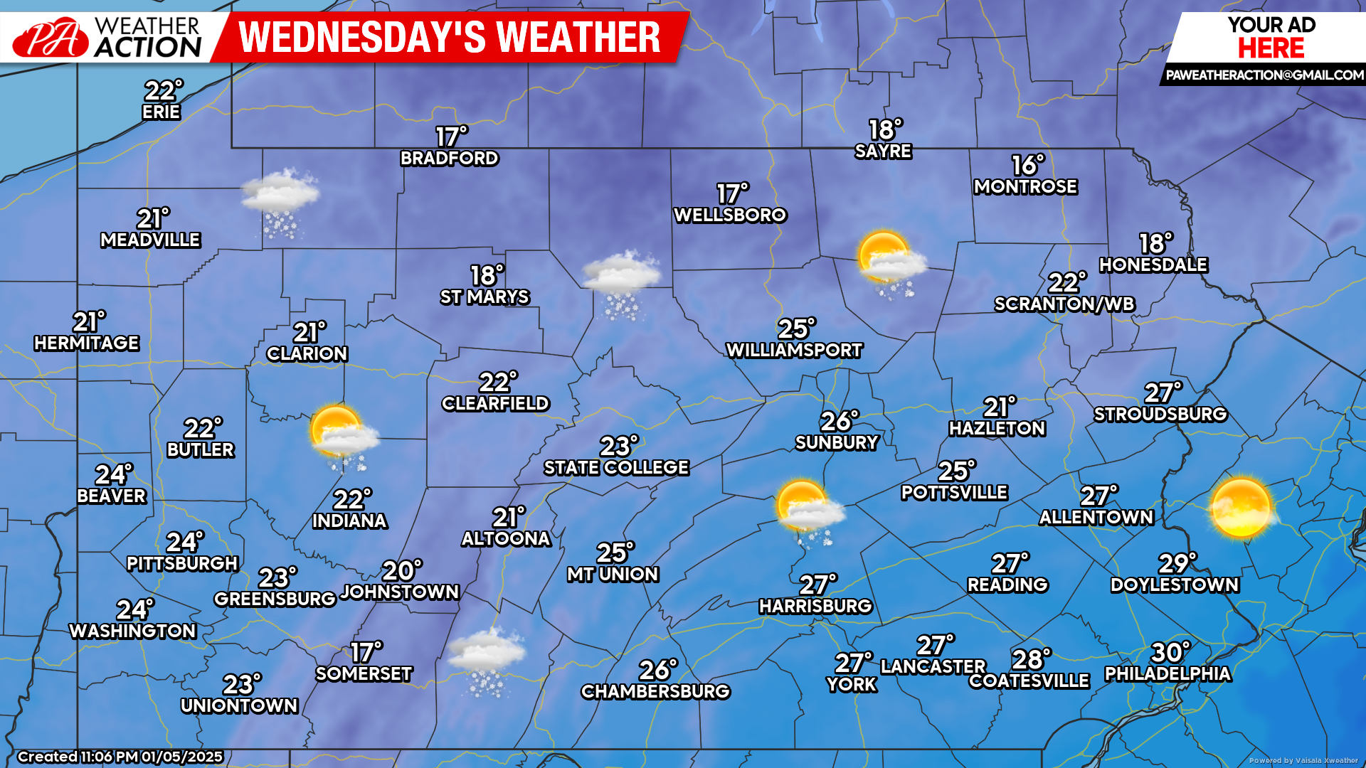
Wednesday’s Weather Forecast: 7/10
Lake effect snow showers will continue across western and especially northwest Pennsylvania on Wednesday. Elsewhere a mix of clouds and sunshine can be expected with temperatures in the teens and twenties.
If you missed our final call snowfall forecast for today’s snowstorm, please view the link below. If you are traveling today, make sure to give yourself extra time to reach your destination.
Final Call Snowfall Forecast for Monday’s Snowstorm in Parts of Pennsylvania

You must be logged in to post a comment.