

A prolonged dry spell has significantly impacted fall foliage up to this point. For many areas in Pennsylvania, it has been three weeks since the last raindrop. This combined with the heat has slowed foliage change and resulted in many brown or even green leaves to fall.
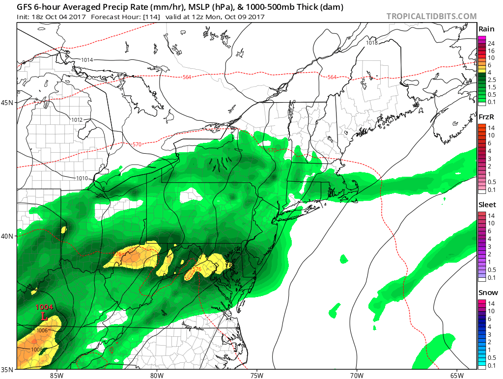
There is hope in sight, as a tropical system looks to possibly head our way early to mid next week. Heavy rain could fall depending on the track of this system. The European Model stands out the most, as it brings significant rainfall days ahead of the low pressure system.
The GFS and Canadian model display less precipitation, though still moderate rainfall. Below is the GFS Model for Sunday Night.
In addition, temperatures will begin to moderate more by mid October. The area will likely experience frequent temperature swings. Foliage will be somewhat behind schedule. However we do think this rainfall will boost foliage.
Our Preliminary 2017-2018 Winter Outlook will be issued Wednesday October 11th. Click here to stay tuned for the outlook by downloading our free app. Don’t forget to share this good news below!
You must be logged in to post a comment.