
Summerlike temperatures are on now on hold as an active pattern has taken hold of the Eastern US. Typically this time of year, rainy days are cool and sunny days are warm to hot. The next three weeks will have so many nuisance systems that finding a completely dry day to mow the lawn will be difficult, but not impossible.
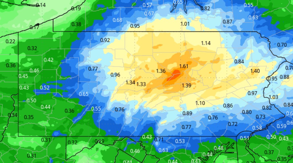
Widespread rain showers are falling this morning in Central and Eastern PA as a low near VA Beach slowly pushes off the coast. Not a heavy rain, but there are some pockets of moderate rain that you’ll want the umbrella for. Here is current satellite imagery of the state this Friday morning.

Live Radar
Rain is and will stay concentrated in and east of the Appalachians today. View the latest radar loop below.
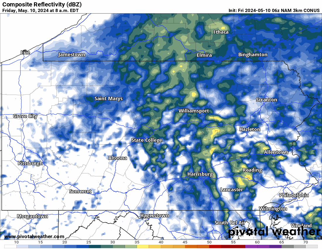
Hi-Res NAM Future Radar Friday AM – Sunday AM
Unfortunately for those of you antsy to get outdoors after the past few dreary weekends, another weak system will push across the Great Lakes into PA on Saturday. Rain will move into Western PA early Sat. afternoon, Central PA by late afternoon and Eastern PA by after dinner.
That system won’t be in a rush to pull out, with scattered showers continuing into Sunday. The timestamp is in the top left on the GIF below!
Fortunately with this pattern change comes the end of severe weather that has taken lives and done hundreds of millions in damage the last few weeks. One last day of severe weather today across parts of the Deep South and Northern Florida.
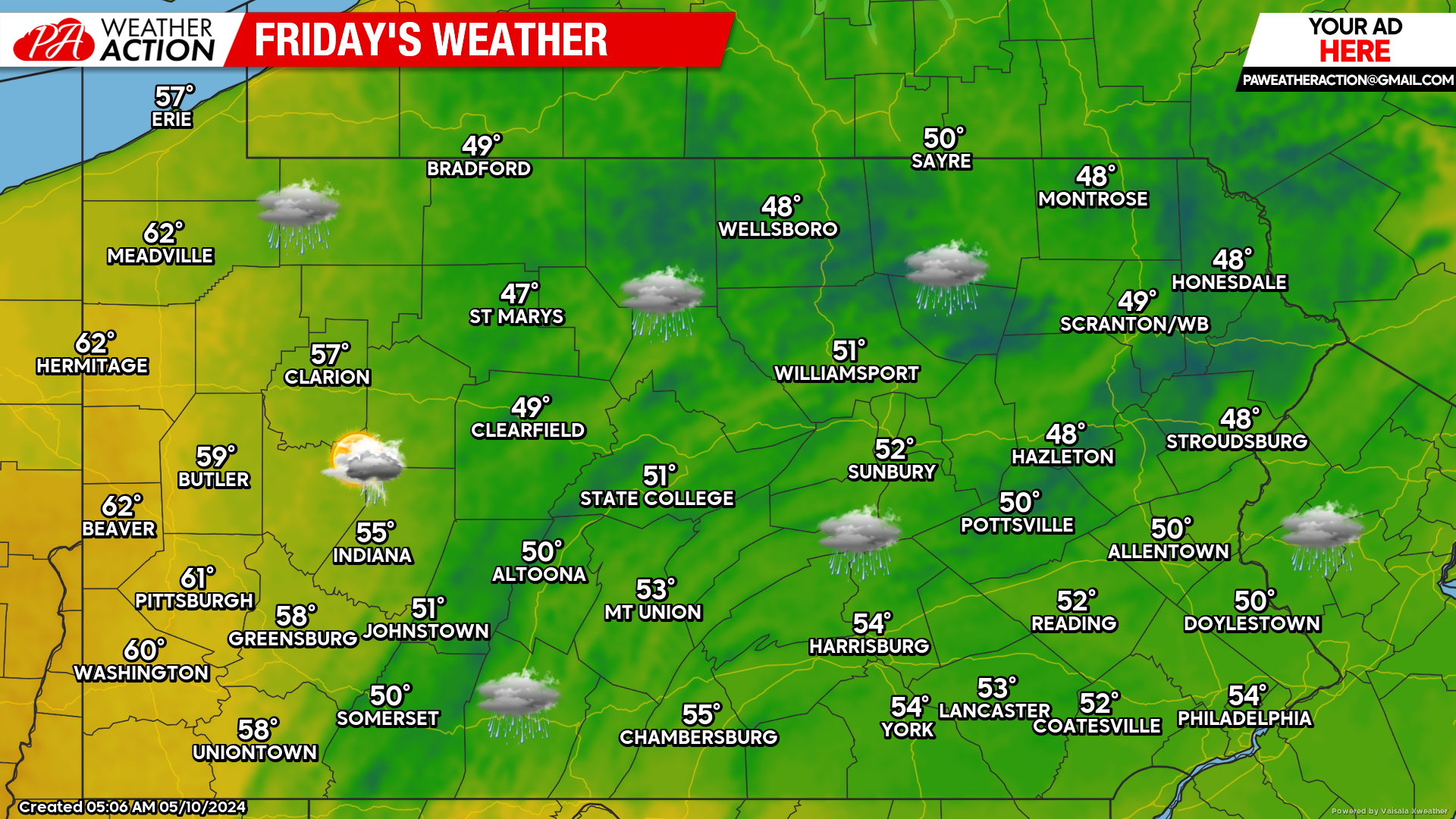
Today’s Forecast: 2-4/10 Weather Day
If it was late January, today would be closer to a five. However we are in one of the nicest times of the year, so 40s and 50s with rain isn’t going to cut it. However out in Western PA where rain won’t be falling, temperatures will reach the 60s today which is deserving of a 4/10.
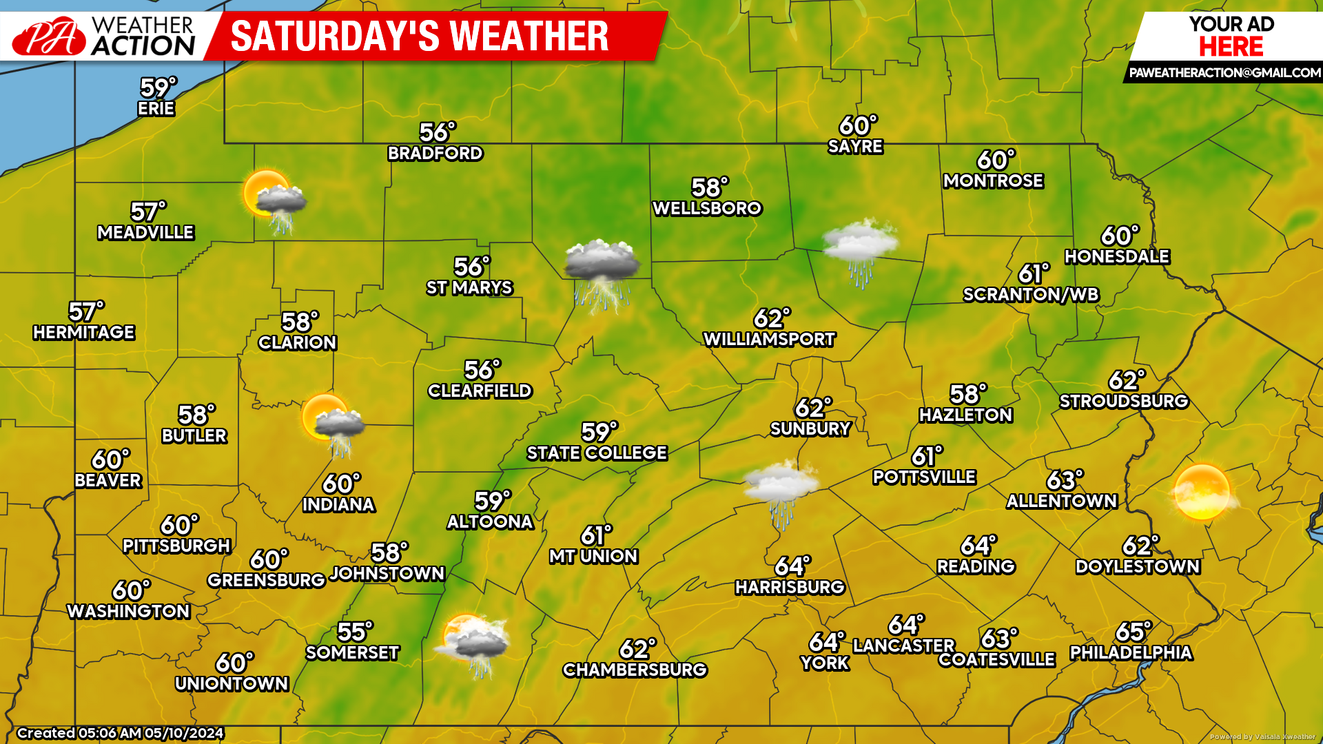
Saturday’s Forecast: 4/10 Weather Day
Saturday will be somewhat warmer in parts of the state with a lull in the action until later in most places. Highs will be much cooler in Western PA where showers push in around lunchtime, but warmer out east where max daytime heating occurs under dry conditions. Saturday afternoon will be salvageable in Eastern PA, so be sure to take advantage of that.
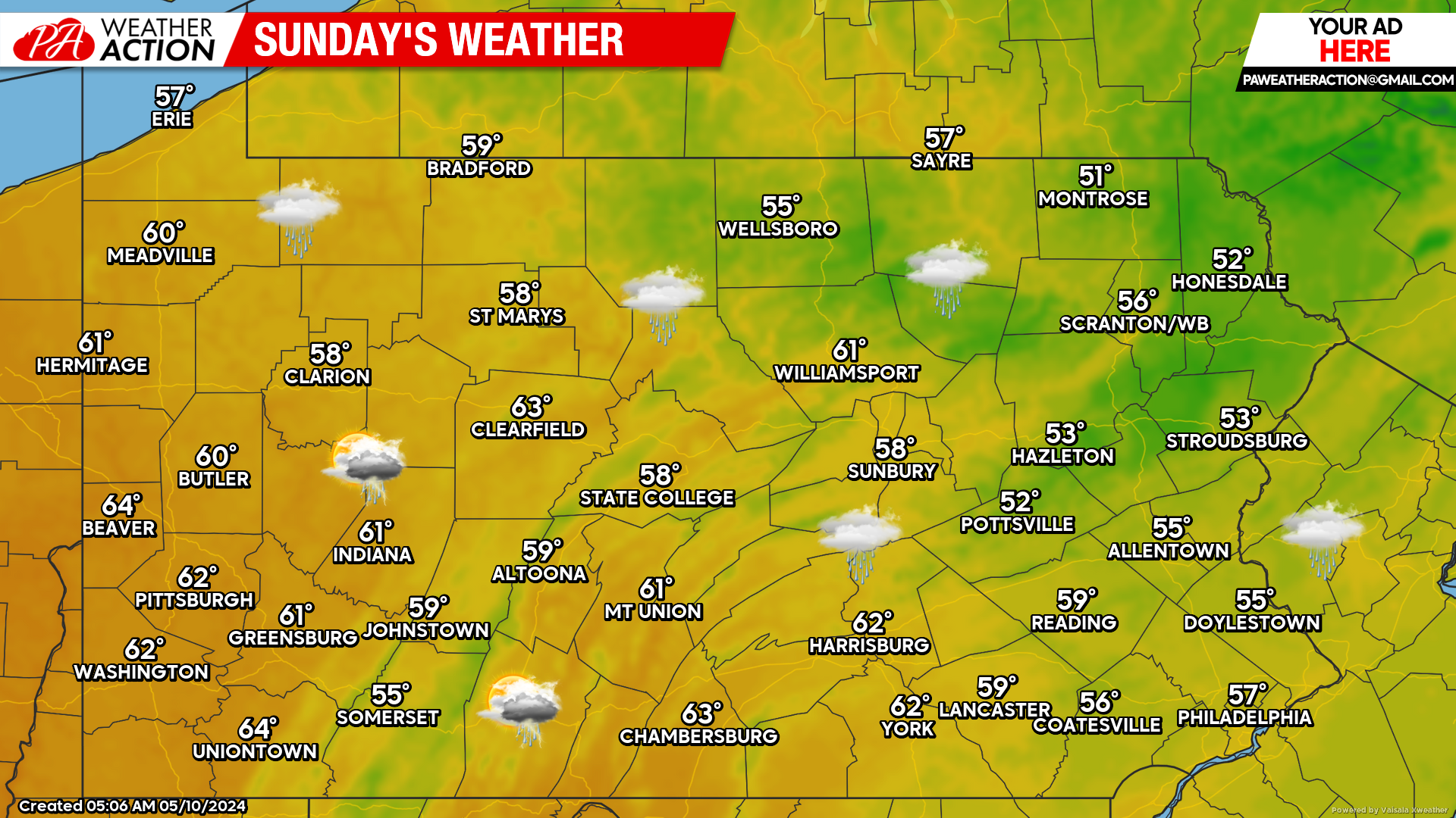
Sunday’s Forecast: 5/10 Weather Day
Mother’s Day will be mostly cloudy, with scattered showers around Eastern and Central PA. Highs will be stuck in the 50s and 60s again. Not a good day for outdoor activities, much more of an Olive Garden and plays games or watch a movie type Mother’s Day.
Next Week Outlook
Monday will be the gem in the rough, with mostly sunny skies and highs in the 70s. After that though, highs will continue to be in the 60s in the mountains and 70s elsewhere. So despite the rain chances, weather will be very comfortable next week. No sweating is expected to be involved. Finally some normalcy after a temperature roller coaster ride!
You must be logged in to post a comment.