
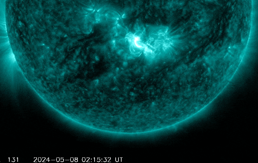
A series of powerful solar flares will likely spark a severe geomagnetic storm early this weekend, with a visible aurora possible for much of the US Friday night or Saturday morning. Unfortunately, as usual, our area will be contending with cloud cover.
An area of low pressure will slide eastward along the southern border of Pennsylvania tonight, spreading rain across all of Pennsylvania. Rain will commence this evening, and last through Friday.
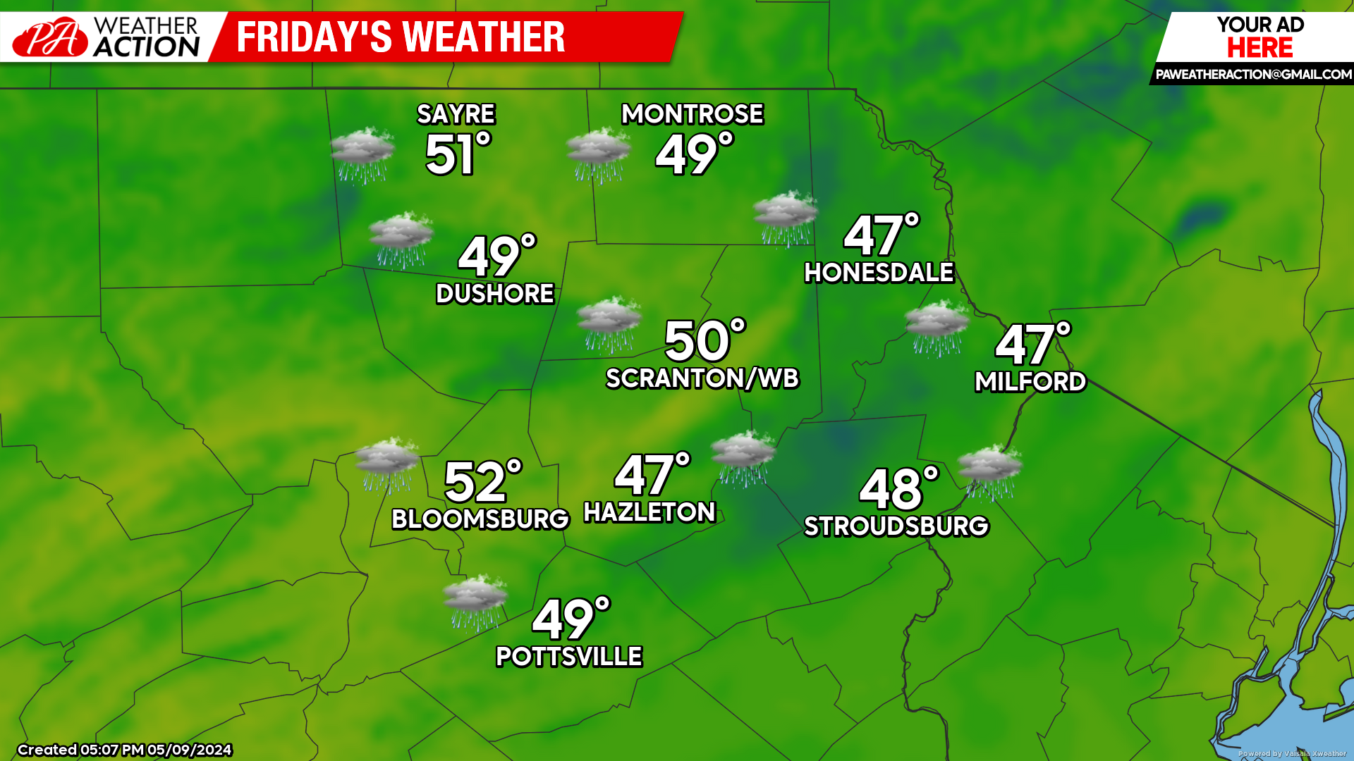
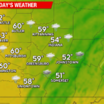
FRIDAY
A soaking rain will continue, with a raw wind off the ocean keeping temperatures near 50. Rain will subside by midnight.
The ‘coronal mass ejection’ (the highly-magnetized plasma ejected from the sun during the flare) is projected to impact our planet Friday night into early Saturday. While clouds will continue overnight and likely block viewing of the aurora, there is the slight hope for partial clearing after midnight. The geomagnetic storm could be strong-enough to affect the electric grid, as well as radio and satellite communications.
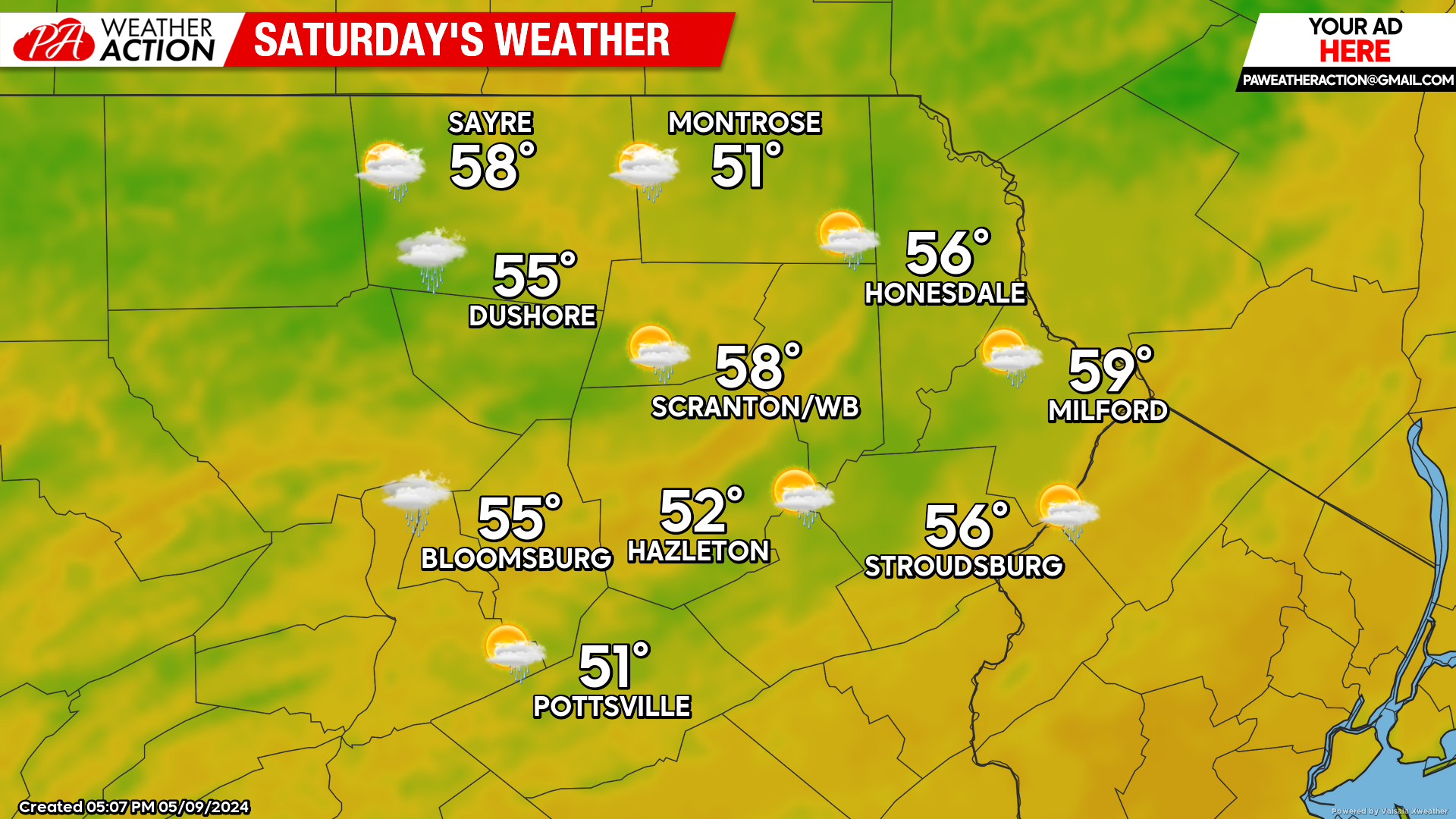
SATURDAY
We will be in between systems on Saturday, as Friday’s system exits into the Atlantic, and the next system approaches our area from the Great Lakes. This will allow a dry start to the day and even some peeks of sunshine during the morning.
Clouds and showers will encroach upon our area during the afternoon and continue through the nighttime hours.
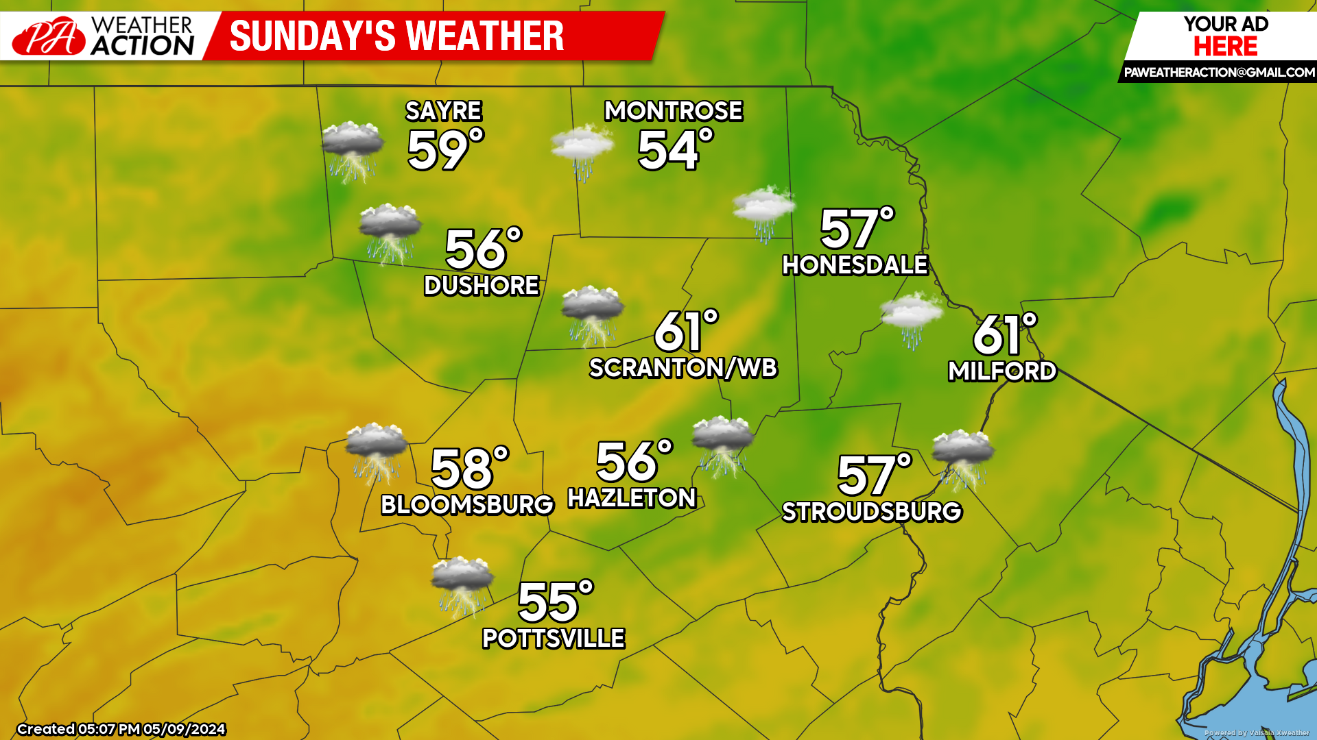
SUNDAY
That system will maintain onshore flow and showers through all of Sunday. The onshore flow will hold temperatures down in the 50s.
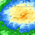
Total rainfall amounts for Friday-Sunday will be in the 1-2″ range for most locations. The heaviest amounts will likely be in our southern and western counties.
You must be logged in to post a comment.