
This forecast has been updated with the latest increased severe thunderstorm threat info. View the article below for details.
The system responsible for producing deadly tornadoes in the Mississippi Valley and Deep South will be pushing east. But this is Pennsylvania in March, so naturally we will have little instability to work with – thankfully. As a result, just a marginal severe weather threat is forecast for PA on Sunday.
Nonetheless, some very gusty winds are still expected with a line of thunderstorms that will push through. The line will develop in Western PA late Sunday morning, before pushing east through Central PA Sunday afternoon and into Eastern PA Sunday evening.
As mentioned, instability will be low. If there is one area that may see a few severe thunderstorms, we believe South Central PA would be it. The main concern would be damaging winds, and a low chance of a quick spin-up tornado.
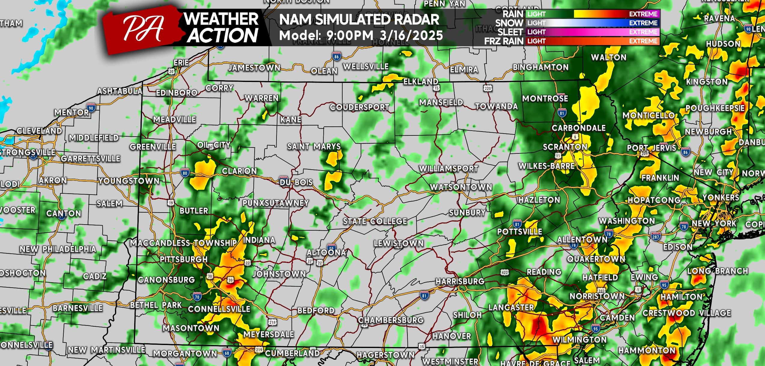
Thunderstorm Timing on Future Radar
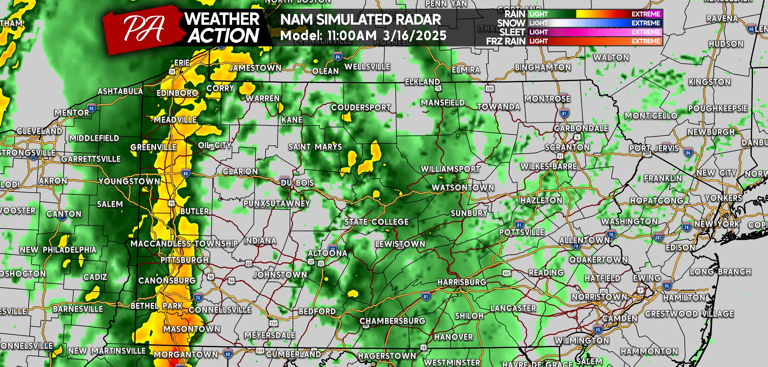
Starting at 11:00 AM Sunday, you can see that line of heavy rain and strong winds beginning to develop on the I-79 corridor. The line will push directly east.
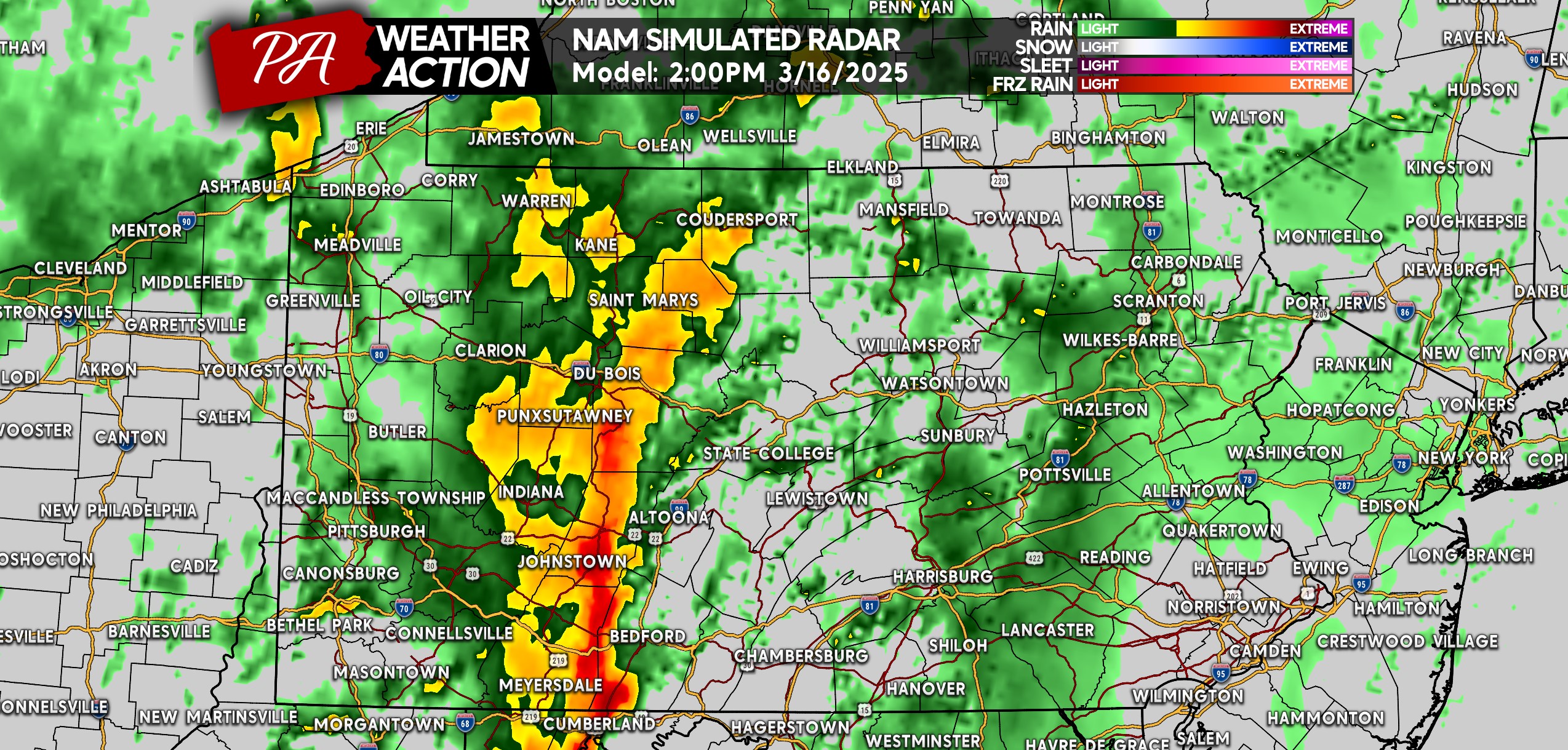
These storms won’t be moving overly fast, likely around 30 MPH to the east. By around 2 PM Sunday, the line, which we expect to be producing lightning at this point, will be over the Allegheny Mountains. If there is an upgrade to a slight risk, we think it would between I-99 and I-476.
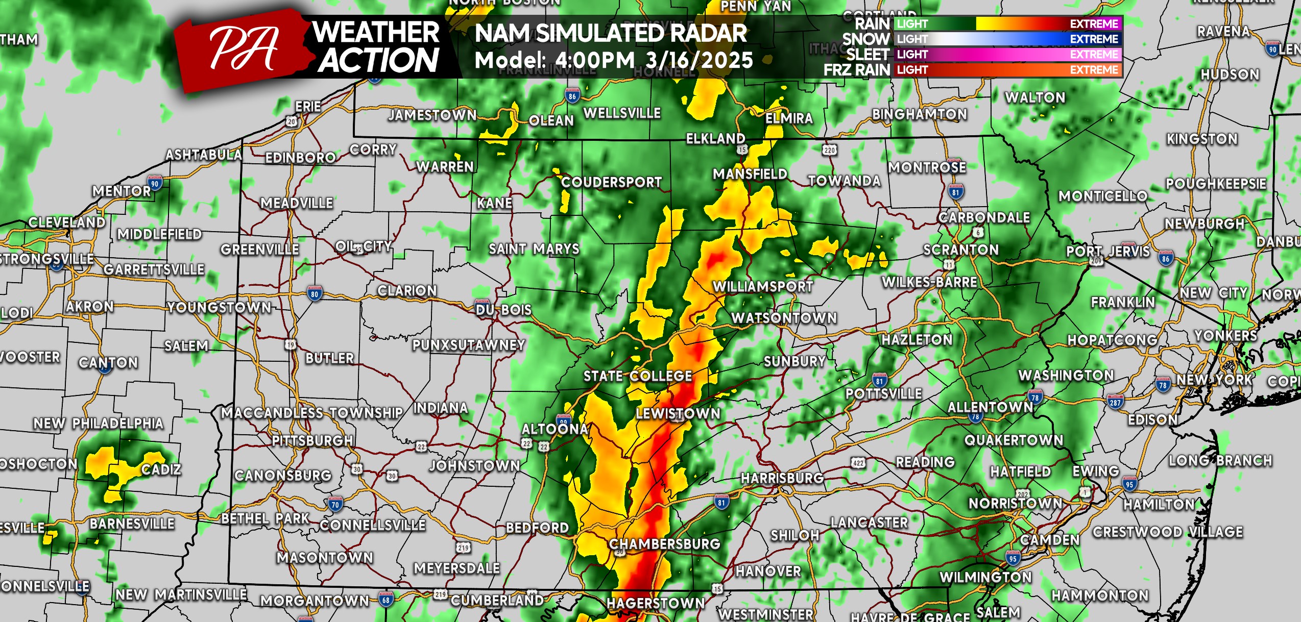
Late Sunday afternoon is when we predict these storms will be strongest. With that said, most of this line should be below severe limits. But you can see it’s looking pretty potent on the Hi-Res NAM Future Radar in South Central PA from Greencastle to Lewistown. The very low tornado threat will peak around this time, mainly south of the PA Turnpike in the Southern PA.
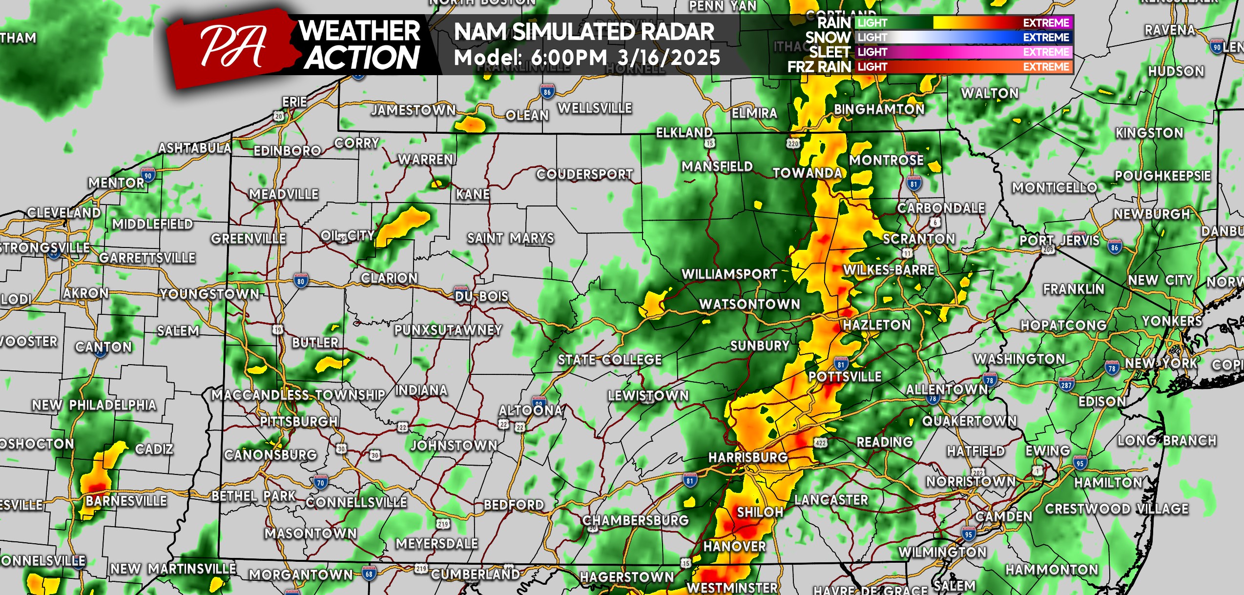
Less instability will be in place for these storms to feed on in Eastern PA, which is why a gradual weakening of them is likely. By dinnertime Sunday, we still see a defined line of storms storms entering Eastern PA.
And by the late evening, the line won’t be producing much lightning as it evolves into just a wide batch of heavy rain in Southeast PA. The activity you see in Western PA won’t be strong.
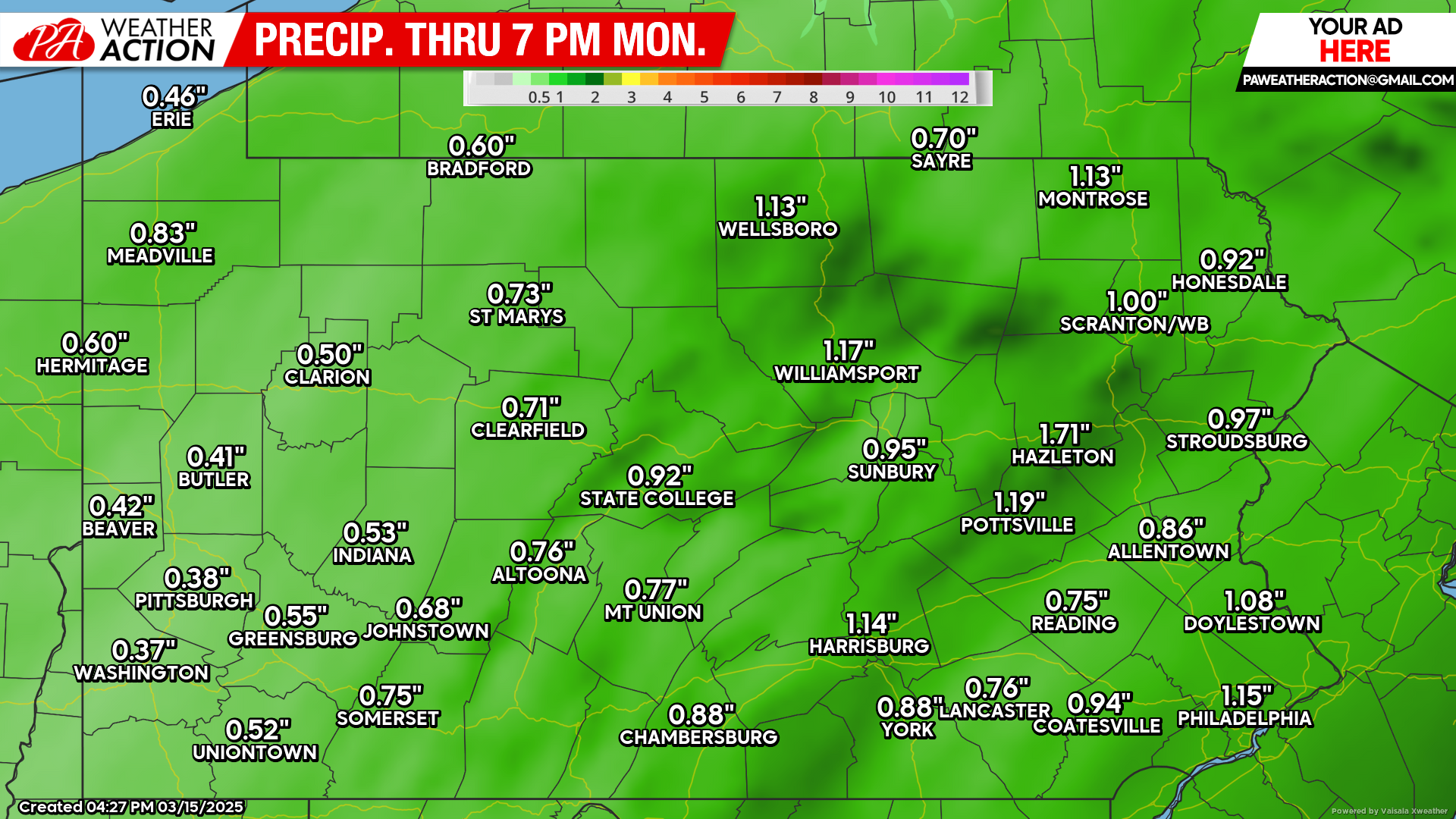
Rainfall Totals Forecast
A general half-inch to an inch of rain is expected statewide, with amounts in Western PA on the lower end and places in Eastern PA seeing the higher end. Some areas especially along I-81 may see rainfall totals exceed an inch.
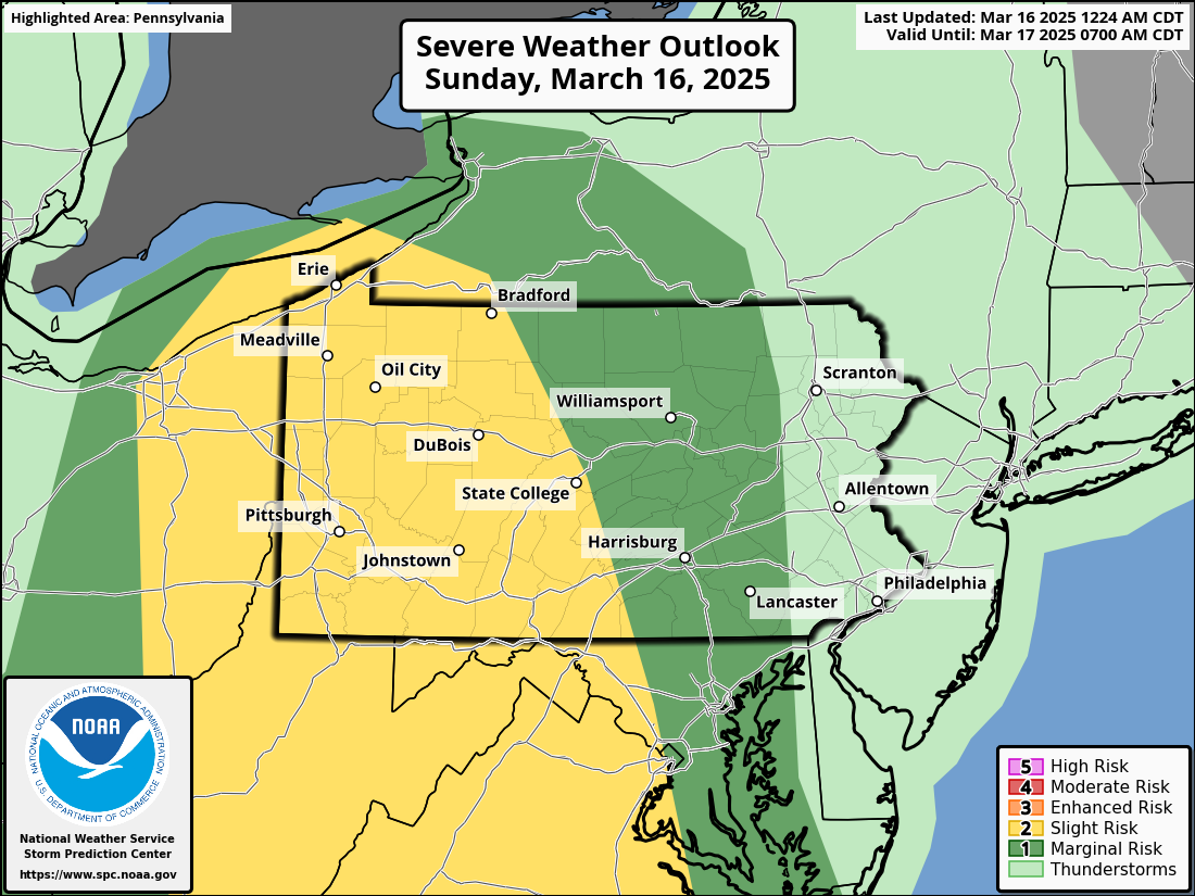
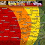
Severe Thunderstorm Threat Forecast
The main risk is damaging winds, but a very isolated tornado cannot be ruled out in Western and Central PA.
Don’t forget to share this forecast with friends and family who may have plans on Sunday!
You must be logged in to post a comment.