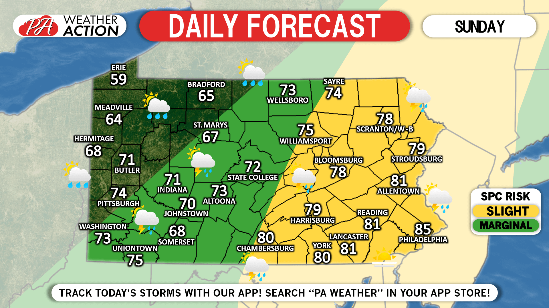
It’s starting to feel like this just may be one of those extremely active severe weather seasons here in PA, as another round of scattered storms is on tap for today. Some storms may be severe, mainly in the eastern half of the state which has been included in the slight risk by the SPC. Timing looks to be roughly between 2 and 8 PM. High temperatures will be much cooler in western PA due to the strong cold front sliding through earlier. Enjoy your Sunday and keep an eye on radar and alerts for your area with our app!
Posted inDaily Forecast
Strong to Severe Storms Possible Today, June 2nd, 2019
Posted by
 By
Lead Forecaster Josh Adams

Josh Adams is the founder and lead forecaster of Pennsylvania Weather Action, a regional forecasting site he launched in 2015. With over a decade of experience analyzing weather patterns across Pennsylvania, his forecasts have reached millions of readers throughout the state.
Josh specializes in Pennsylvania’s complex microclimates and terrain-driven weather patterns, providing detailed coverage of severe thunderstorms, winter storms, and flooding events. His forecasting focuses on delivering precise, timely information to help Pennsylvanians stay informed and prepared during impactful weather.
Last Updated: March 10, 2026
Post navigation
Previous Post
 Daily Forecast for Saturday, June 1st, 2019

You must be logged in to post a comment.