
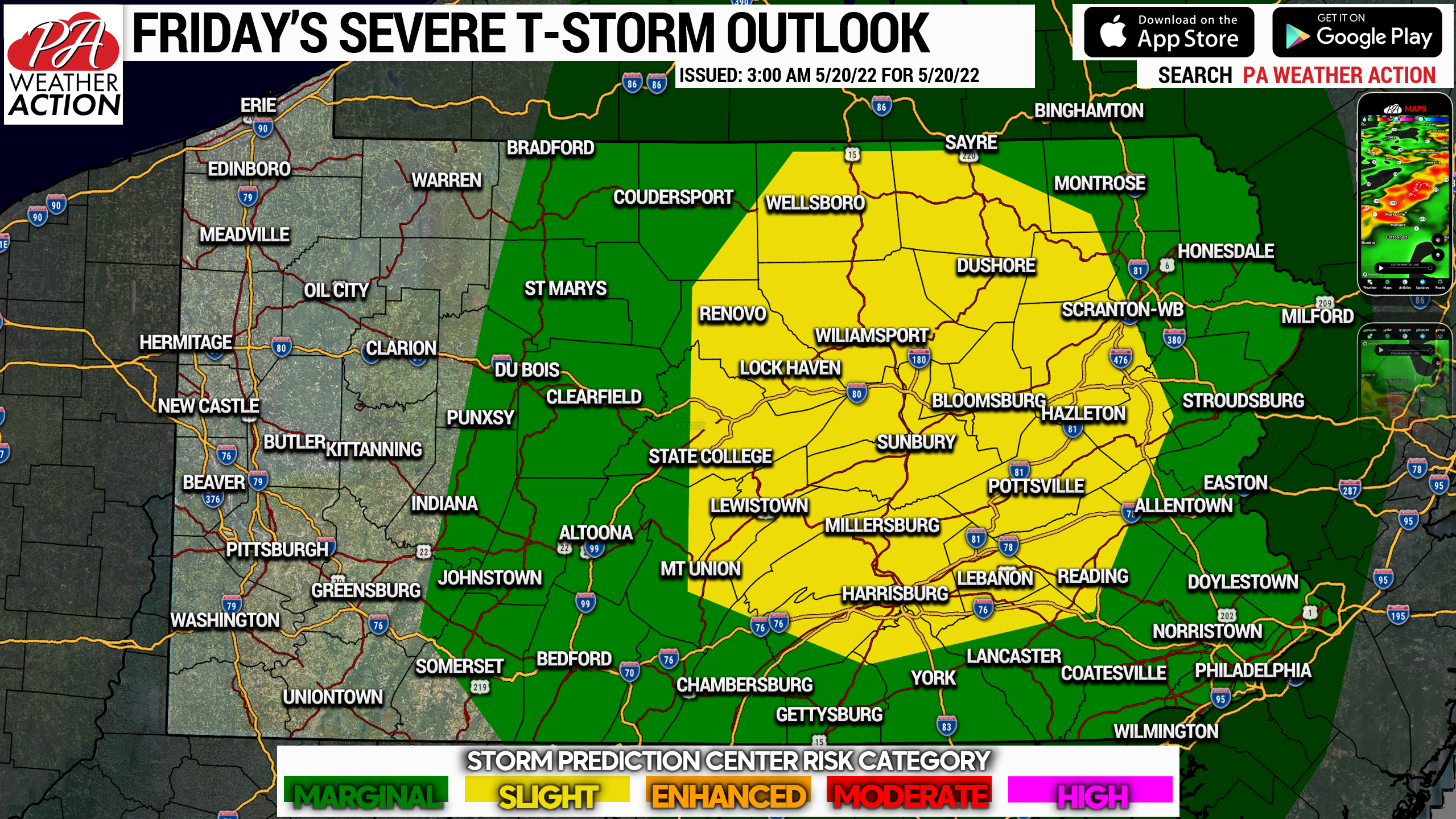
Latest short range model guidance indicates a cluster of thunderstorms developing across Southwest PA late this morning, before strengthening as they head into Central PA by the early afternoon. The cluster of storms is then expected to make its way into Eastern PA by late this afternoon. Damaging winds are the main concern, along with isolated hail and a very isolated tornado chance. Below is the SPC Risk Map for today (Friday May 20).
GET THE FREE PA WEATHER APP HERE
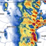
Below is the HRRR model run from 5:00 AM this morning for the storms. Overall, late morning in SWPA, early afternoon in SCPA, and late afternoon in SEPA. You can always get the latest model runs on interactive maps centered on your area in our app!
Be sure to share this last-second forecast with family and friends who may be impacted.
[social_warfare]


You must be logged in to post a comment.