
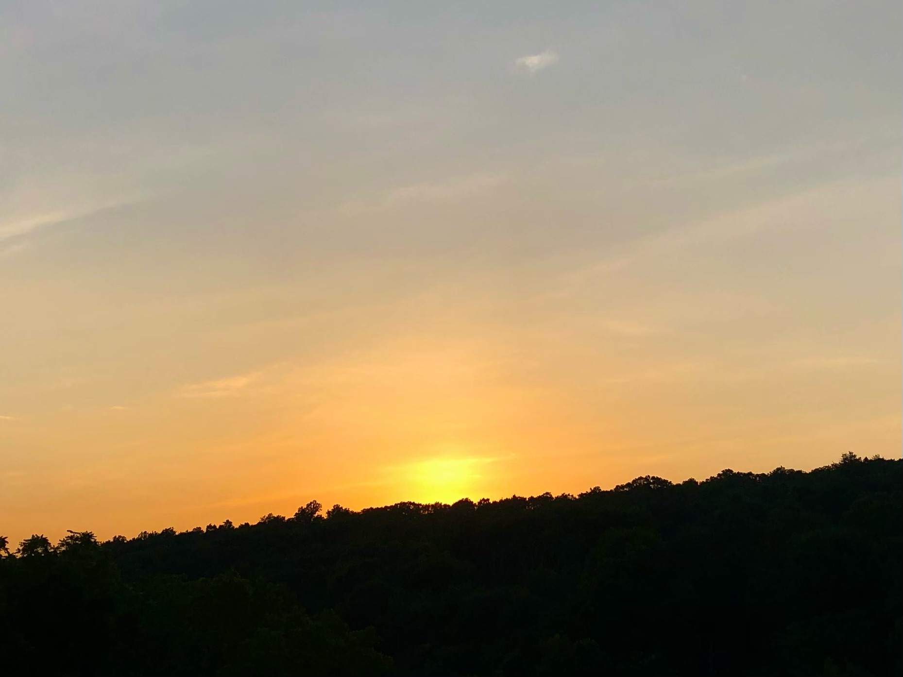
The Summer Solstice occurred today at 4:45pm, marking the sun’s highest point in the sky, and the shortest night of the year! The moon is almost full, as the full moon will occur Friday evening.
To celebrate the arrival of summer, widespread heat and humidity afflicted our area this week, along with isolated thunderstorms. High temperatures reached into the 90s in many locations!
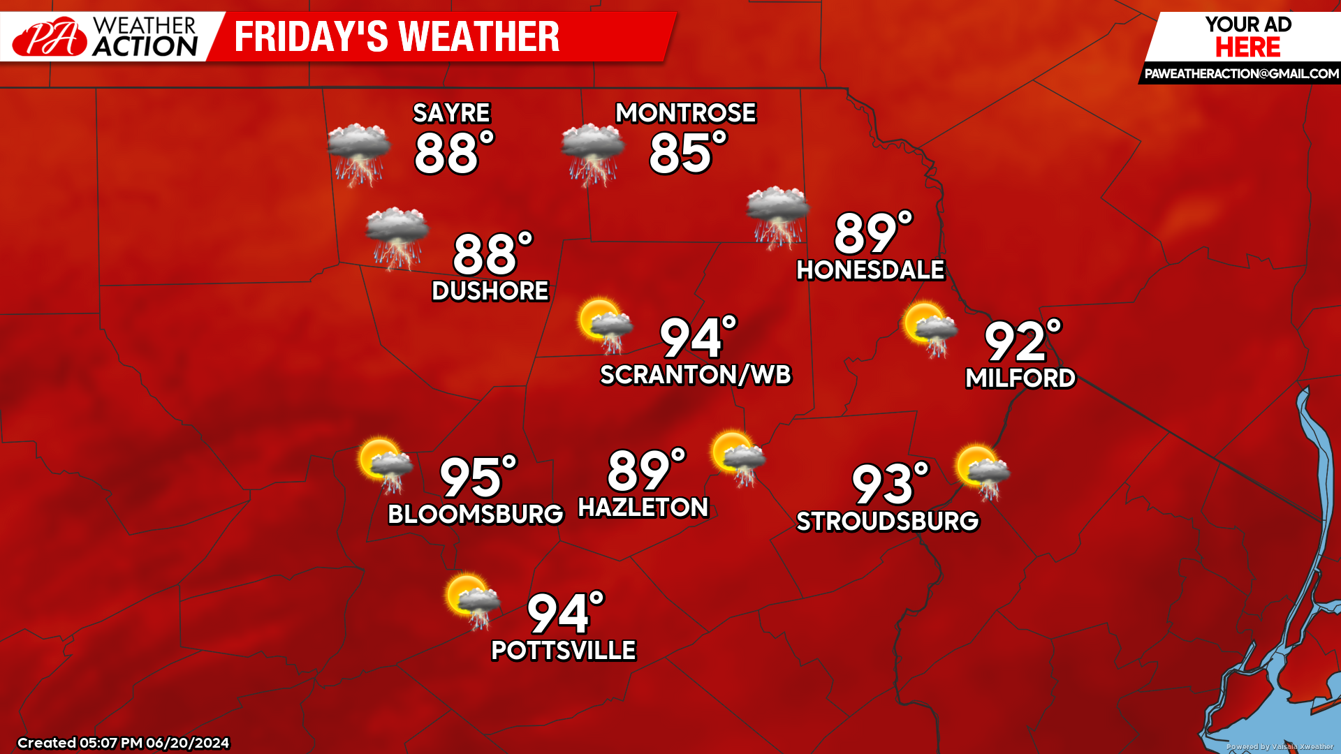
FRIDAY
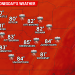
The heat and humidity will continue with widespread highs in the low 90s. Thunderstorms will develop during the afternoon as a weak frontal zone drops southward into the area. Some of these storms could be quite strong, but not everyone will get to enjoy one. The best opportunity will be in our northern counties. The chance for storms will persist into Friday night.
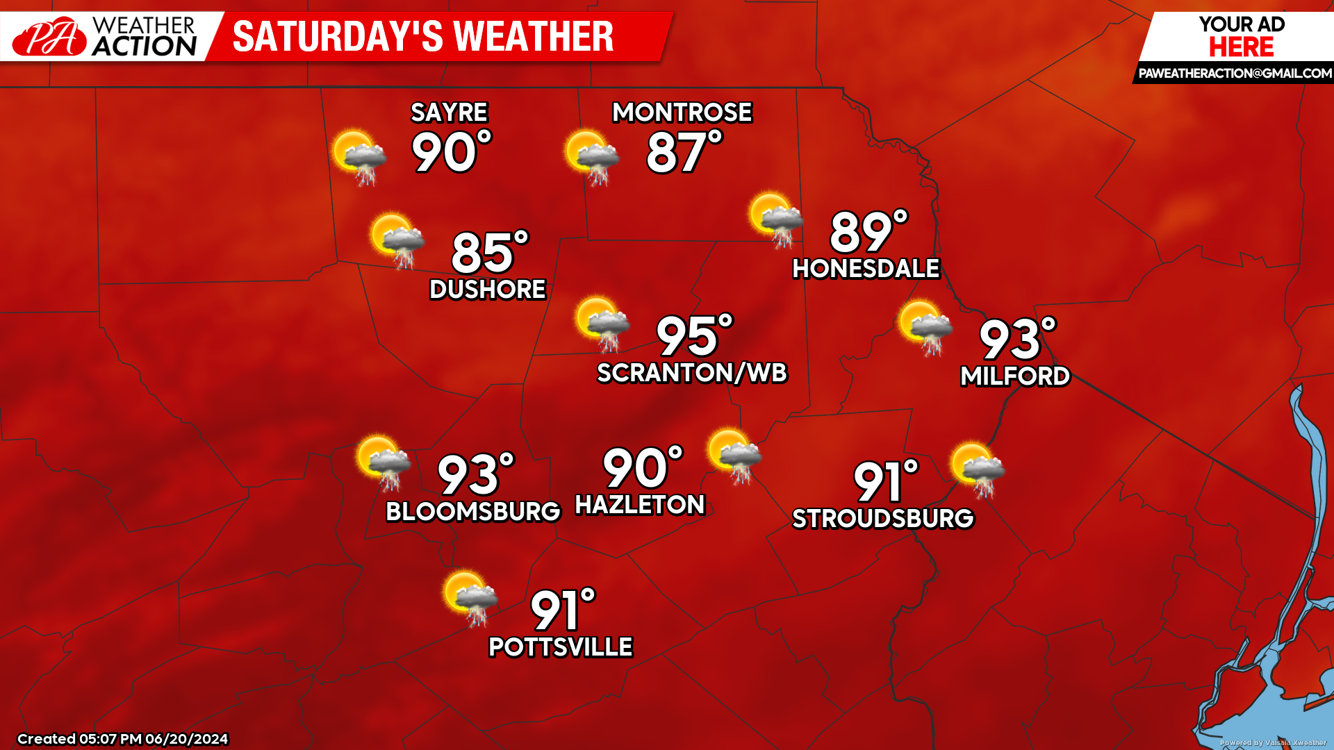
SATURDAY
Hot and humid weather will continue, along with the chance for a few thunderstorms. Once again, not everyone will get to enjoy one.
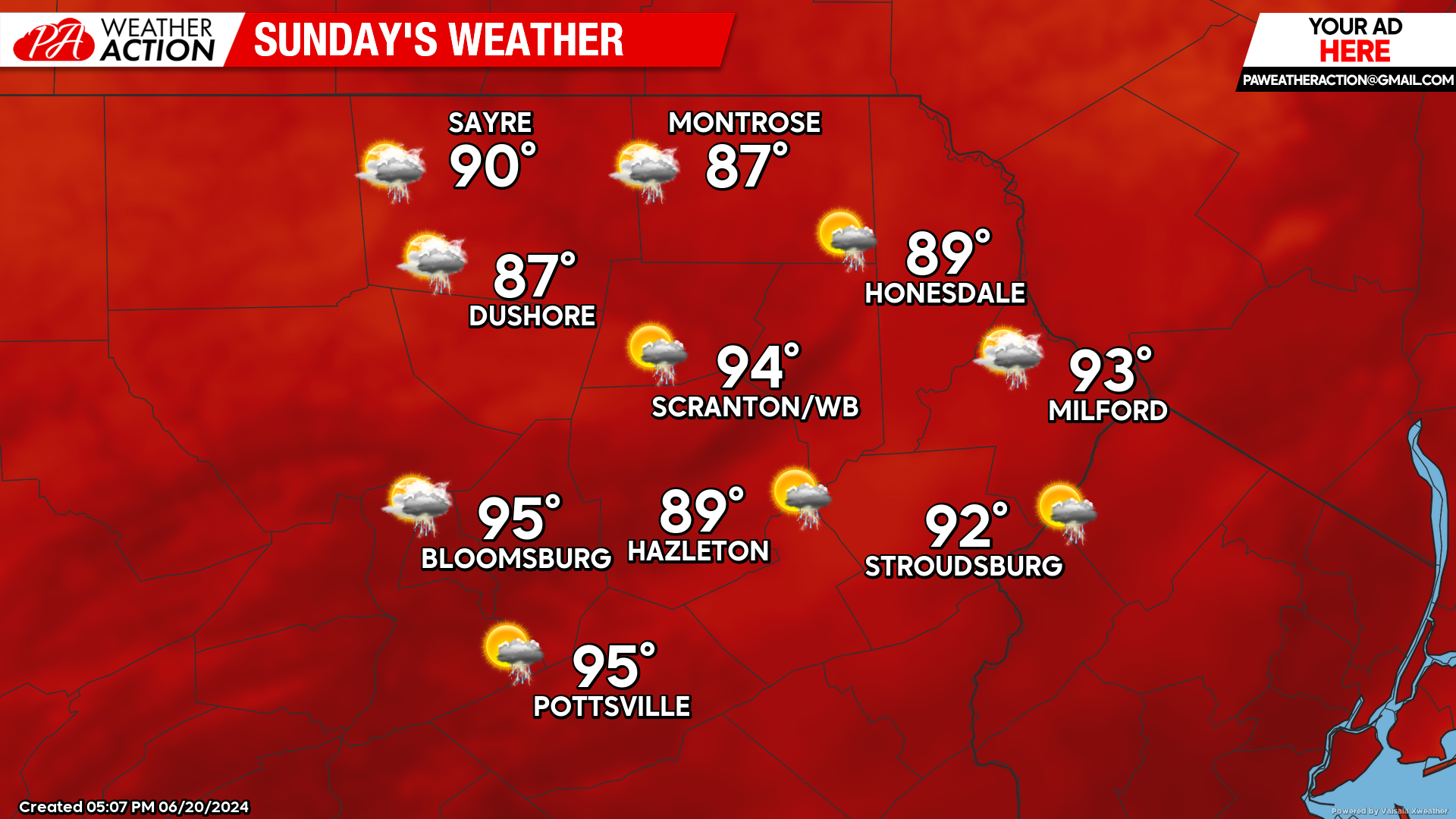
SUNDAY
Once again, hot and humid weather will cover the area. Thunderstorms will encroach on the area from the west during the afternoon as a cold front approaches.
BEYOND SUNDAY (Next Week M-F June 24-28)
Sunday’s cold front will provide a brief reprieve from the heat on Monday. However, heat and humidity will return midweek before another cold front offers reprieve toward the end of the week.
You must be logged in to post a comment.