
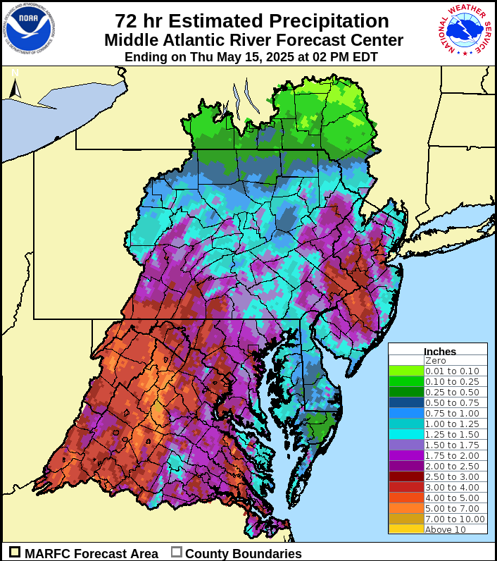
A cut-off low drew copious amounts of moisture northward over our area this week. This delivered a heavy soaking rain Tuesday and Wednesday, with 2-3″ falling on parts of our area! Scattered thunderstorms boiled into the atmosphere this afternoon over our area. These storms will diminish this evening. Here is a radar-estimated rainfall map for 2pm Tuesday through 2pm Today (Thursday).
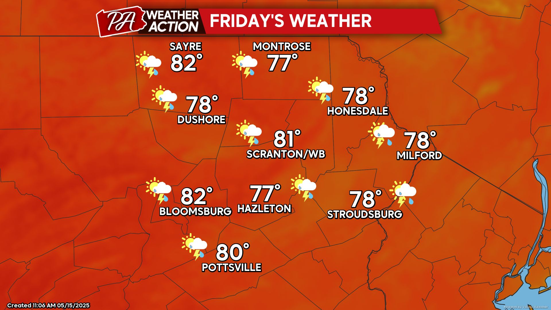
FRIDAY
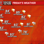
The front will herald a very warm day with summer-like humidity. There will be the opportunity for scattered thunderstorms along with the summer conditions.
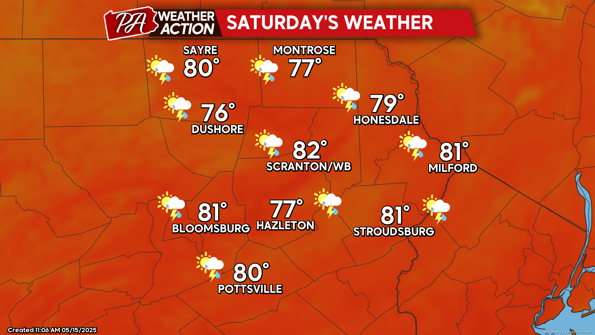
SATURDAY
Friday night will be another muggy night with temperatures remaining in the 60s. Saturday will start quite summery, but a cold front will cross later in the day. The approaching front will generate several rounds of showers and thunderstorms during the daytime. Behind the front, breezy wind from the west will deliver cooler and less-humid air Saturday night.
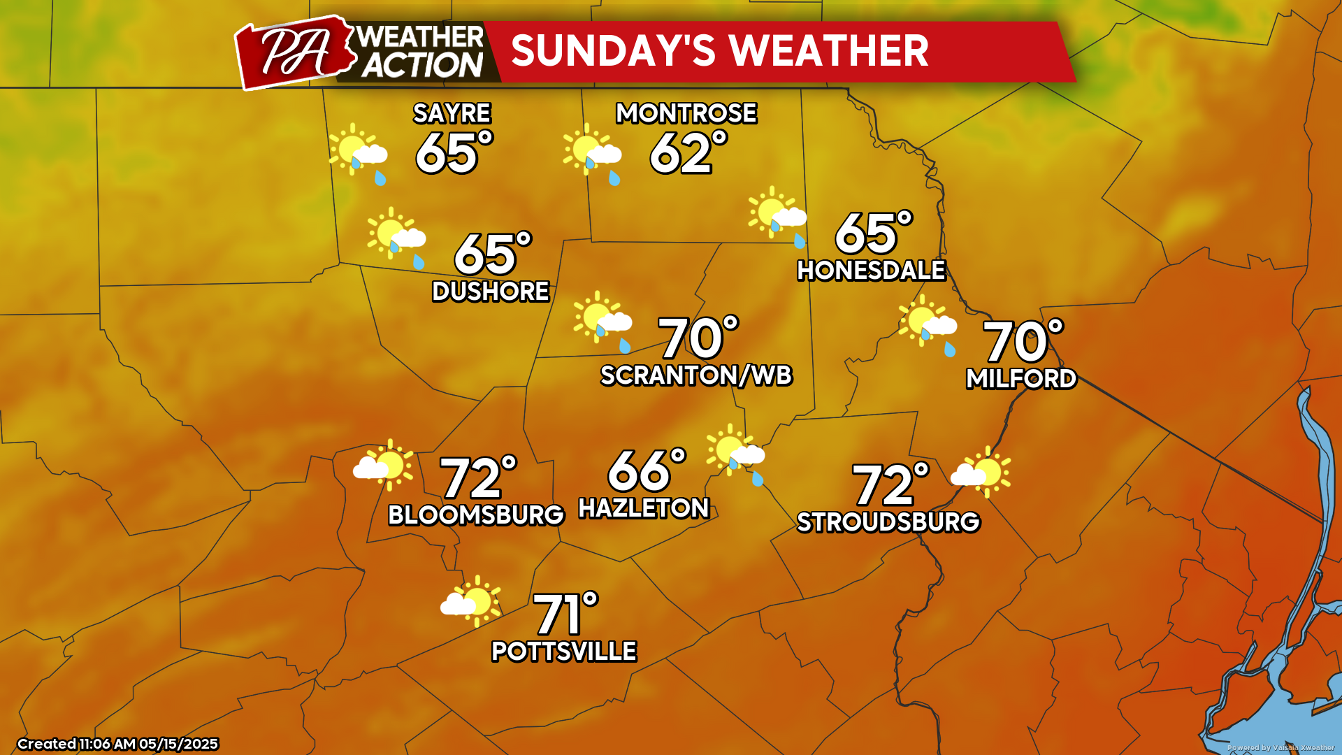
SUNDAY
Sunday will feel quite different, with gusty wind from the west and more-normal temperatures for this time of year. There will be variable clouds and isolated showers bubbling into the cool upper-level air during the daytime.

You must be logged in to post a comment.