
Very warm and humid air currently pervades the area. A cold front will cross this evening, which will spark some thunderstorms. Less-humid air will briefly grace our area Friday and Friday night. However, a large upper-level ridge will expand eastward over our area this weekend as a strong surface high over the western Atlantic builds westward into our area. This combination will pump very hot and very humid air into our area later this weekend into the first half of next week.
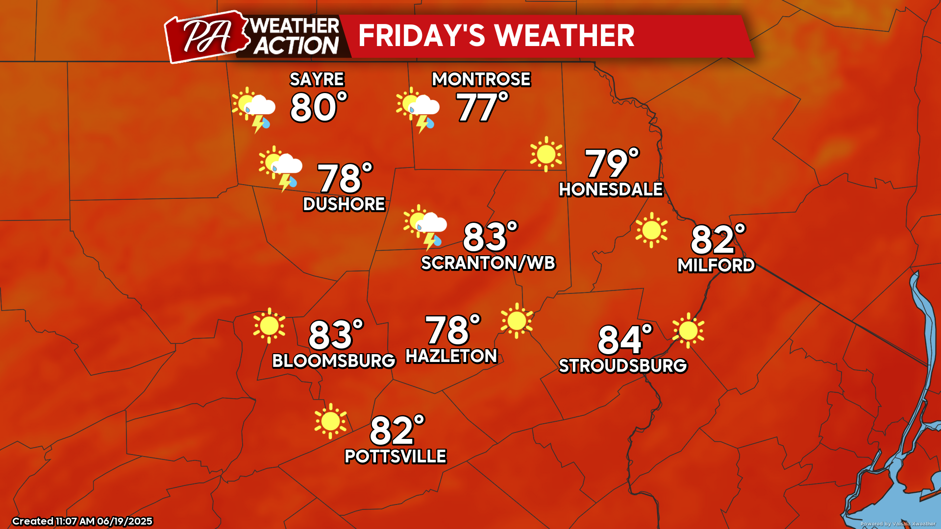
FRIDAY
Friday will feature noticeably less humidity and lower temperatures than the past couple of days. There could be a few isolated showers or or thunderstorms, although most people will experience a dry day. The Summer Solstice occurs at 10:42 PM, marking the start of summer. The atmosphere will acknowledge this by delivering a period of extreme heat and humidity.
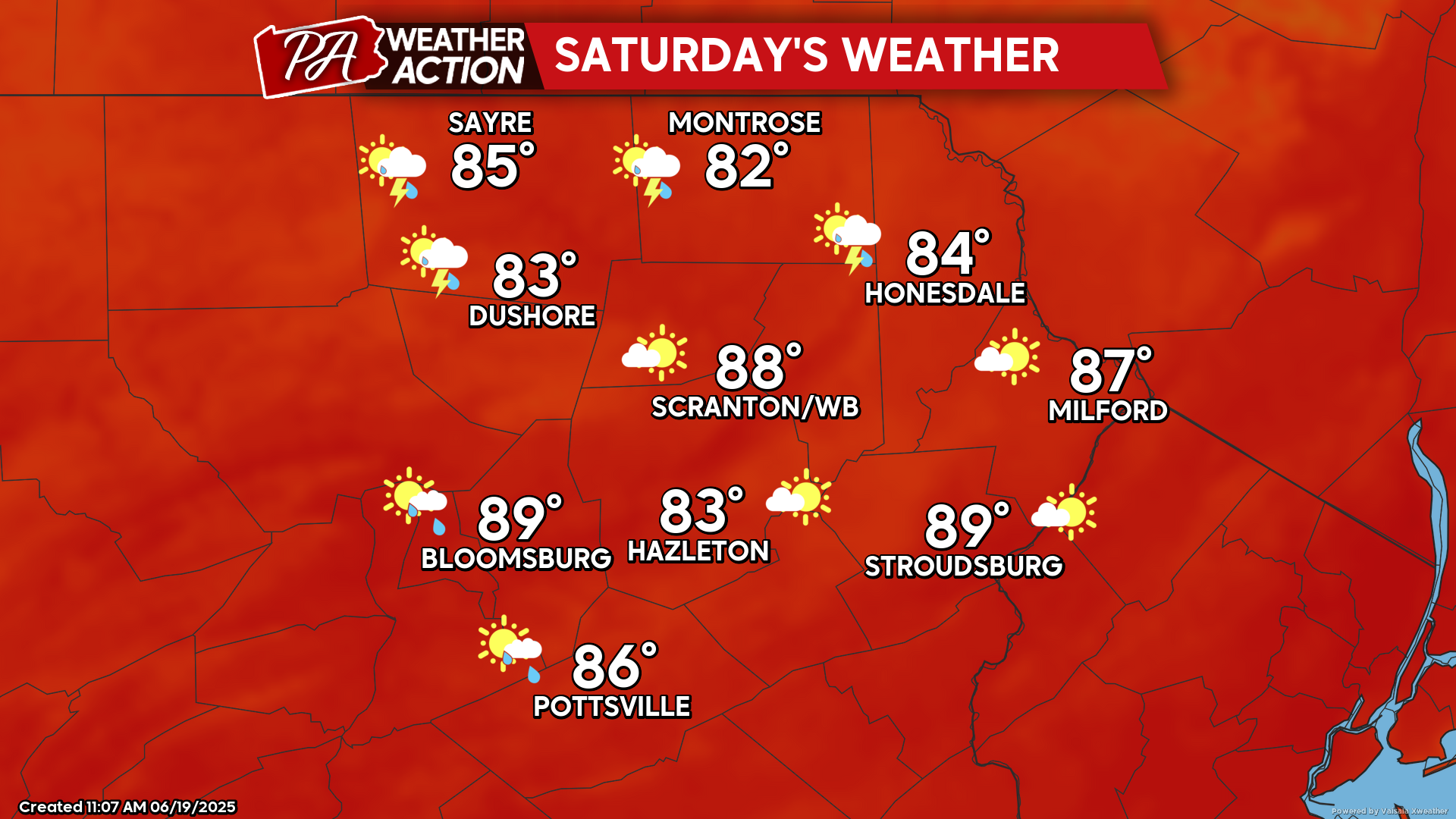
SATURDAY
The expansive upper-level ridge will start to build eastward into our area, resulting in heat and humidity returning to our area. An upper-level disturbance sliding southeastward along the northern periphery of the upper-level ridge could spark some showers and thunderstorms during the afternoon and evening, mainly in our northern counties.
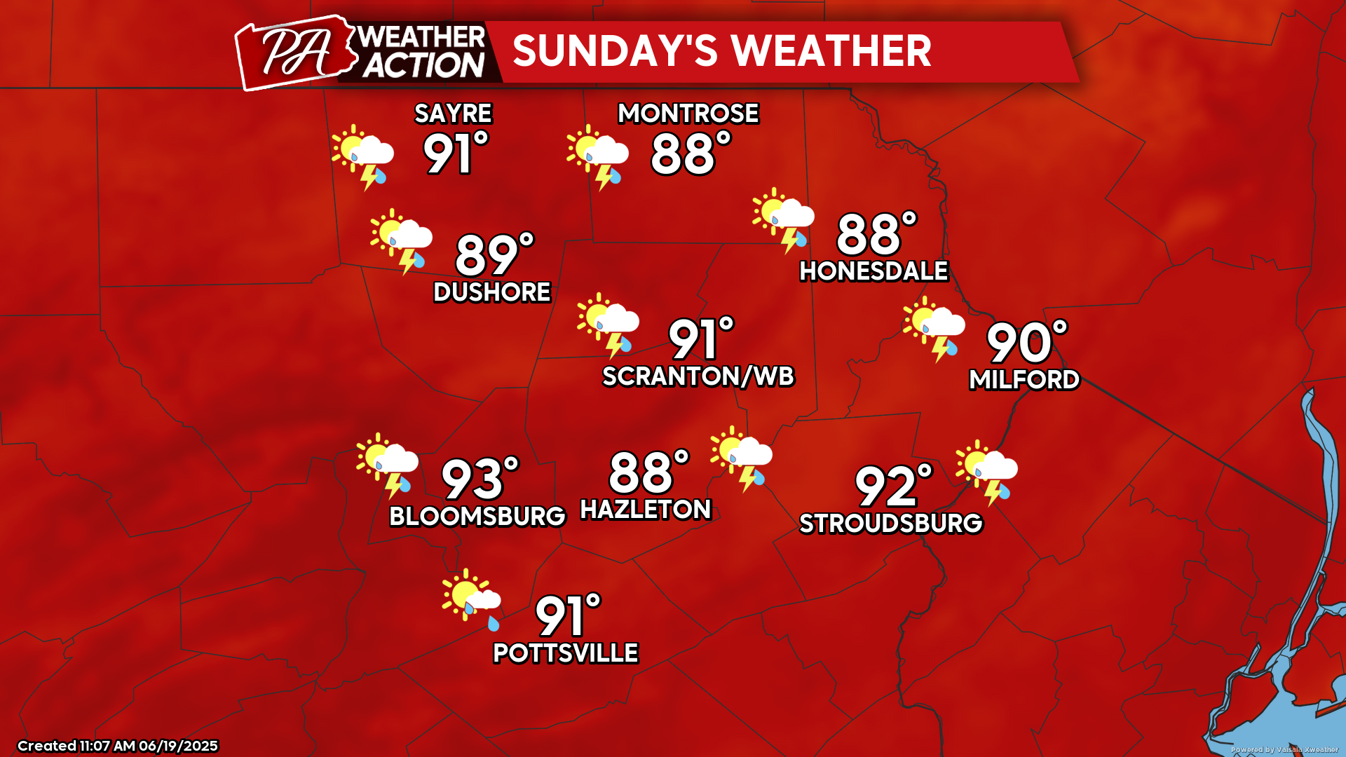
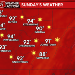
SUNDAY
Sunday will be the first in a string of extremely hot and humid days. Temperatures will soar into the 90s in the valleys along with excessive humidity. The will send the heat index to near 100 F for the cities and the valley locations. While an isolated thunderstorm cannot be ruled out, it will be a dry day for most locations. Temperatures and humidity will continue to climb as we head into the first part of next week.
You must be logged in to post a comment.