

The remnants of Tropical Storm Chantal inspired thunderstorms with heavy downpours over Southeast Pennsylvania today. A few storms managed to pop over parts of our eastern counties as well. That system will swirl away to our east tonight. In its wake will be high humidity that will result in a warm sticky night across the region. Meanwhile, a cold front approaching our region will deliver thunderstorms to the western and northern parts of the region this evening.

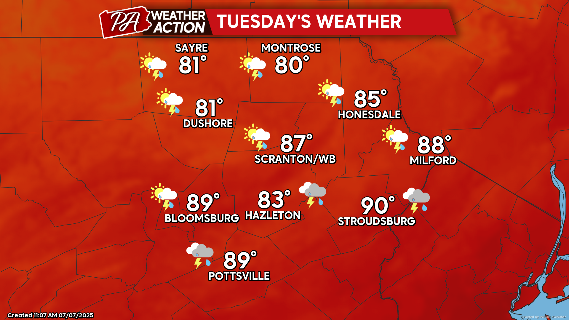
TUESDAY
The cold front will stall over central Pennsylvania through Tuesday. This will result in a hot and humid day across our area, along with the development of strong afternoon thunderstorms. Some of these storms could be severe, especially over our southeastern counties.
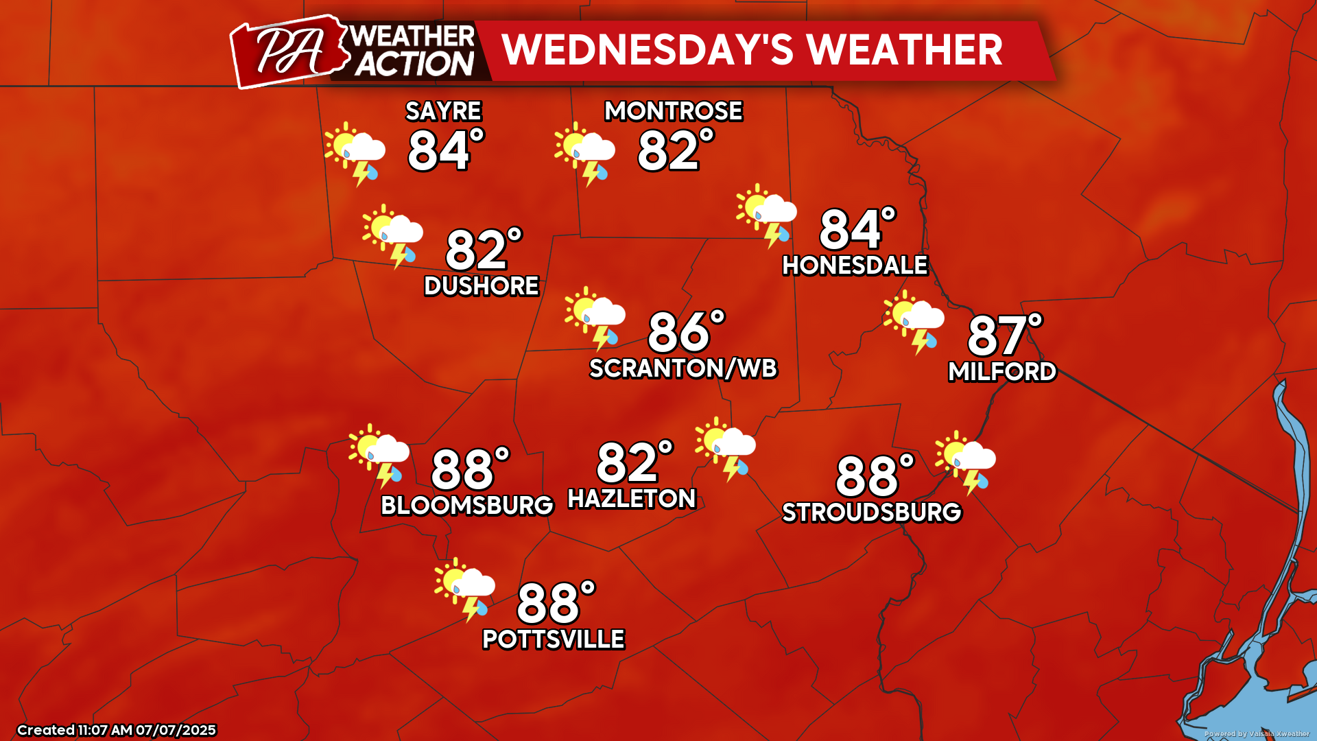
WEDNESDAY
Hot and humid conditions will persist on Wednesday. Some thunderstorms will ignite during the afternoon and evening hours.
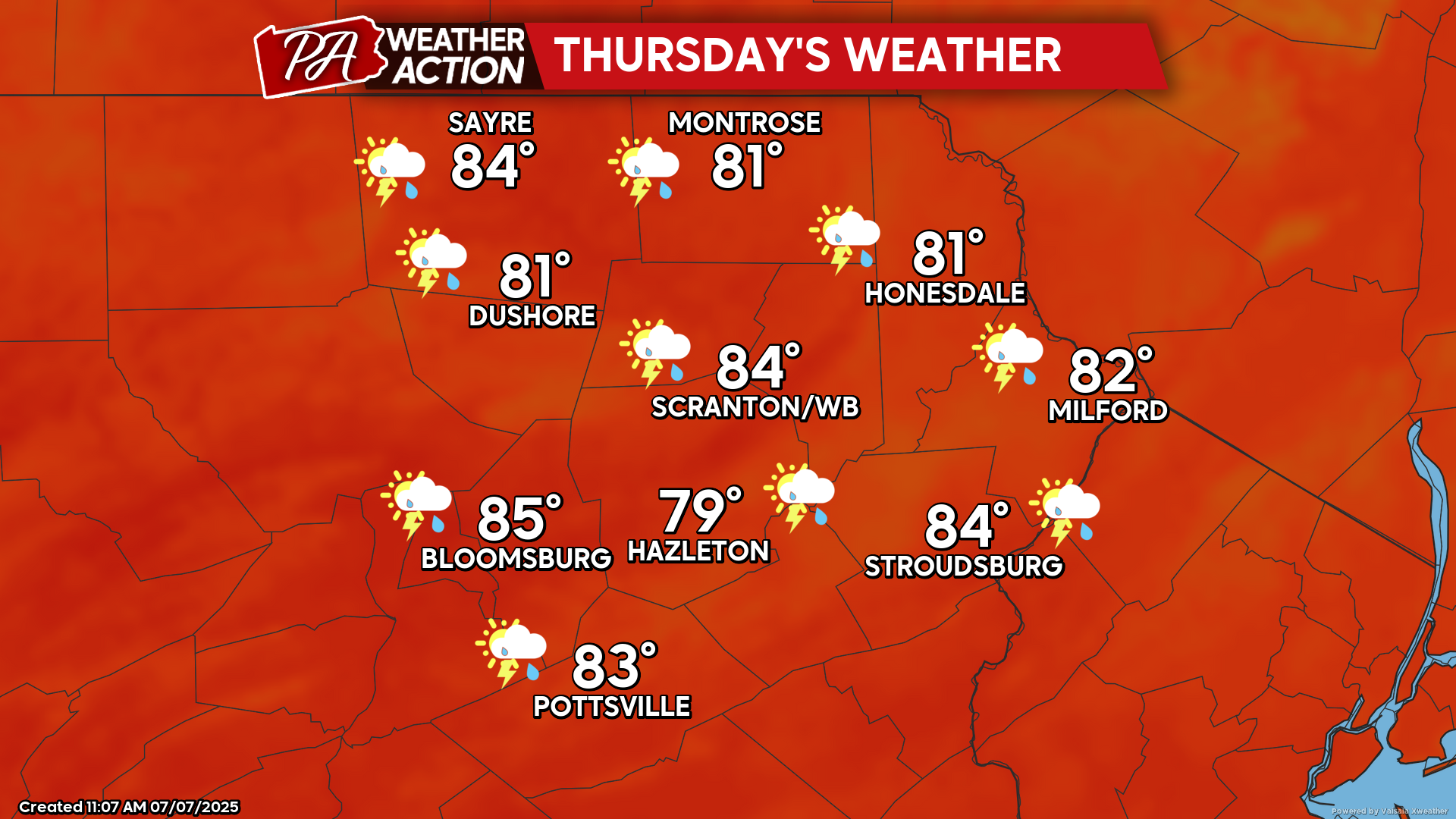
THURSDAY
Humid conditions will continue through Thursday, although with lower temperatures. An approaching upper-level disturbance along with afternoon instability will once again promote the development of showers and thunderstorms.


You must be logged in to post a comment.