
A powerful storm system unleashed over 2″ rain onto parts of our area during the predawn hours Saturday. Along the southern portions of our area, strong wind gusts mixed to the surface just after the heavy rain ended. Widespread power outages resulted, with full restoration not expected until Monday evening. On a more somber note, today marks the 27th anniversary of the infamous June 2 1998 Lake Cary F3 tornado. That tornado embarked on an hour-long rampage from Bradford County through Wyoming County before dissipating in Lackawanna County after a 35-mile trail of destruction. It reached F3 intensity over Lake Cary, Wyoming County, unfortunately destroying dozens of homes and resulting in numerous injuries and 2 fatalities.

Chilly air followed the system, and temperatures fell into the 30s Monday morning in the colder locations! After this morning’s chill, hot summer-like weather will arrive by tomorrow. We will also have a milky haze to the sky courtesy of a plume of smoke from wildfires in western Canada. This could also impart a reddish hue to the sunshine. The plume of smoke can be seen streaming southward into our area in this afternoon’s visible satellite loop:

TUESDAY
Much warmer temperatures and higher humidity will arrive, pushing temperatures to near 80 across the area. While the skies will be mostly sunny, there will also be a hazy sky due to Canadian wildfire smoke.

WEDNESDAY
Wednesday will be the most summerlike day so far this year. High temperatures will soar well into the 80s along with high humidity (dewpoints in the 60s). Those high dewpoints will result in a warm muggy night Wednesday night with temperatures remaining failing to fall below 60. Enjoy!

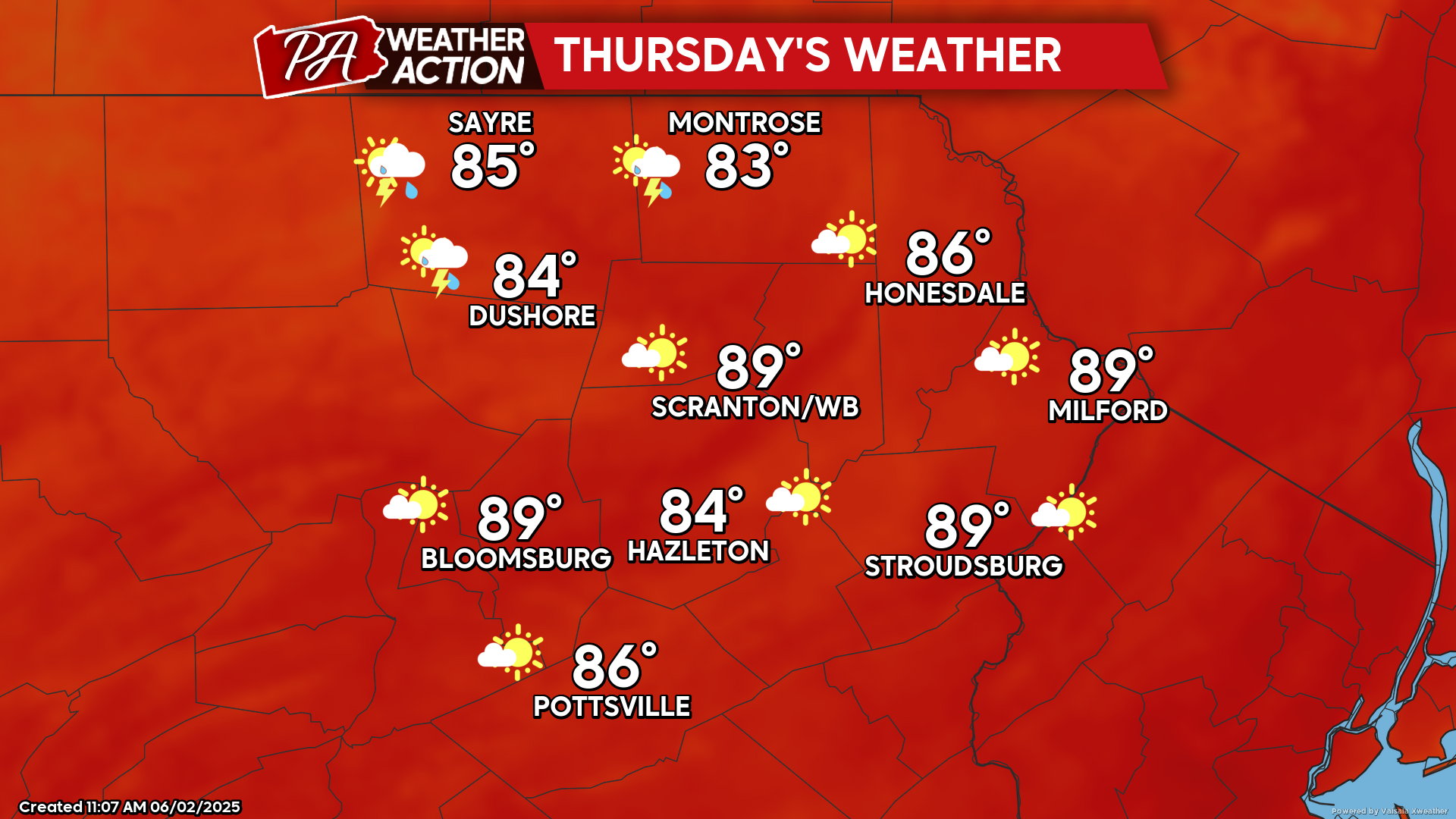
THURSDAY
The hot and humid conditions will continue. A cold front will approach from the north and inspire thunderstorms to ignite during the afternoon, with locally heavy downpours possible.

You must be logged in to post a comment.