
High pressure will move into the region this weekend bringing dry conditions and slightly warmer temperatures.
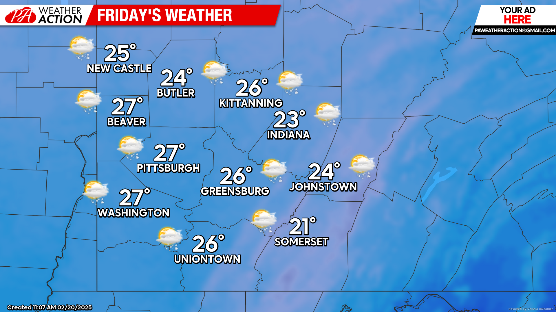
Friday
Lingering isolated snow showers are possible in the morning hours before transitioning to mostly cloudy conditions. Highs will be in the mid to low 20s, lows will be in the mid to low teens. Winds will be out of the west at 10-20 mph, with wind gusts approaching 30 mph in some areas especially in the higher altitudes. Wind chill values as low as -5 are possible.
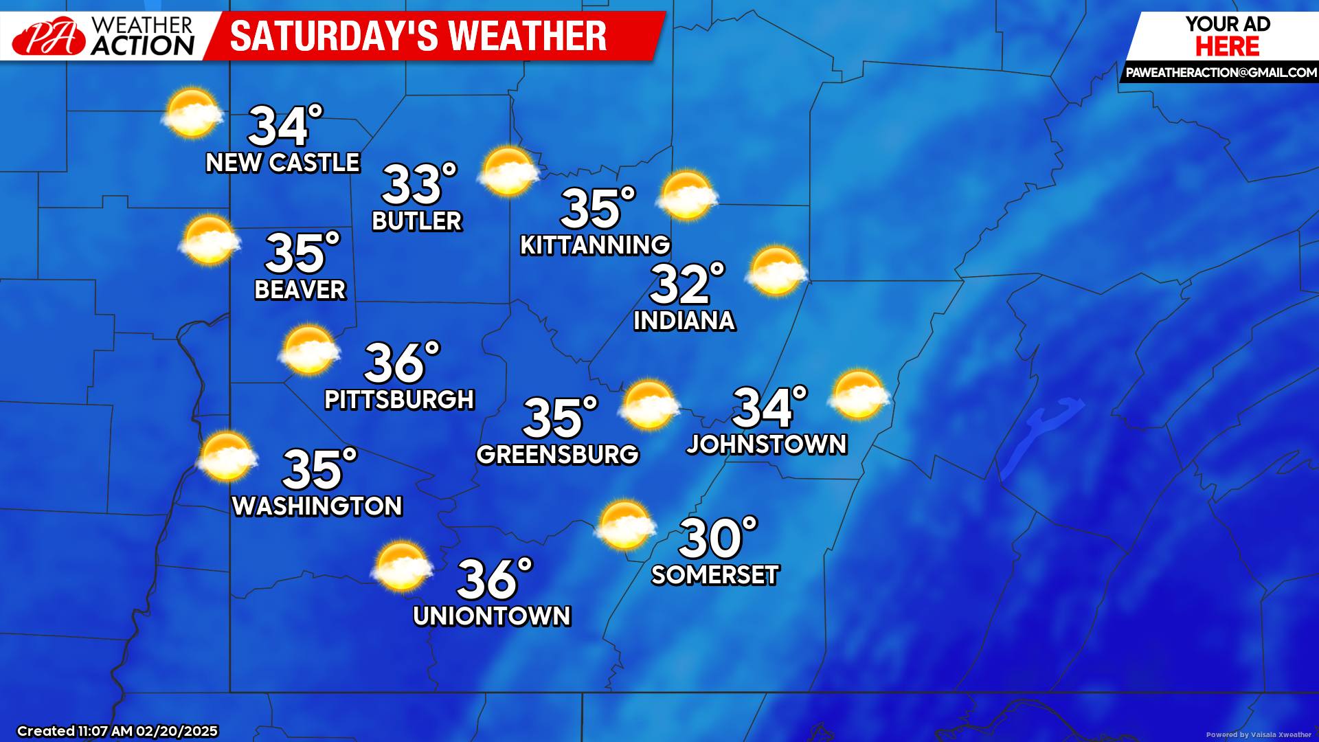
Saturday
Mostly sunny skies with warmer temperatures. Highs will be in the mid to low 30s, lows will be in the low 20s. Winds will be West-Southwest at 3-8 mph.
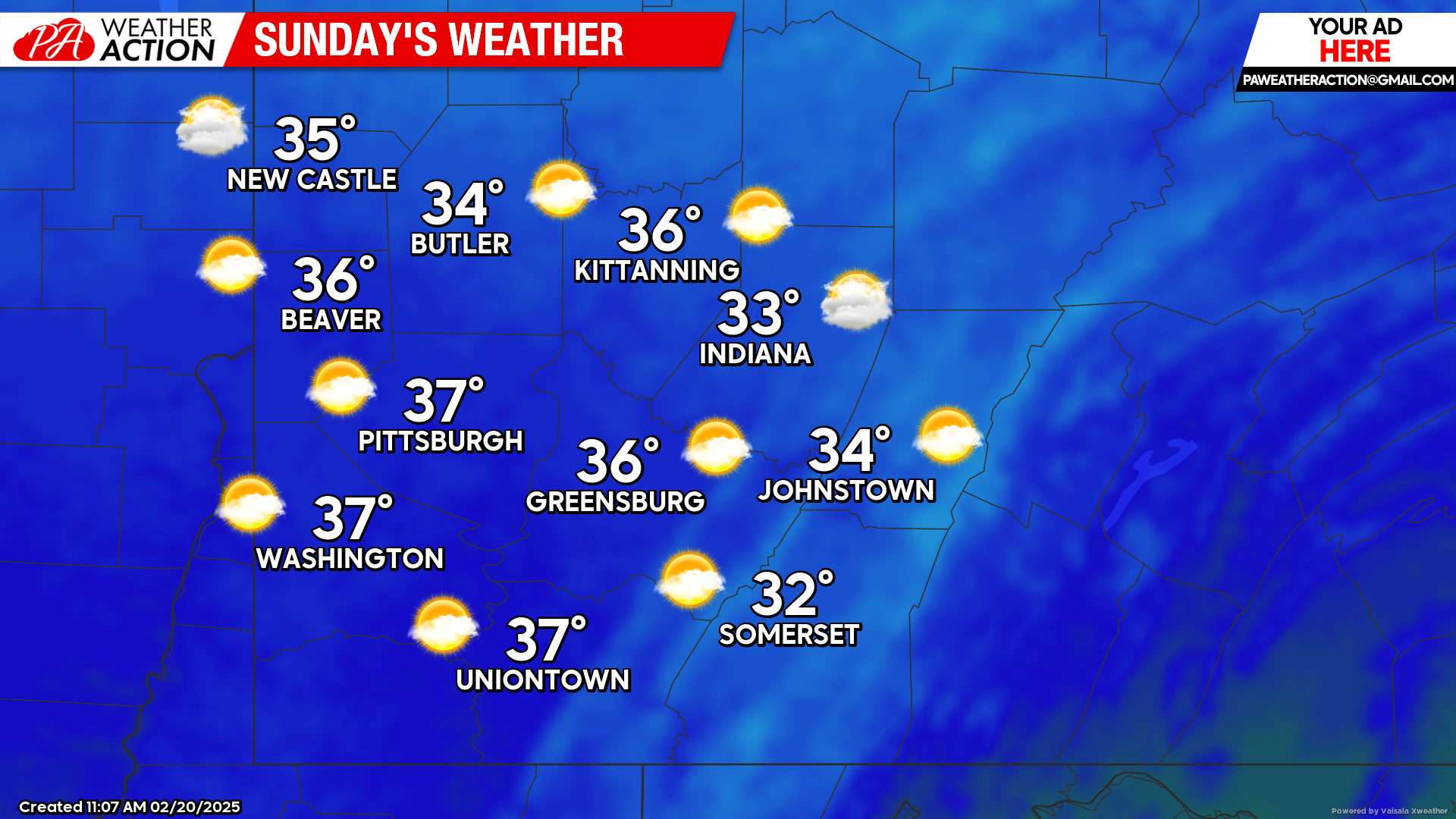
Sunday
Partly sunny. Highs will range in the 30s, lows will be in the upper to mid 20s. Winds will be out of the Southwest at 7-10 mph, with gusts approaching 25 mph.
Rain chances return to the region early next week. Be sure to follow PA Weather Action for more forecasts.

You must be logged in to post a comment.