
High pressure is expected to move into the region by midweek, bringing clear conditions, sunny skies, and warmer temperatures.
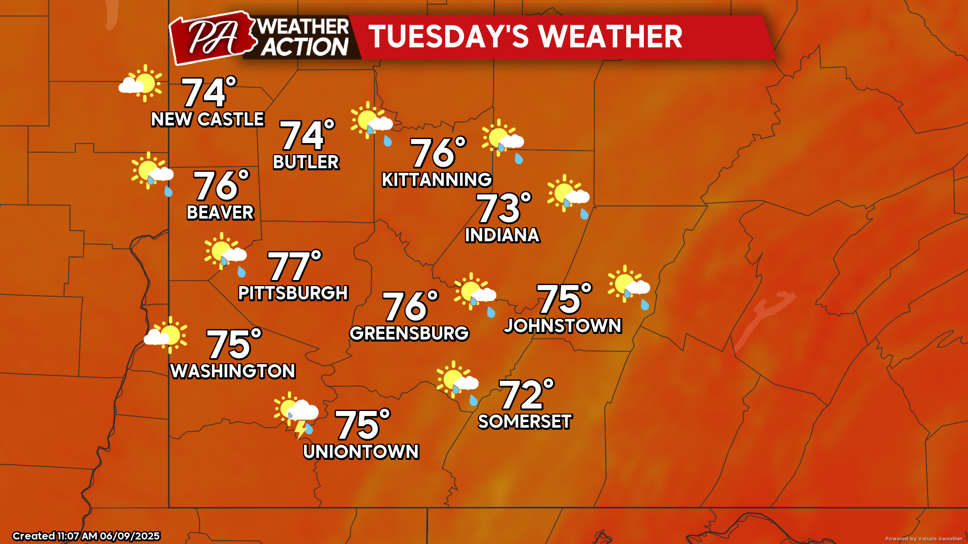
Tuesday
Hazy conditions are expected for most of the region, and an afternoon shower or thunderstorm is possible. Highs will be in the mid to low 70s, lows will range in the 50s. Winds will be out of the west at 3-11 mph, the higher elevations could experience wind gusts approaching 20 mph.
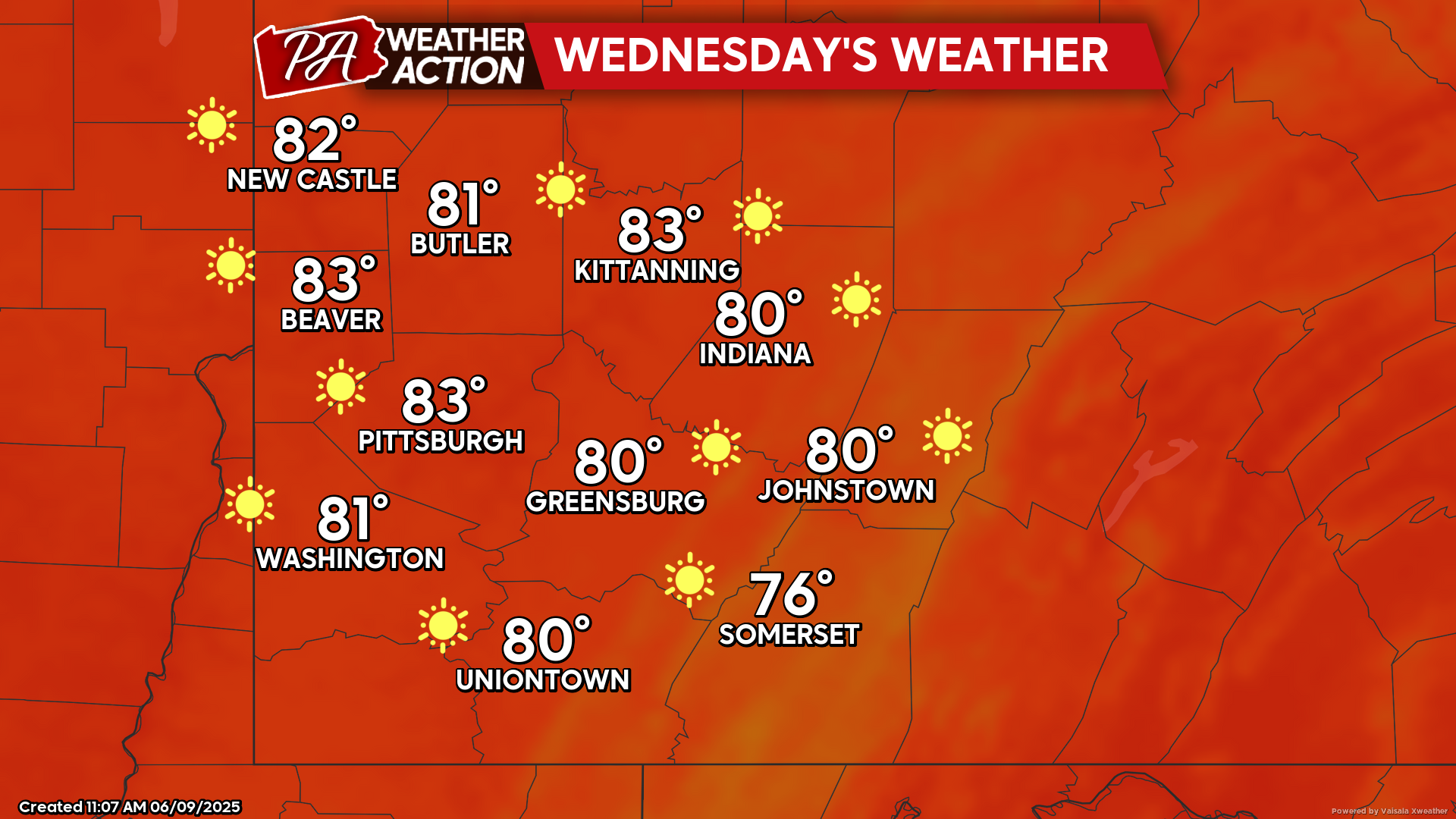
Wednesday
High pressure sets in, bringing clear, sunny skies. Highs will be in the low 80s to mid 70s, lows will be in the low 60s. Winds will be out of the west-southwest at 5-10 mph.
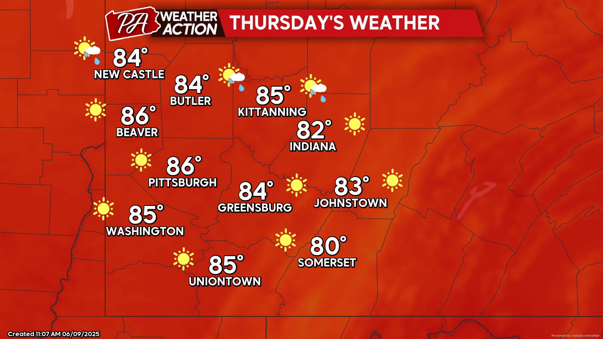
Thursday
Sunny skies and hot temperatures. Highs will be in the mid to low 80s, lows will be in the mid to low 60s. Winds will be light and variable.
Another round of active weather is expected this weekend. Be sure to follow PA Weather Action for more details and daily Statewide forecasts.
You must be logged in to post a comment.