
Click to Skip to Wednesday’s Severe Threat
Click to Skip to Thursday’s Severe Threat
After the 2025 Severe Thunderstorm Season got off to a hot start in April, it has greatly calmed since. This has been the quietest start to severe season in the eastern half of the state in many years.
Meanwhile since late April, we’ve been socked in the clouds and rain. If this May pattern came in February, it would’ve been an incredibly snowy winter.
But the good news is that summer will start right on time. The bad news is that we will immediately be greeted by a significant heat wave. More details on that are here:
Before we discuss Thursday’s larger threat, let’s briefly touch on Wednesday’s threat.
Wednesday’s Thunderstorm Timing
We expect scattered thunderstorms to pop up near the Susquehanna River late Wednesday afternoon, and push east. A few storms are also possible in Northwest PA at this time.
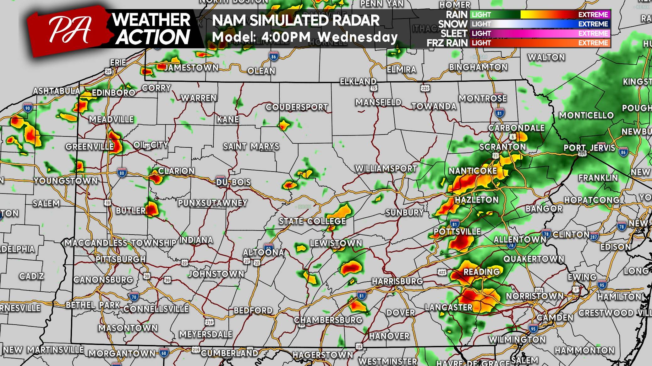
As storms enter Eastern PA, some may be strong to severe. Here’s a look at 4:00 PM Wednesday on the Hi-Res NAM.
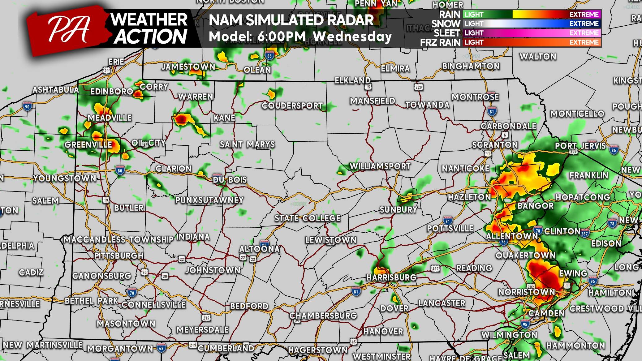
By dinnertime Tuesday, thunderstorms are projected to be just west of the Delaware River from Philadelphia to Allentown to the Southern Poconos. The greatest severe threat by this point will likely be in Southeast PA.
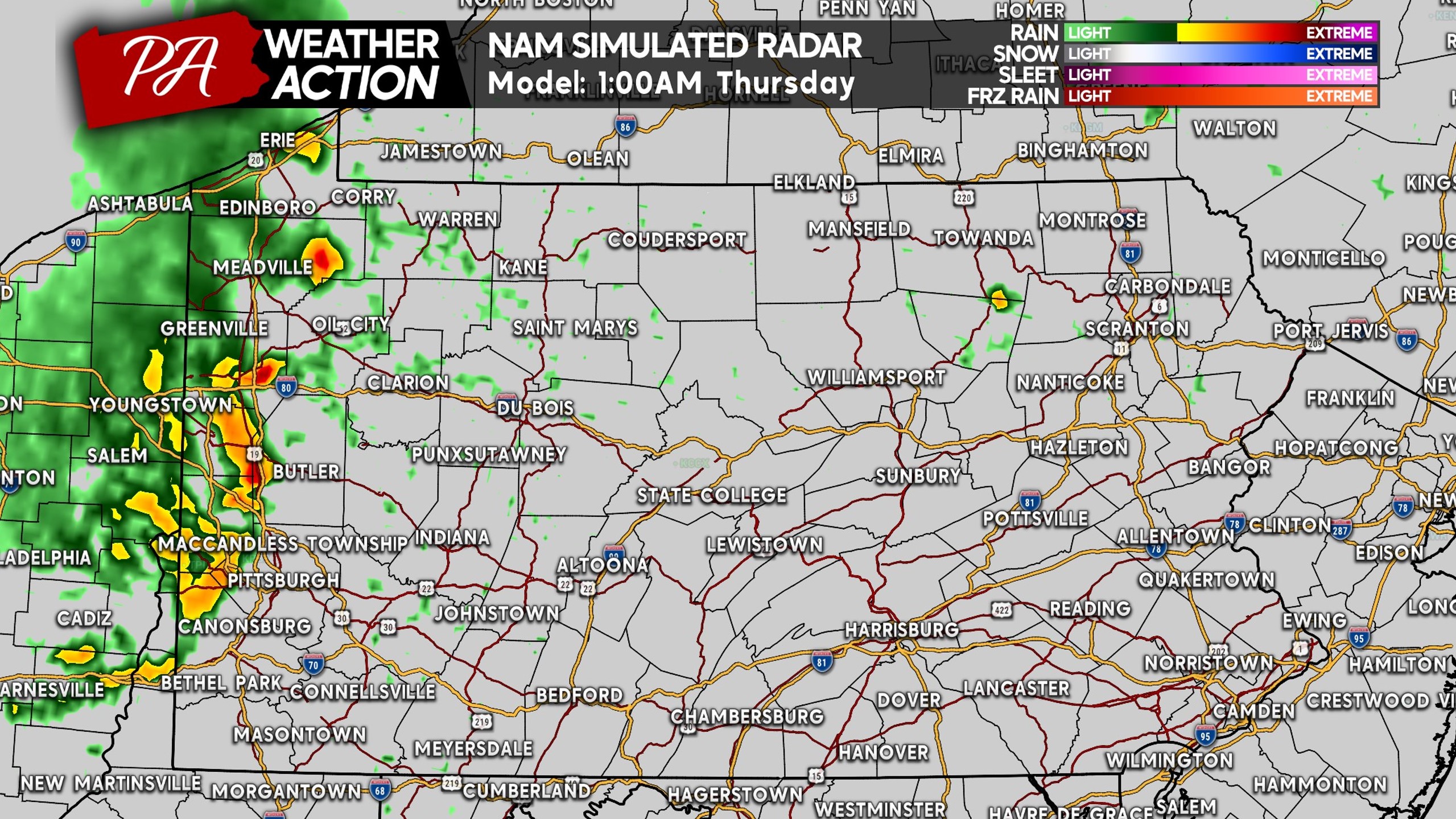
A larger and more significant severe weather outbreak will be to our west across the Midwest. A weakening line of storms may reach far Western PA late Wednesday night, potentially still containing a few strong segments.
WEDNESDAY’S SEVERE THUNDERSTORM THREAT FORECAST
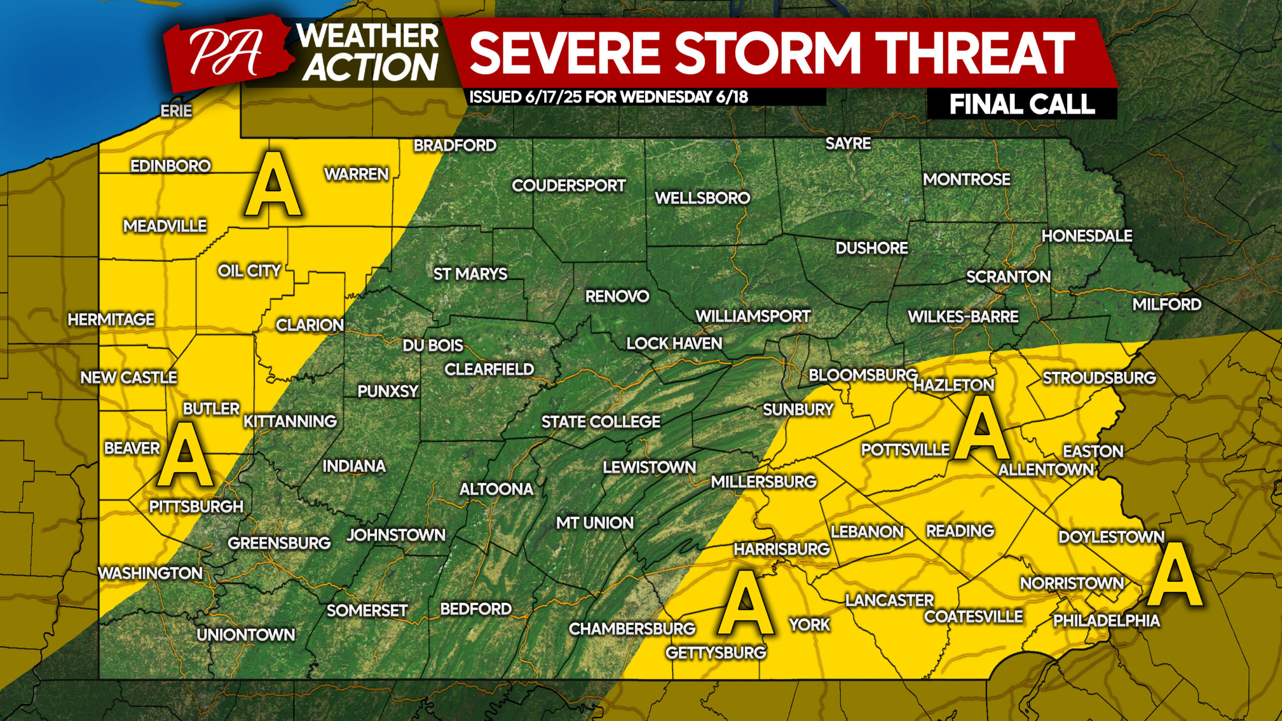
Area A: Scattered thunderstorms are expected, with a few isolated storms going severe. Damaging winds of 50-60mph are the main concern, but most storms will contain gusts of 25-45mph.
Thursday’s Thunderstorm Timing
A low pressure will move to our north Thursday, bringing scattered severe storms to our region and a very brief reprieve from the heat.
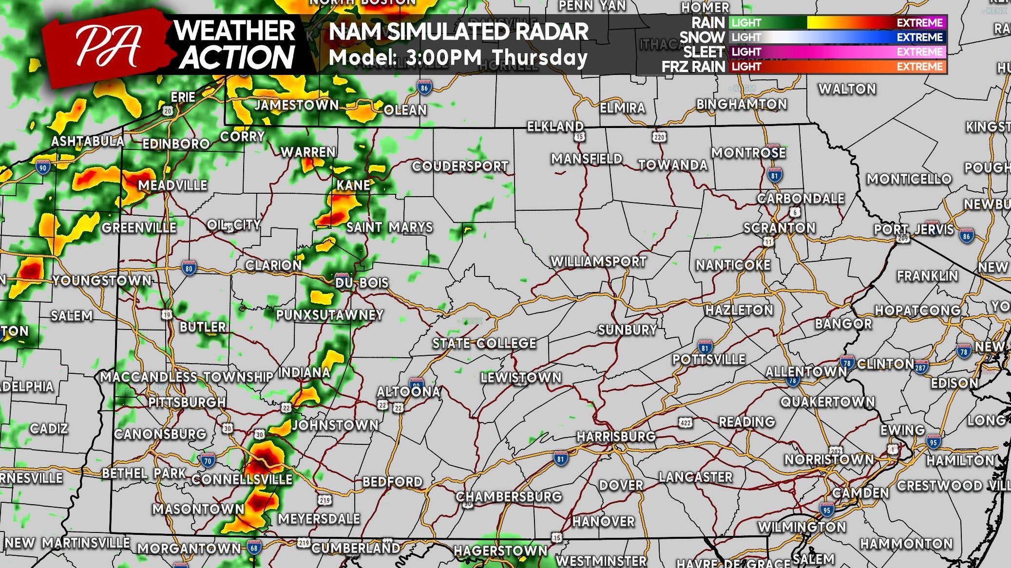
We may see two broken line segments form Thursday afternoon in Western PA. Flash flooding will continue to be a concern Thursday, though lesser than today (Tuesday). By 3:00 PM Thursday, we don’t expect severe activity quite yet, but strong storms are probable.
As the leading line of thunderstorms approaches the Route 15 corridor in Central PA, some cells may begin to go severe. We may also see a few pop-up storms especially in NEPA that could strengthen into supercells. Below is the Hi-Res NAM for 5:00 PM Thursday.
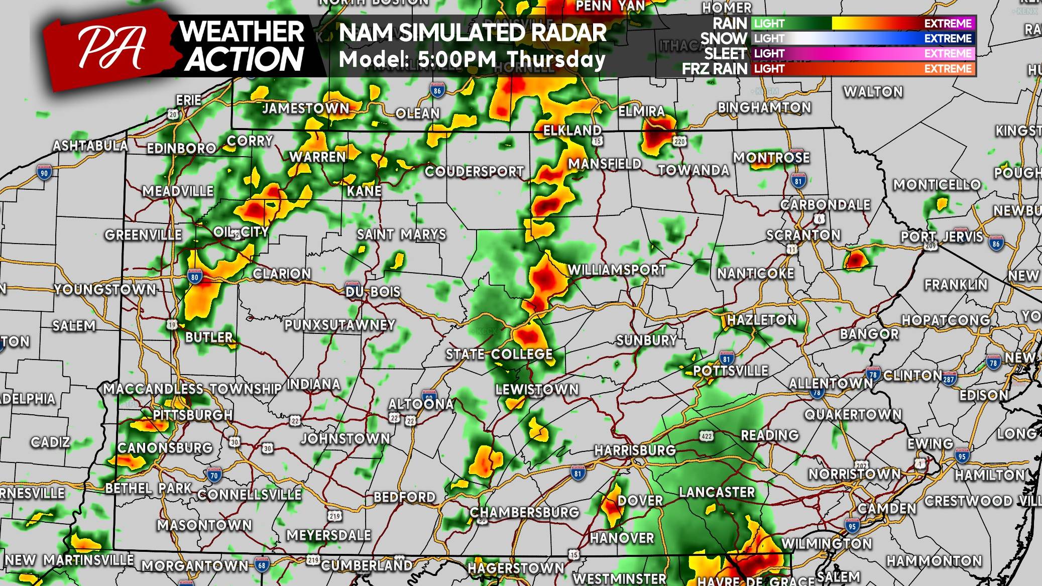
The NAM model has an area of showers stabilizing the environment in SEPA, but that’s unlikely. Scattered severe thunderstorms are likely around dinnertime Thursday in Eastern PA.
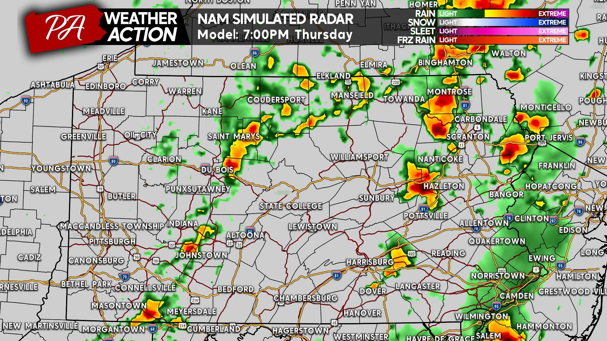
The severe threat is anticipated to exit the area by 8-9 PM Thursday.
THURSDAY’S SEVERE THUNDERSTORM THREAT FORECAST
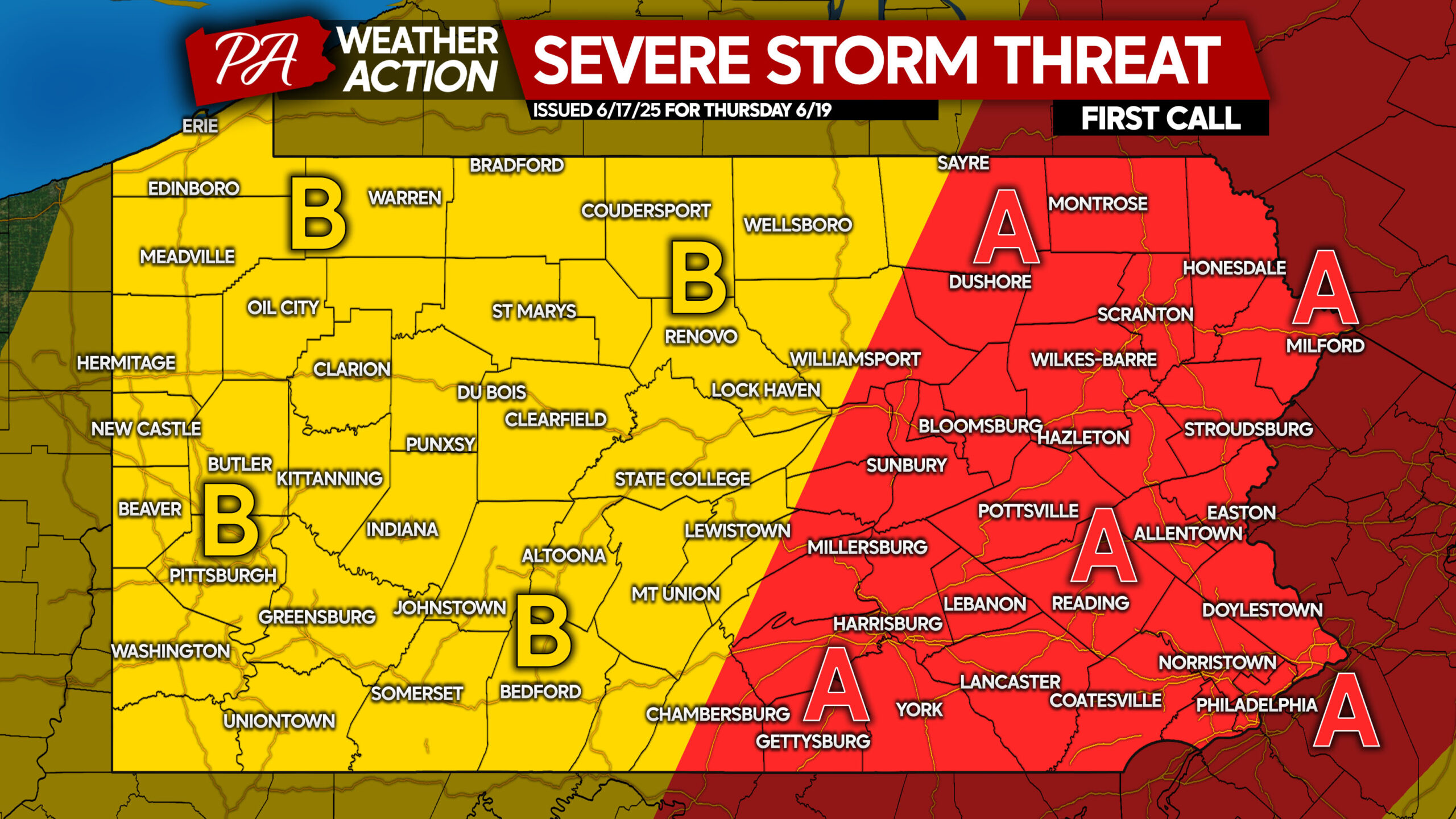
Area A: Scattered severe thunderstorms expected, with bowing line segments producing a damaging wind (50-70mph) threat. A few supercells that form ahead of the line may pose a low-end tornado threat.
Area B: Isolated strong to severe thunderstorms are anticipated, with gusty winds of 30-60mph possible. Flash flooding will be possible, but should remain fairly isolated.
Be sure to share this forecast with friends and family who may have outdoor plans on Thursday. Many people now have off work for Juneteenth.

You must be logged in to post a comment.