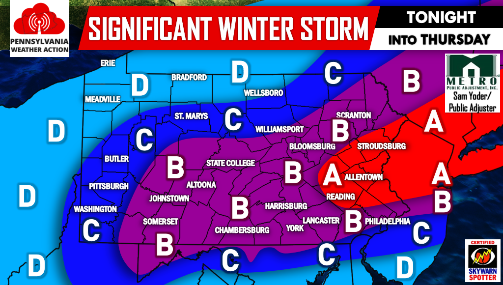
Posted inWinter Weather Final Call for Significant Winter Storm Tonight into Tomorrow Morning A significant snowstorm is less than 12 hours away from impacting the area. Temperatures across the state are currently in the 30s and 40s for… Posted by By Lead Forecaster Josh Adams February 8, 2017
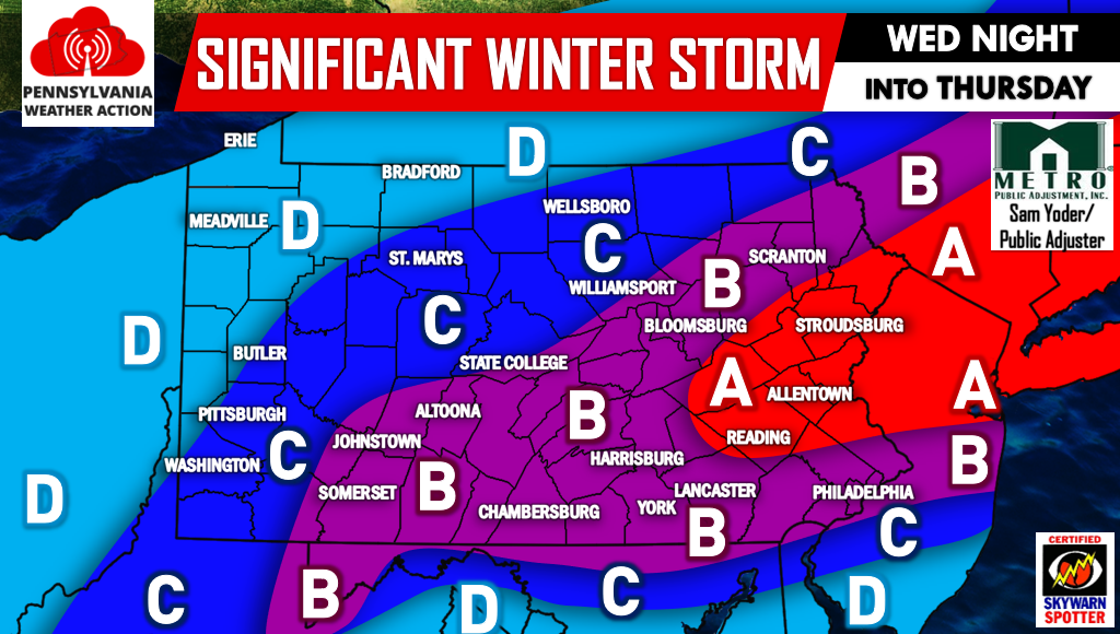
Posted inWinter Weather First Call for Significant Winter Storm Wednesday Night into Thursday We are now under 30 hours away from a significant winter storm impacting regions of the state that have so far had little snowfall. Winter… Posted by By Lead Forecaster Josh Adams February 7, 2017
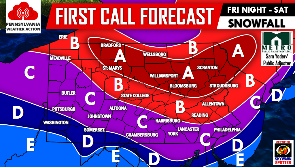
Posted inWinter Weather First Call on Friday Night into Saturday’s Significant Winter Storm OUR SECOND CALL FORECAST FOR THIS WINTER STORM HAS BEEN POSTED, CLICK THIS LINK TO VIEW IT. As many of you know by now, we… Posted by By Lead Forecaster Josh Adams December 14, 2016
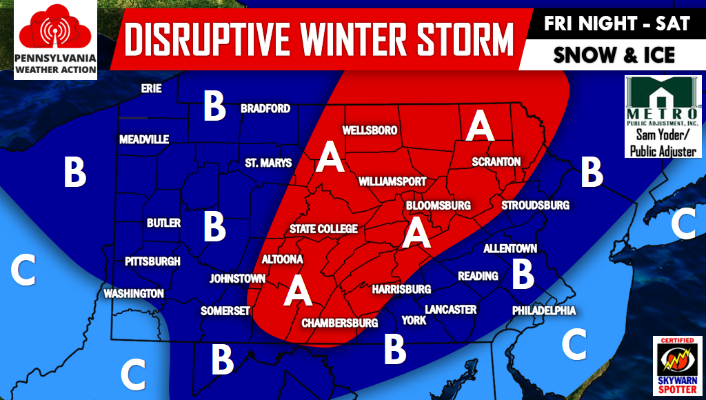
Posted inWinter Weather Significant Winter Storm Possible Friday Night into Saturday OUR FIRST CALL FORECAST INCLUDING SNOW AND ICE AMOUNTS HAS BEEN POSTED. CLICK HERE TO SEE OUR FIRST CALL While this pattern has been snowy… Posted by By Lead Forecaster Josh Adams December 13, 2016