
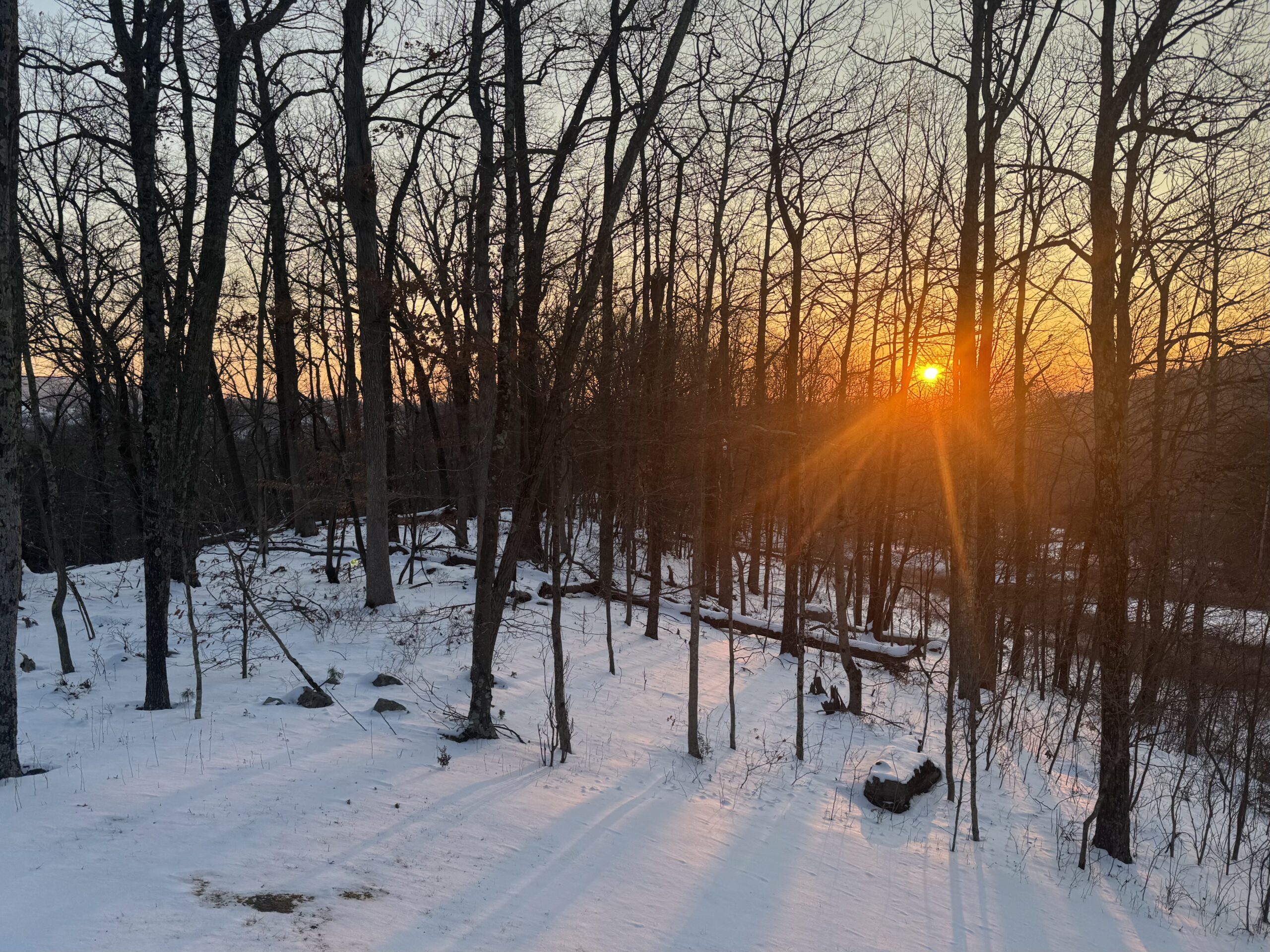
This week featured some of the lowest temperatures in decades for parts of the area. Sunday evening’s fresh mantel of low-density dendrites insulated the air from the ground. Without that warmth from the ground when the arctic high settled upon our area Tuesday night, the clear skies and light wind allowed rivers of extremely cold air to form and flow downhill into the valleys. Temperatures across our southern valleys fell to 15-25 below zero!
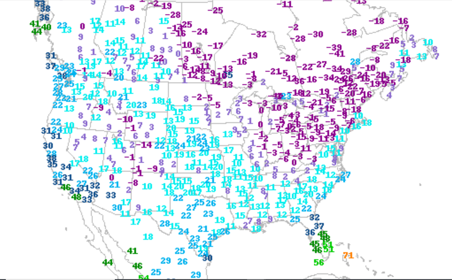
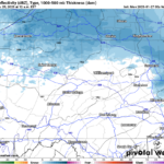
To illustrate how we were one of the coldest places in the Nation and even in North America, here is a plot of low temperatures for Wednesday morning
WEDNESDAY MORNING LOW TEMPERATURES:
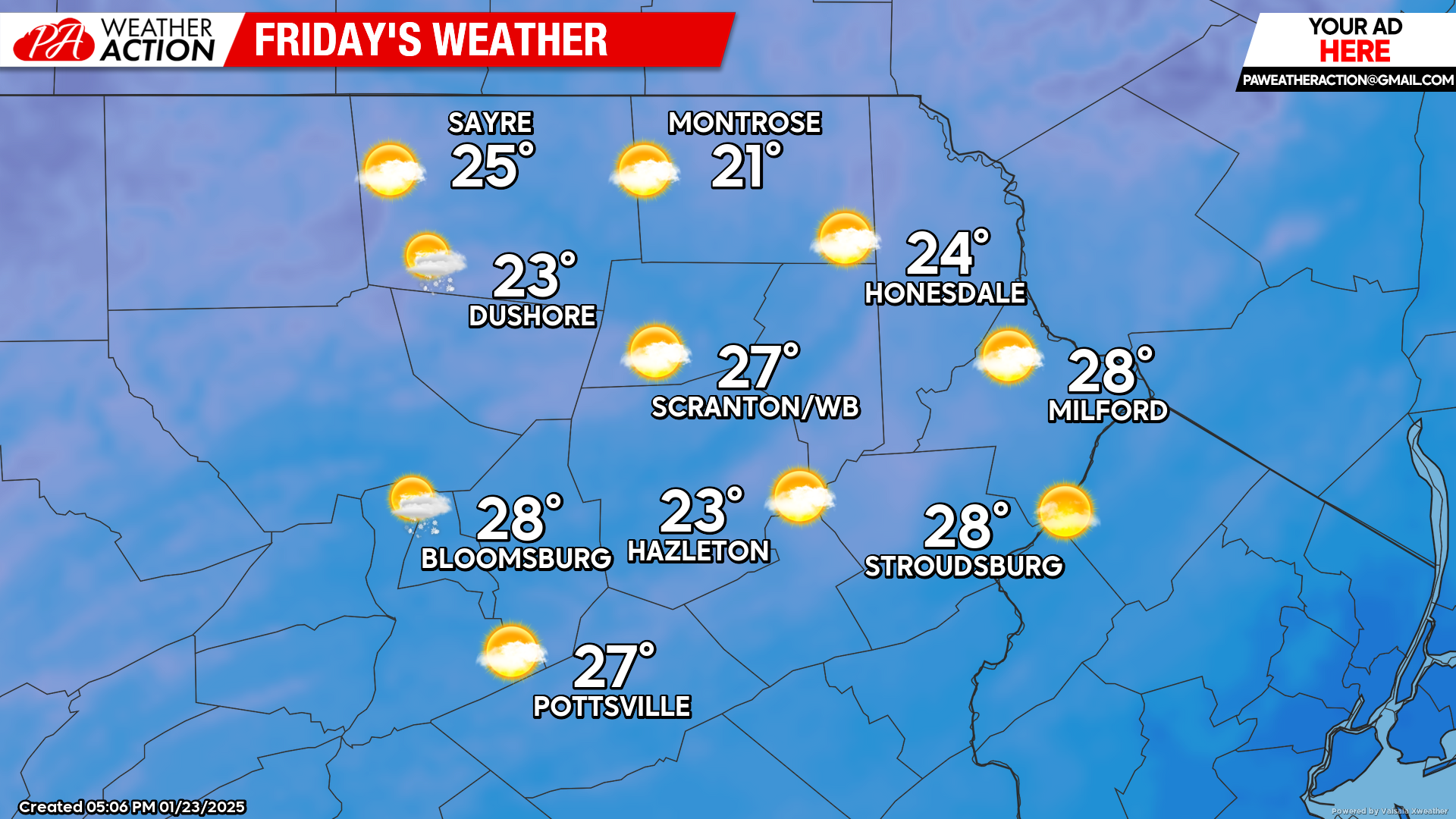
FRIDAY
After another frigid night, temperatures will warm well into the 20s on Friday. Get outside and enjoy the warmth! More is on the way.
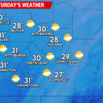
SATURDAY
Saturday will feature sunshine, a few clouds, and temperatures starting in the single digits but rebounding well into the 20s across the region. Enjoy!

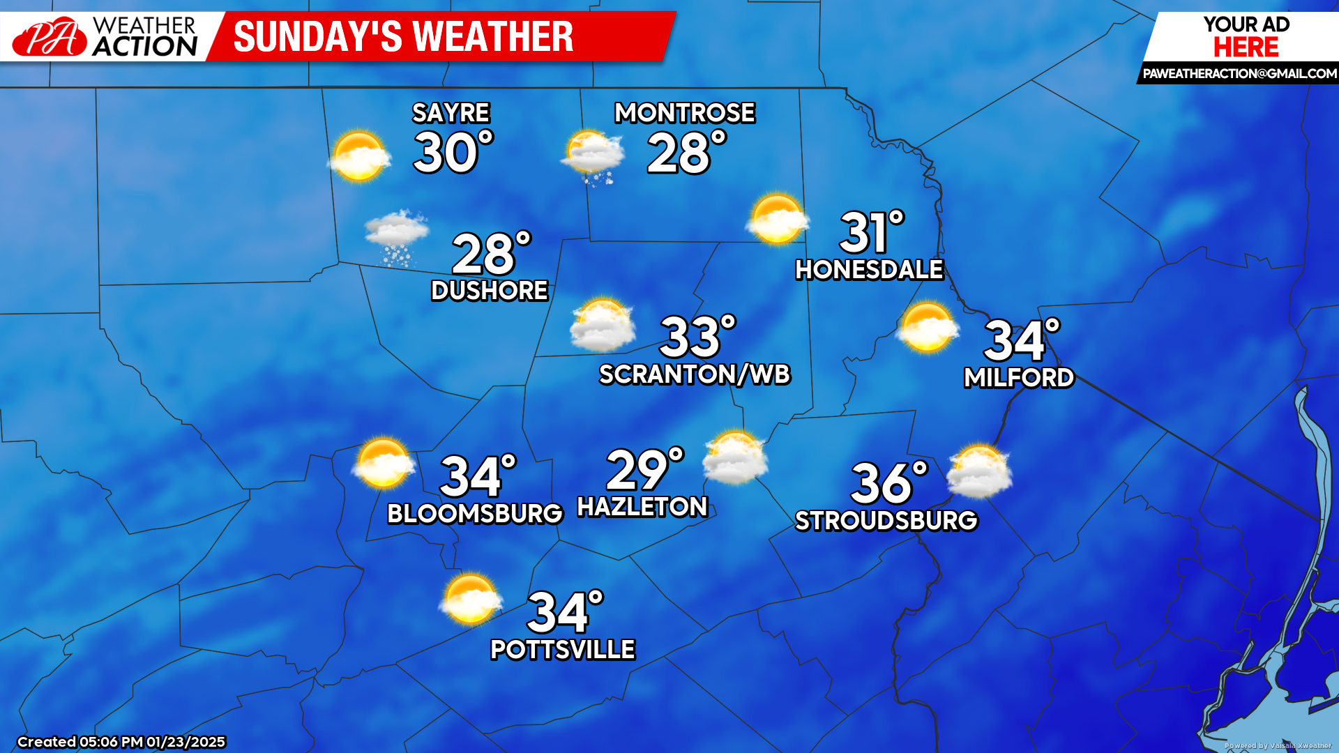
SUNDAY
The warming trend will continue with temperatures getting into the upper 20s to mid 30s! There could be some light snow in our northwestern counties but nothing of consequence.
You must be logged in to post a comment.