
A strong upper-level disturbance is approaching our area. It is currently igniting a severe weather outbreak across western Pennsylvania. Showers and thunderstorms will move into our area overnight into Tuesday morning. Some of those storms could be quite strong.
TUESDAY
As the upper-level disturbance moves over our area, strong storms will be possible early Tuesday morning. Those widespread showers and thunderstorms will exit to our east by mid-morning. The rest of the day will feature partly cloudy skies, but isolated thunderstorms will develop during the afternoon.

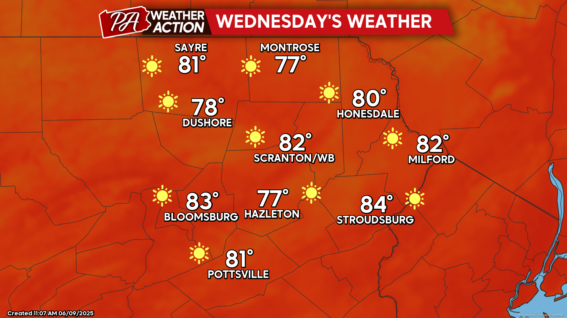
WEDNESDAY
Wednesday will bring breezy conditions, ample sunshine, and lower humidity. The wind will gust to 20 mph from the west during the afternoon.
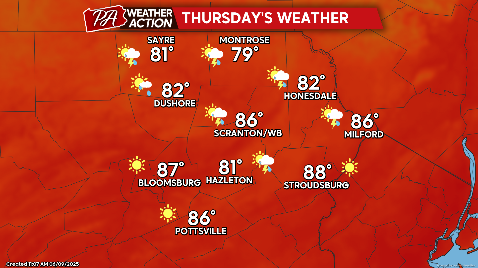
THURSDAY
Humidity and temperatures will increase Thursday to provide a summertime atmosphere. Most of the day will feature sunshine, and most locations will be dry. However, there could be an isolated thunderstorm moving eastward through the area during the afternoon.

You must be logged in to post a comment.