
Happy Friday the 13th folks! Hopefully the weather today is not great enough to spook you, but the forecast for tomorrow should be a lot more scary…
STARTING TODAY…
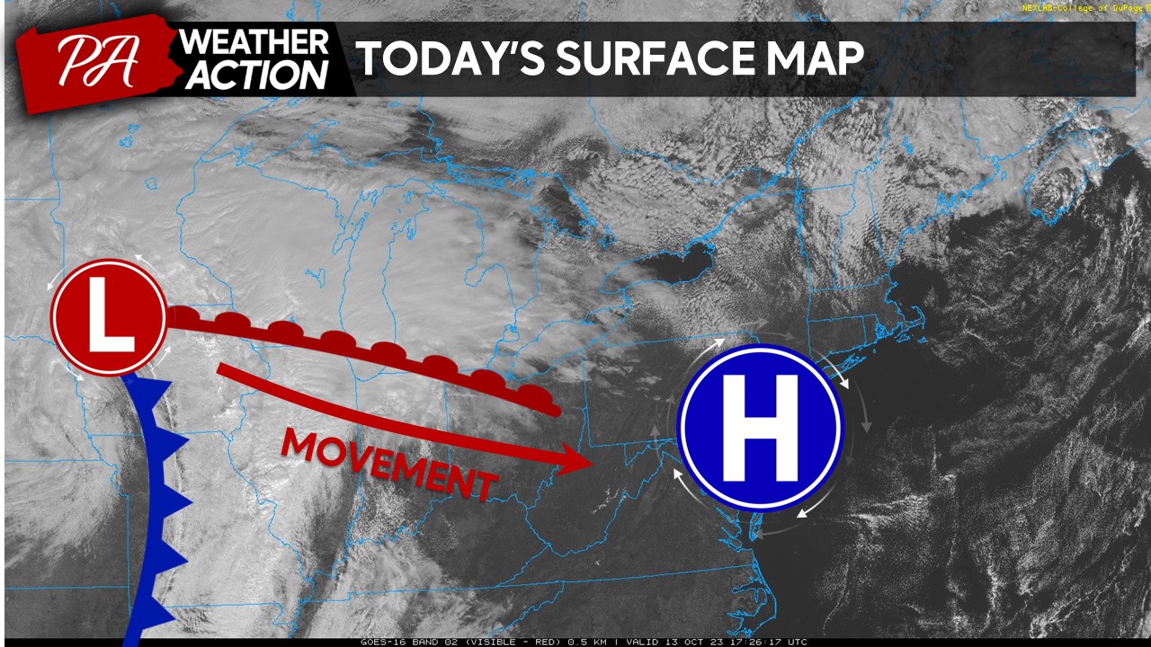
High pressure over the region this afternoon is leading to a rather comfortable weather conditions as temperatures climb into the low-to-mid 60s under mostly sunny skies and calm winds. However, as we look to our west, a rather strong low pressure system is beginning to get its act together is heading our way. Normally, these low pressure systems would head north, however, due to STRONG high pressure blocking across Canada, this low pressure system is forced to head eastward, instead of northward. Expect cloud cover to increase during the evening hours with the first bouts of precipitation arriving by 6-7 AM tomorrow morning! If we were talking about this same system in mid-December, this would have been more white/icy than wet for our region!
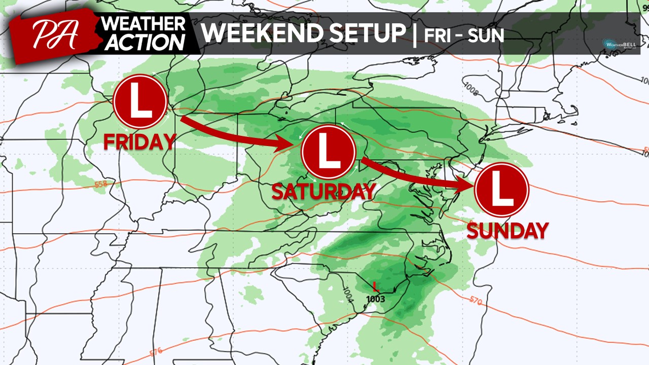
 As we progress through the weekend, as shown in yesterday’s blog post, due to strong blocking across southern Canada, this low pressure system will drift southeastward, bringing plentiful of precipitation and cooler conditions to our region.
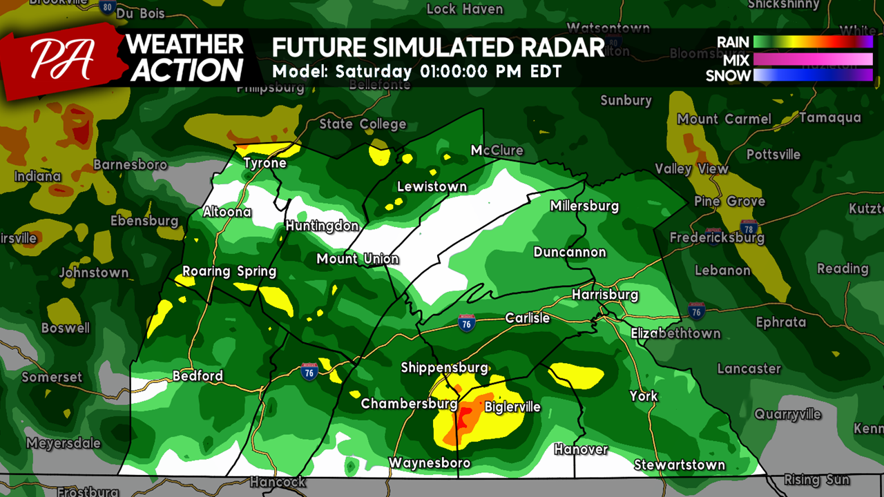
 Future Radar:
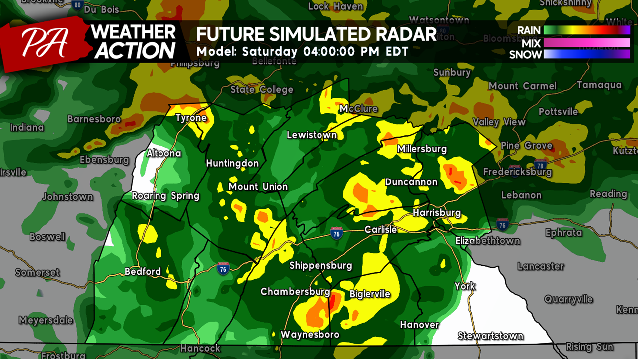
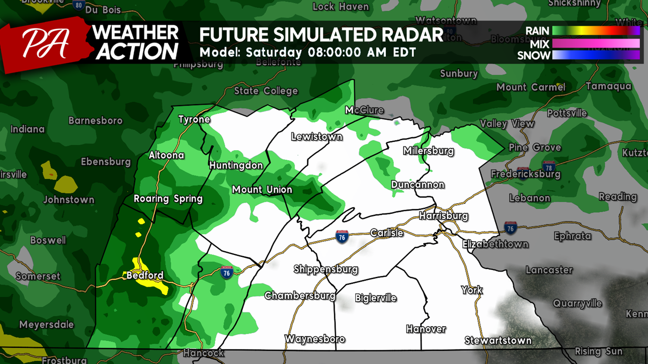
By the early morning hours, precipitation will begin to fill into the region, especially across the western and northern zones. The rain shield will continue to fill in significantly quicker past 8 AM. Do not forget your rain gear if you are heading out early in the morning!
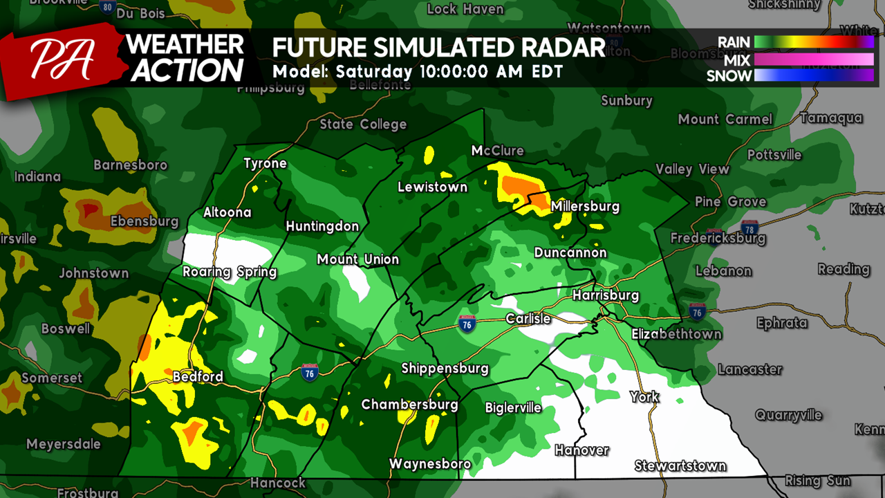
As we progress into the latter half of the morning, much of the region will be encased in rain, with a few localized areas seeing heavier precipitation rates. Keep in mind, there will also be small, short-lived breaks within the precipitation shield (denoted by the white = cloud colors).
 By the early afternoon hours, nothing much will have changed with precipitation shield with rain likely occurring across the entire region area with areas of heavier rainfall rates expected.
 The extent of the most widespread and heaviest rainfall rates should peak around the mid-afternoon hours, especially between 3-6 PM.
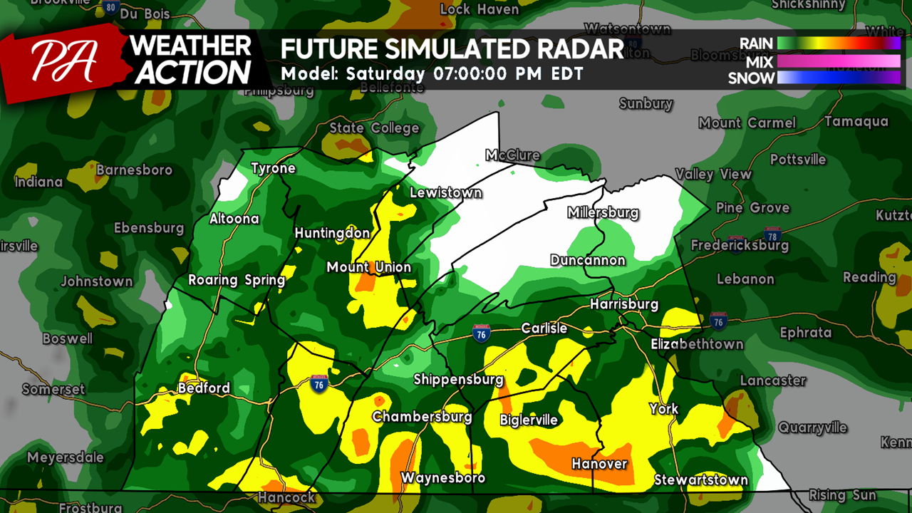
 Toward the evening hours, the heaviest of the precipitation will continue to shift southward into the southern portions of the viewing area. Areas across the northern counties may experience lighter rates and/or complete short-term breaks.
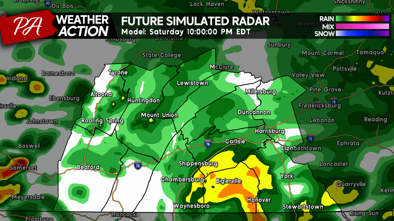
 As we head into the overnight hours, expect the overall rain activity begin to slowly wane, although some areas across the southern counties may still experience a steady rainfall. Overall, expect much of the precipitation to taper off during the middle of the night, especially after midnight.
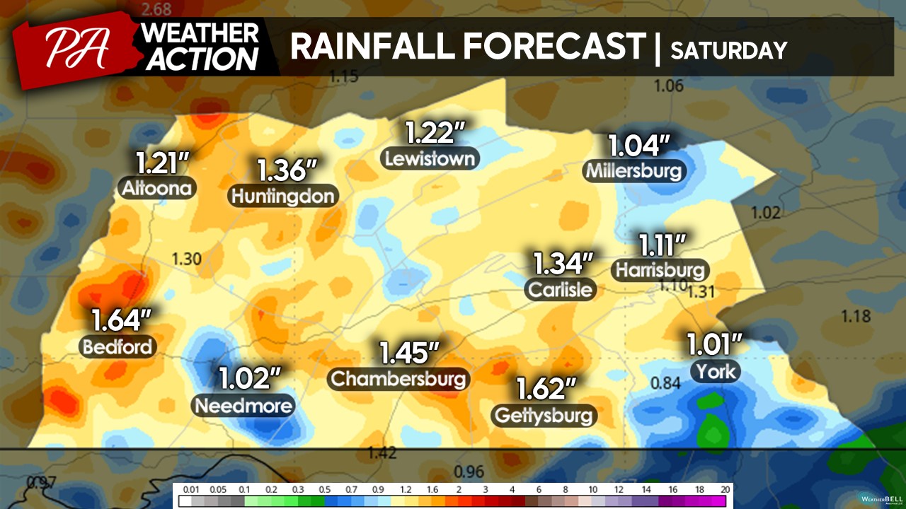
 EXPECTED RAINFALL:
Unfortunately, much of Saturday will be rained out across the entire region. Expect a general 1-1.50″ of rainfall, with isolated areas of lower and/or higher amounts, which will be dependent on where the heaviest banding sets up during the event. Some of you may be questioning on how much snow would’ve fallen if this system were to have occurred during the winter months. On average, a foot of snow is equal to an inch of liquid precipitation. Therefore, it is possible some areas across the region could have picked up a foot or more of snowfall, dependent on if any mixing would have occurred. Anyway, there has been some drier extended periods during the last few months so this rain is much-needed, but it would have been better if this system came on another day than Saturday!
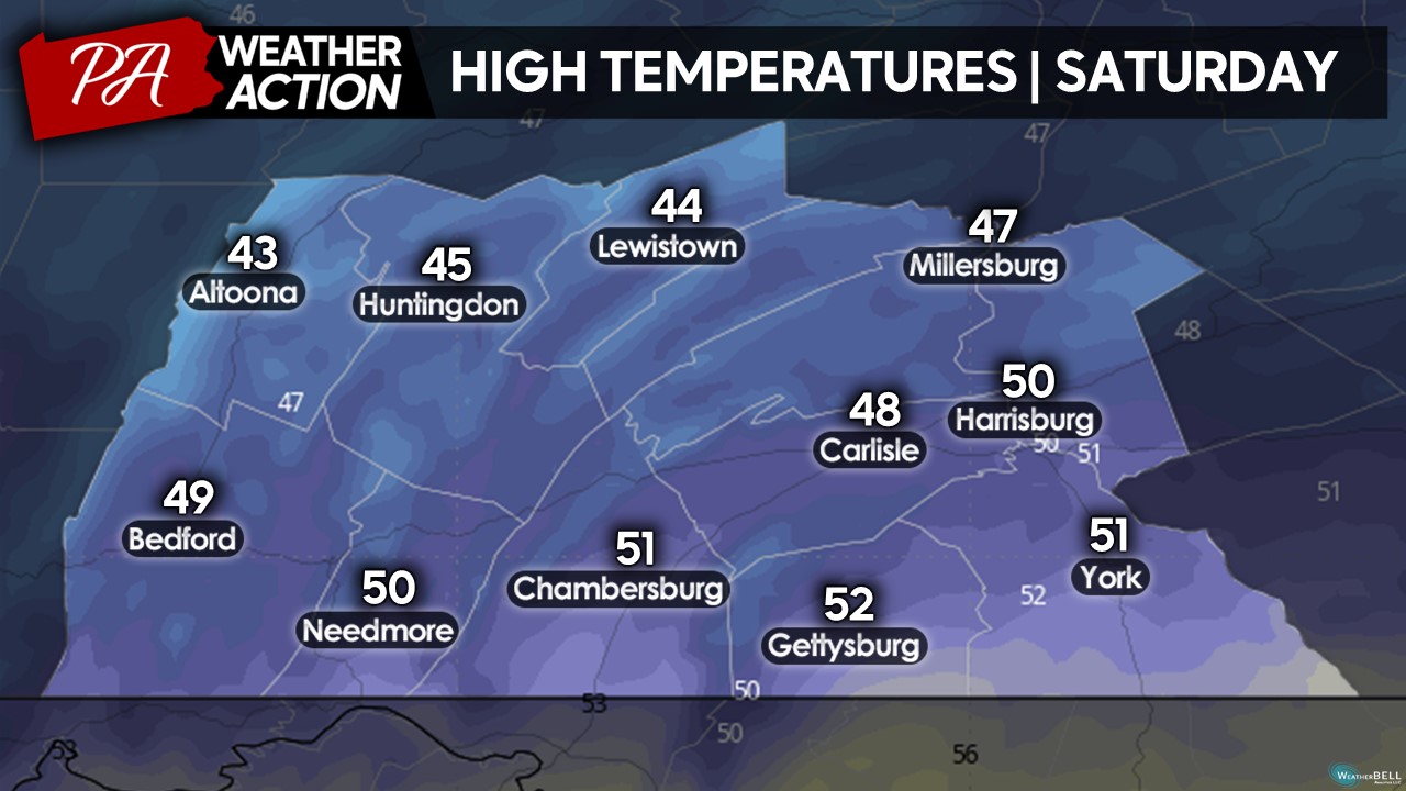
AFTERNOON TEMPERATURES:
With the continuous rain expected during the afternoon hours, afternoon high temperatures will struggle to warm up much. Expect temperatures ranging from the low-40s to low-50s north-to-south. Accompanied with rain and slightly gusty winds, it may feel slightly colder at times! If you are braving the outdoor conditions tomorrow, make sure to wear proper rain and cold weather gear to prevent cool weather hazards!
Despite the washout expected on Saturday, I hope you still make the best out of it, whether you are staying indoors or still braving the cold and rain in the outdoors! Sunday should be significantly drier with temperatures in the mid-50s, although a few isolated afternoon showers cannot be ruled out! If you have any questions regarding the forecast, please do not hesitate to reach out.
Denys
You must be logged in to post a comment.