
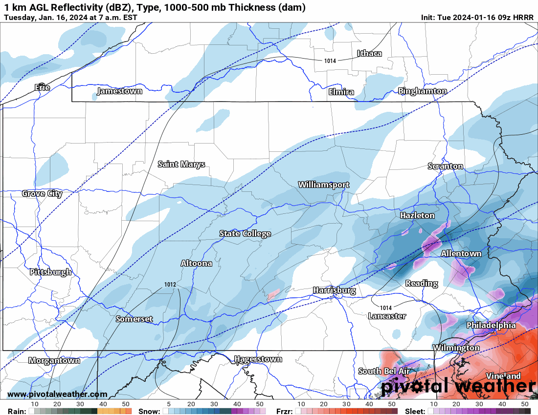
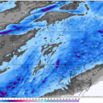
As of 5 AM Tuesday, radar may give you the impression that snow will be wrapping up very shortly in Southeast and South Central PA, with only a few hours left farther north. While there will be a lull for a few hours, more light to even moderate snow is expected to fill in across Central and Eastern PA between 7 – 8 AM, which will continue through lunchtime.
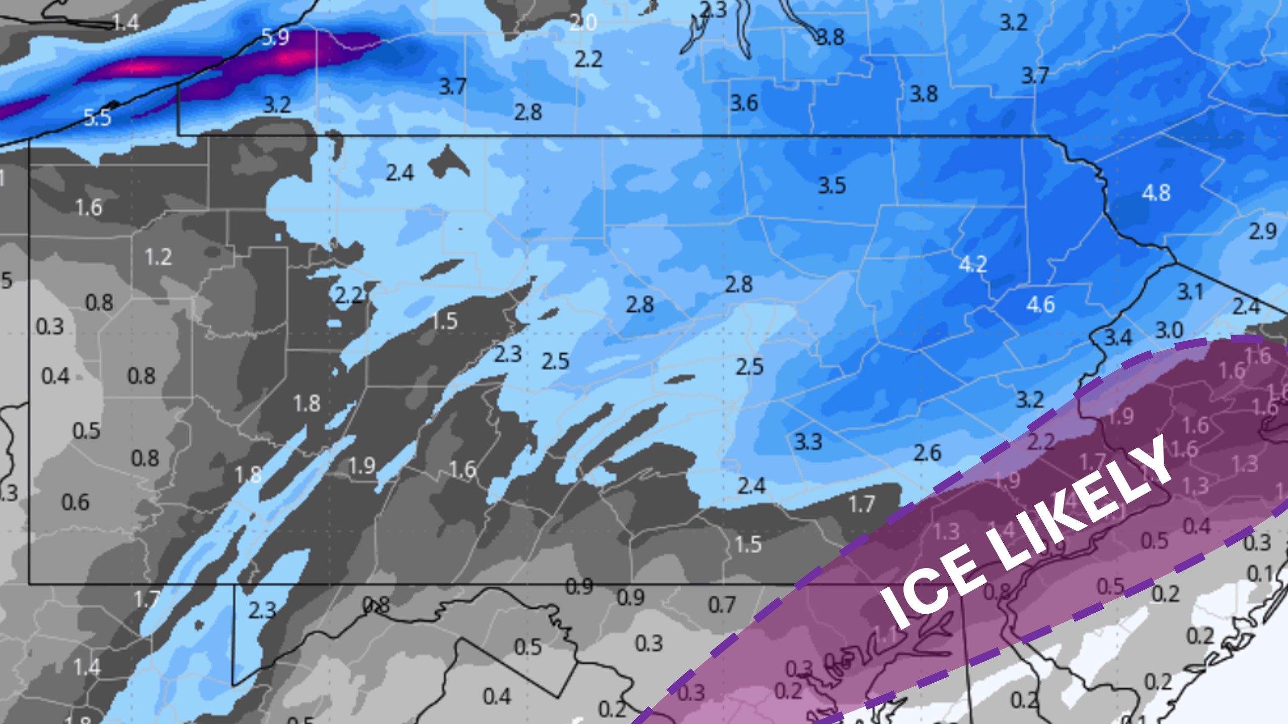
This additional banding is expected to produce another 1-4″ in the eastern half of the state, east of Chambersburg, State College, and Wellsboro. However, that excludes the Philadelphia Metro. This is because a several hour period of freezing rain is now expected in Chester, Delaware, Philadelphia, Montgomery, and Bucks County from 8 AM Tuesday until around 1 PM.
View future radar from the HRRR Model below.
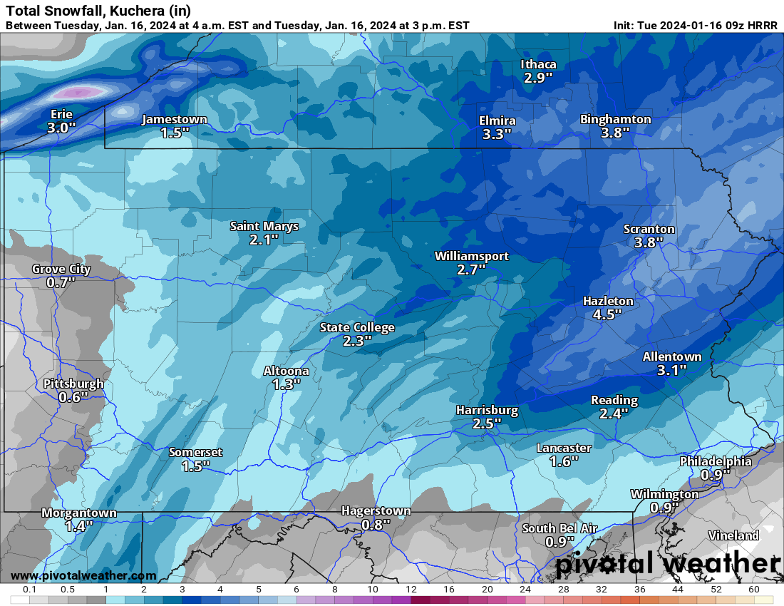
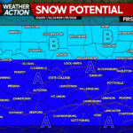
Below is the model’s latest snowfall projection through the end of the event. The Poconos will see the most additional snowfall, on the order of 3 – 4″, with isolated 5″ amounts.
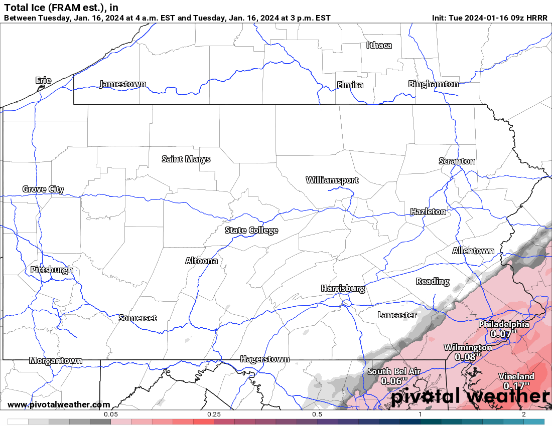
More concerning though, is the likelihood of freezing rain in the Philadelphia Metro through the morning into lunchtime. These amounts, between 0.01 – 0.10″ of ice, can easily cause extremely slick roadways and numerous accidents. We do not advise traveling through the mid afternoon. Temperatures will not warm above freezing either afterwards!
Our forecast of 2 – 4″ in most of the eastern half of the state looks good at this junction, though there may be a few reports of 5 – 6″ in the Poconos!
The majority of people in SEPA are not aware of the freezing rain/ice potential in Southeast PA. If you can pass along this information to them by sharing, please do so!
You must be logged in to post a comment.