
Another tricky winter storm is on the way, with a slightly higher ceiling than the event this past week. Overall, the areas to be most highly impacted are similar once again. As to be expected when two to three days out, models haven’t made up their minds yet. We are confident northern PA will see the most snowfall out of this storm, but a gray area exists around whether or not eastern PA will see anything in the way of snowfall accumulations after rain changes to snow Tuesday Morning.
STORM TIMING
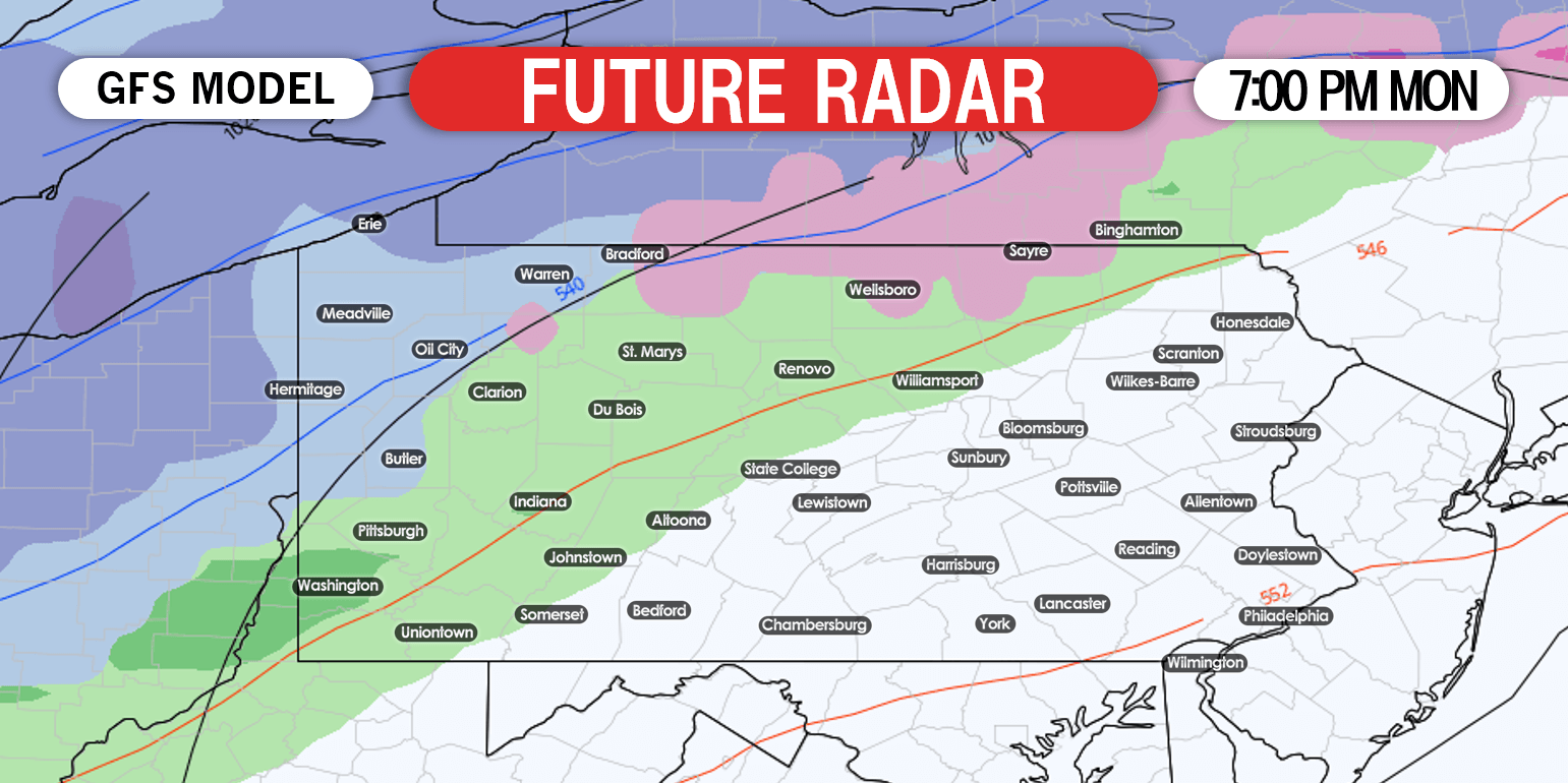
Light rain and snow will begin in western PA Monday evening. The rain/snow line will quickly move southeast as the evening progresses. Here’s a look at 7:00 PM Monday per the GFS.
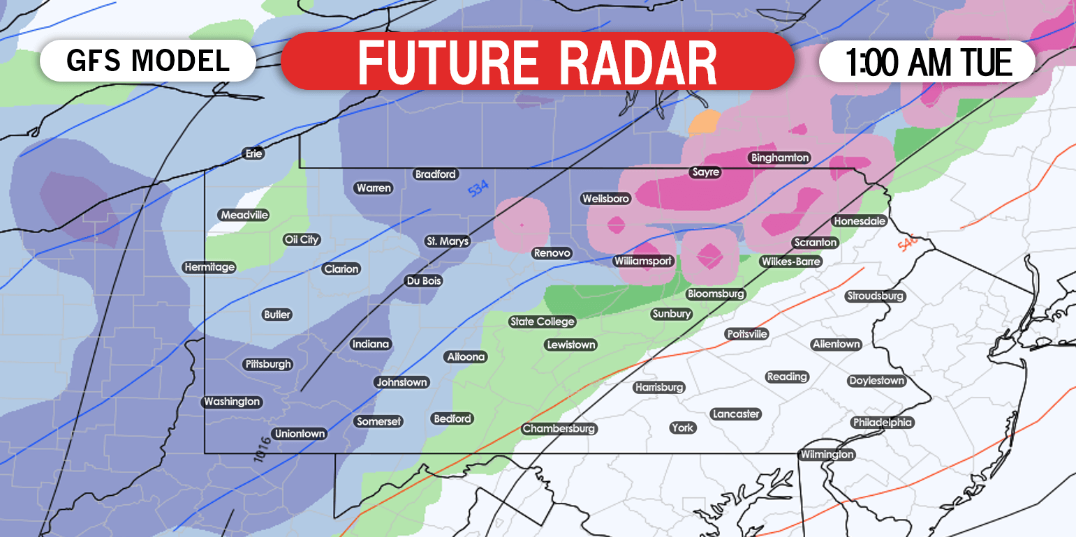
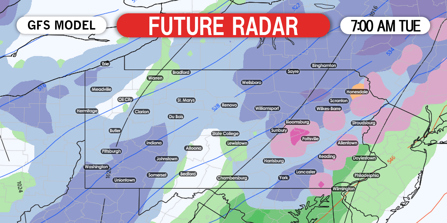
By around sunrise Tuesday, light snow is expected to continue in western and northern parts of the state. In addition, the eastern half of PA may switch from rain to snow for a few hours Tuesday morning. Future radar for 7:00 AM Tuesday is below.
A period of light snow is possible in southeast PA late Tuesday morning, just before precipitation ends. At the same time, lake effect snow will take over in western PA. Here is the GFS for 1:00 PM Tuesday.

SCENARIO #1 MAP – 60% CHANCE
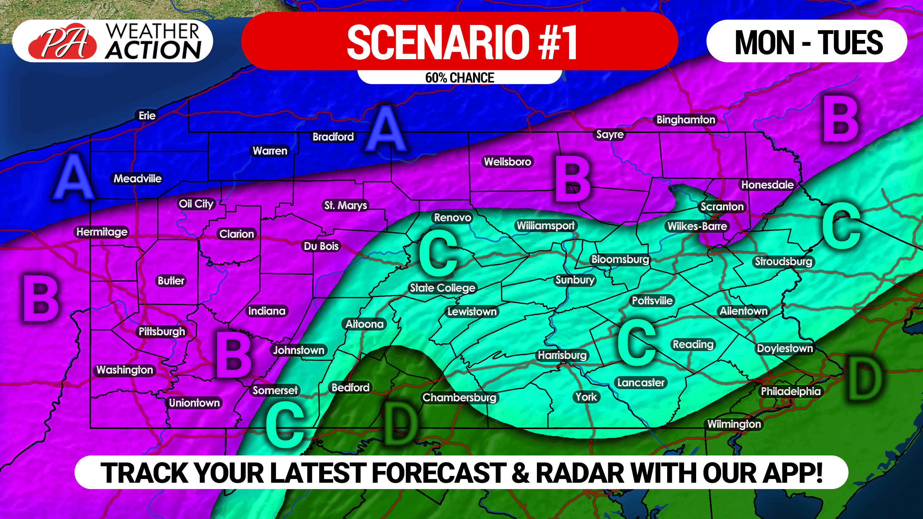
Area A: Light rain will quickly change to snow Monday afternoon, continuing into Tuesday morning. Snowfall accumulation of 3 – 6″ expected.
Area B: Light rain Monday afternoon and evening will change to snow from northwest to southeast by late evening Monday. Snow will continue through Tuesday morning. Snowfall accumulation of 1 – 3″ expected.
Area C: Light rain Monday evening could change to a brief period of snow Tuesday morning. Snow accumulation under 1″ possible on grassy surfaces.
Area D: Light rain Monday night possibly leading to an hour or two of non-accumulating snow Tuesday morning.
SCENARIO #2 MAP – 40% CHANCE
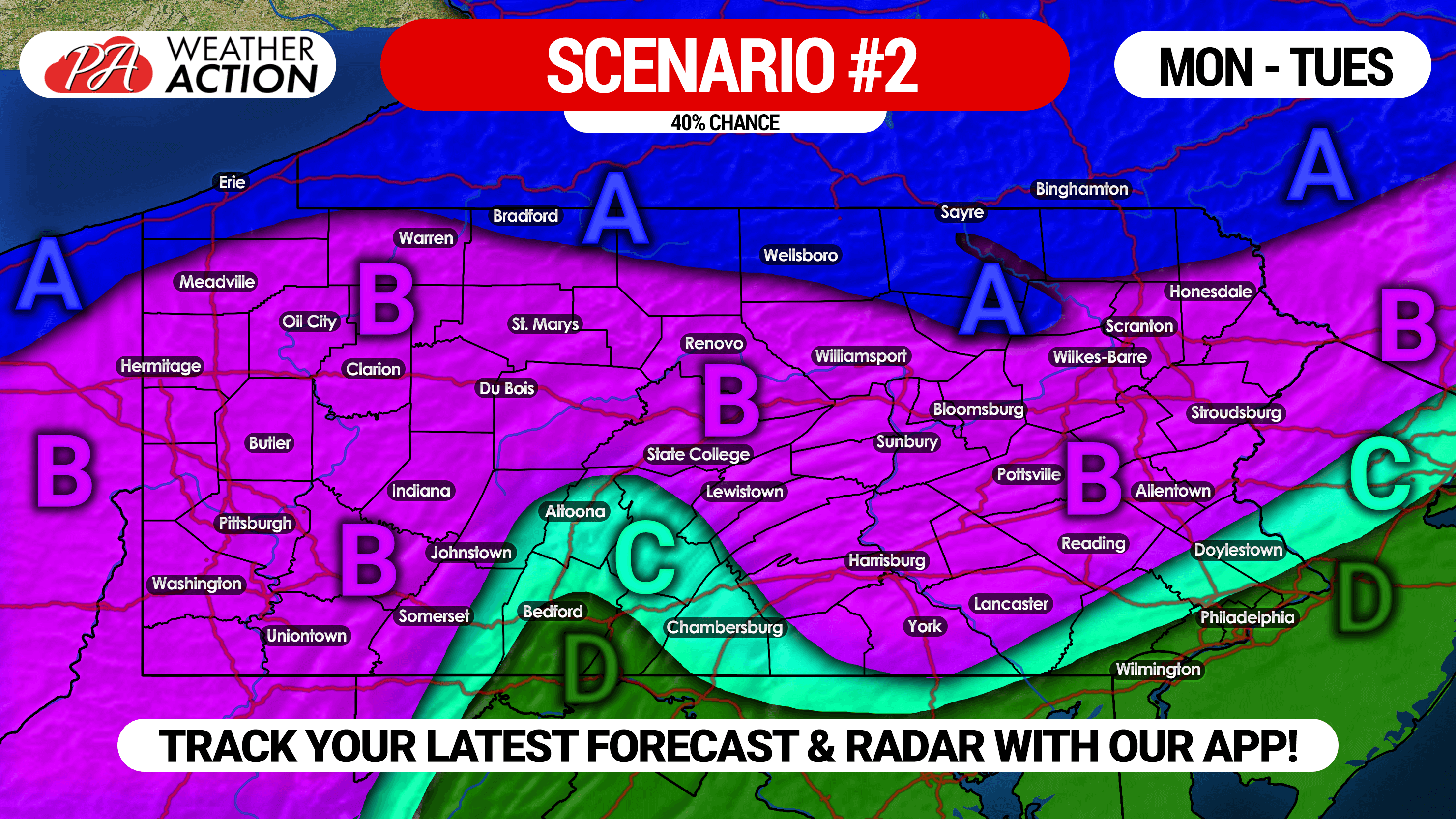
Area A: Light rain will quickly change to snow Monday afternoon, continuing into Tuesday morning. Snowfall accumulation of 3 – 6″ expected.
Area B: Light rain Monday afternoon and evening will change to snow in western PA Monday evening. Light rain changing to snow in the pre-dawn hours of Tuesday in eastern PA. Snowfall accumulation of 1-3″ expected.
Area C: Light rain Monday evening could change to a brief period of snow Tuesday morning. Snow accumulation under 1″ possible on grassy surfaces.
Area D: Light rain Monday night possibly leading to an hour or two of non-accumulating snow Tuesday morning.
If you are in the same scenario on both maps, than as of now you can expect to see what your scenario reads. If you are in different scenarios, than more uncertainty lies around what impacts you may see.
We will know more by Sunday evening, which is when you can expect our snowfall forecast.
Inform your friends and family of the wintry weather by sharing this with them using the button below!
To receive more updates like this during the winter season, download our free app >>> Weather Action App
For morning video forecasts about the latest on this storm and the winter storms to come, subscribe to us on YouTube >>> YouTube Channel

You must be logged in to post a comment.