

The parade of disturbances that began impacting our area with persistent gloom earlier this week will continue through this weekend, ending as a period of snow Sunday into Sunday night. Total precipitation amounts so far this week have exceeded an inch over much of our area.
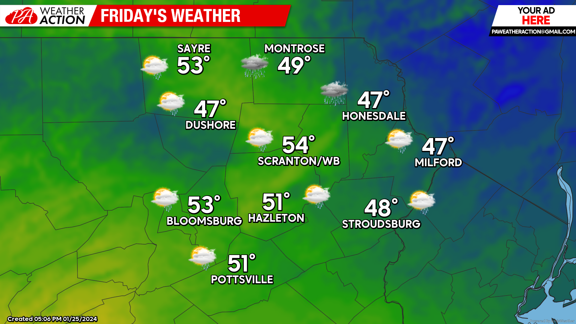
FRIDAY
Yet another disturbance will bring an additional half-inch of rainfall to our area tonight through midday Friday. Temperatures will remain above freezing across the area overnight, and daytime temperatures will once again climb well into the 40s and even low 50s for some. Precipitation will taper off for Friday afternoon, but don’t get excited about much prospect of sunshine.
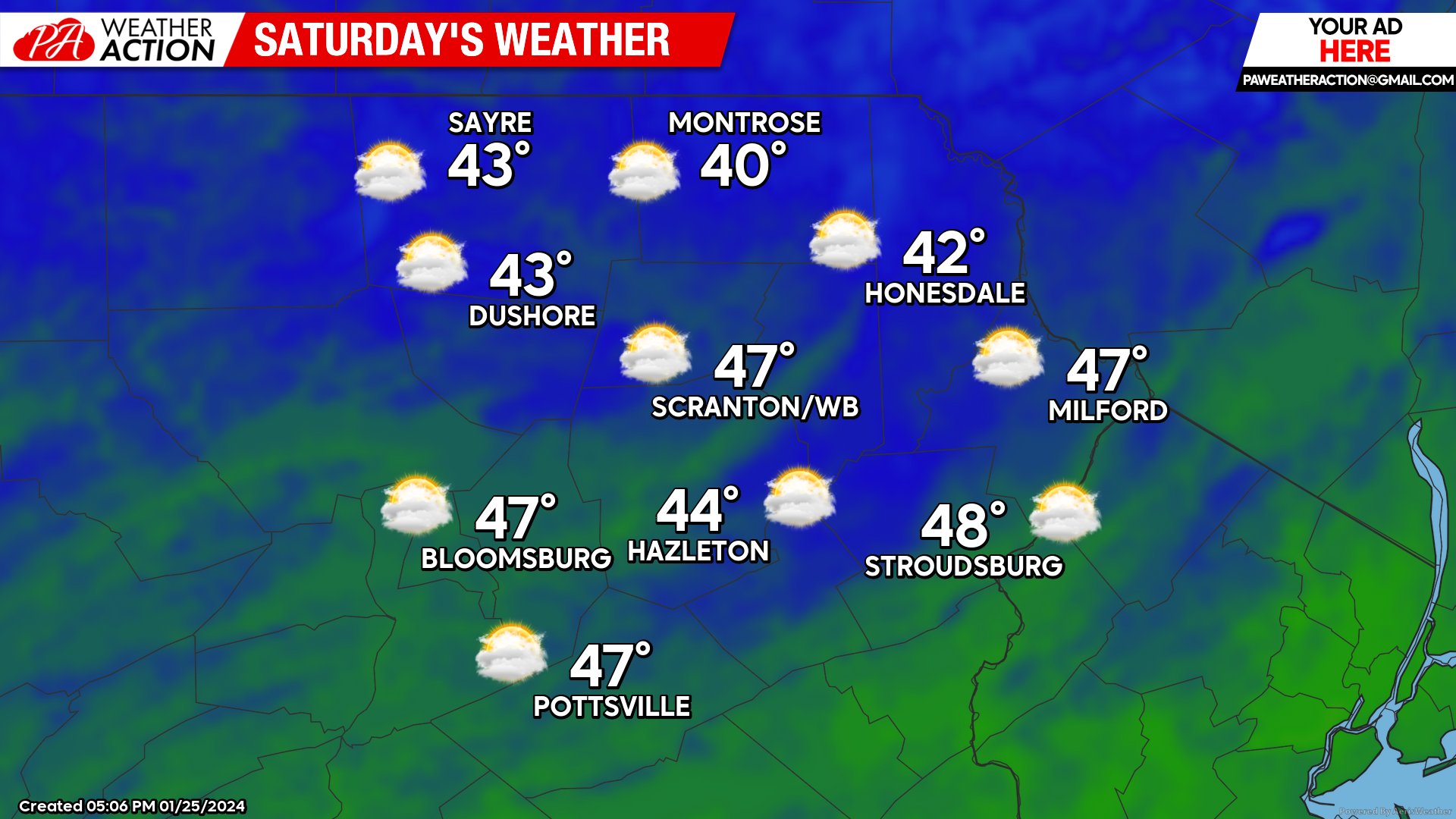
SATURDAY
Saturday will be in between systems, but once again hope for any sunshine will be slim. Temperatures will remain much above normal. The next surface low will approach from the south and spread precipitation northward into our area Saturday night.
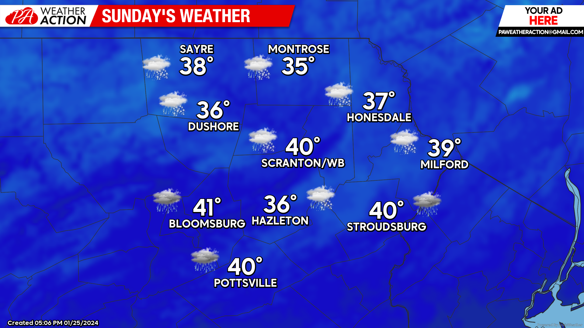
SUNDAY
That surface low will track through southern Maryland and off the Delaware/New Jersey coast during the afternoon. As it exits the coast it will draw cooler air southward into our area, and thus temperatures could be marginally cold enough to change the precipitation to accumulating snow Sunday afternoon into Sunday night. There remains uncertainty regarding exactly how this unfolds, but there is a good chance for several inches for at least part of the area.
BEYOND SUNDAY
Next week (Jan 29 through Feb 2)
We will experience a welcomed reprieve from the onslaught of tropical moisture we are currently enduring, leading to a much drier week. There are indications of a northern-branch disturbance dropping southeastward into our area midweek which could deliver some wintry precipitation.
Most of the contiguous U.S. will be dominated by much above normal temperatures. For our area, temperatures will start the week near normal. The aforementioned disturbance could draw above-normal temperatures into our area midweek. It remains to be seen whether that disturbance can tap any colder air behind it for the end of the week.


You must be logged in to post a comment.