
A stationary front lies draped east-west south of our area. This frontal zone helped maintain cloudy wet conditions through the weekend and into today. Later this week, hot and humid air will finally infiltrate the region along with thunderstorms.
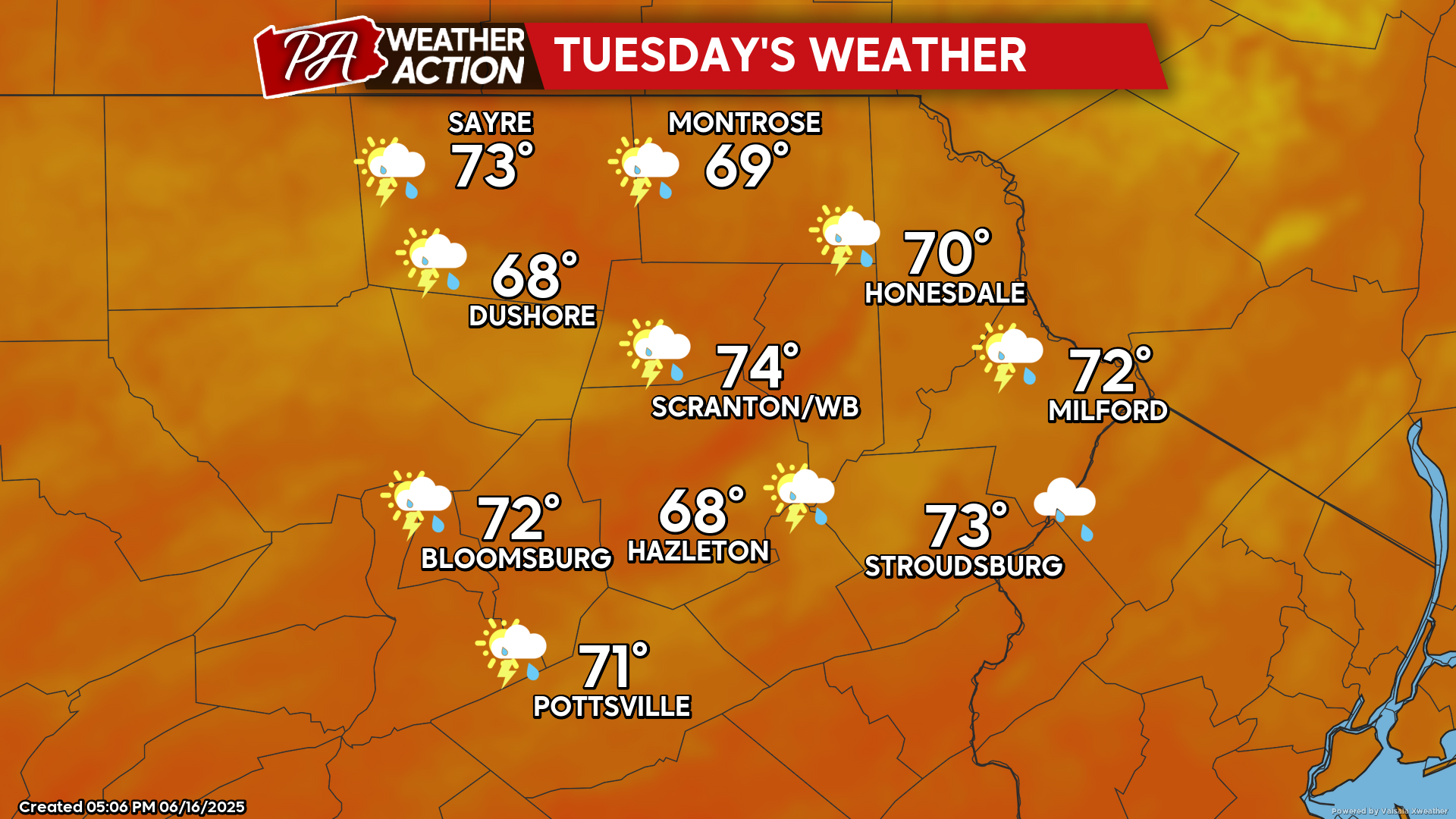
TUESDAY
Tuesday will be mostly cloudy with a few peaks of sun. An approaching upper-level disturbance will generate showers and isolated thunderstorms especially during the afternoon. Humidity will increase during the afternoon, which will result in a warm muggy night with temperatures remaining in the 60s.
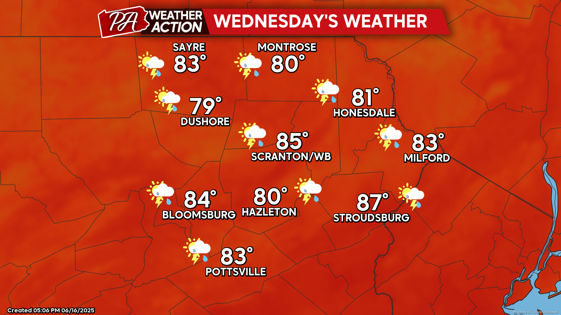
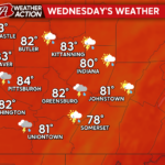
WEDNESDAY
Very warm and humid air will move into our region. Scattered thunderstorms will ignite, especially during the afternoon. Localized strong gusty wind and heavy downpours will be possible. With the high humidity in place, Wednesday night will be another very warm muggy night.
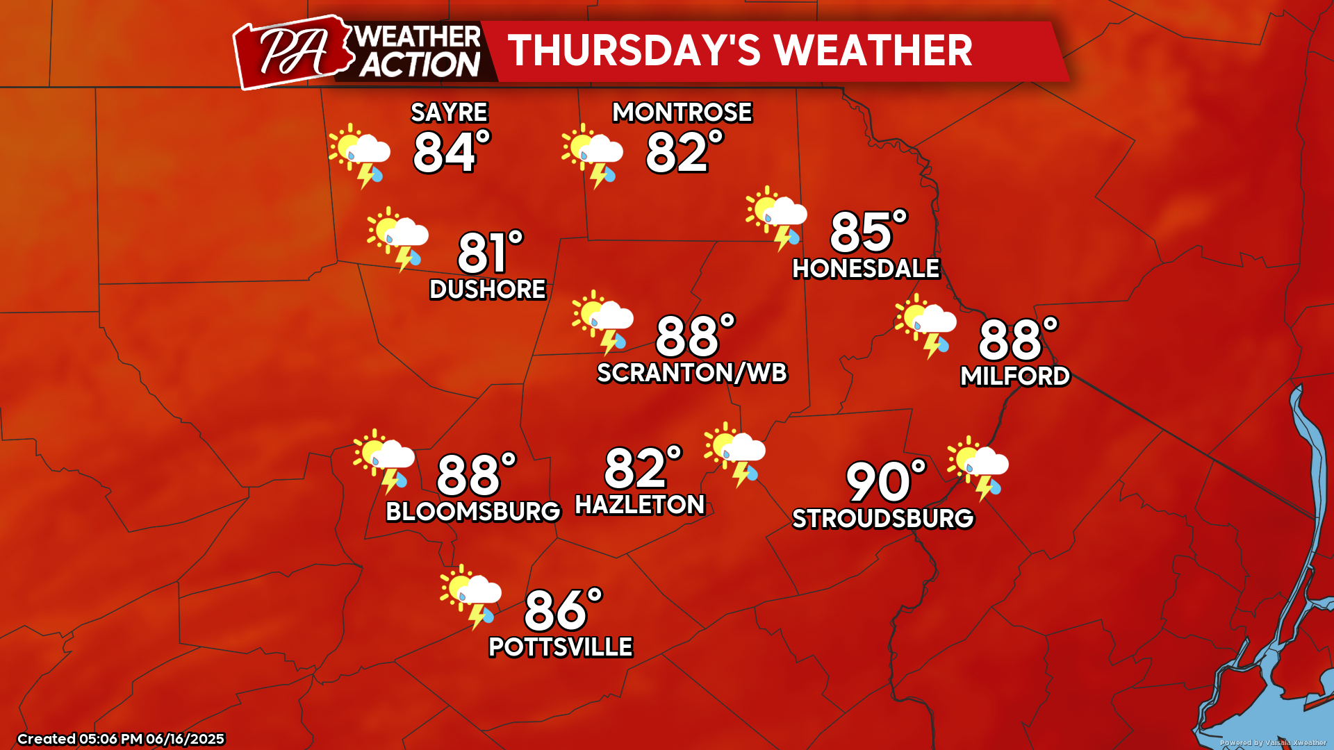
THURSDAY
Thursday will feel like the dog days of summer as temperatures soar to 90 in parts of the area along with very high humidity. A cold front will cross the area from west to east during the afternoon. Strong thunderstorms are likely with the front during the afternoon and evening, especially in our southern and eastern counties. This cold front will only slightly squelch the heat wave Friday and Saturday. The summer solstice occurs at 10:42pm Friday evening, making Saturday the first full day of summer. And with the start of summer, even hotter weather is anticipated to move into our area on Sunday into at least the first part of next week. Temperatures next week will likely soar into the 90s!
You must be logged in to post a comment.