
Above averages temperatures expected with the warmest day being mid-week. Rain chances move back into the region throughout the week.
Tuesday
Mostly cloudy with chances for light rain throughout the day. Highs will be range in the 40s, lows will be in the low 30s. Winds will be out of the West-Southwest at 5-10 mph, with gusts near 20 mph in some areas. 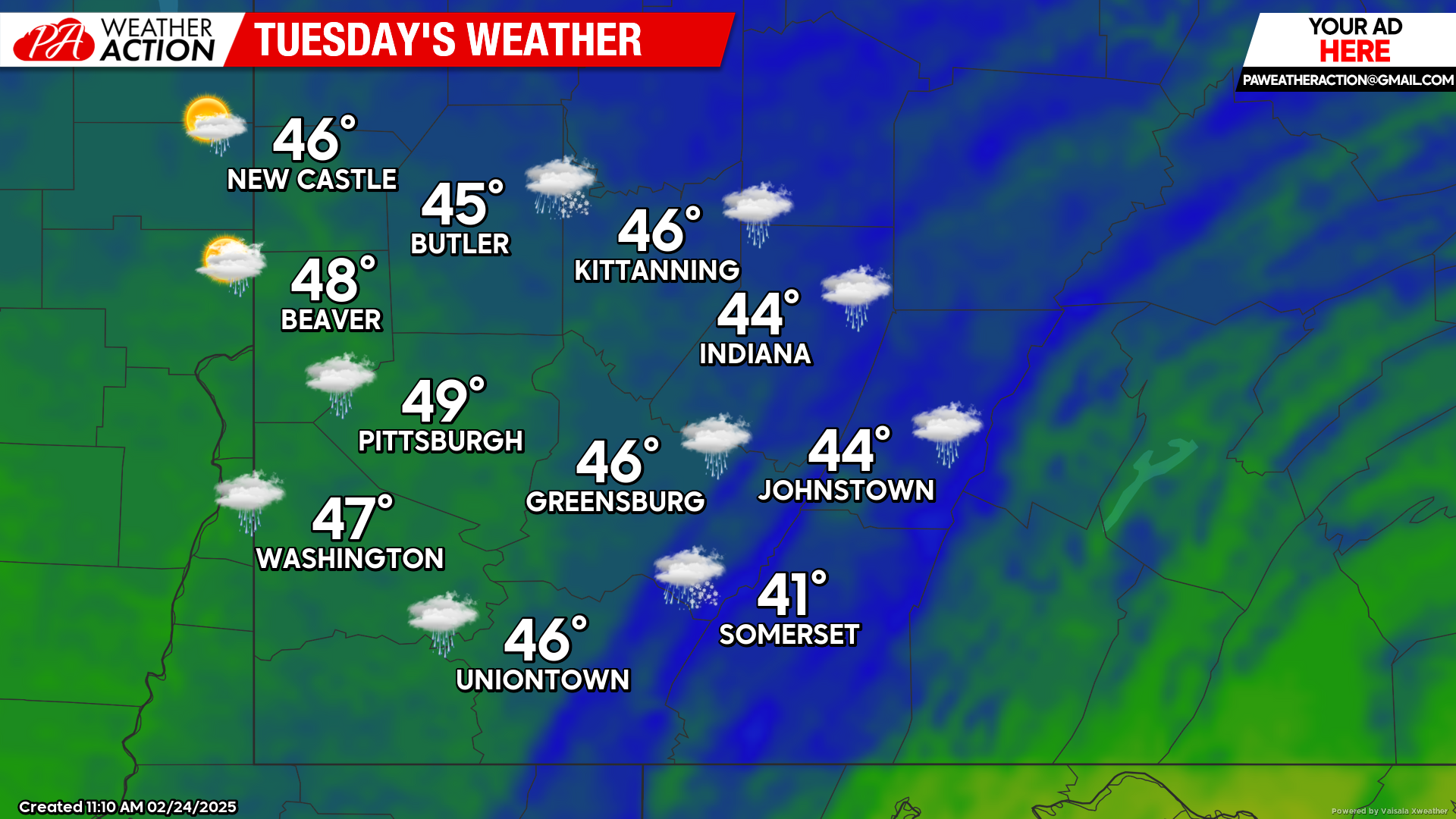
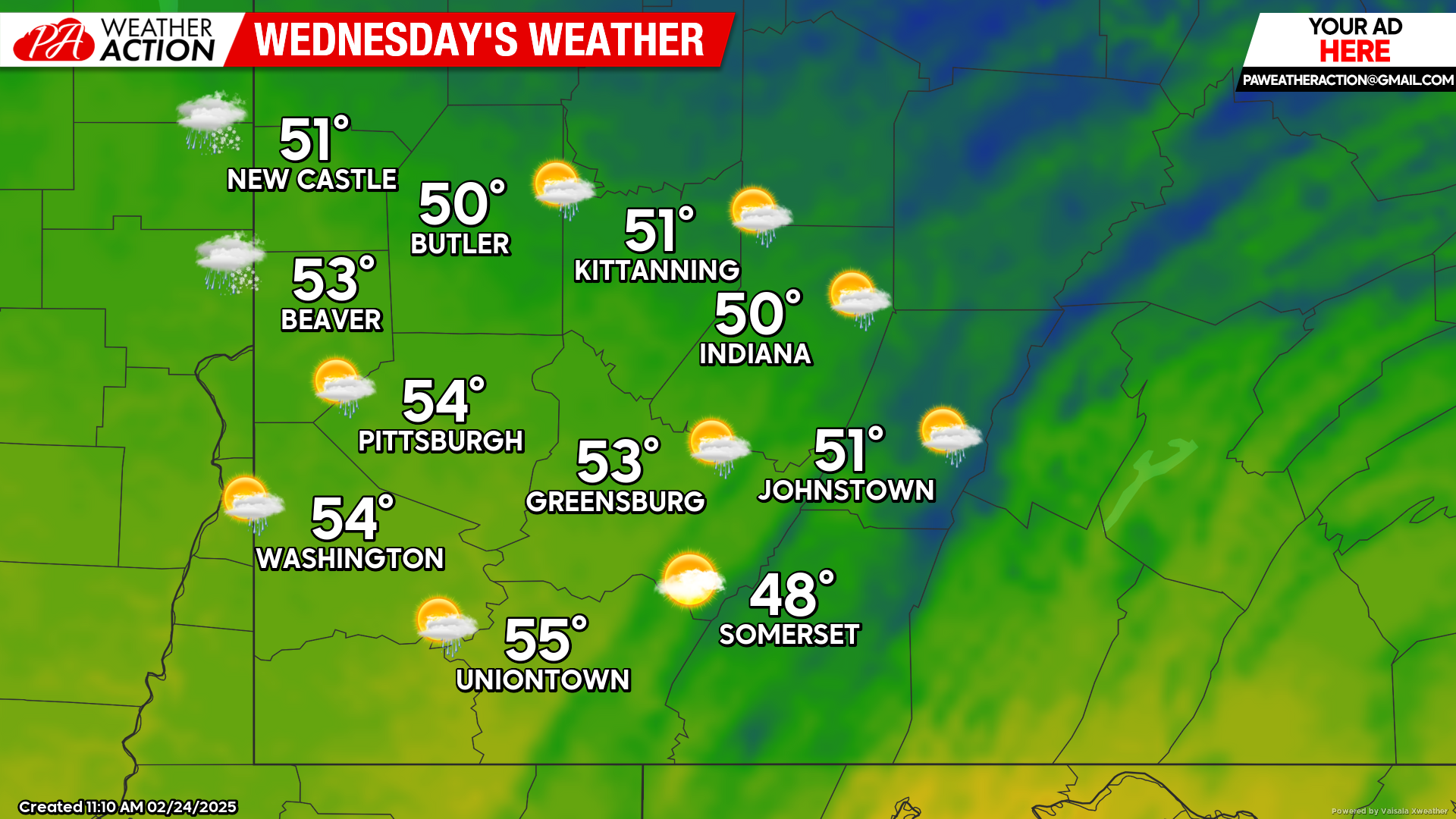
Wednesday
Morning fog will transition to partly sunny skies and warm temperatures. Rain chances return in the evening and overnight hours. Highs will be in the mid to low 50s, lows will be in the low 40s. Winds will out of the South-Southwest at 5 to 7 mph.
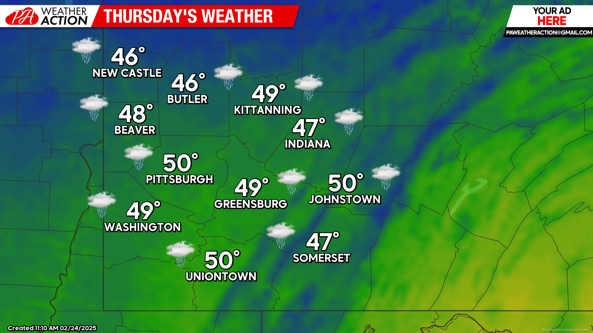
Thursday
Chances for rain are expected throughout the day. Highs will be in the low 50s to mid 40s, lows will be in the low 30s to upper 20s. A rain/snow mix is possible in the higher elevations during the evening and overnight hours. Winds will be out of the west at 7-15 mph, wind gusts approaching 30 mph are possible.
Similar conditions are expected this weekend with slightly cooler temperatures. Be sure to follow PA Weather Action for more forecasts.


You must be logged in to post a comment.