
A gradual increase in temperature is expected to begin the weekend before the next low-pressure system moves in bringing chances for rain and snow showers. An artic outbreak will bring dangerously cold temperatures and extremely cold wind chill values early next week.
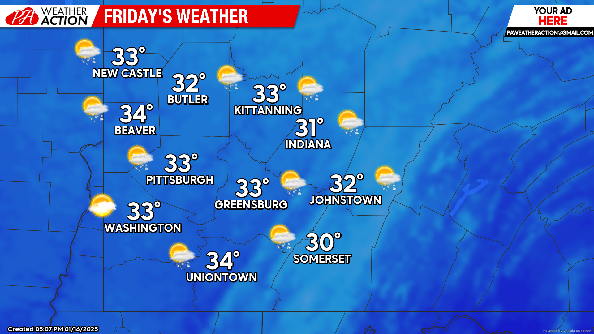
Friday
A mostly cloudy start to the day with portions of mostly sunny conditions throughout the day. Highs will be in the mid to low 30s, lows will be in the mid to low 20s. Winds will be out of the south-southwest at 6 to 11 mph, wind gusts in the higher elevations could approach 25 mph.
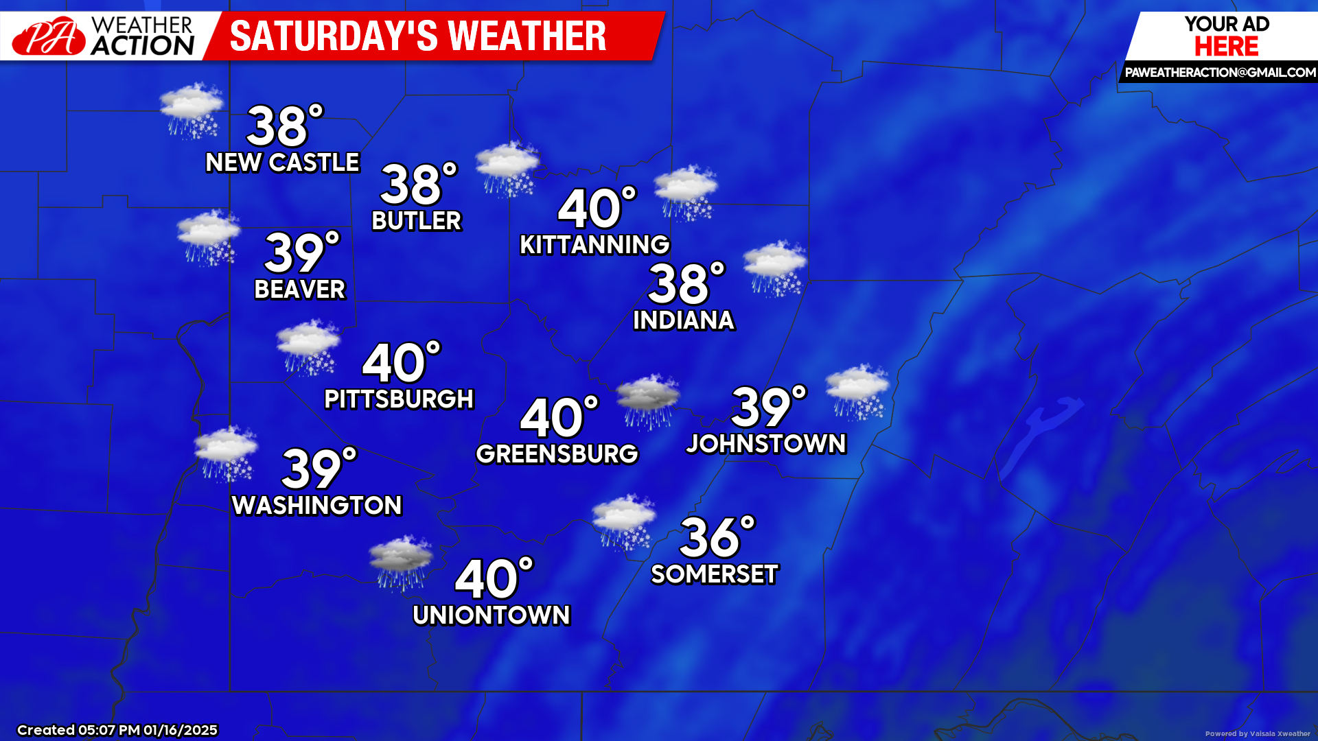
Saturday
Warmer temperatures during the daytime hours with chances for rain throughout the day, rain showers will transition to snow in the evening hours and snow showers will continue overnight. Highs will be in the low 40s to mid 30s. Winds will be out of the south at 6 to 10 mph.
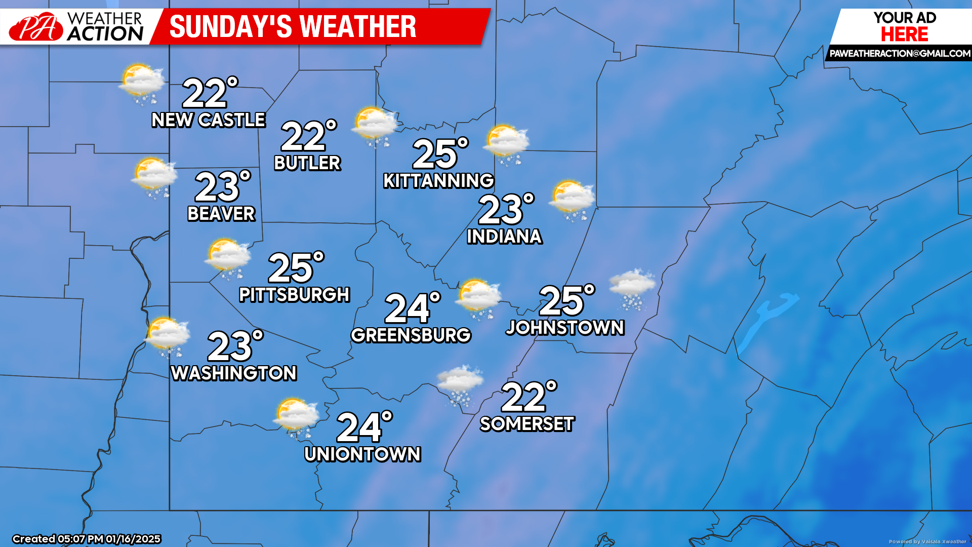
Sunday
Mostly cloudy with snow chances throughout the day, temperatures will begin to plummet in the overnight hours. Highs will be mid to low 20s, lows will be near zero with the higher elevations having low temperatures below zero. Winds will be out of the north at 5 to 10 mph.
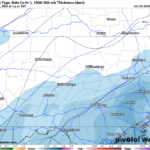
An artic blast will move into the region to start the week with temperatures near or below zero with0 extremely dangerous lows wind chill values. Be sure to follow PA Weather Action for more details and statewide snowfall totals.

You must be logged in to post a comment.