
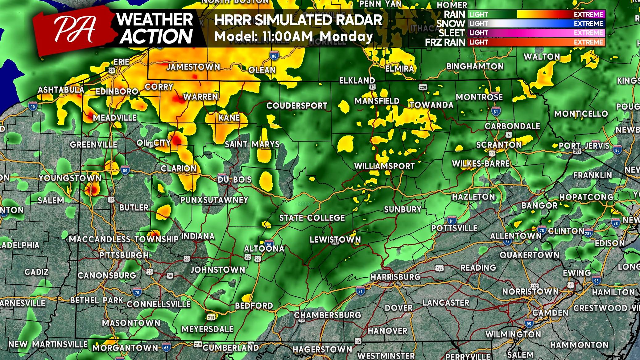
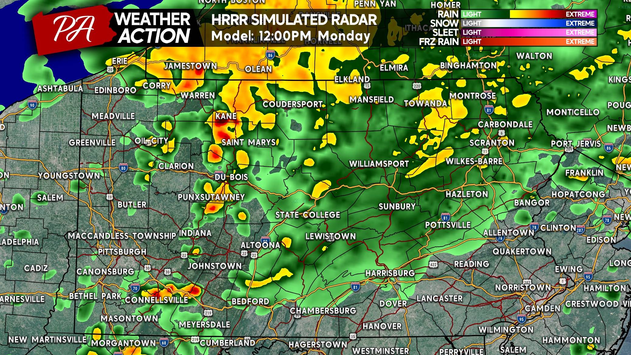
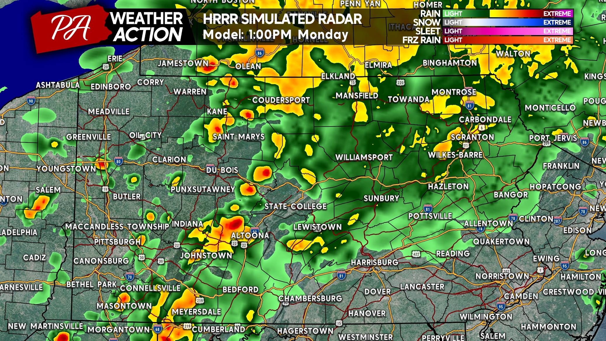
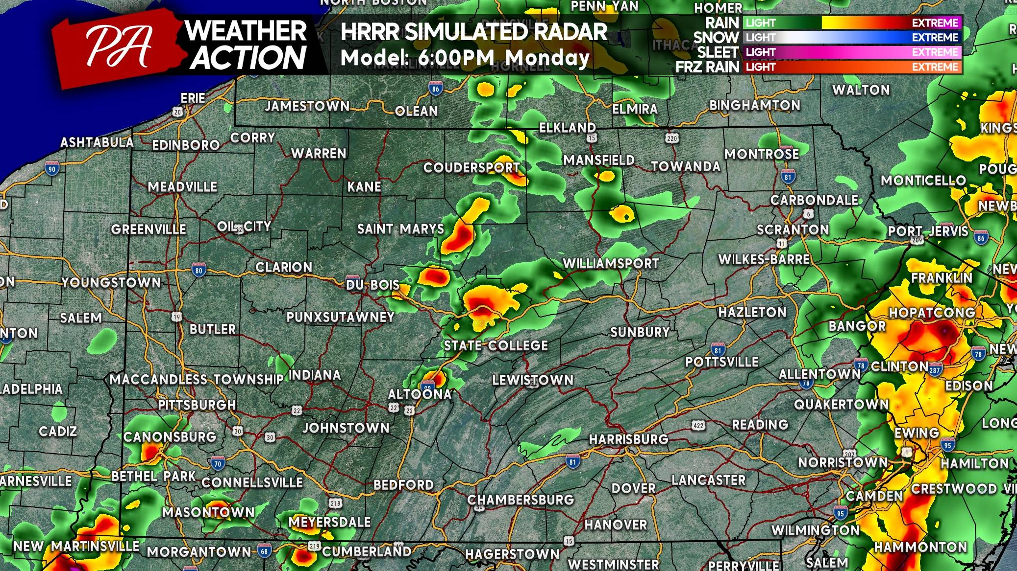
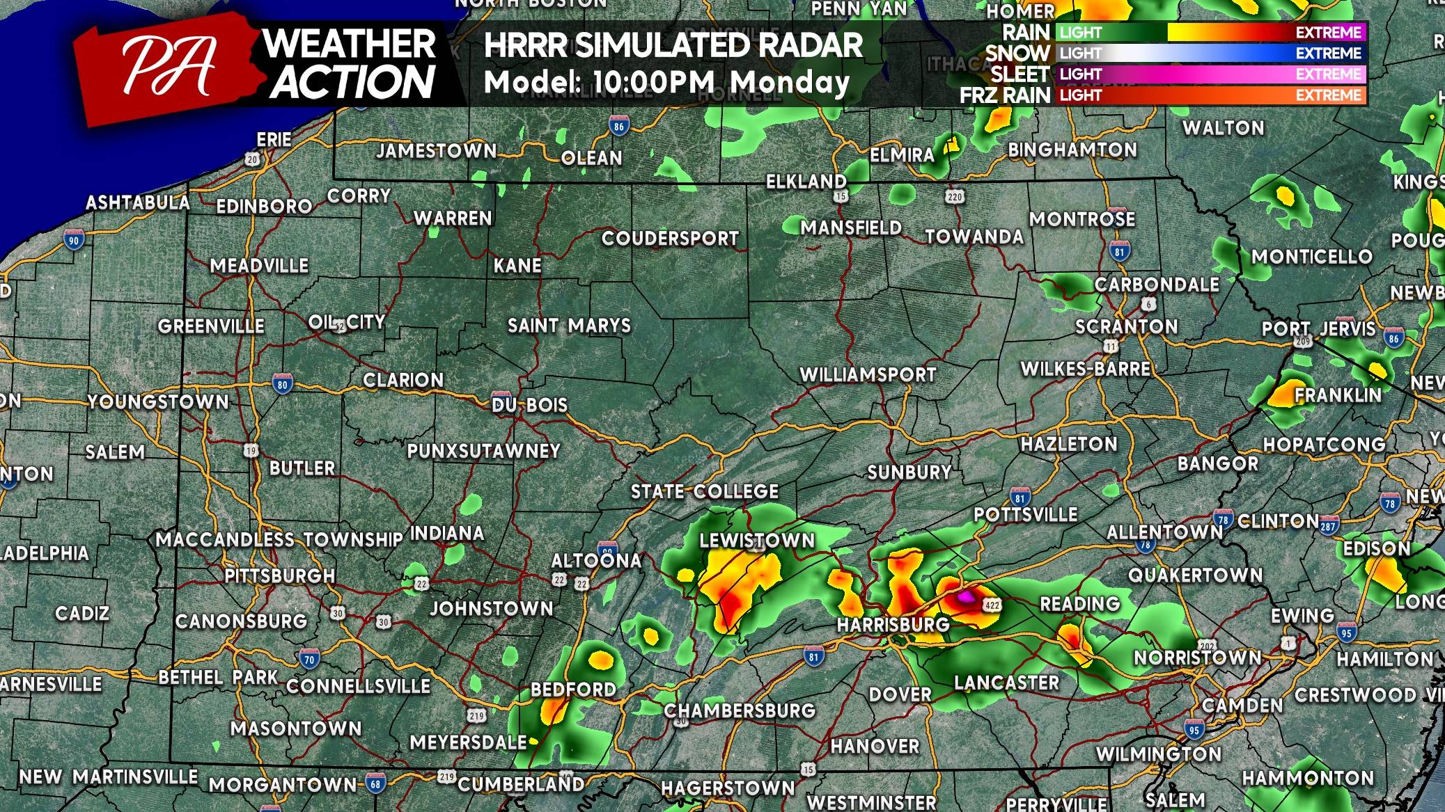
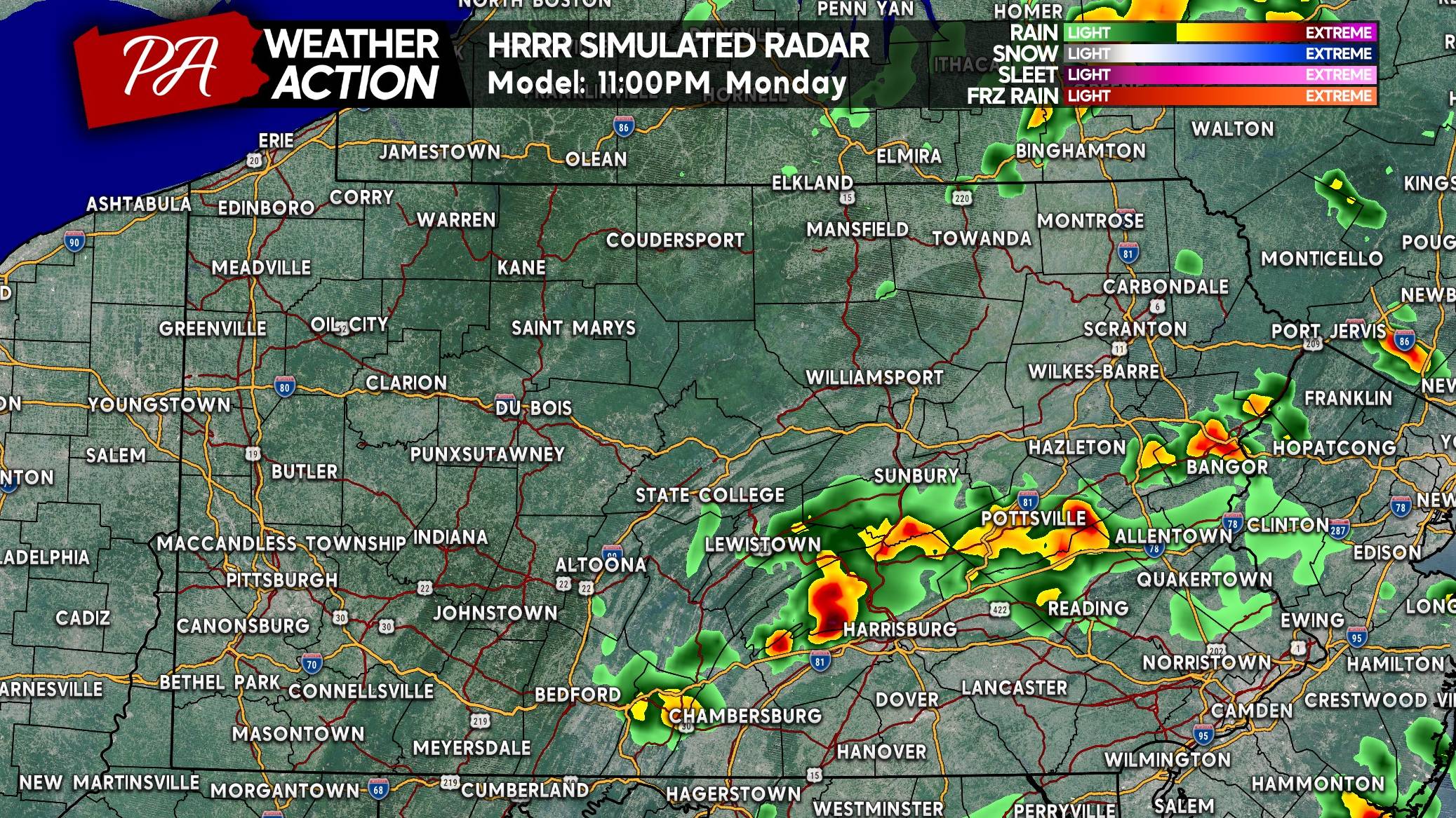
Strong to severe thunderstorms will return to parts of the state Monday as a low pressure passes overhead. While Northern PA sees moderate rain and a more stable environment, south of I-80 will be south of the boundary. Breaks in low and mid-level clouds will allow for thunderstorms to fire up and move east.
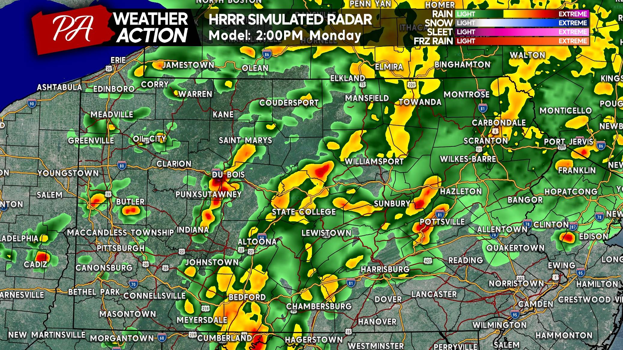
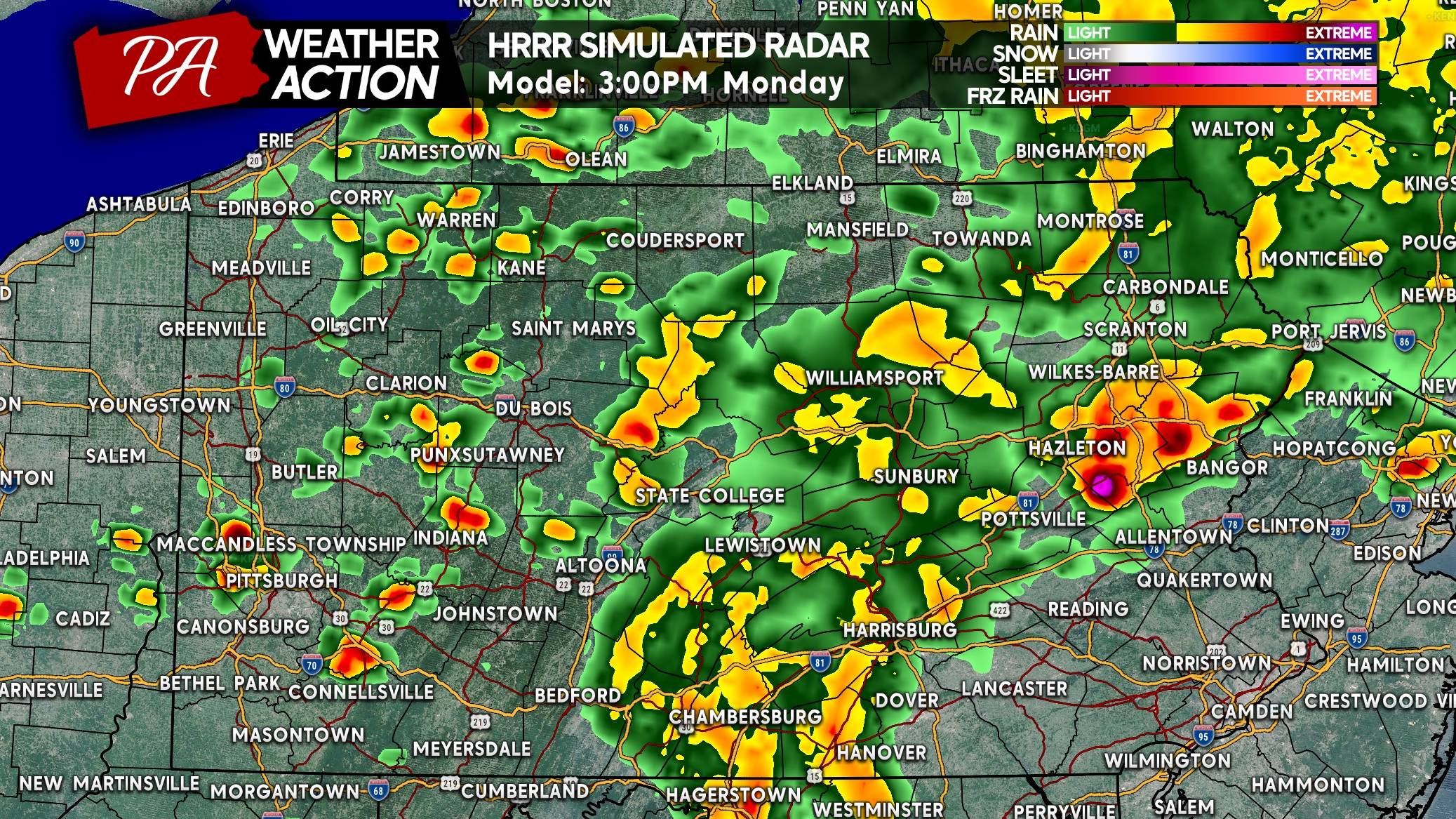
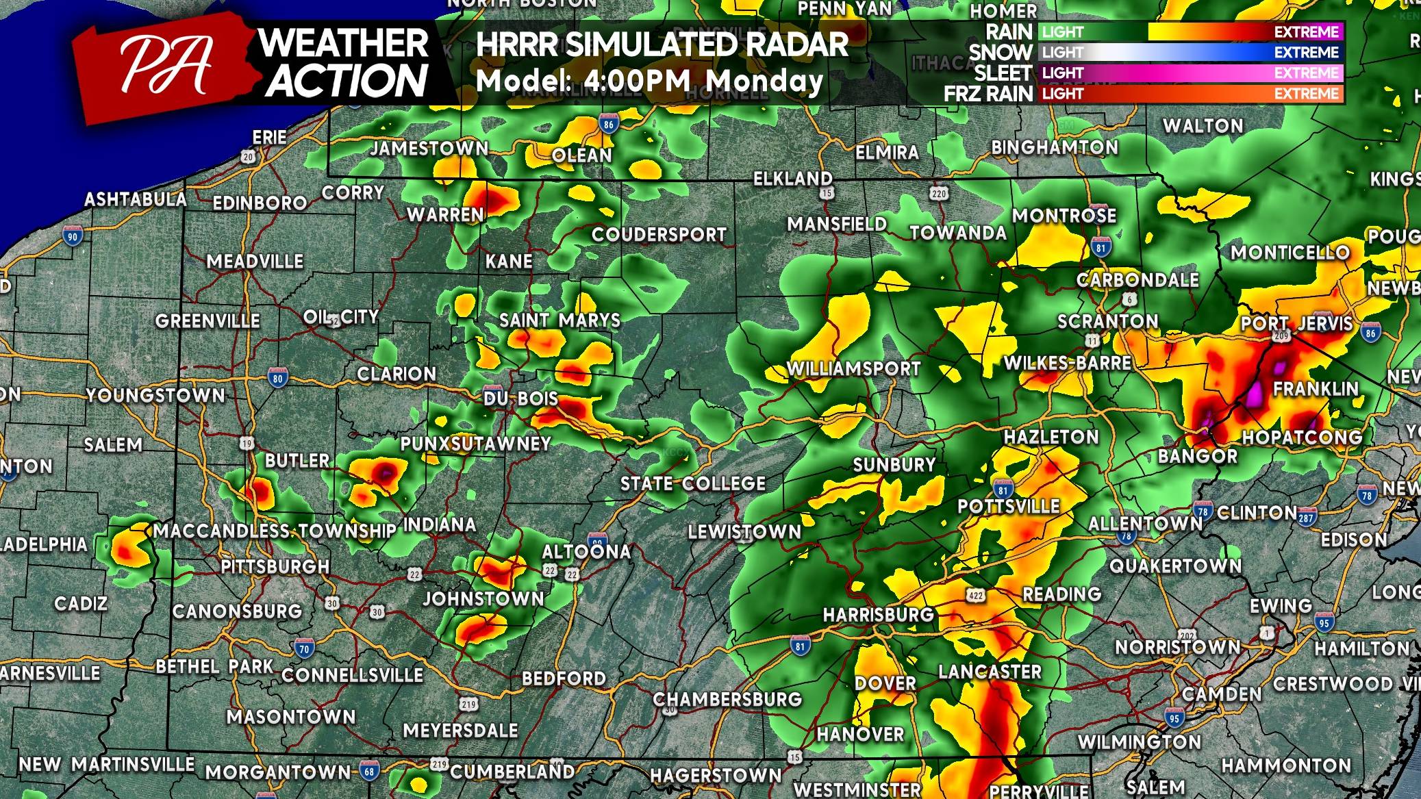
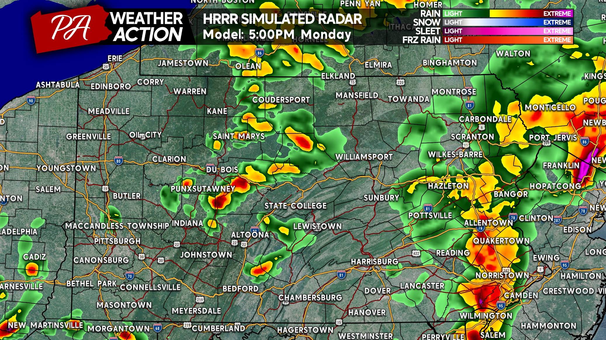
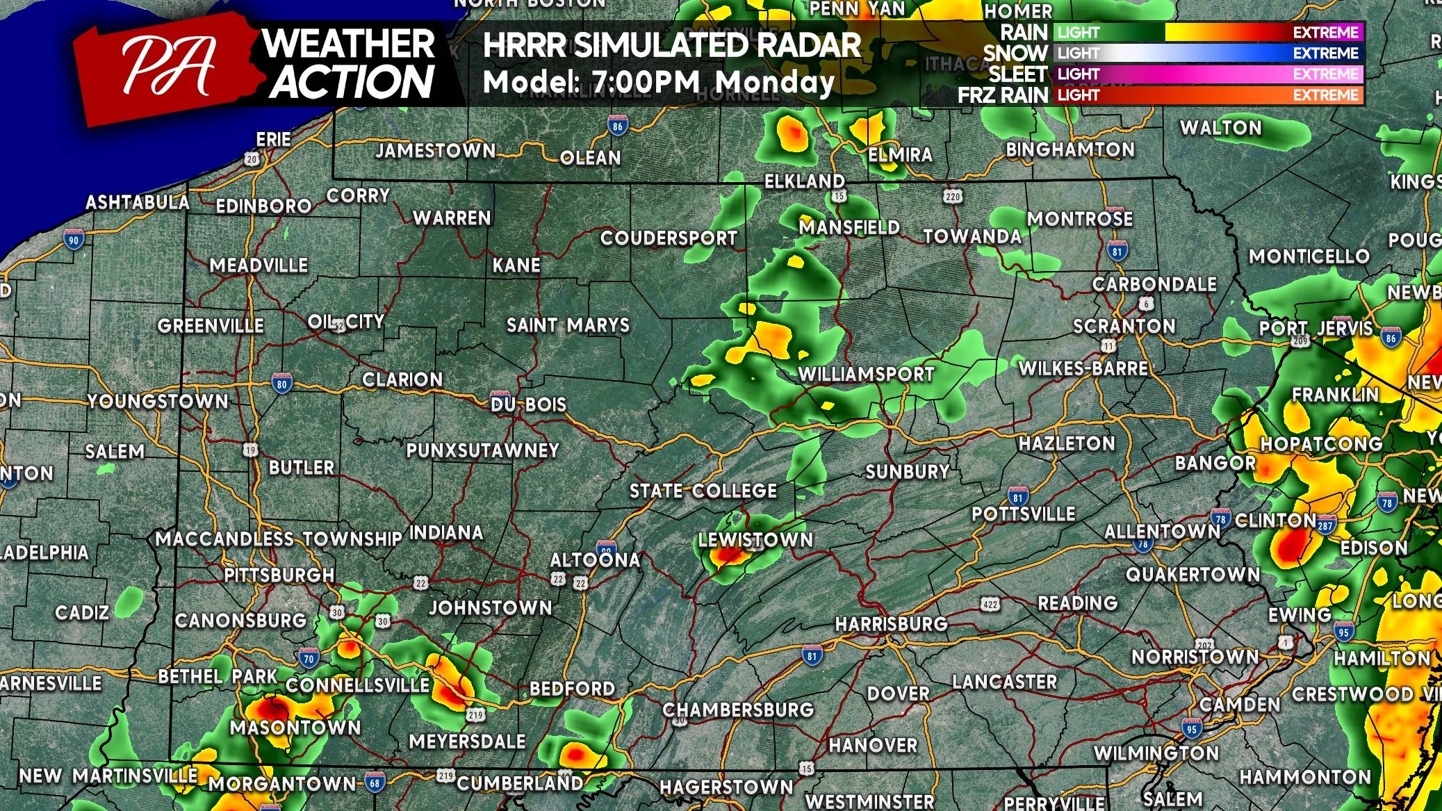
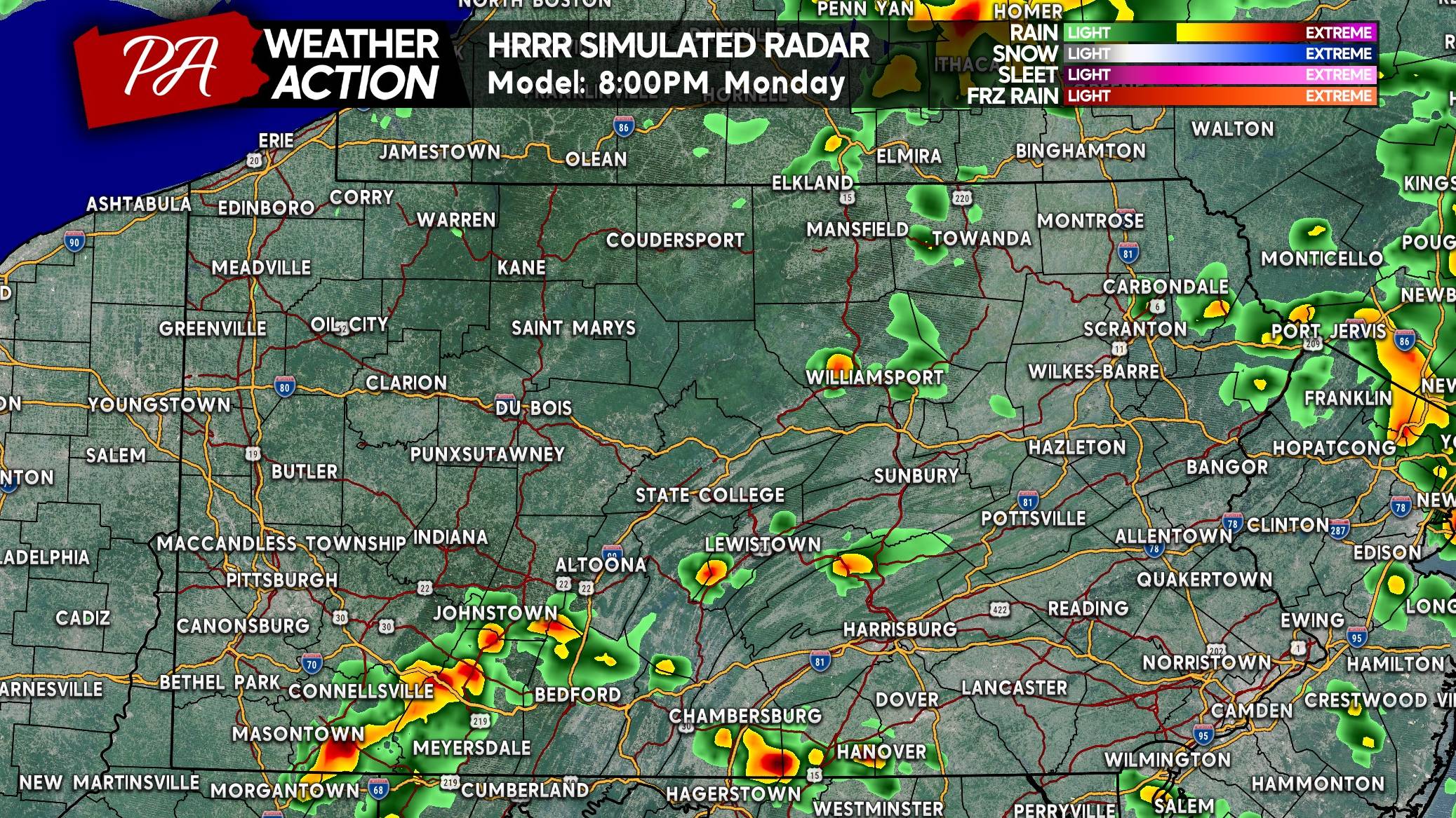
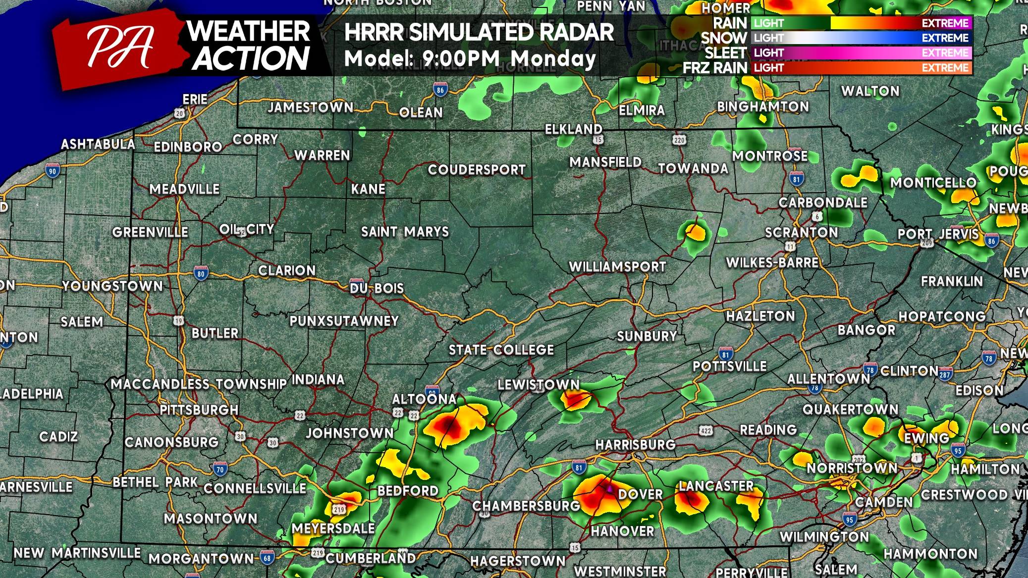
Models suggest a line of potent thunderstorms near I-81 around 2 PM Monday moving into Eastern PA (south of I-80) in the late afternoon to early evening. This line will pose the largest damaging wind threat and a low-end tornado concern.
Meanwhile, scattered thunderstorms back in Western PA will be strong to severe in some cases, with a lower-end all-hazards risk. These storms will ride east along and south of I-76 into Central and Eastern PA as the sun sets with a continued severe threat. Severe threat forecast information is at the bottom of this article.
FUTURE RADAR TIMING
The HRRR and RRFS models are similar with the NAM in disagreement, so we’ll be using the HRRR for future radar this time around.

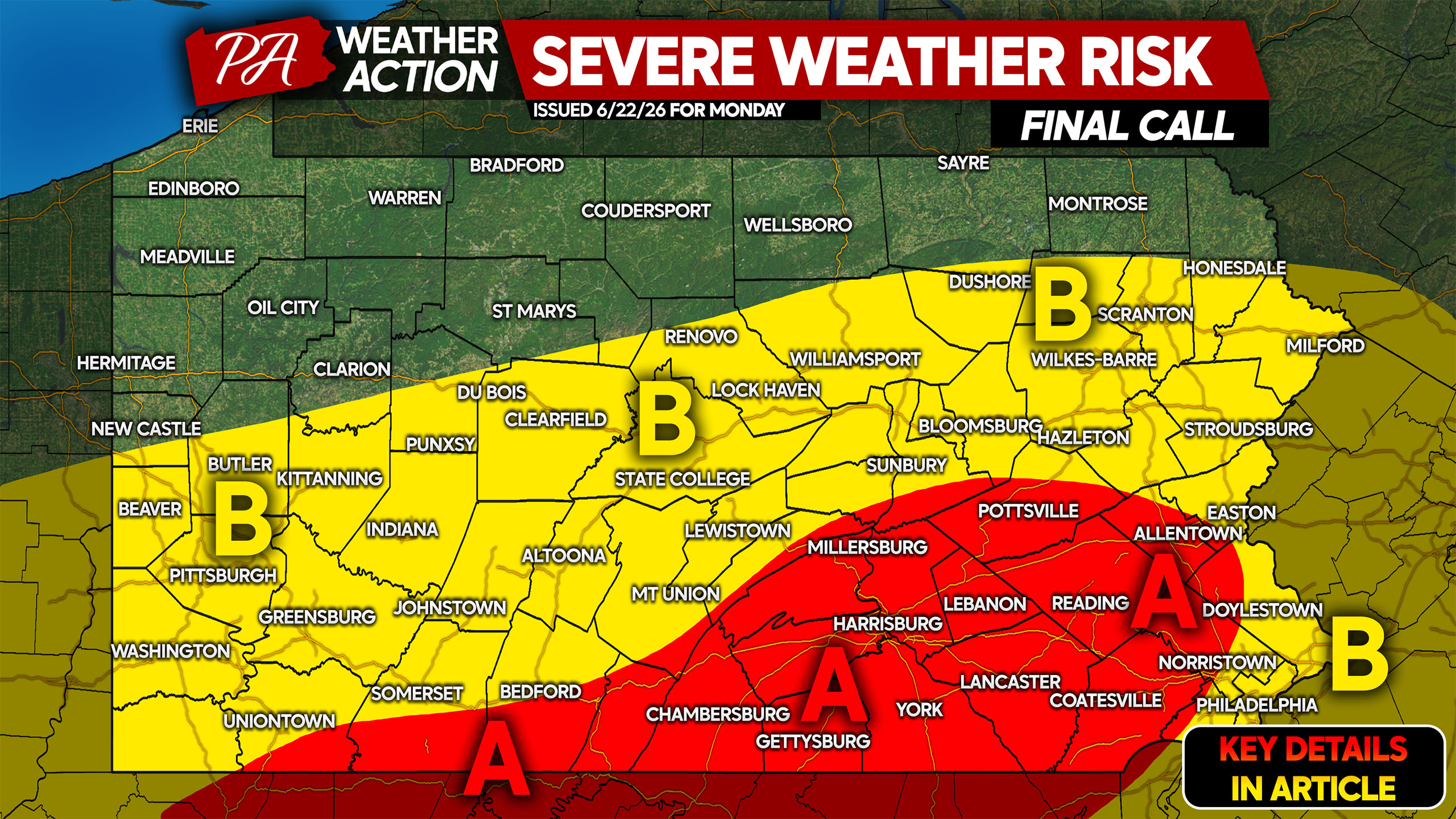
SEVERE THUNDERSTORM THREAT FORECAST FOR MONDAY 6/22
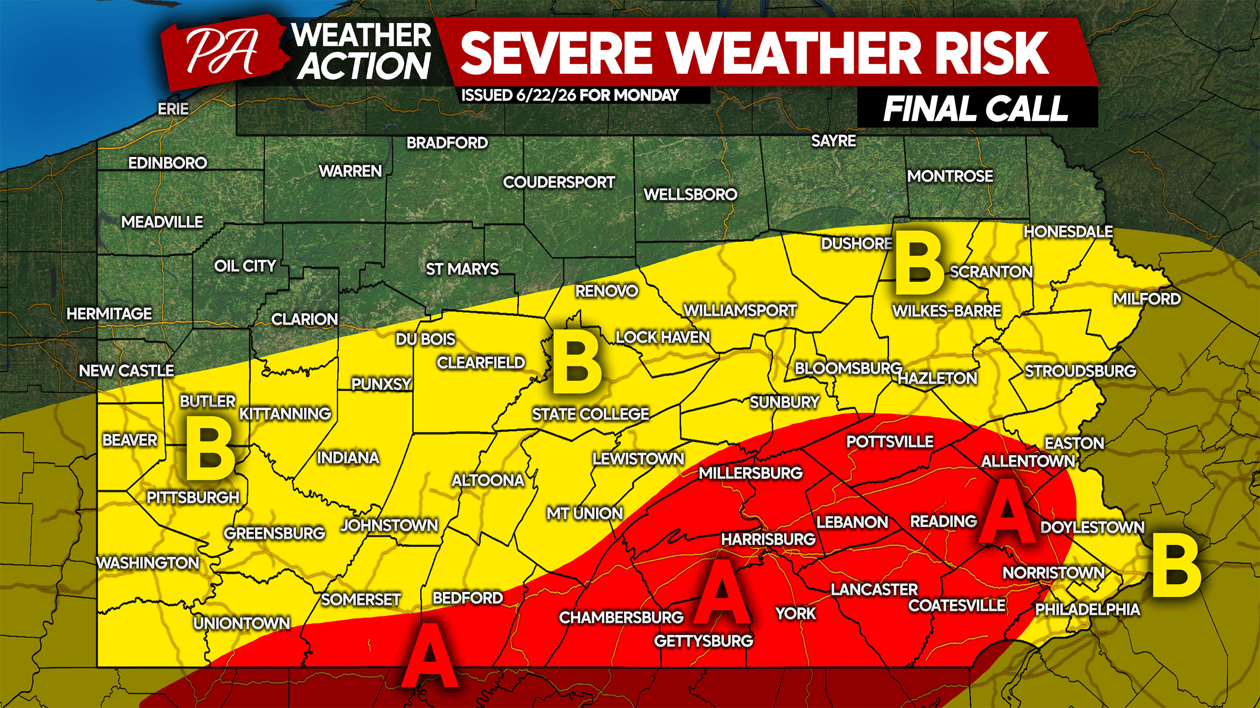
Area A: Scattered severe thunderstorms are expected, capable of producing damaging wind gusts up to 70 MPH and a very isolated tornado. Widespread strong thunderstorms likely Monday afternoon and evening with wind gusts up to 55 MPH.
Area B: Isolated severe thunderstorms are anticipated, capable of producing damaging wind gusts up to 70 MPH. Scattered strong storms are likely with wind gusts up to 55 MPH.
Be sure to share this forecast with friends and family who may have Monday plans with summer kicking off and schools being out!


You must be logged in to post a comment.