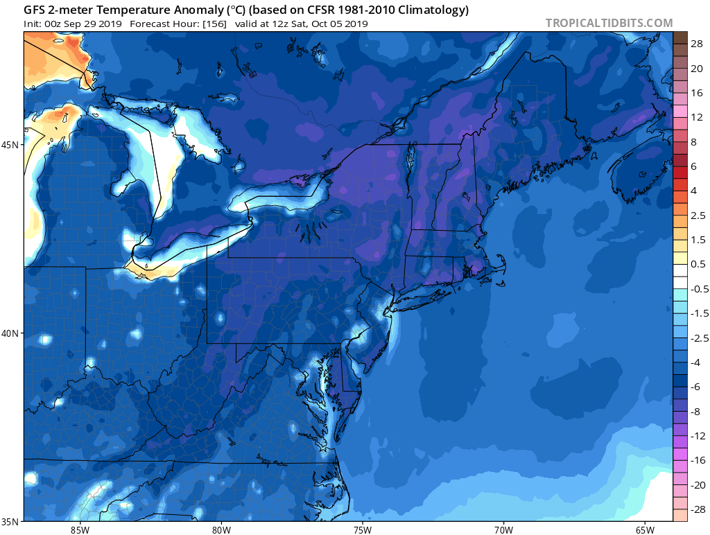
After a warm start to the week with highs in the 70s and 80s for many of us, fall will finally make an appearance by Thursday. A cold front will sweep through the area Thursday, bringing some showers and much cooler weather behind it. Highs by the weekend will be in the 50s and 60s, with lows in the 30s and 40s. In fact, parts of northern PA may see their first frost or even freeze by the upcoming week, with could bring an end to the growing season. We’ll keep you updated on that! If you’re interested in seeing all this illustrated in video form, check out the video below >>>
Posted inFall Weather
Weekly Forecast for Sept. 29 – October 5th: Fall Is Here
Posted by
 By
Lead Forecaster Josh Adams

Josh Adams is the founder and lead forecaster of Pennsylvania Weather Action, a regional forecasting site he launched in 2015. With over a decade of experience analyzing weather patterns across Pennsylvania, his forecasts have reached millions of readers throughout the state.
Josh specializes in Pennsylvania’s complex microclimates and terrain-driven weather patterns, providing detailed coverage of severe thunderstorms, winter storms, and flooding events. His forecasting focuses on delivering precise, timely information to help Pennsylvanians stay informed and prepared during impactful weather.
Last Updated: March 10, 2026
Post navigation
Previous Post
 Fall Foliage Update – September 28th, 2019
