
Good afternoon! After a quite chilly week with high temperatures stuck in the 20s, 30s, and 40s, with scattered snow showers, we will begin to break out of the cold regime to the end the week and head into the weekend. As we open up December, it will be feeling more like mid-October with milder conditions surging into the region.
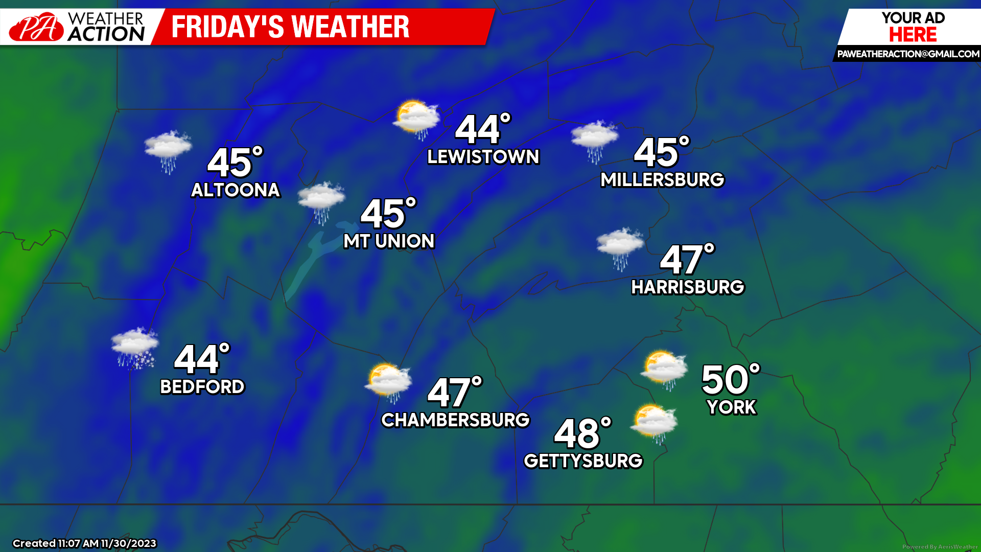
FRIDAY:
Friday will bring a dreary and a cool end to the week as a low pressure system moves into our region. This will allow for cloudy conditions with scattered rain showers throughout the day to overspread the region, with the best chance during the mid-afternoon and evening hours. Expect high temperatures to only climb into the low-top-upper 40s. While Friday is not expected to be a total washout, keep your rain gear at hand throughout the day! Total rainfall amounts should range between 0.10-0.25″.
 SATURDAY:
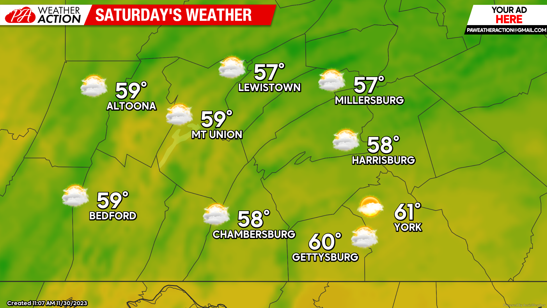
Saturday will bring much warmer and drier conditions to our region. Expect a southerly wind of 5-10 mph, helping to warm up our temperatures. Highs will reach the mid-50s to low-60s across the area, which will be as much as 15 to 20 degrees above average. It will be a great day for any outdoor activities and it will feel like a “heat wave” compared to the colder conditions from earlier this week.
 SUNDAY:
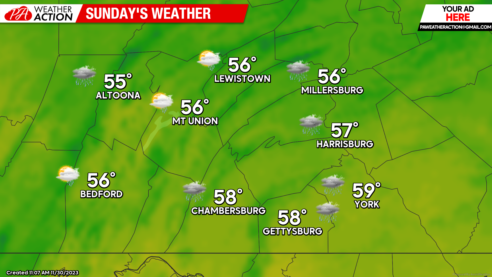
Sunday will bring another day of mild conditions as temperatures will climb into the mid-to-upper 50s. However, it will be a tad less dry than Saturday as we could have rain showers enter the region into the latter half of the day, especially in the evening and overnight hours. Otherwise, temperatures will still hold roughly 15-20 degrees above average, making for a comfortable day.
 As we head beyond the weekend into next week, the pattern will turn colder and active yet again, so try your best to enjoy the warmer conditions this weekend! It is possible we might be tracking another threat of rain and snow showers, especially between Monday and Wednesday. Have a great weekend, for more updates follow PA Weather Action on Facebook and download the app!
Denys

You must be logged in to post a comment.