
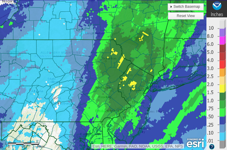
A strong surface low detonated off the Mid-Atlantic coast and spread heavy soaking rain into eastern Pennsylvania last night, unleashing a large swath of over an inch of rain. That system will help drive a brief arctic blast into our area for the next couple of days, featuring the coldest air so far this season and the first significant lake-effect event for the snowbelts. Please enjoy the radar-derived precipitation map for last night’s event:
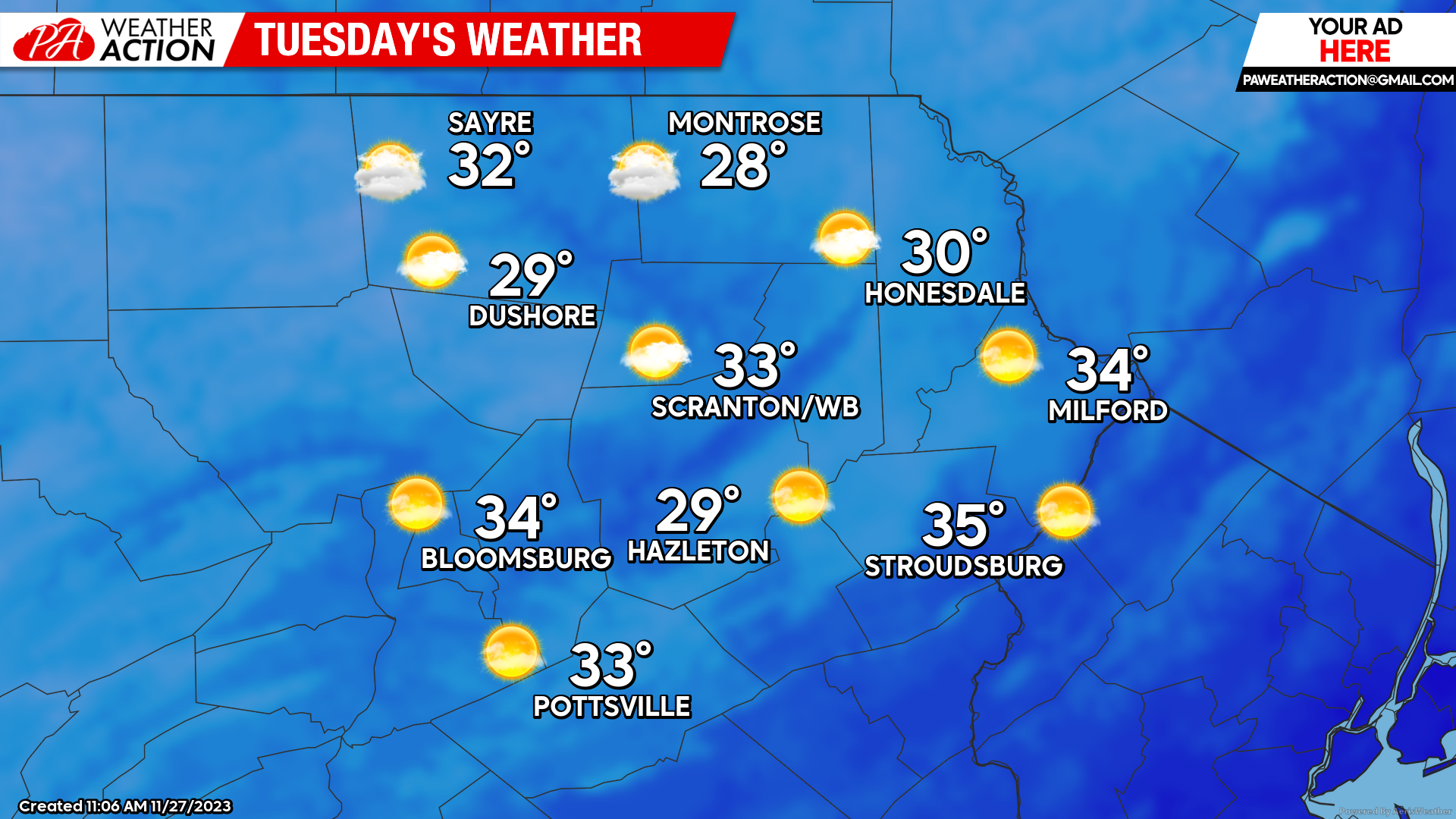
TUESDAY
The day will dawn with widespread 20s. Strong northwest wind gusting to 35mph will drive arctic air into our region all day, keeping temperatures below freezing for all but the lowest elevations. Heavy lake-effect snow will pummel the snowbelts downwind of Ontario and Erie, where up to 2ft of snow could fall! We won’t be as fortunate, but snow showers will provide a light coating to parts of our area. Windy conditions will continue Tuesday night, with temperatures falling into the upper teens to near 20.
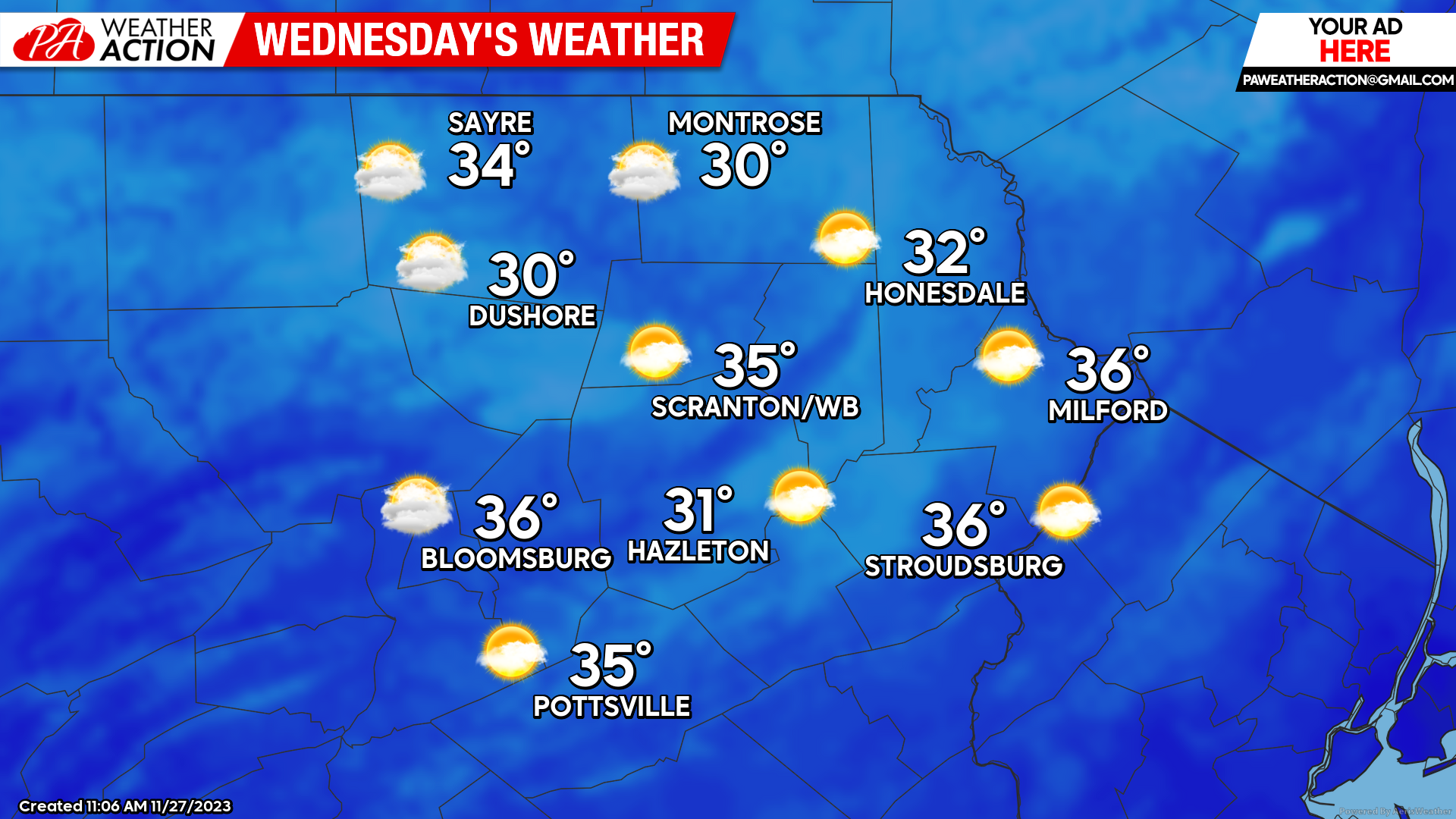
WEDNESDAY
Breezy conditions will linger on Wednesday along with temperatures climbing near to slightly above freezing.
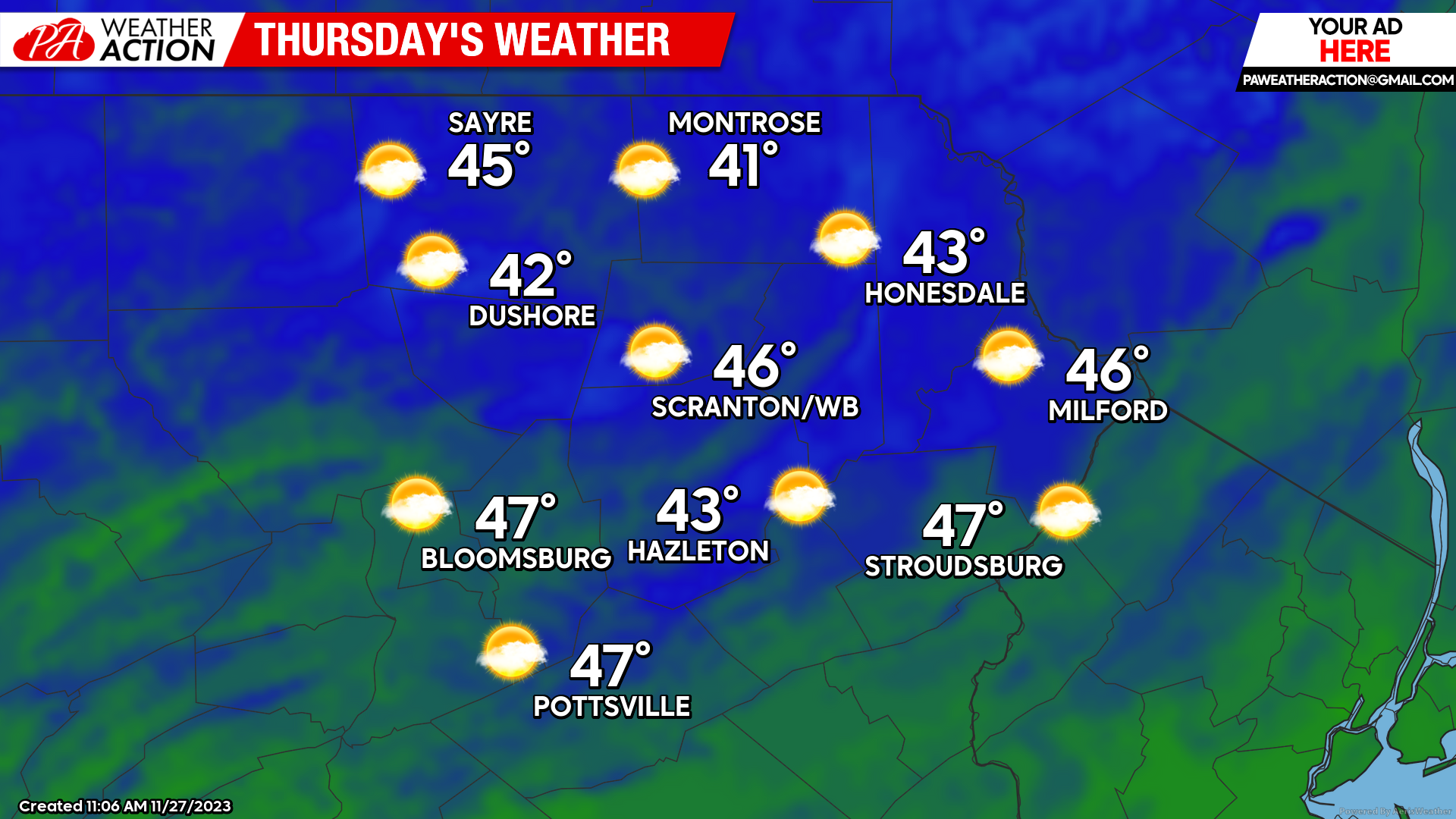
THURSDAY
The arctic surface high will move offshore by Thursday, circulating above-normal temperatures northward into our area. Widespread highs in the 40s will result.
BEYOND THURSDAY:
Looking beyond Thursday, a series of disturbances will affect our area. The first system will deliver rain to our area Friday into Friday night, with some mixed precipitation possible near the NY border. Another series of systems could bring a wet period from Sunday night into early next week.
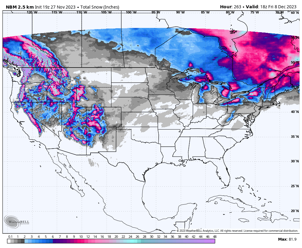
These systems will be primarily rain events for our area, although once again there could be some mixed precipitation near the NY border. This pattern will result in widespread significant snow for northern New England and eastern Canada, as illustrated by the blend of the GFS and ECMWF model forecasts of total snowfall through the end of next week:
You must be logged in to post a comment.