
Good evening and happy Thursday everyone! Over the past couple of days, high pressure brought a welcome relief to the extended stretch of wet weather we’ve seen. I hope you got a chance to enjoy the sunshine, as cloud cover is already on the increase as we’re watching another coastal low set to bring some wet weather to close out the month. You’re probably wondering, how long this stretch of wet weather is going to last and when may we see some sunshine again. Keep reading to find out!
Friday
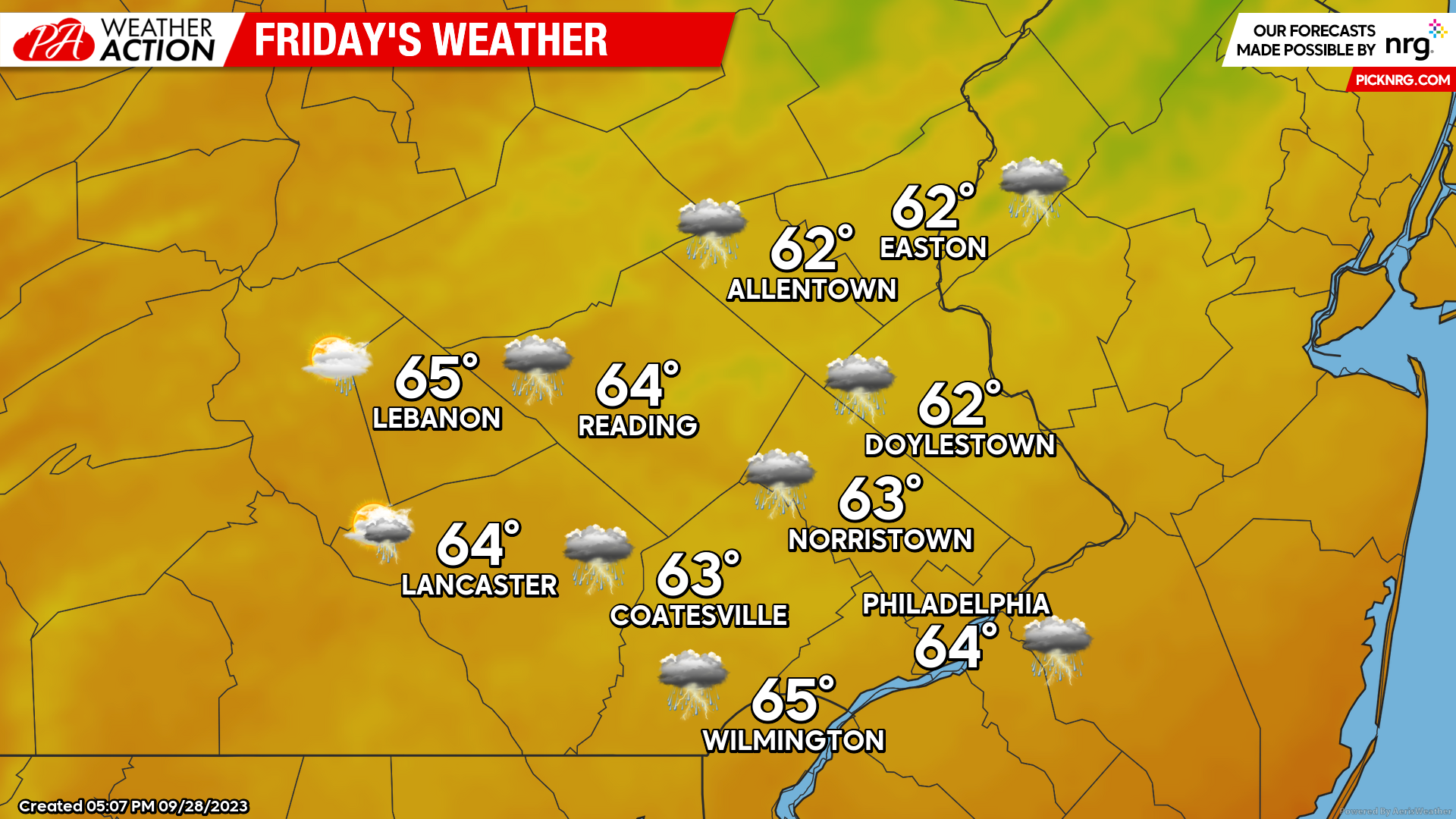
By the time you wake up tomorrow, overcast skies will have overspread the region and rain will likely be underway, especially across the Deleware River Valley. Morning lows will start off in the upper 50s – low 60s. Periods of showers and thunderstorms will make their way through the region throughout the day. The most widespread coverage of precipitation will be across Eastern Areas. Winds will be out of the NE at 10-15mph throughout the day. Onshore flow will also bring the risk of coastal flooding for low-lying regions along the Delaware River. Water levels should remain elevated through early Friday afternoon. For this reason, the National Weather Service has issued coastal flood advisories for portions of Delaware, Philadelphia, and southern Bucks Counties. Highs on Friday should peak in the low-mid 60s.
[quads id=2]
Saturday
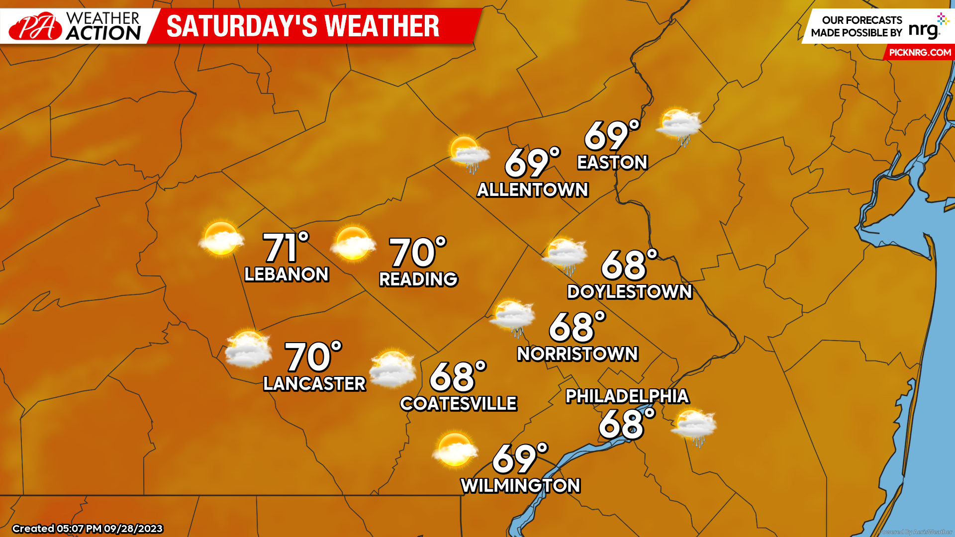
Saturday will bring some improvements to the forecast with more breaks in the clouds, however, occasional showers can still be expected across Eastern zones. As the coastal low pulls away from the region throughout the afternoon, expect a gradual decrease in cloud cover and rain coverage from West to East. Lows Saturday morning will start in the upper 50s-low 60s with highs peaking in the upper 60s – low 70s. Winds will be out of the N at 5-10mph
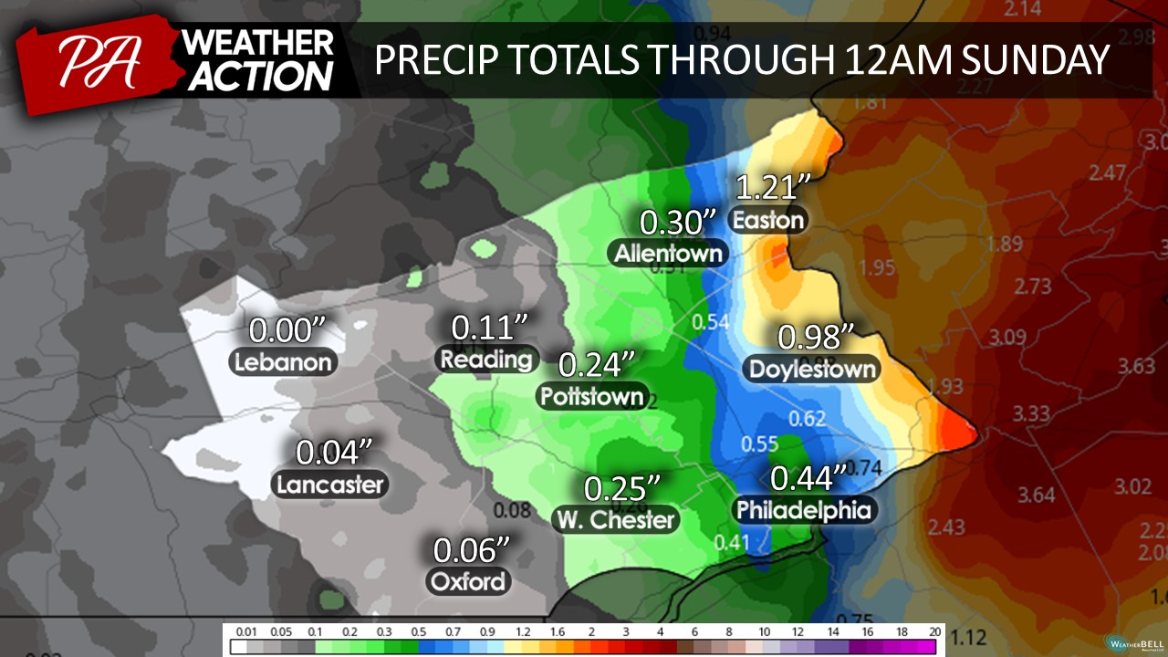
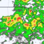
All in all, given the nature of this coastal low, a substantial gradient of precipitation totals is likely to occur across the region. As mentioned previously, Eastern regions are likely to see the most substantial accumulations with a general 0.5-1.5 inches of rain across the region. Western regions will remain substantially drier with some areas picking up little to no precipitation throughout the weekend. It is worth mentioning that an axis of very substantial precipitation, 2-4in+, is currently forecasted just to the east of the region across portions of New Jersey, induced by multiple rounds of training thunderstorms. Slight shifts in the track of this low could shift that axis of heaviest precipitation further west which would make a substantial difference in precipitation totals across the Delaware Valley. If this were to occur, flash flooding may be a concern.
[quads id=3]
Sunday
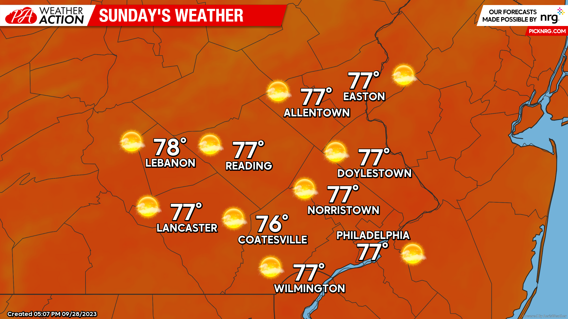
Sunday will certainly be the pick of the weekend as a ridge of high pressure builds into the region. This ridge will bring much drier, and warmer conditions to the region. Expect morning lows to begin in the mid-upper 50s with afternoon highs topping in the mid-upper 70s. Plentiful sunshine will be in place to kick off October as Friday and Saturday’s rain quickly becomes a distant memory. Winds will be out of the N at 2-7mph.
Sunday will begin a stretch of dry weather and above-average temperatures as this ridge of high pressure dominates our pattern into next week. Looking ahead, expect plenty of sunshine and a return of summer to kick off October. Many will see highs reaching into the 80s by midweek! Thanks, everyone for all the support thus far on these posts! Make sure to download to PAWeatherAction app for continued updates! If you have questions or would like to discuss the forecast feel free to reach out!
– Michael Woytowiez

You must be logged in to post a comment.