
Good evening! I hope everyone had a great weekend and had a chance to soak in some of the sunshine and enjoy the warmer conditions. We are currently in a summer-like regime pattern with a very strong high pressure system across the eastern United States helping to bump up our temperatures and keep our skies clear. Unfortunately, good things do not last forever, and with that- major changes are coming toward the weekend. Read below for an outlook of the next 3 days and a peak of what is to come beyond this week!
PATTERN THIS WEEK:
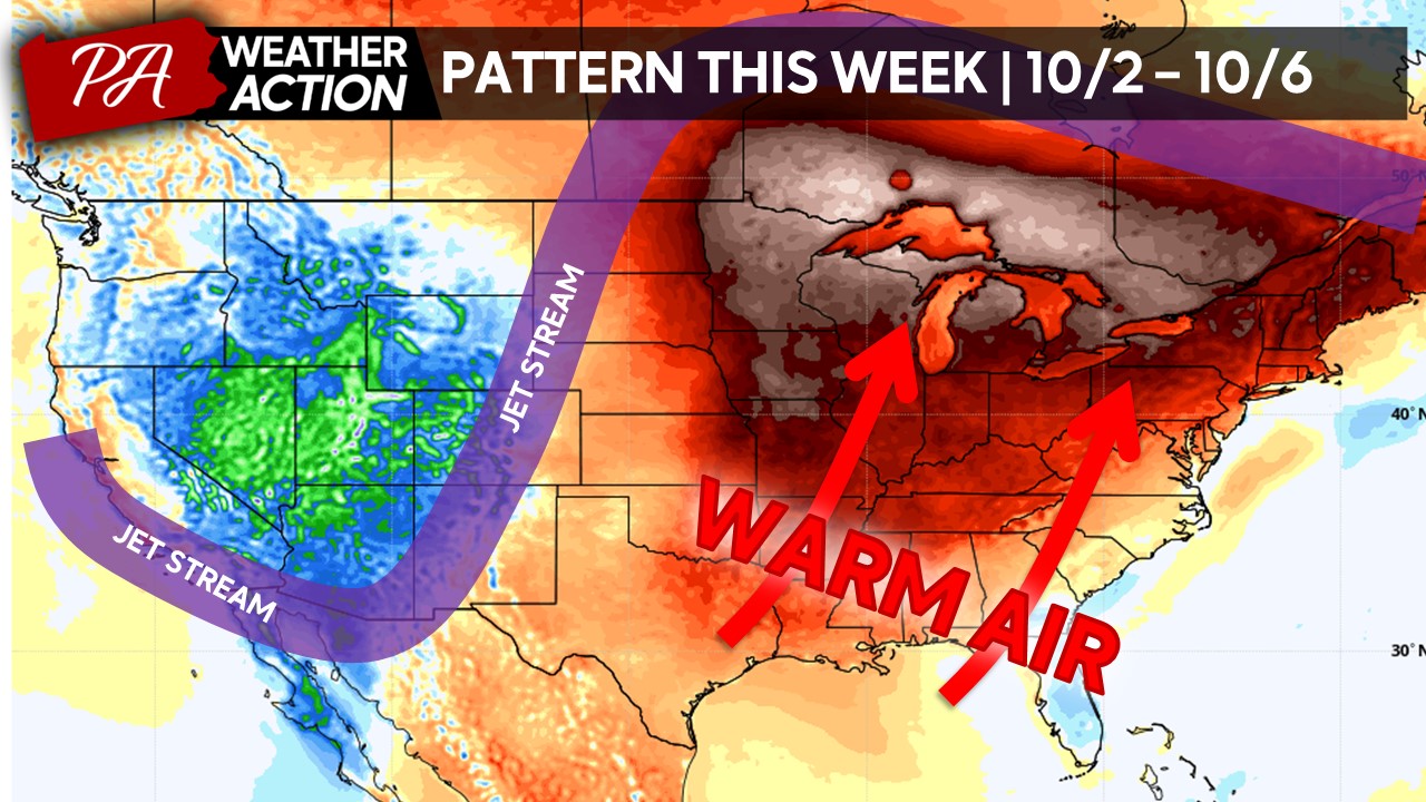
The pattern this week is dominated by a ridge of high pressure across the central and eastern United States. This is leading to a lot of warm air that is being pulled north from the southern United States, allowing for temperatures to climb into the low-80s for much of this week. Portions of the area will peak this week with high temperatures as much as 10-15 degrees above the current average.
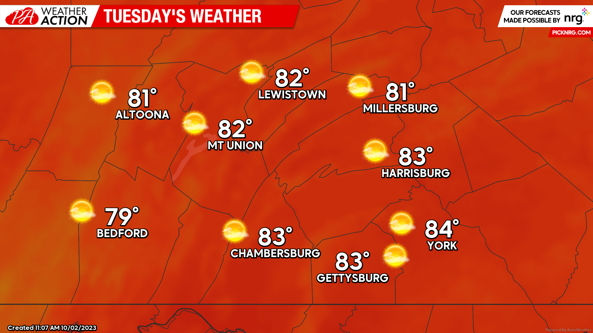
TUESDAY:
Tuesday will be a beautiful day with high temperatures ranging from the upper-70s to lower-80s across the region under mostly sunny skies. It will be great to get outdoors to enjoy the sunshine!
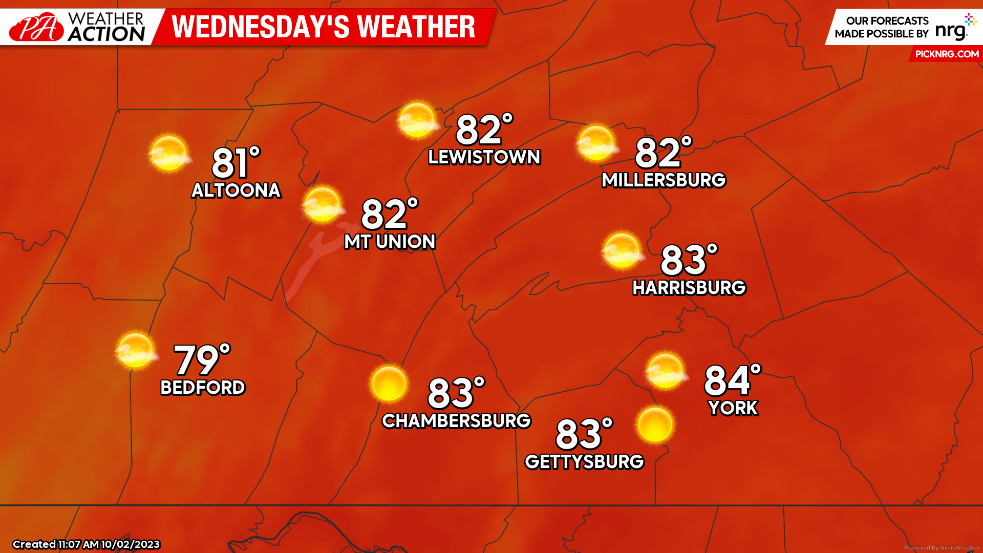
WEDNESDAY:
Wednesday will be a copy-and-paste from Tuesday, with high temperatures ranging yet again from the upper-70s to lower-80s. A few spots in the Susquehanna River Valley could break into the mid-80s. Make sure to get outdoors and enjoy it!
*This may be the last day of the year for widespread low-80s until 2024 given climatology.*
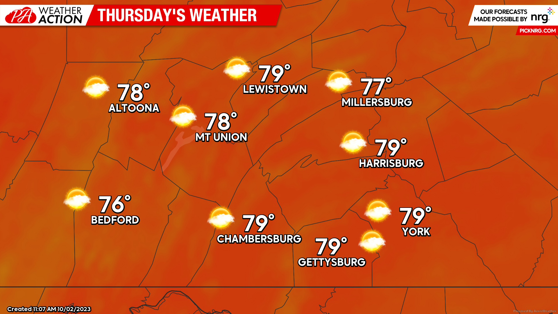
THURSDAY:
On Thursday we will begin to see the high pressure center break down across the region, allowing temperatures to slightly lower with highs expected in the mid-to-upper 70s with partly cloudy skies. Expect a southerly wind of 5-10 MPH during the afternoon hours, making it feel breezy compared to earlier this week.
LOOKING BEYOND:
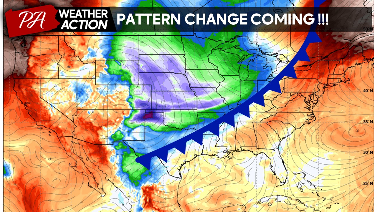
The first significant cold front of the season will sweep through much of the central and eastern United States Friday through Saturday morning, bringing much cooler air to the region. A new-developing low pressure system may develop along the front Saturday afternoon/evening, bringing a potential deluge of rain to the region – stay tuned for more updates later this week regarding this! Additionally, the first lake effect season event of the year will take place for those in the Great Lakes region, although it should be warm enough for all rain at the moment.
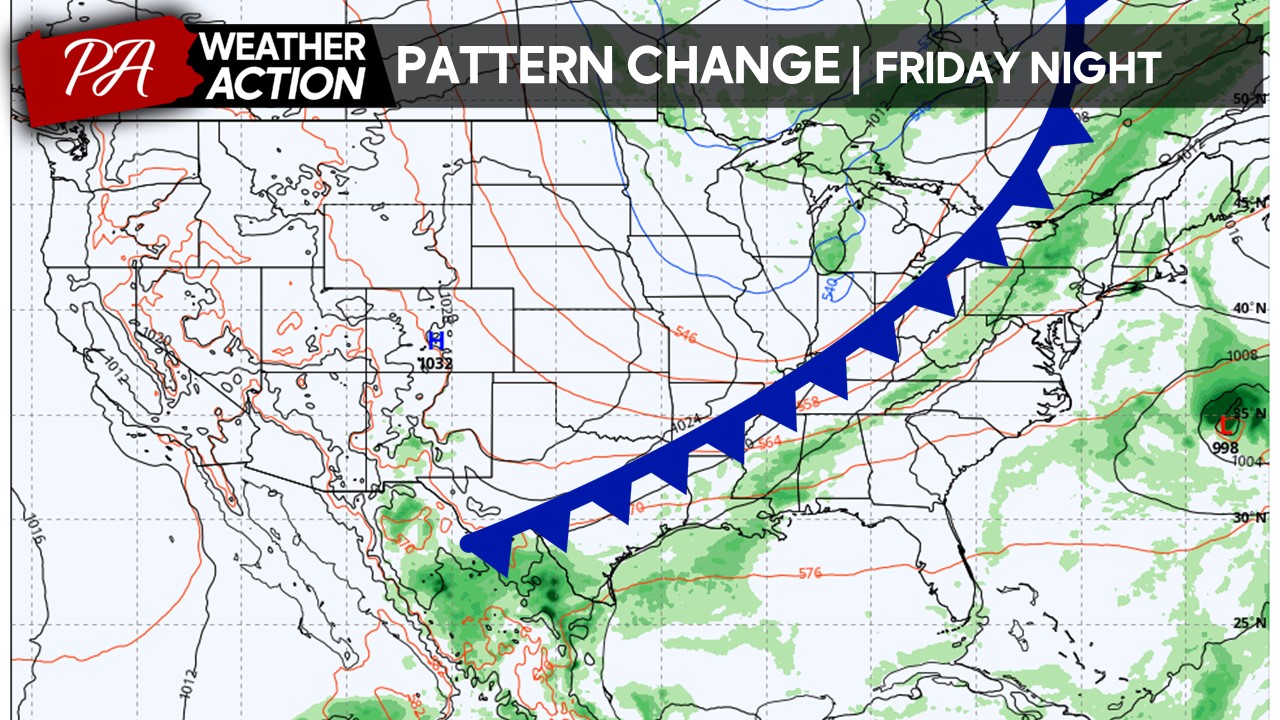
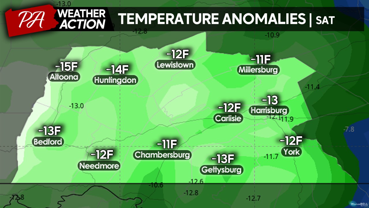
Due to the strong cold front, afternoon high temperatures during Saturday afternoon will be as much as 10-15 degrees below normal across the entire region – which correlates to temperatures in the low-to-mid 50s with a few higher elevations in the upper-40s. A complete reversal from Tuesday-Thursday of this week! As we head into early next week, we will need to watch the potential for the first frost/freeze of the season.
TO SUMMARIZE:
– Very warm with high temperatures generally in the upper-7os to lower-80s Tuesday – Thursday. ENJOY!!! ☀️
– Stronger cold front will move through late Friday morning into Saturday morning, bringing in much cooler conditions. ☁️
– Watching the potential for heavier rains Saturday afternoon through the evening hours with potential low pressure development along the cold front. ?️
– First frost/freeze potential early next week. ?
That is all for now! If you have any questions regarding the forecast, please reach out at any time and I will do my best to respond. For more updates, make sure to download the PA Weather Action app on your phones and stay tuned on Facebook. Have a great week.
– Denys Khrulov

You must be logged in to post a comment.