The endless cycle of rain showers continues, as scattered rain showers are ongoing throughout the state this morning. We have received many questions as to when our area will see a stretch of dry weather.
Unfortunately, the overall pattern is an active one. Every couple days, a new disturbance brings a period of rainfall to the region. As of right now, the next week looks to continue the trend of having more rainy days than dry days.
Looking at this morning’s radar imagery, you can see the scattered showers throughout the state.
Today’s Weather Forecast: 5/10
Much similar to yesterday, the eastern half of the state has a better opportunity for heavier downpours. Any severe weather will remain limited. 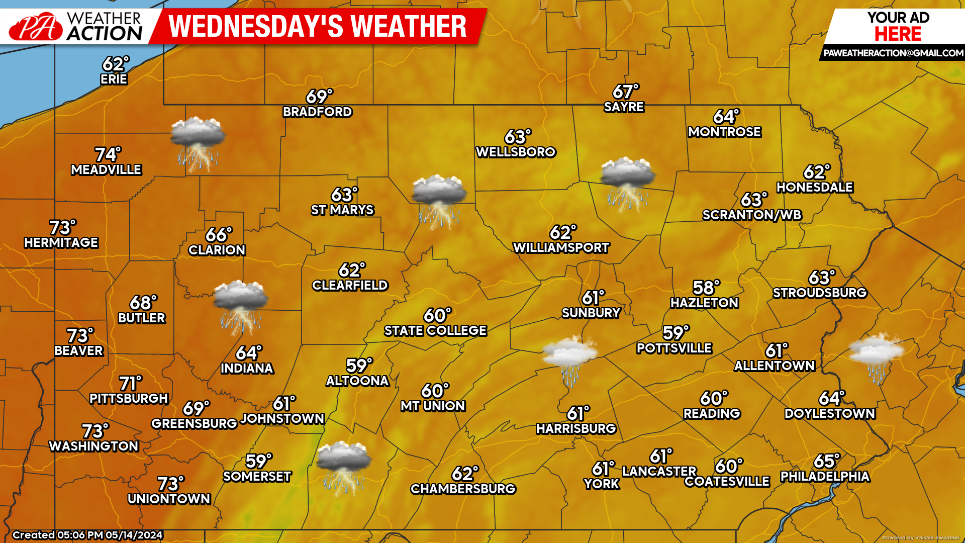
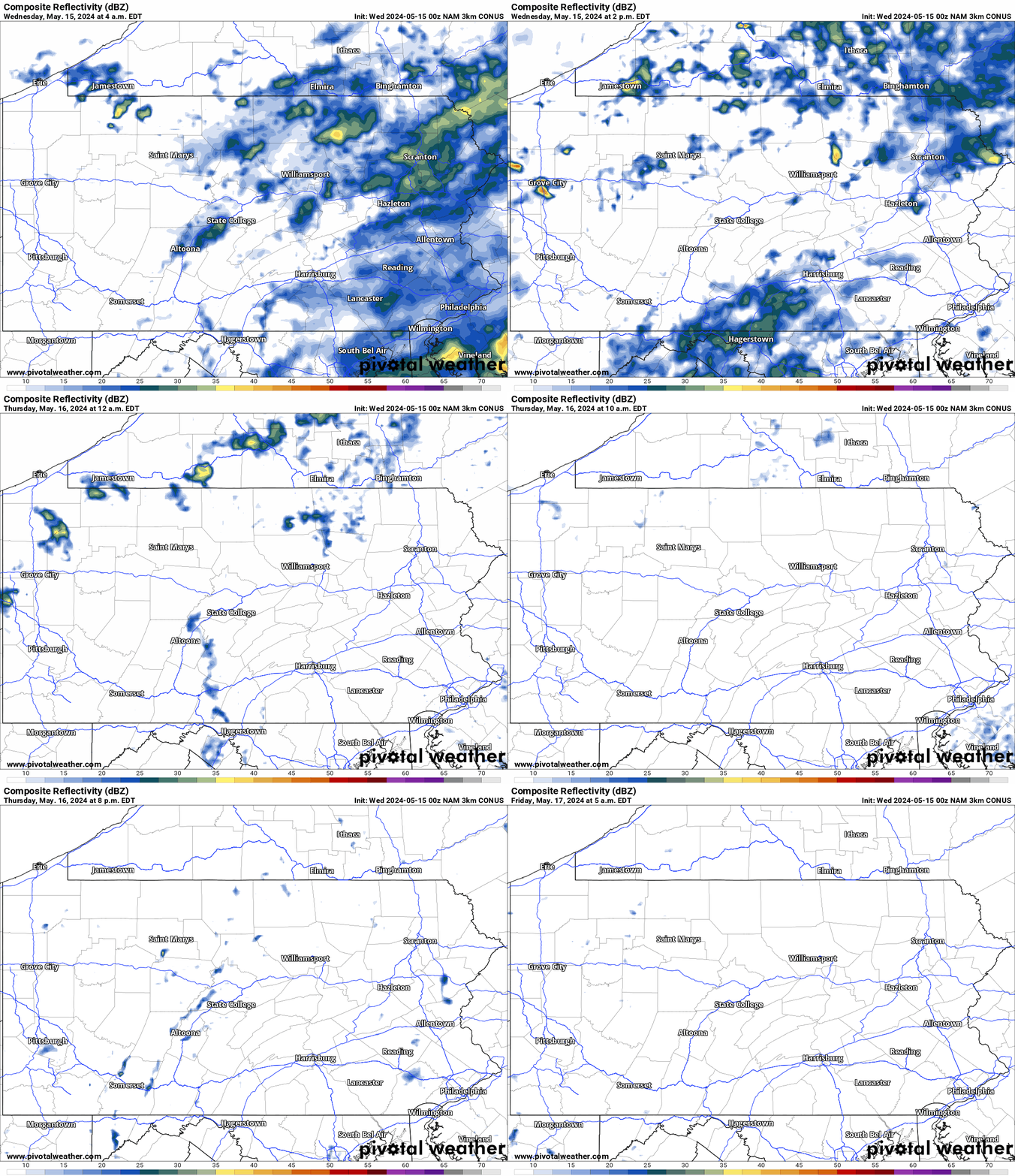
Hi-Res NAM Future Radar Through Friday AM:
The Hi-Res NAM future radar displays a good picture of what we can expect for the next couple days. While scattered showers will remain a threat for today, Thursday and Friday look mainly dry. The timestamp is in the top left of the graphic below.
Rainfall Projection Through Friday AM: 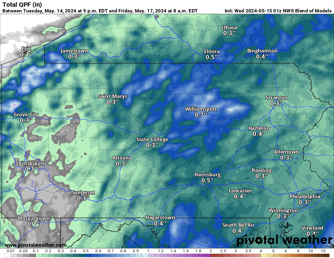
Please note that most of the rainfall amounts that you see in the image above will be from today’s rain.
Thursday’s Weather Forecast: 7/10
Thursday finally looks like a generally dry day. An isolated shower cannot be ruled out. Limited sunshine is still expected. 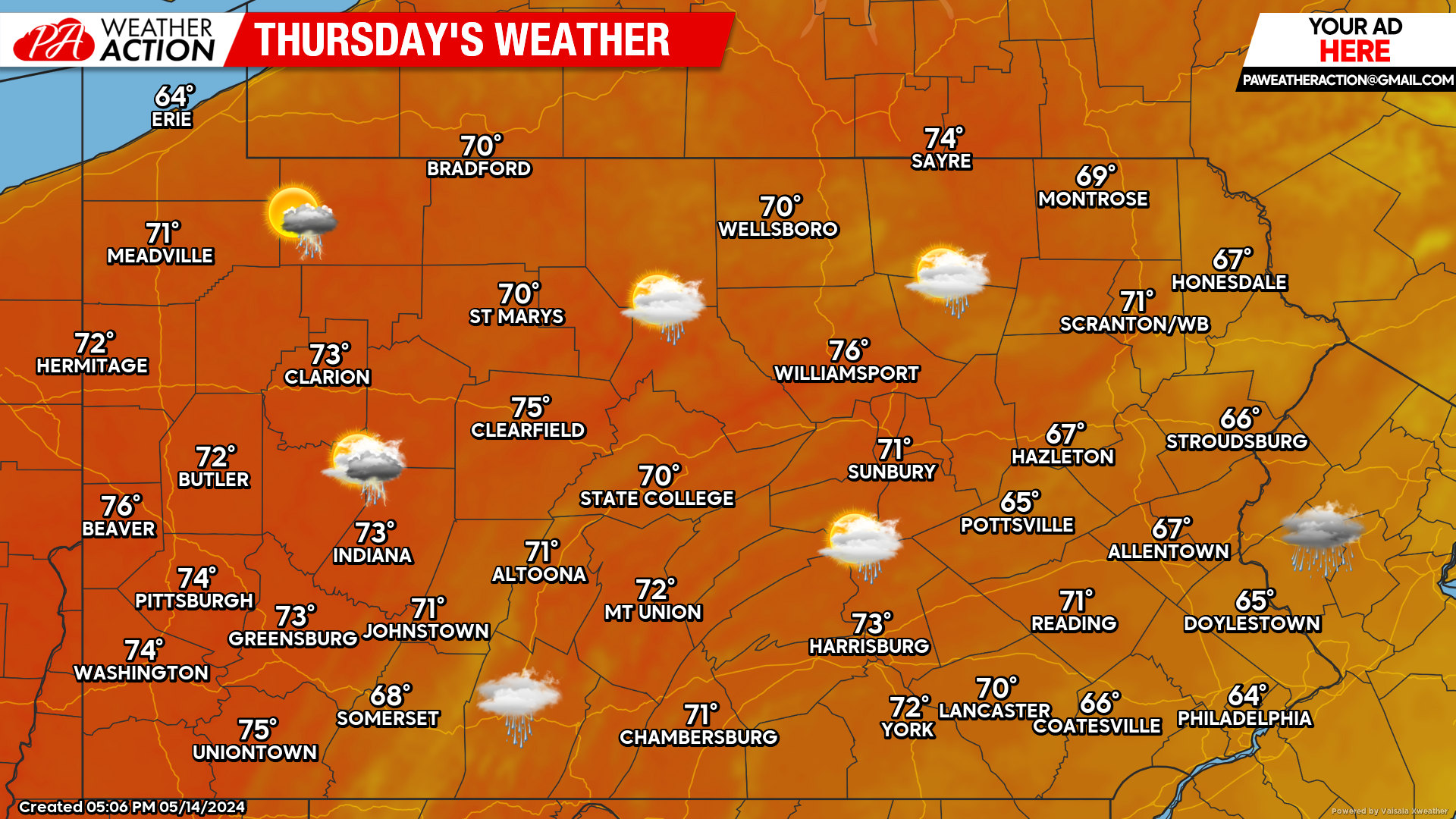
Friday’s Weather Forecast: 7/10
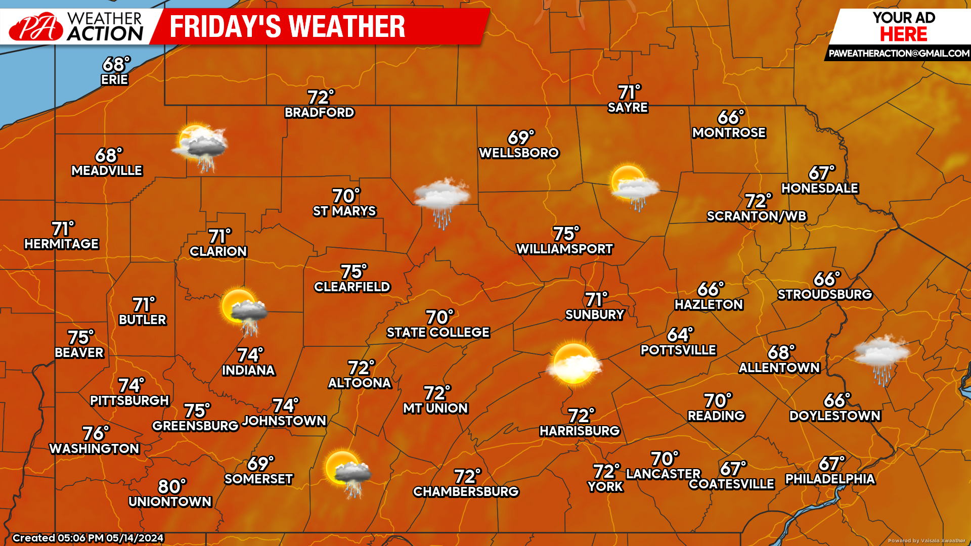
Friday will be another day that will be mainly dry. Late evening showers can be expected across the western part of the state out ahead of our next rain maker that arrives just in time for the weekend.
Weekend Outlook:
Models are in a bit of a disagreement right now with how much rain we can expect this weekend. As of right now, it appears Saturday will feature showers, with Sunday being the bigger question mark. The European model has the state completely dry Sunday, while American model has steady rain impacting the area. As always, we will keep you updated!

You must be logged in to post a comment.