
In the past several weeks, you probably have read that this winter is expected to be about 1,000 different things. One forecast says cold and snowy, the next one warm and dry, the next says average temperatures and wet. However for the most part, predictions for a colder winter and perhaps snowier winter have been the most common. But just a week ago, NOAA released their winter outlook that, as usual, differed from the commonalities of most other outlooks.
Despite each year having a different global sea surface temperature anomaly configuration, with some years having very cold analogs and favorable teleconnections, for the past decade, NOAA has predicted above normal temperatures to be most common anomaly in the United States every single winter. So what are they looking at that everybody else is not? Or, what are they considering to be the biggest player in seasonal forecasting? The overwhelming majority of the weather community considers the ENSO (El Niño-Southern Oscillation) to be the most important factor in winter forecasting. However, that’s not the case for NOAA.
An article on NOAA’s website, Climate.gov, states “But what if I told you that there is another mysterious thing that, at least for seasonal temperature outlooks, gives forecasters a better idea of what will happen than predictions of ENSO or the Madden Julian Oscillation, or the Arctic Oscillation or the North Atlantic Oscillation or the Pacific Decadal Oscillation or…I think you get the point. And it’s much simpler than all of those. It’s called the trend.”
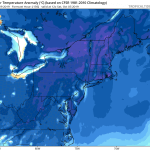
Climate scientists have determined the ideal number of years to look at for recent trends is 15. As a result, many of the recent winter outlooks from NOAA have had a recurring theme. Above average temperatures across the western and southern US, as well as New England. And if there is going to be an area of average to slightly below average temperatures, it will likely be in the northern Plains and/or Midwest. This all makes sense when you look at the past 15 years’ temperature anomalies.
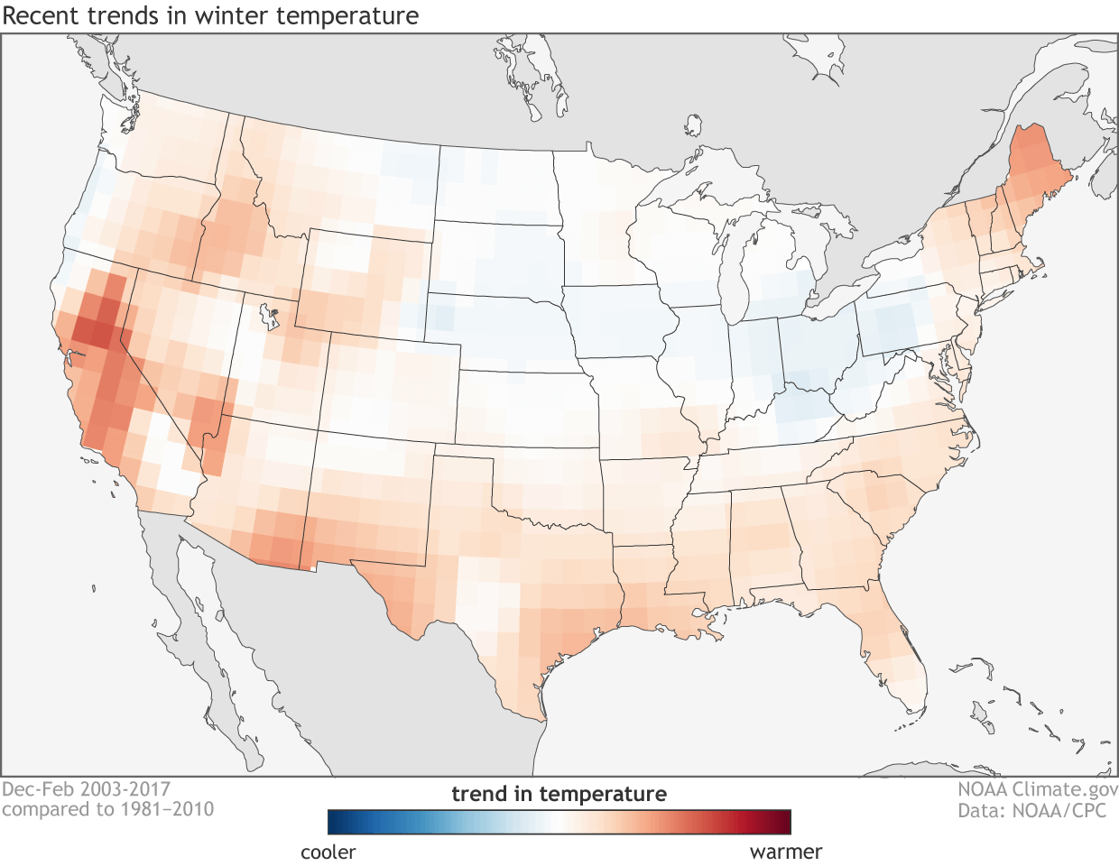
Compare the map above to the past four winter outlooks below, and it is easy to see trends are the biggest factor in NOAA’s winter outlooks.
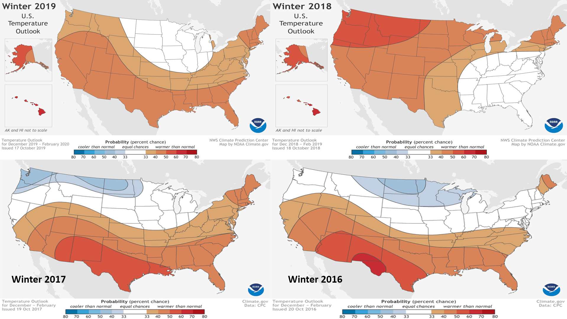
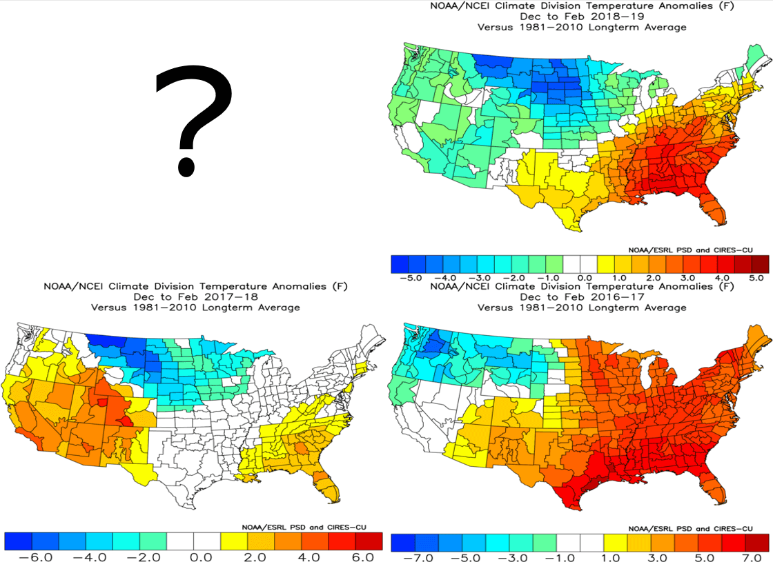
The past three winters have featured below average temperatures in the northern Rockies and northern Plains, and above average temperatures in the southern US overall. For the most part, this is close to their outlooks (except last winter), but the area of below normal temperatures seems to be slightly larger than they predict each year.
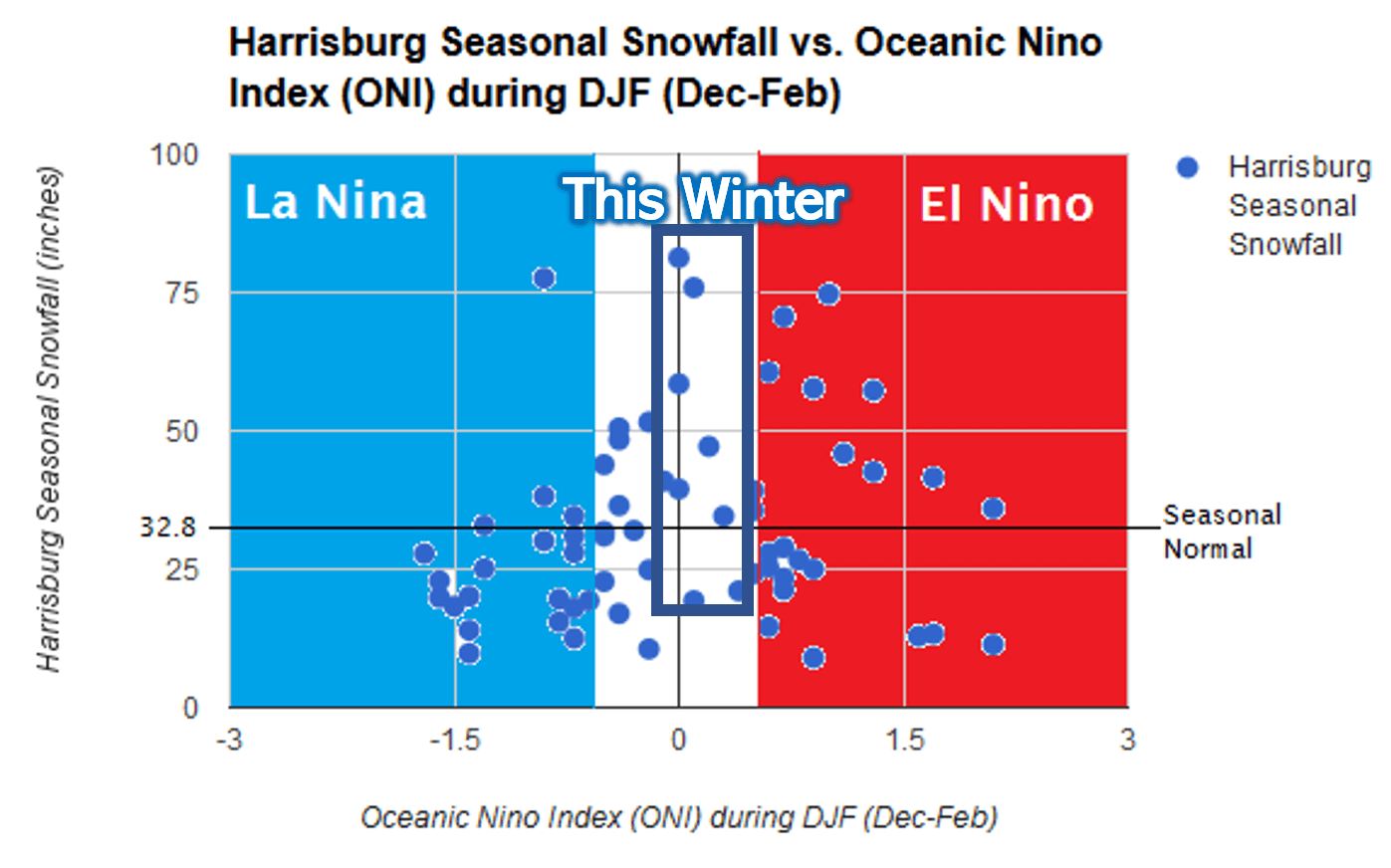
So is it a bad idea to predict below average temperatures or even just average temperatures in the northern Plains once again this winter? Not really, as both analogs and trends support it. The real question is, what will we see here in Pennsylvania? Will we be influenced by the southeast ridge once again, or will the polar jet-stream be south of the area for much of the winter? We will have our Official 2019-2020 Winter Outlook on Tuesday, November 12th. For now, we’ll just leave this graphic here.
You must be logged in to post a comment.