
Showers and thunderstorms return to the forecast today as our next disturbance approaches the state. Looking at this morning’s radar, isolated showers are beginning to develop. These will become more widespread by the afternoon hours:
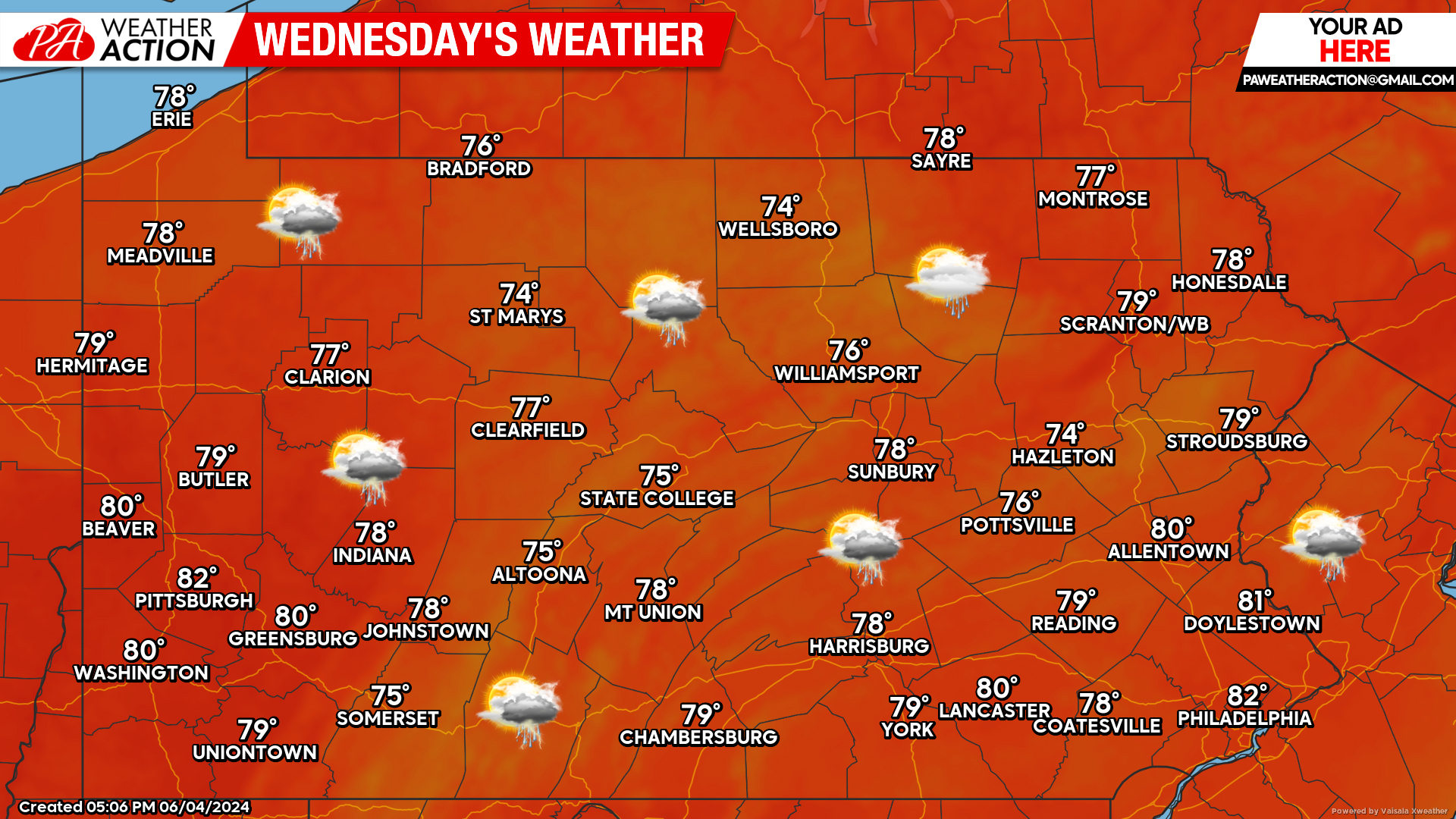
Today’s Weather Forecast: 5/10
If you have any outdoor plans for today, our recommendation is to try to have them done before lunchtime. Widespread showers and thunderstorms are expected to develop in the afternoon hours and will continue through the overnight hours early Thursday morning.
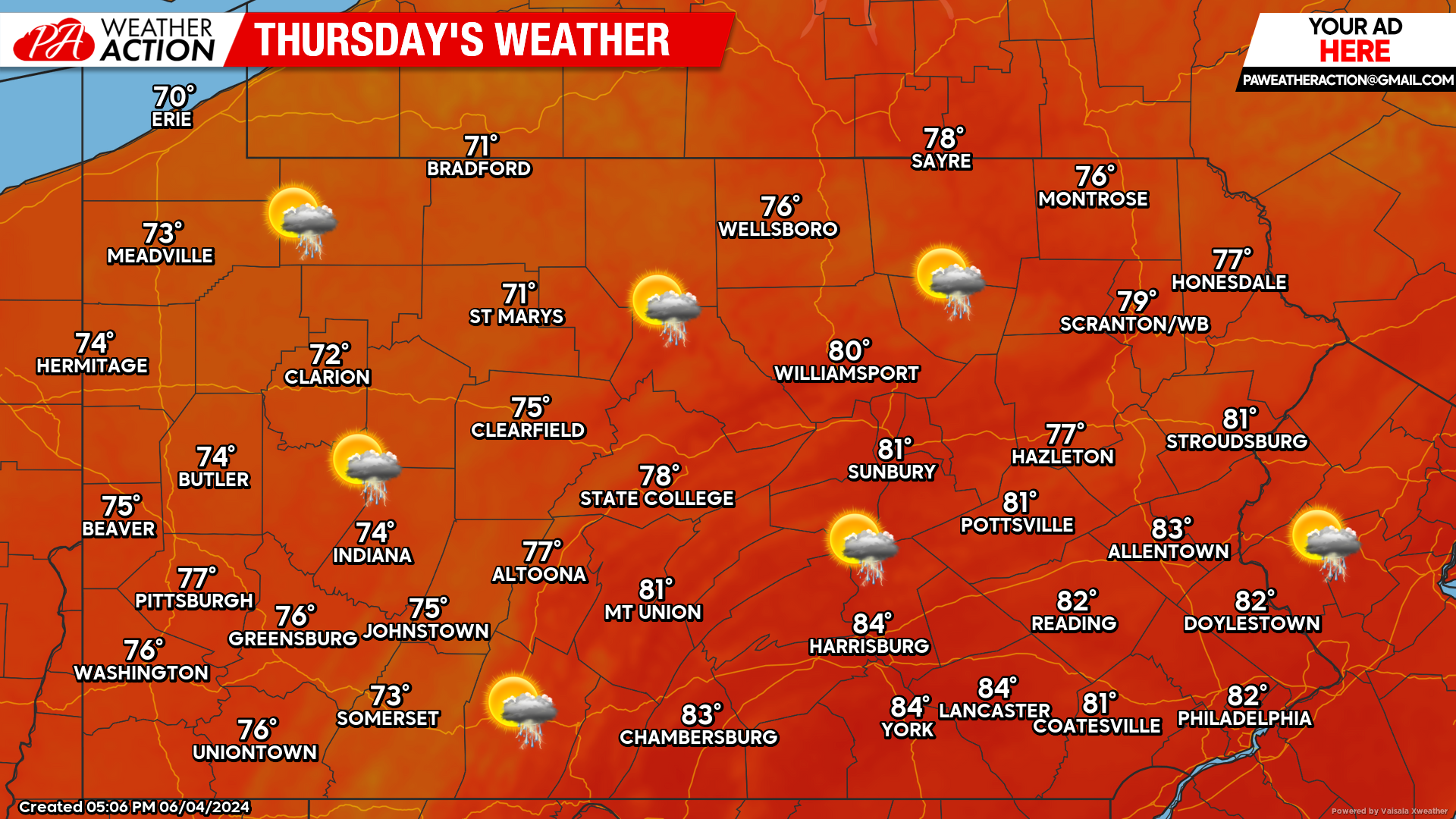
Thursday’s Weather Forecast: 7/10
A mix of clouds and sunshine with the chance for thunderstorms are expected during the day Thursday.
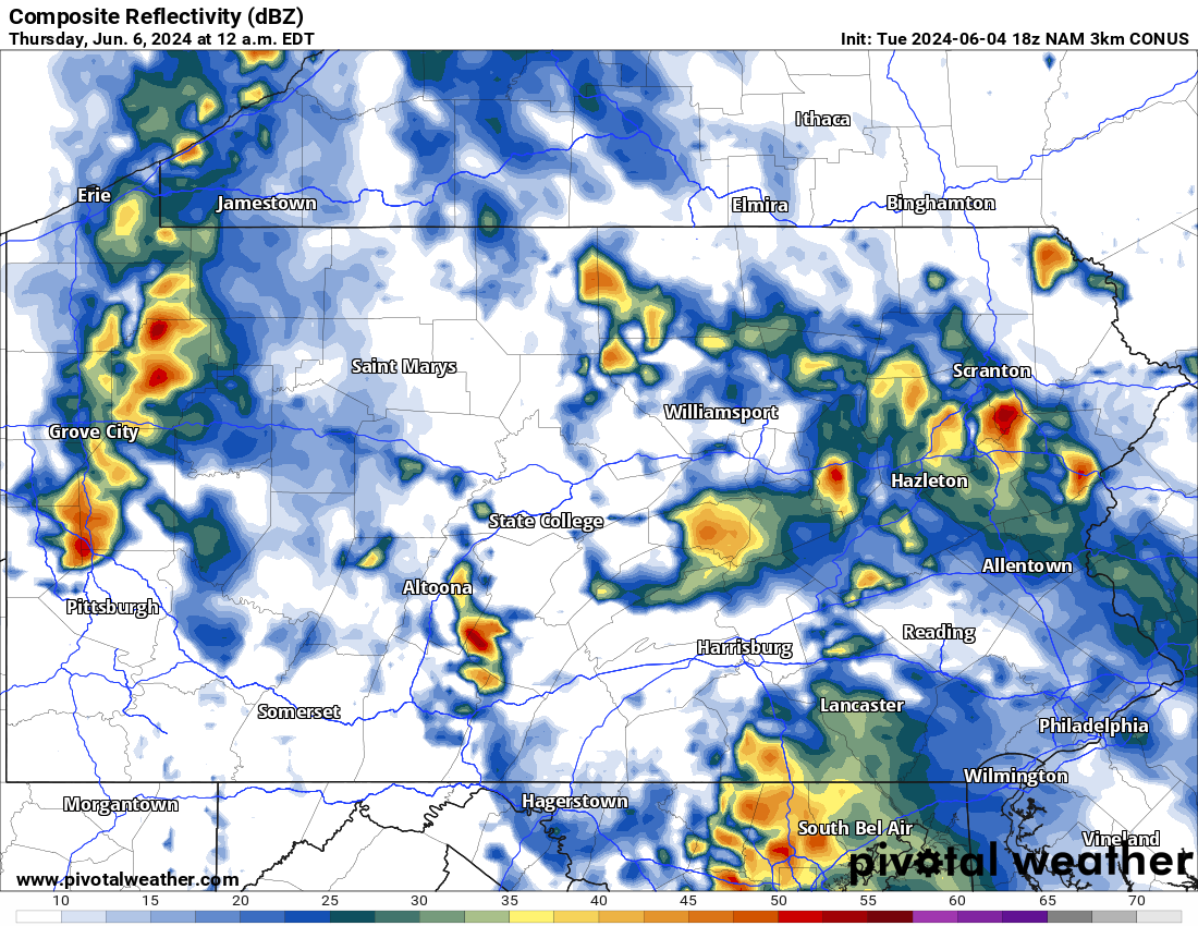
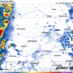
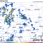
Hi-Res NAM Future Radar through Thursday:
Looking at the future Hi-Res NAM radar below, we can see the growth in shower development as we head into the afternoon hours today. Heavy downpours are possible, however the overall severe weather threat will be limited this time around. For reference, the top left of the graphic below shows the time stamp.
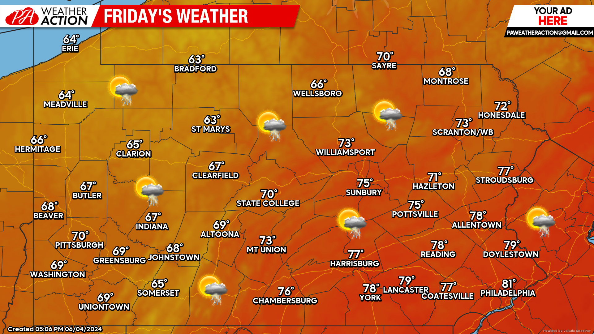
Friday’s Weather Forecast: 7/10
Cooler weather is expected Friday with temperatures only in the 60s and 70s across the state. With the cooler weather comes a chance for showers throughout the day.
Looking ahead into the Weekend:
While we do not anticipate a washout for Saturday or Sunday, we are in the middle of a weather pattern that produces threat for showers and thunderstorms almost everyday. This looks to continue, with the better chance for showers and storms to be on Sunday. Again, nothing to cancel outdoor plans over, but the threat for showers and storms is there.
You must be logged in to post a comment.