

After a very warm week inspired nature to enter Springtime, a series of upper-level disturbances and cold fronts will cross our area this week, delivering normal to below-normal temperatures this week into next week. Gusty windy conditions this week will also result in an elevated brush-fire danger.
The Spring Equinox will occur shortly after 11pm Tuesday evening, heralding the astronomical start to Spring.
A weak cold front will cross the area tonight, driving temperatures down into the mid 20s with windy conditions along with the opportunity for some flurries.
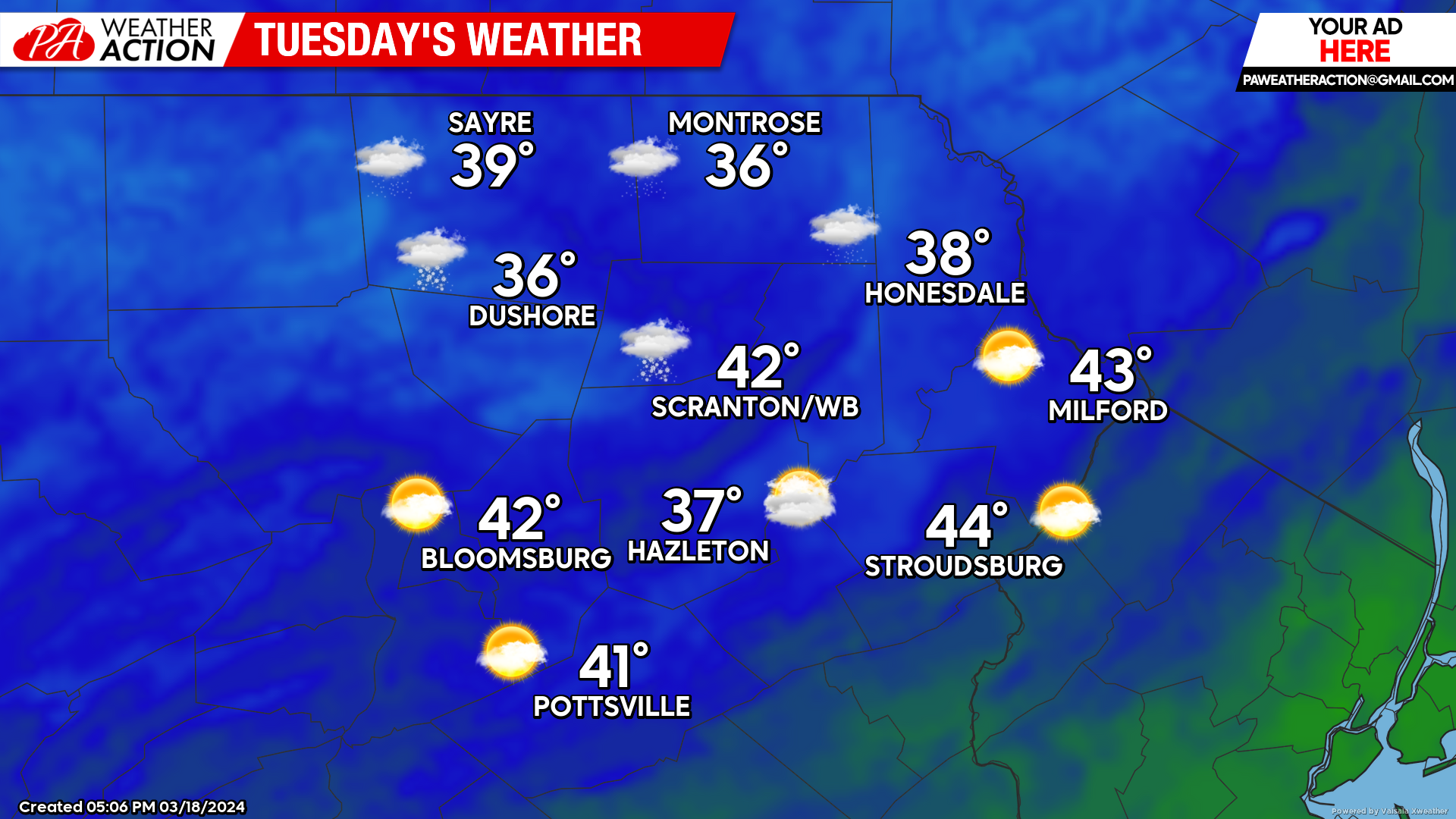
TUESDAY
Windy conditions will continue Tuesday, with gusts 20-30 mph and the slight chance for a few rain / graupel / snow showers. Temperatures Tuesday will range from the mid-upper 30s in the higher elevations to the low 40s in the valleys.
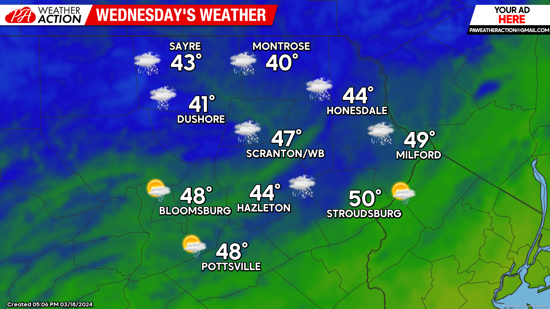
WEDNESDAY
Another cold front will cross our area Wednesday evening. Southwest wind ahead of that front will return daytime temperatures to near normal levels, with highs ranging from the lower 40s in the higher elevations to near 50 in the southeastern Valleys.
Windy conditions will continue, with gusts to 30 mph during the day, and over 30 mph possible after the cold front crosses during the night. Some rain and snow showers could be possible with the frontal passage. The strong WNW wind behind the front will drive temperatures down into the low 20s by Thursday morning.
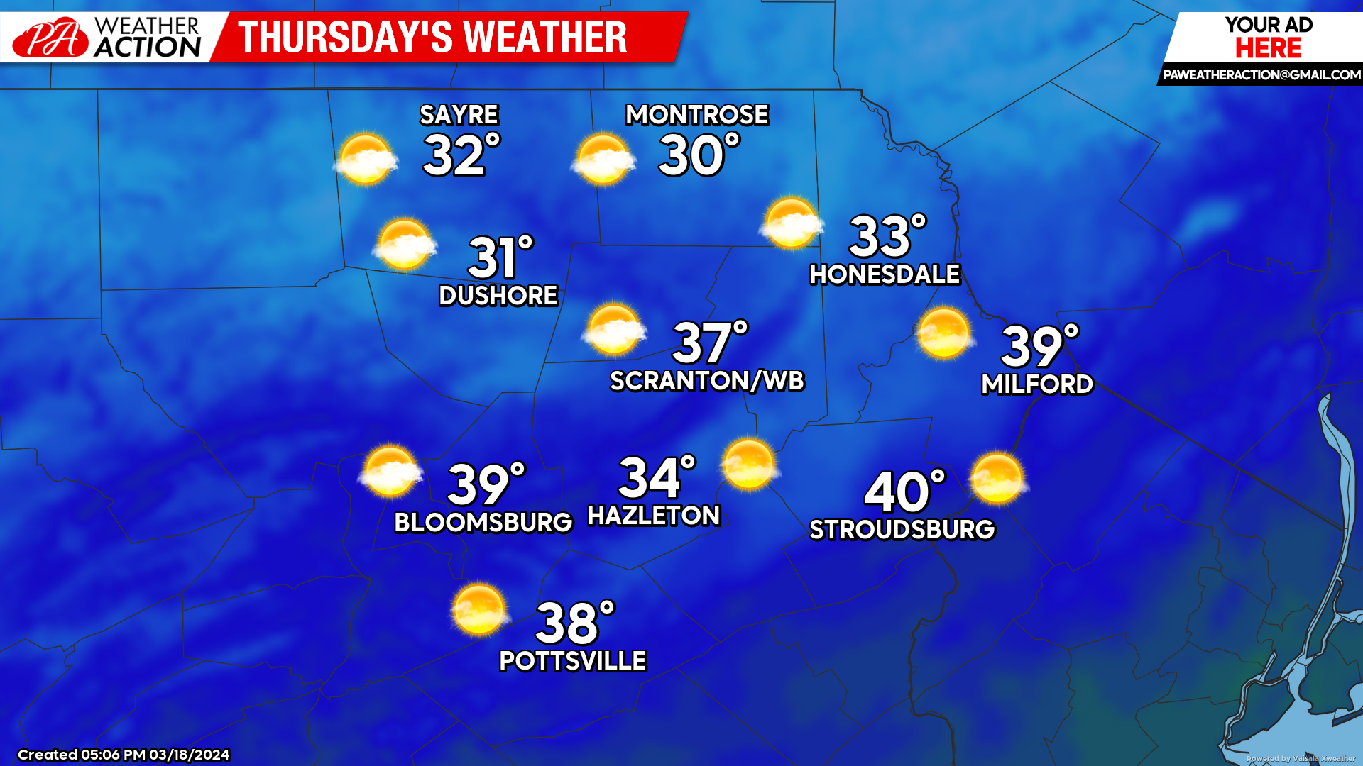
THURSDAY
Wind gusts over 30 mph will continue the springtime wildfire danger on Thursday, and also maintain below normal temperatures High temperatures could remain below freezing in the higher elevations, and stay in the upper 30s for the valleys.
BEYOND THURSDAY
Friday will dawn quite chilly for this time of year, with most areas falling to around 20 F. Normal highs range from the upper 40s in the valleys to the low-mid 40s in the higher elevations. Normal lows are in the mid-upper 20s.
The colder-than-normal weather will continue. There could be some late-winter (early-Spring?) entertainment Friday night into Saturday as a storm system develops along the Southeast Coast late this week and will move northeastward along the coast to tease our area with wintry precipitation Friday night into Saturday. Conditions will be marginally cold-enough for snow, especially at the start and at the end of the event, which could provide some late season (early season) snowfall accumulations, especially near the PA-NY border.
The normal to below-normal pattern will continue through the first full week of Spring.

You must be logged in to post a comment.